
Cape Flattery: Conglomerates at the End of the World
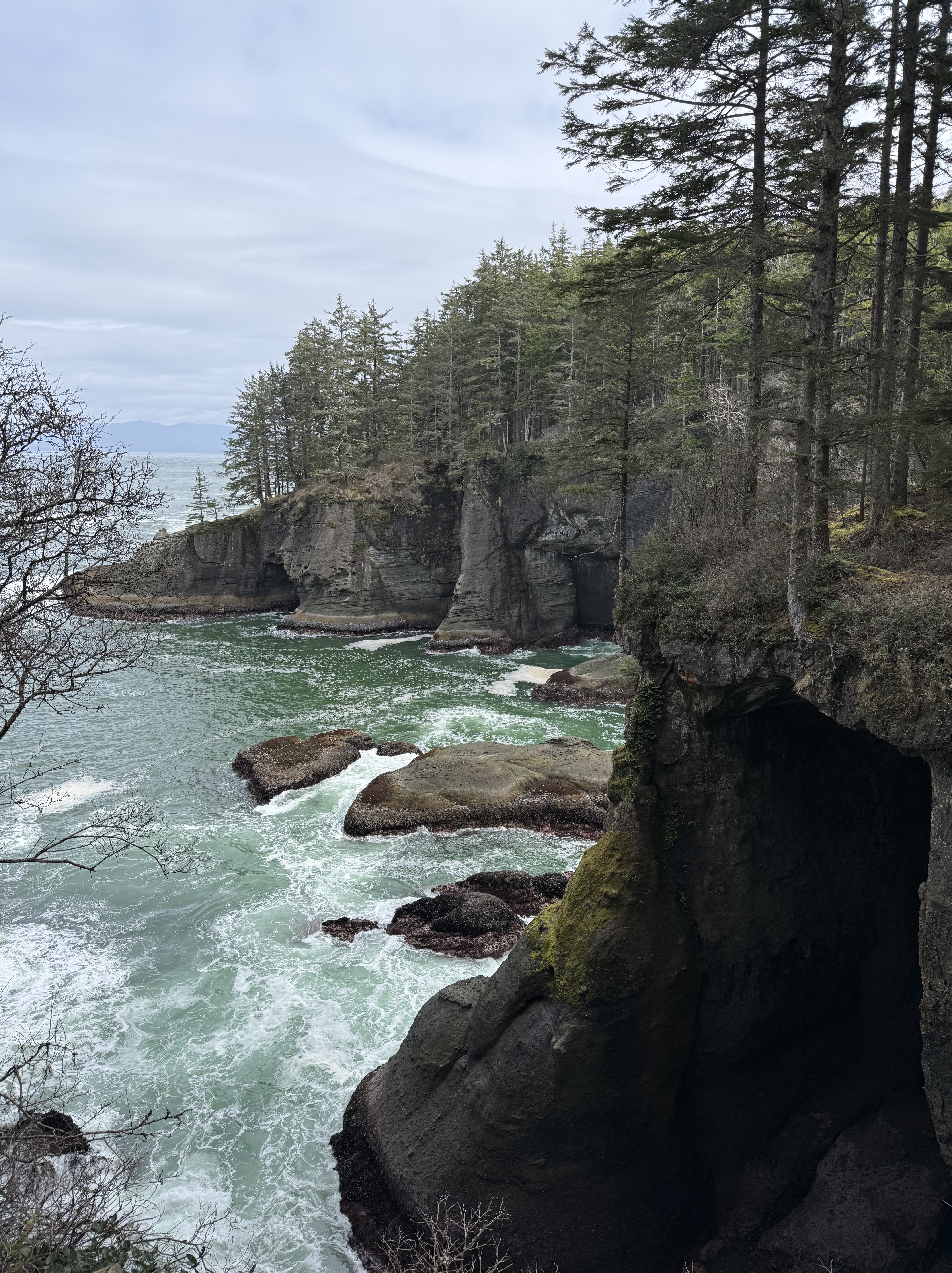
Figure 1. I ran out of road and land, ending up at Cape Flattery on the Makah Reservation. This is Location D in Fig. 2. A half-mile hike down a boardwalk took me to the end of the world, where the cliffs are about 80 feet above sea level. This photo is looking northward towards Vancouver Island, Canada, in the distance. Wave action has cut a wave terrace, a seen in the center of the image, and a series of sea caves.
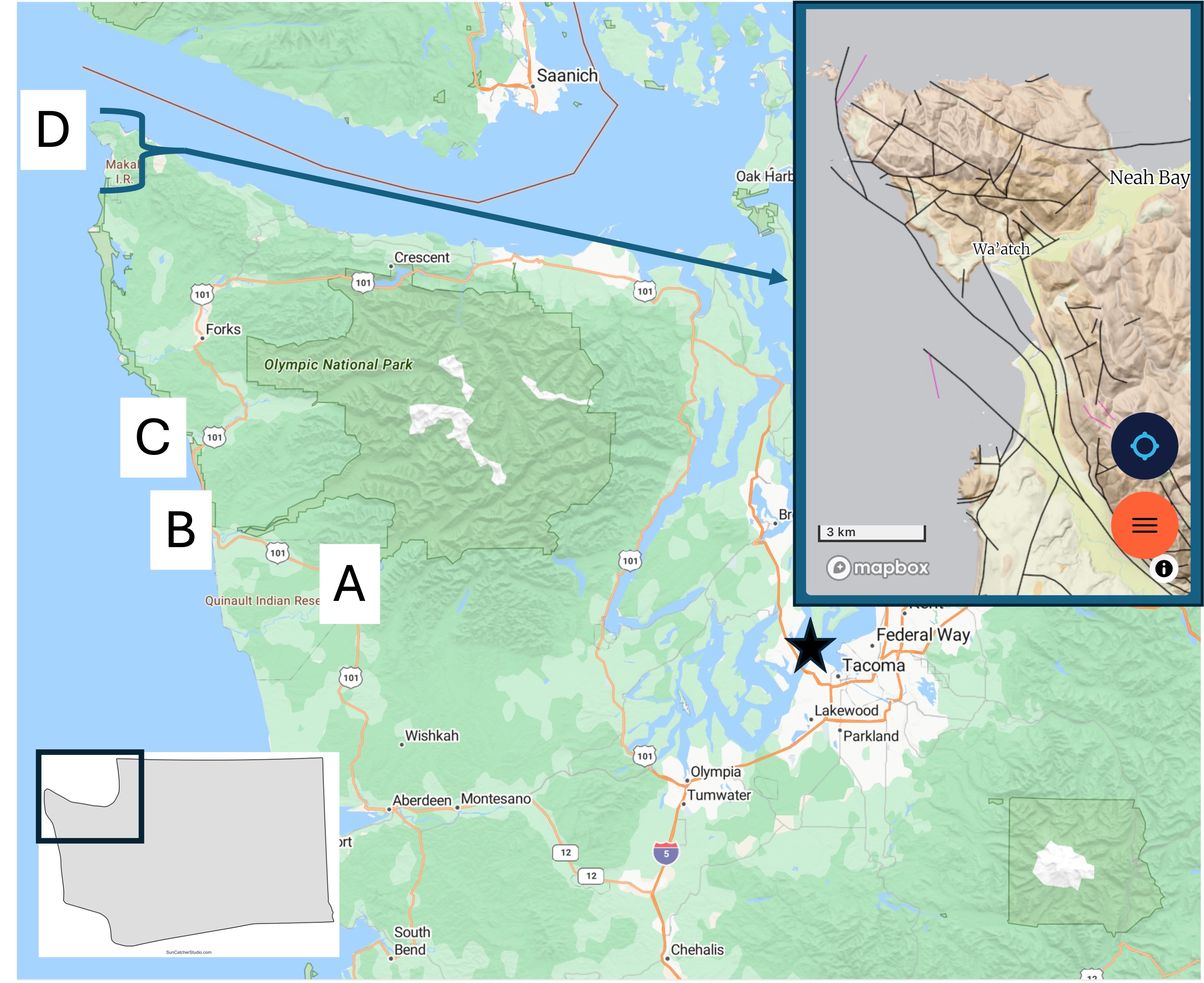
Figure 2. Today’s post takes us to Site D, which is shown in a geologic map from Rock D in the inset map. The rocks are a mixture of sandstone and conglomerate of Eocene age (56-34 Ma). This is the same time that the lower Cascades were being created east of Puget Sound. Note the large number of faults (thin lines) shown in the inset map. Many of these are strike-slip faults with motion of the opposing crustal block to the left, which would explain why the sedimentary layers in seen in Fig. 1 are almost horizontal, dipping slightly towards the sea.
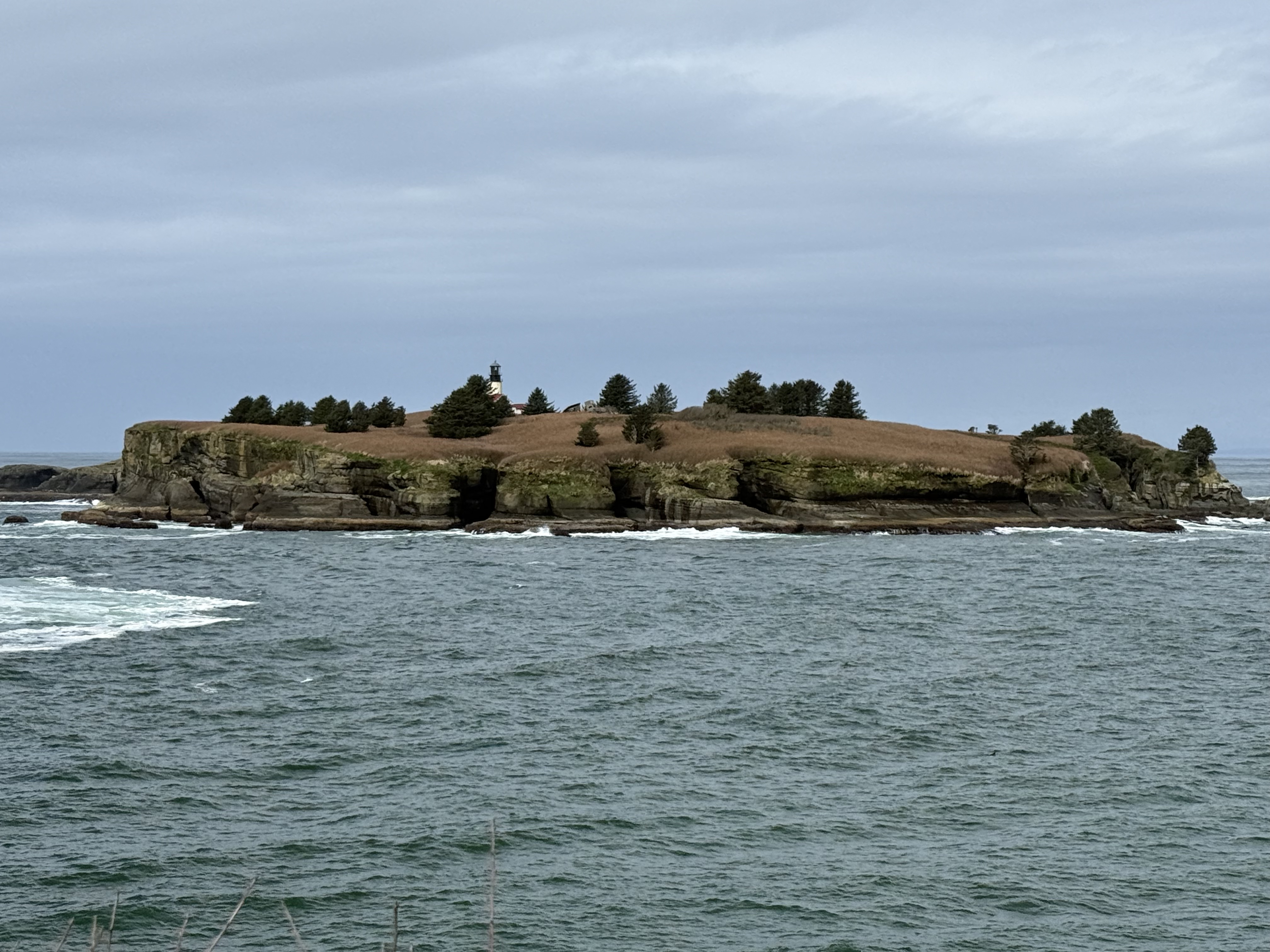
Figure 3. The sea stacks seen further south have been replaced with rocky islands like Tatoosh Island, which has a light house. Pacific Ocean seafloor (Juan de Fuca tectonic plate) is being actively subducted along the Washington-Oregon coast at about 2 inches/year, but the plate tectonic geometry is complex in this area. This could partly explain the large number of faults seen in Fig. 2 as well as the high elevation of bedrock. Maybe.
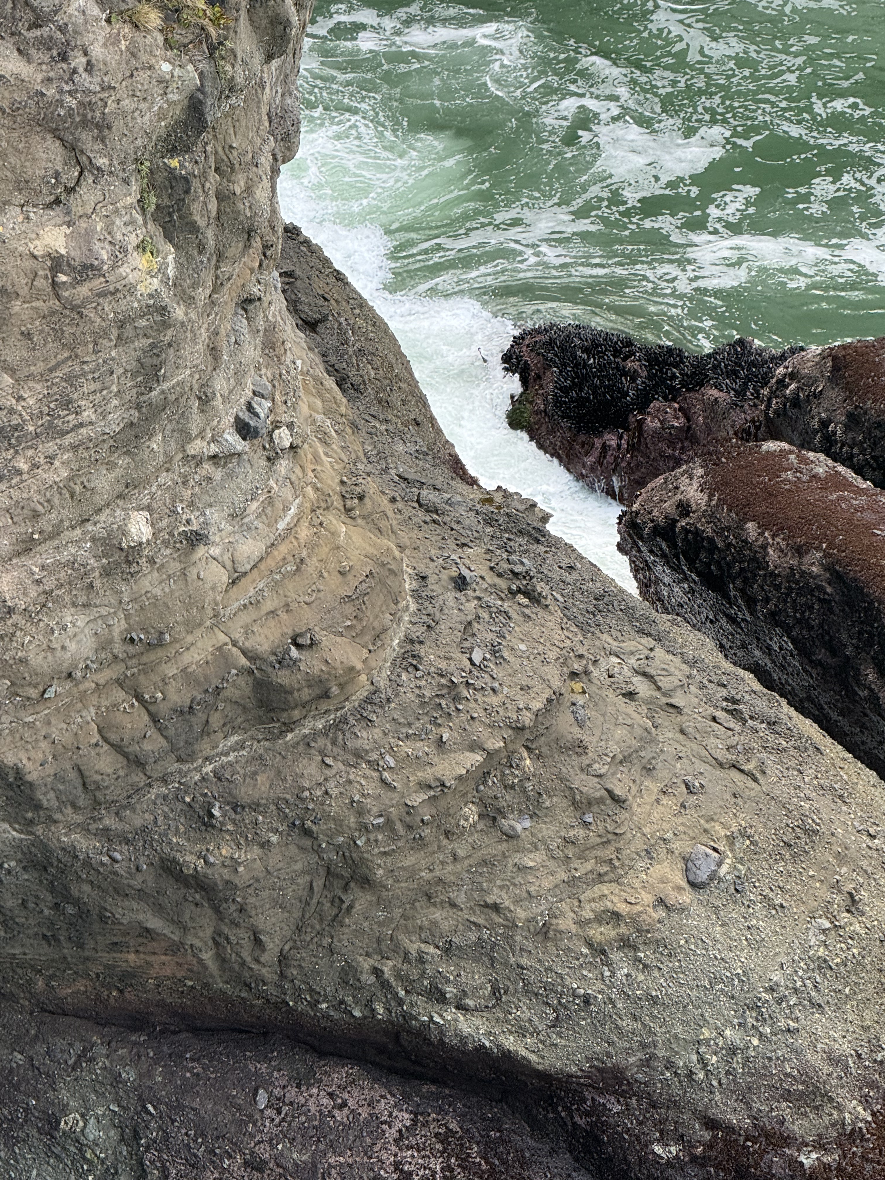
Figure 4. This photo was taken looking down towards the wave-terrace on the south side of the lookout point. For scale, the largest boulders are a couple of feet long, based on exposures at the surface of the trail. This is a textbook tectonic breccia. However, note that most of the rock fragments are rounded, so they have been transported some distance before reaching their final resting place. Some of the layers are relatively uniform with a few large boulders whereas others resemble the cobblestones we saw at Ruby Beach. Each bed might represent a single depositional event (like a landslide) or accumulation over years. These are marine rocks, deposited on a submarine fan, probably as turbidity flows. The process that created them is occurring now a few miles offshore, where the rocky outcrops we saw are eroding and supplying large and small fragments to a steep continental shelf.
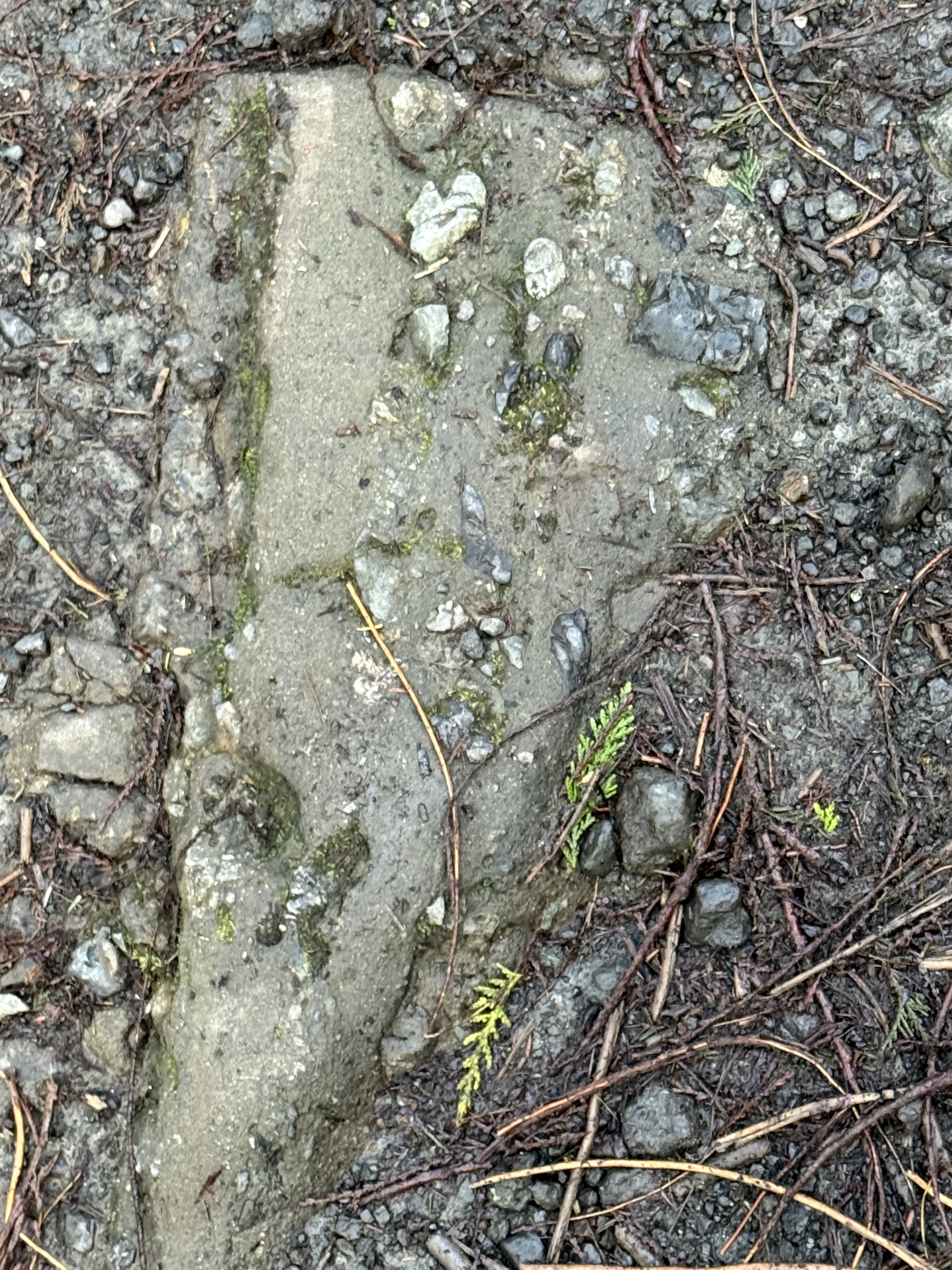
Figure 5. This image looks like run-of-the-mill gravel like you see on pathways and drives, but it is Eocene rock, and I mean solid rock (Note the large, gray piece protruding from the cliff in Fig. 4). This angular slab is about a foot in length. There is no Pleistocene glacial till in this area, even if the ground looks the same. This is a picture frozen in time, where an angular piece of what looks like sandstone, but could be andesite, slid downslope along with smaller fragments.
Summary.
This is the last of my geology posts from a weekend excursion along a hundred-mile stretch of the Washington coast. This is a high wave-energy coast with a tidal range of about 10 feet, the beaches covered with sand and cobbles. Sea stacks protrude from the beach, culminating in cliffs made of 50 Ma conglomerates. Beneath our feet, ocean crust was being subducted at several inches per year, feeding a system of magma chambers that are actively venting through volcanoes like Mt. Saint Helens, Rainier, and Mt. Baker. Rainfall drops along this coast at up to 12 feet per year, feeding streams that carry immense quantities of sediment into the trench created by the subducting ocean crust.
Geology doesn’t get any realer than this…

Recent Comments