
Tectonic Breccia at Ruby Beach
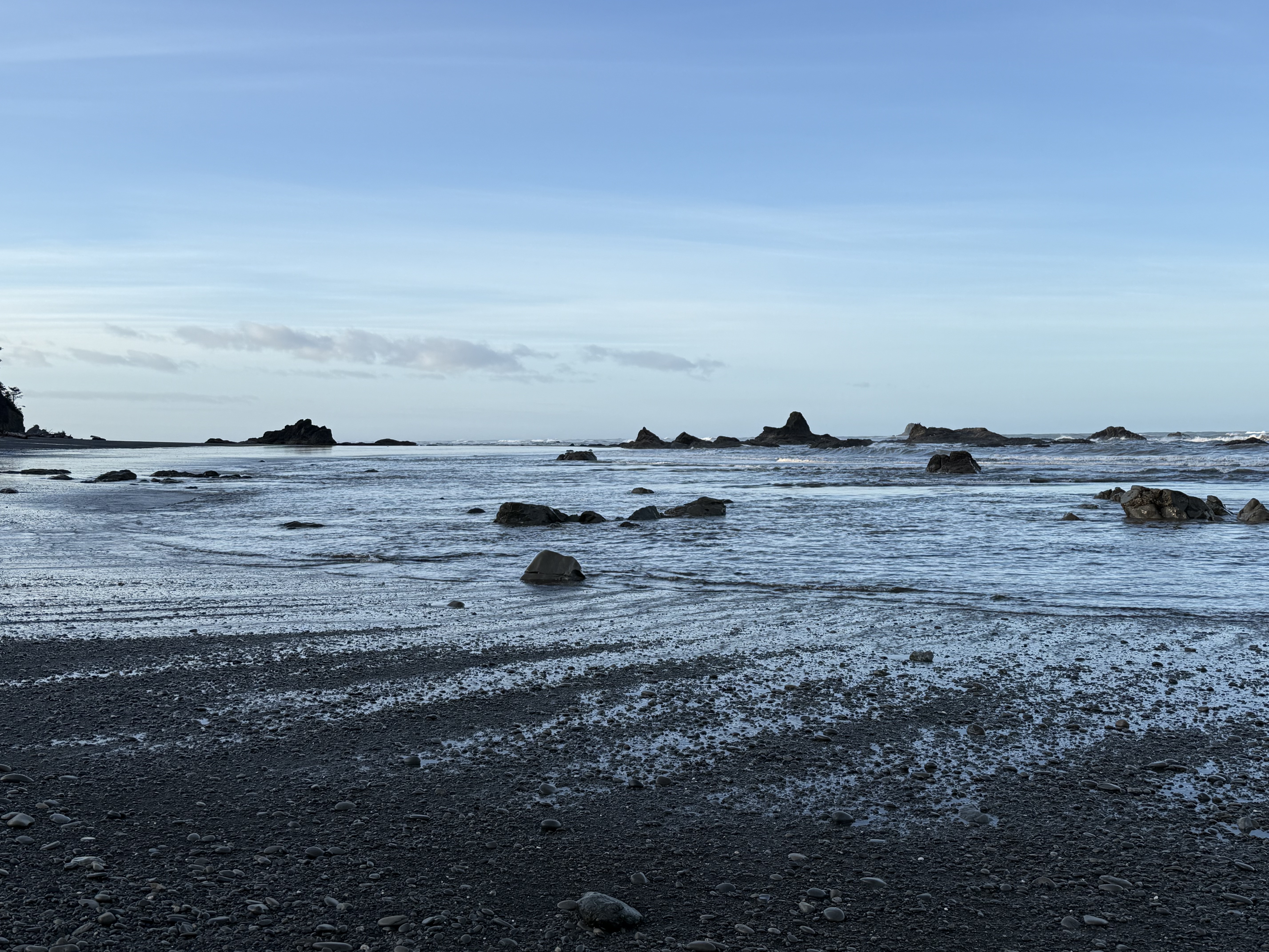
Figure 1. Ruby Beach is located about 10 miles north of Kalaloch Beach (Point C in Fig. 2), but the coastal morphology has changed substantially. This photo was taken at sunrise during low tide, exposing many outcrops of basement rock, which is the same unnamed sandy rock formation we saw before, but its composition has changed.
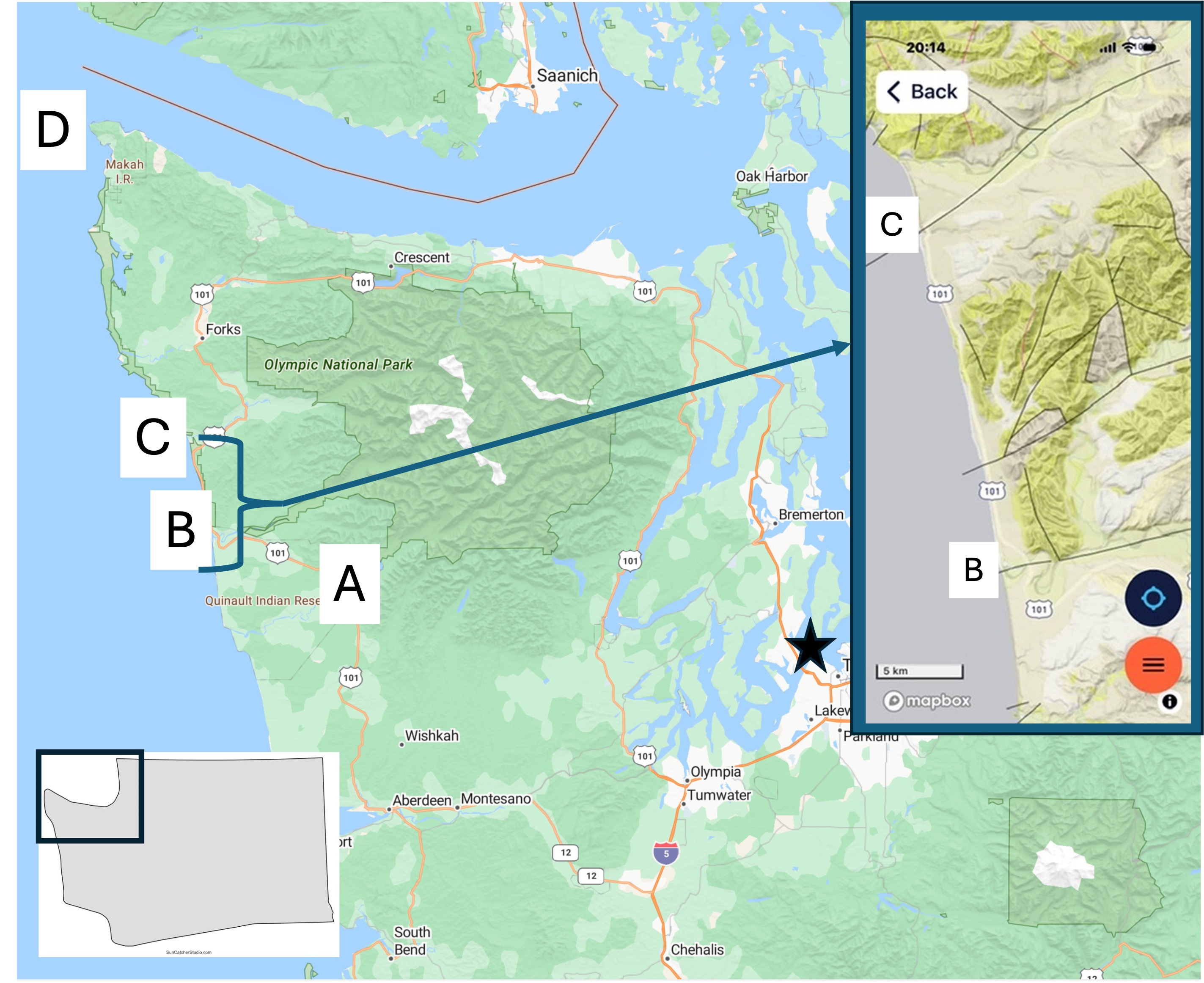
Figure 2. Today’s post describes the coastal geology at Site C. I’ve already discussed the Quinault Rainforest and Kalaloch Beach. I will focus on what is different from the previous post. The inset geologic map from Rock D will be referred to below.
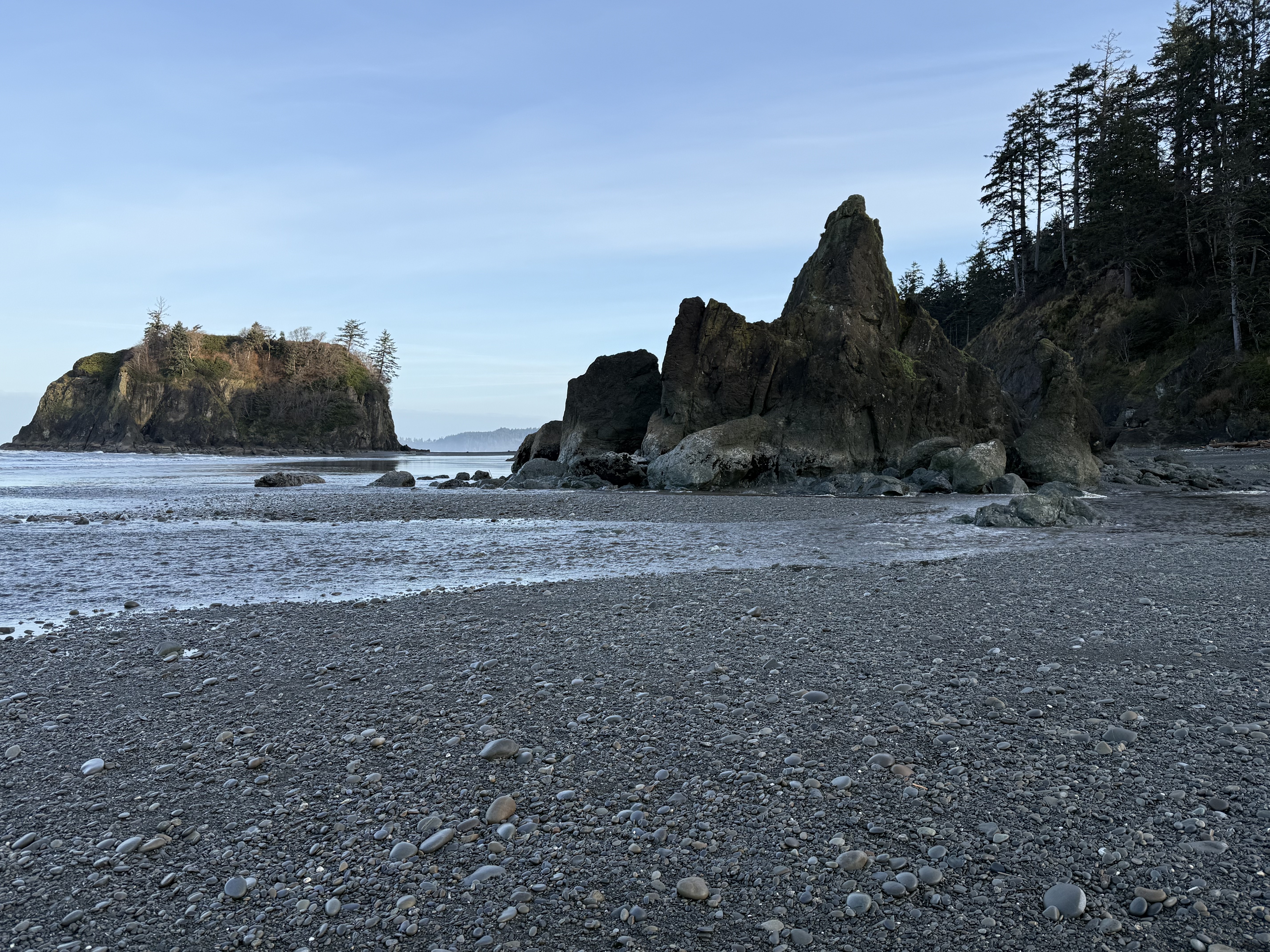
Figure 3. Basement rock of general Tertiary age (66.5-2.4 Ma) is more exposed here although it is overlain by Pleistocene glacial sediments. This photo shows a rocky island that can be reached at low tide, and a promontory. The beach is composed of rounded cobbles in a matrix of sand, silt, and some clay. The finer sediments are restricted to the lower swash zone (Fig. 1).
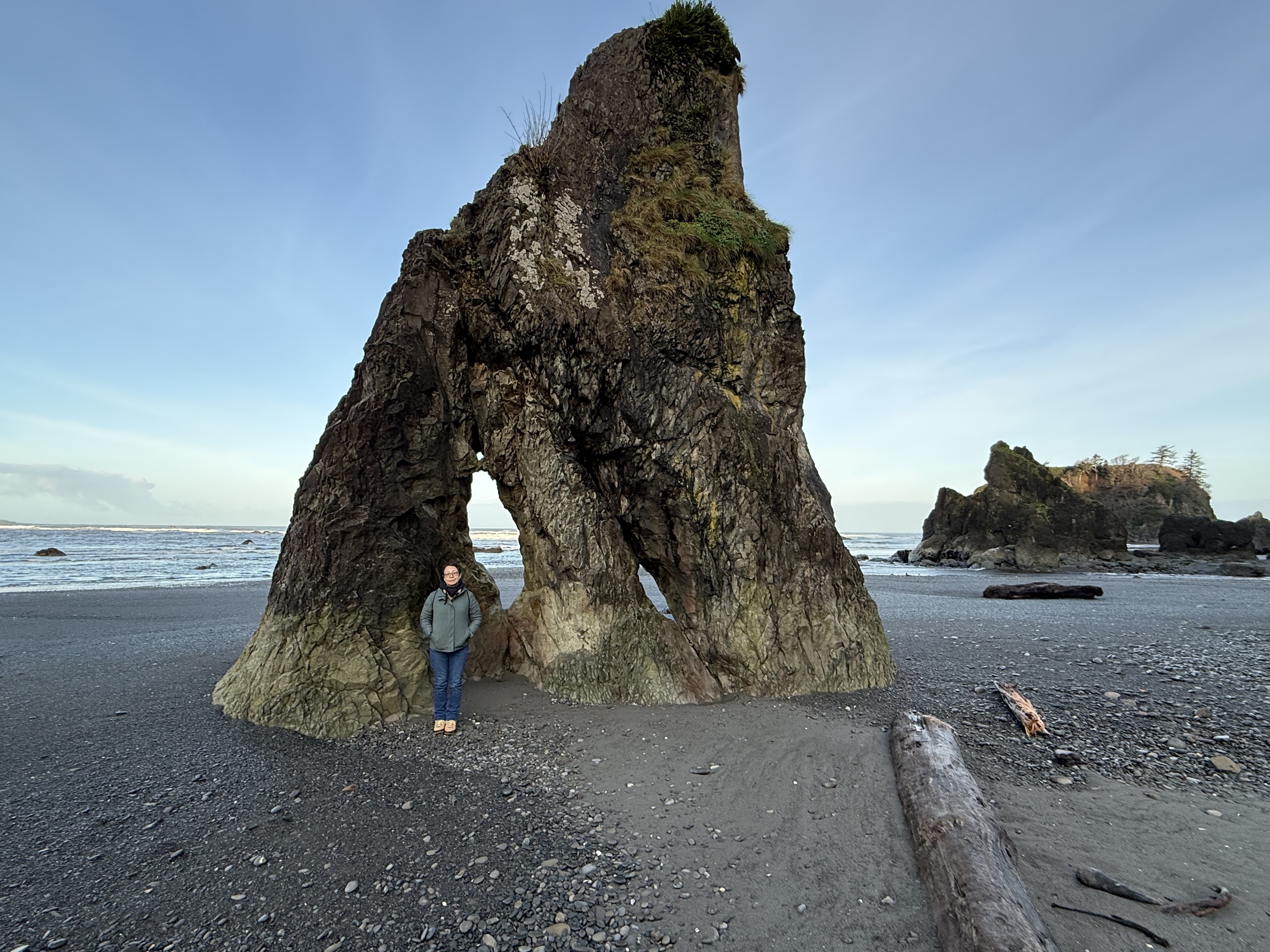
Figure 4. This is a sea stack, a standalone rock pillar. The beach is a thin veneer spread across a rocky basement that is more irregular than we saw at Kalaloch Beach, where the outcrops resembled a wave-cut platform more than we see here. The first thing that occurs to me is that this area hasn’t been exposed to the erosive power of waves for as long an interval. Maybe. Let’s take a look at the inset map of Fig. 2. The black lines represent geologic faults, where rocks have been displaced by tectonic activity. Note that the stretch of coast we’re concerned with is bounded by faults perpendicular to the coast. Furthermore, there is another fault separating Sites B and C. I should take a moment to point out the relationship between faults and river valleys: faults create weak zones within the crust, which are exploited by erosional forces like water and glaciers. Thus we see valleys at both B and C; however, the intervening fault is part of a complex fault system that appears to have led to less surface erosion. Faults cannot be directly dated, only indirectly by the age of the rocks they displace, and in this case those rocks are themselves difficult to date. Thus, it is possible that vertical movement, even a few hundred yards, could have made this beach more irregular than Kalaloch Beach only a few miles to the south–on the other side of a fault. Plausible, but don’t bet your retirement on my hypothesis.
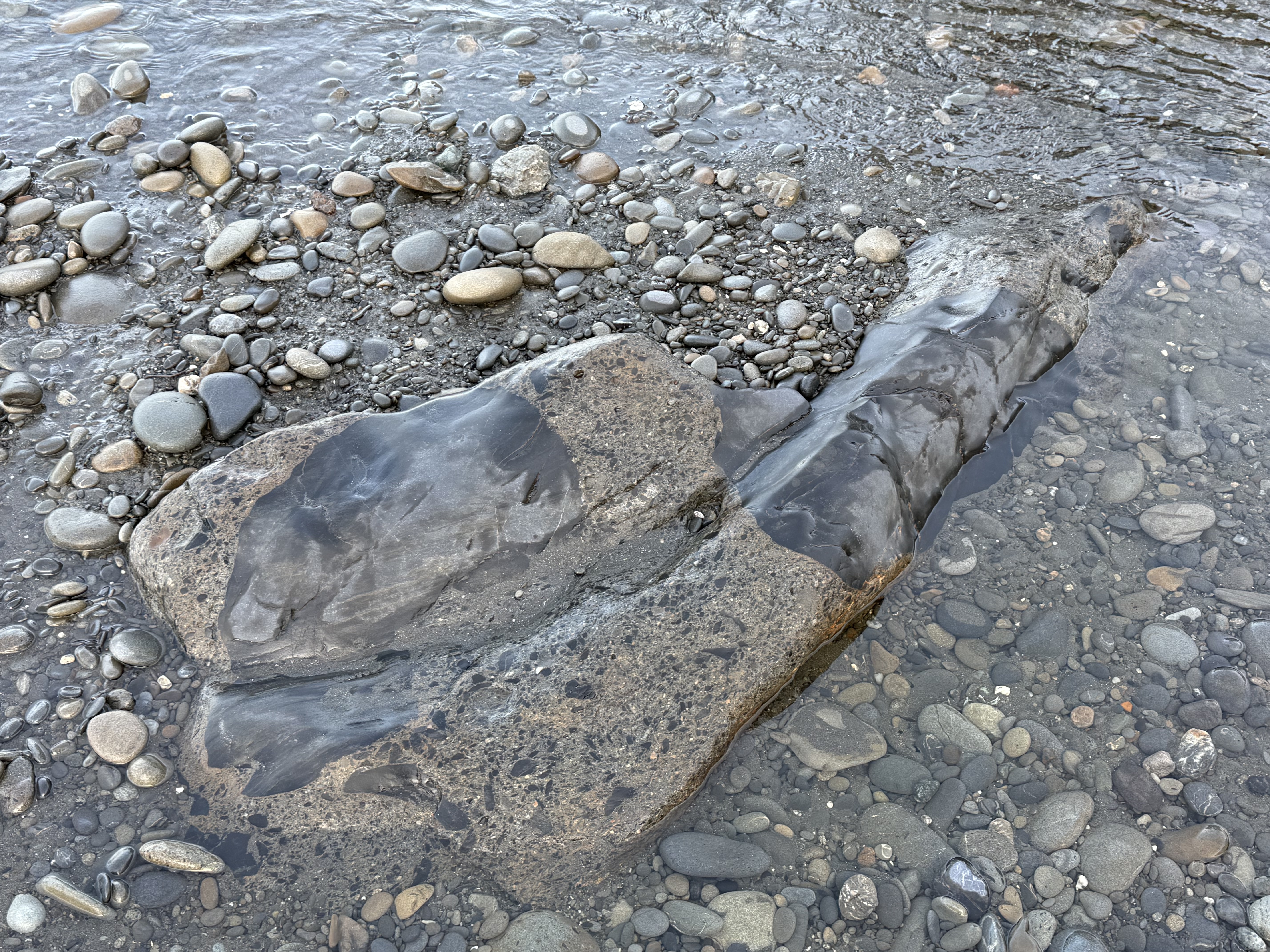
Figure 5. Back to the rocks. This photo puzzled me because I’m not an experienced field geologist, despite my regular posts; however, CoPilot came to the only plausible conclusion: the primary material here is a breccia/graywacke; the smoother material is calcite filling fractures that occurred during faulting (see Fig. 2 inset). We must ALWAYS remember that a sedimentary rock’s history isn’t confined to deposition; a lot happens during burial to many miles and subsequent exhumation and deformation.
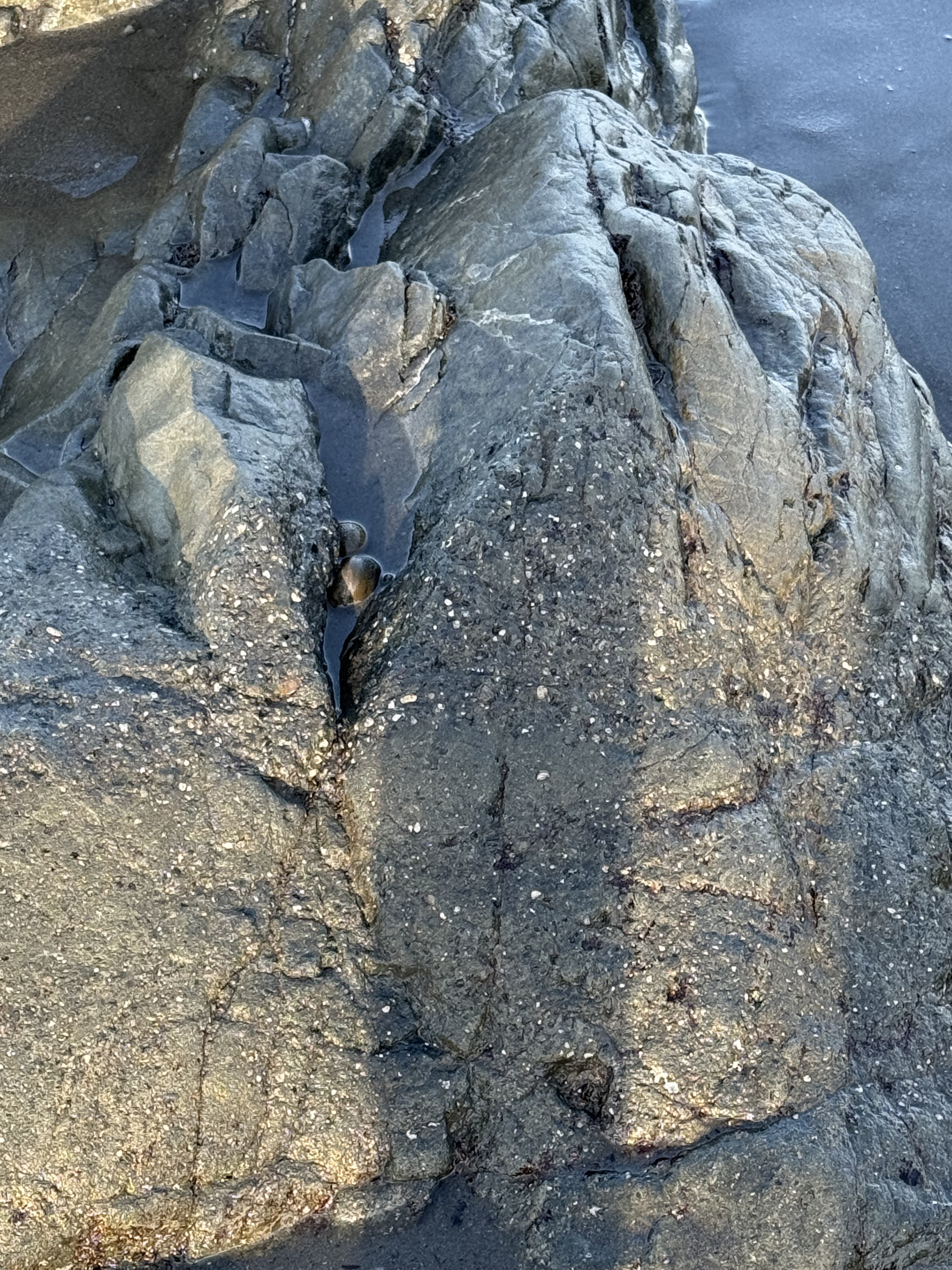
Figure 6. This photo shows a typical graywacke texture with layering, as you might expect with episodic deposition of event beds (e.g. turbidites on a submarine fan); but the upper part of the image is similar to Fig. 6. I asked CoPilot about the source of so much Calcium and I agree with its answer: Some of the Calcium came from marine invertebrates living in the area, but the bulk arrived later, when the sediments were buried deep (several miles) within the accretionary wedge where Calcium is released from minerals like feldspar. It’s really hot down there and the pressure is INTENSE.
Summary.
Not only was Ruby Beach a beautiful area on a cool winter/spring morning, it gave us more insight into the complex life of the earth’s crust. These rocks were probably deposited as poorly sorted graywacke on a steep continental margin overwhelmed by sediment eroded from the rising Cascades (more than likely the Eocene, 56-34 Ma). They were buried for a few million years, before being scraped off the subducting oceanic crust and filled with hot fluids that originated from deeper within the accretionary prism. They were never so humiliated that they became melanges but it was a pretty rough ride, even for a rock.
To put this all in perspective, dinosaurs had just gone extinct (~65 Ma) when all hell broke loose and the Cascades Subduction Zone became very active about ten-million years later; the earth became hot as hell, mammals and birds were beginning to get their legs and wings. While the ecosystem changed dramatically, these rocks were being ground up and spit out by the earth because they were stuck on the end of its tongue. We hominids didn’t come along until these rocks were exposed to the vagaries of the weather and had eroded for a VERY long time.
Try not to laugh at the punch line: Our entire history is contained in the Pleistocene glacial sediments overlying these fairly young sediments.
It boggles the mind…

Recent Comments