
Coastal Geology of Kalaloch Beach
This report is the geology supplement to my general post about the Olympic Peninsula. It focuses on the geology of the beaches because, to be honest, Quinault Rainforest was impenetrable, physically and geologically, without massive logistical planning and support. What I found was more than I expected.
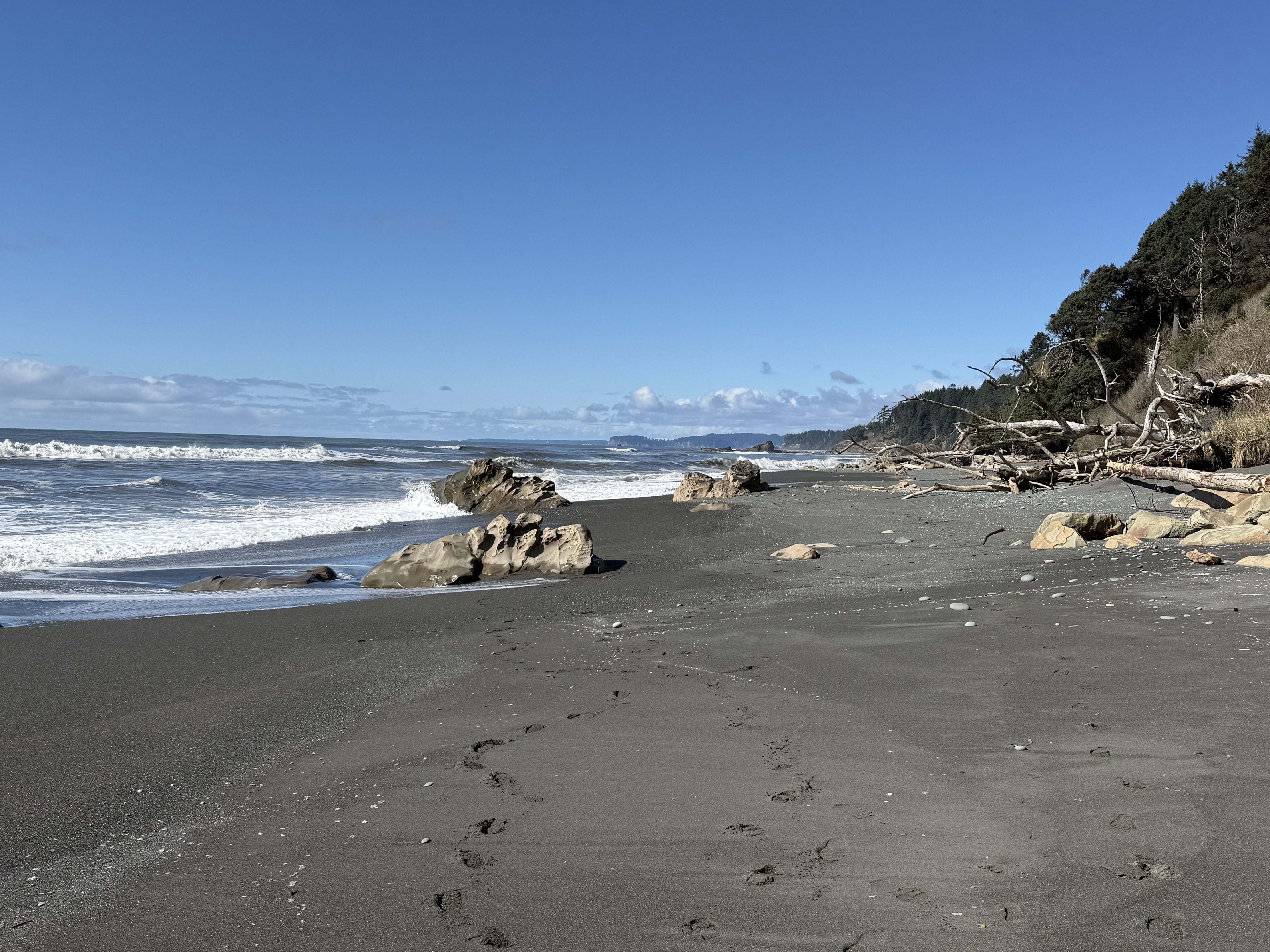
Figure 1. Photo looking north along Beach 4 at Site B in Fig. 2. The tidal range is about 10 feet here and the primary sediment consists of sand with a substantial mud component. The rocks seen in this image are bedrock that protrudes above the veneer of beach sediment. The cliffs to the right comprise glacial till that is less than 2.4 my old (Ma hereafter) deposited by glaciers during the Quaternary geological period. This photo was taken near low tide. The dark color of the beach surface is caused by the relatively large clay component (i.e. mud).
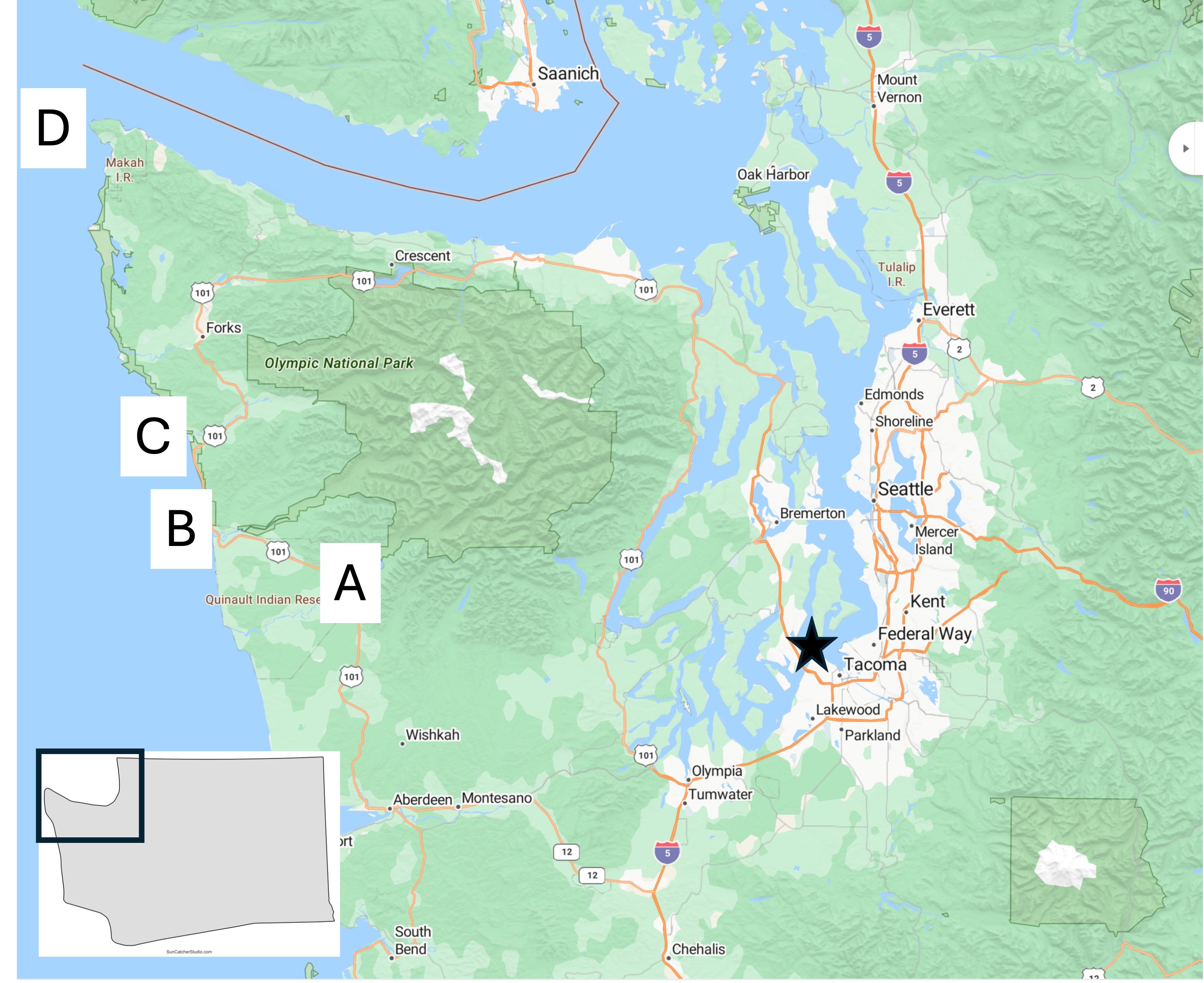
Figure 2. Location map of today’s field area, which will focus on Site B.
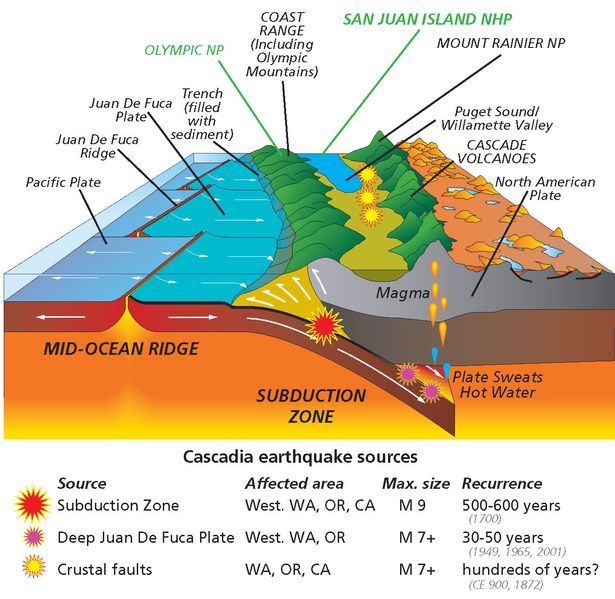
Figure 3. Schematic of the Cascadia Subduction Zone as it appears today. The Coast Range, which includes the Olympic Mountains, consists of sediments and volcanics that have been scraped off the subducting ocean crust. The white arrows at the front of the image don’t reflect the actual geometry of these sedimentary rocks. We’ll get to that in a minute. Today’s post will focus on these sediments and discuss their original depositional environment during the Tertiary period (~65.5-2.4 Ma), as well as evidence for structural deformation.
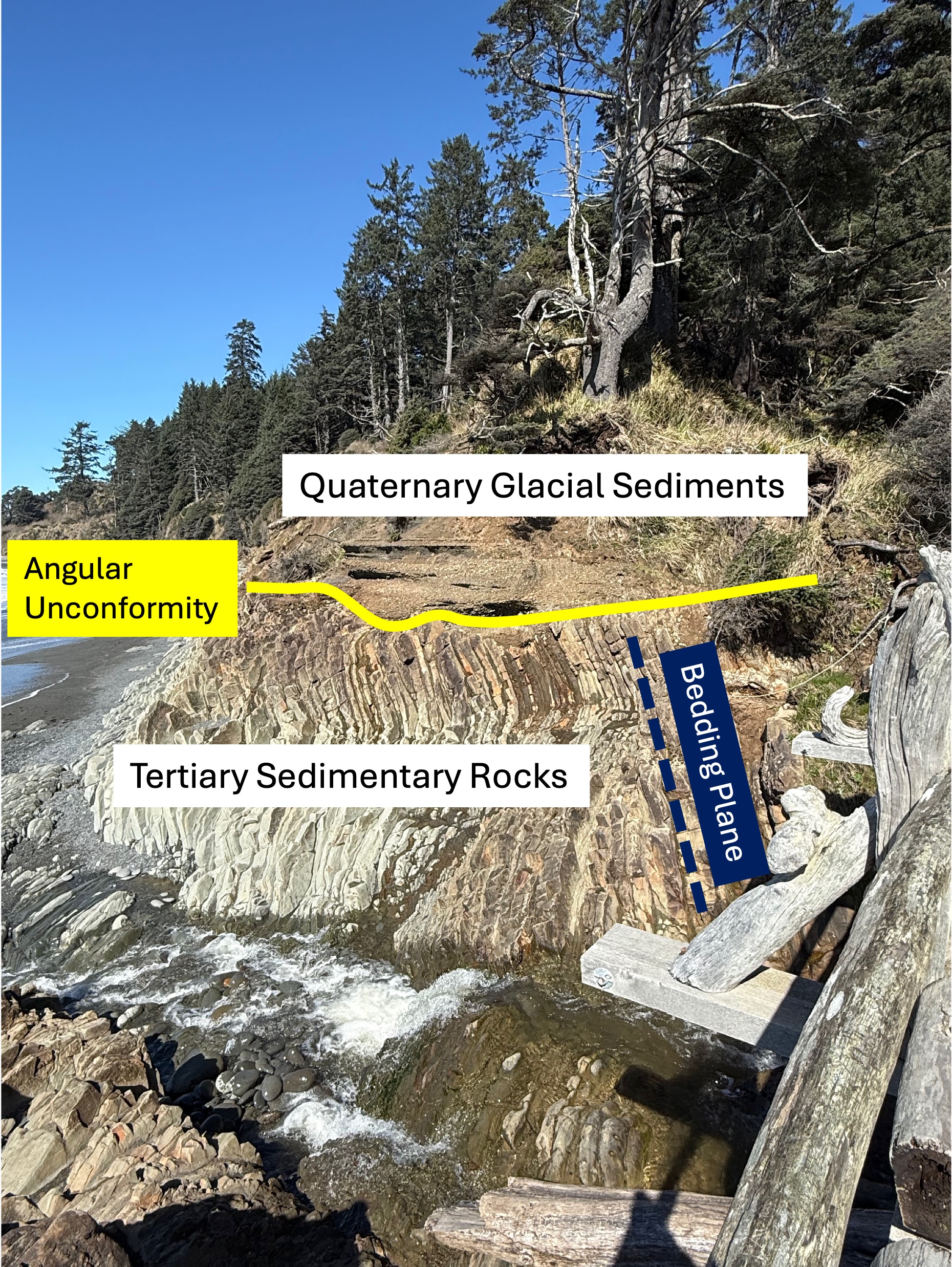
Figure 4. This photo has been marked-up to highlight what might not be obvious to a non-geologist. First, older sedimentary rocks have been tilted to a high angle (dark blue bedding plane line) by faulting, as suggested in Fig. 3, and exposed to erosion at the surface. This erosional surface is shown by the yellow line. These Tertiary sediments were buried several miles beneath the ocean surface where the grains were cemented by heat and pressure. We don’t know exactly when this occurred or how long this process took, but they were later overlain by younger glacial sediments during the Pleistocene epoch (2.4 Ma to present). The age of sedimentary rocks can’t be pinned down unless they contain material datable by radiometric methods or, more qualitatively, by the fossils they contain. Sandy sediments don’t contain fossils very often and I didn’t find any radiometric ages in either Rock D or the USGS geologic map, so I guess the Tertiary date is the best we can do for now.
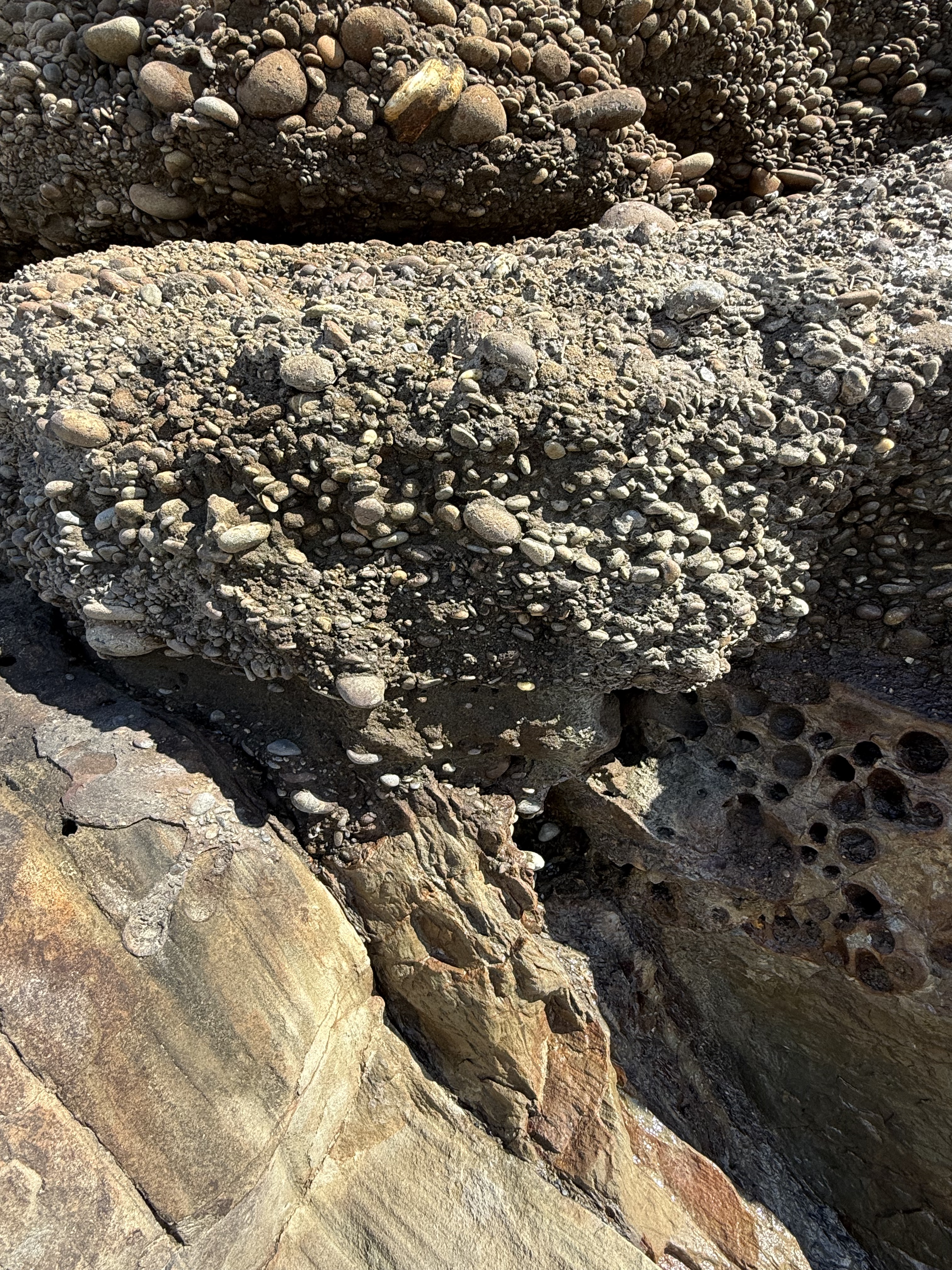
Figure 5. Close-up photo of the contact between the Tertiary rocks and the glacial till. Note that the cobbles aren’t falling out of the fine matrix sand and clay; this is because these young (>2.4 Ma) conglomerates have been partially cemented and, in fact, they were stuck to the older rocks below. This photo tells us a lot: 1) the older rocks were tilted at depth (maybe a mile or more) and then pushed upward as suggested in Fig. 3 until they were exposed to the atmosphere; 2) in a very short time they were covered by cobbles (~2 inches or less) that had already been rounded in a river, which takes several miles of transport; 3) the type of sediment varied rapidly, from coarse sand to cobbles, probably within decades if not years, due in part to periodic changes in surface drainage (e.g. the advance and retreat of glaciers); 4) this is a good example of the principle of Uniformitarianism–the present is the key to the past: we see similar processes occurring today along the many streams and rivers draining the Olympic Mountains. But what about those pesky Tertiary sandstones?
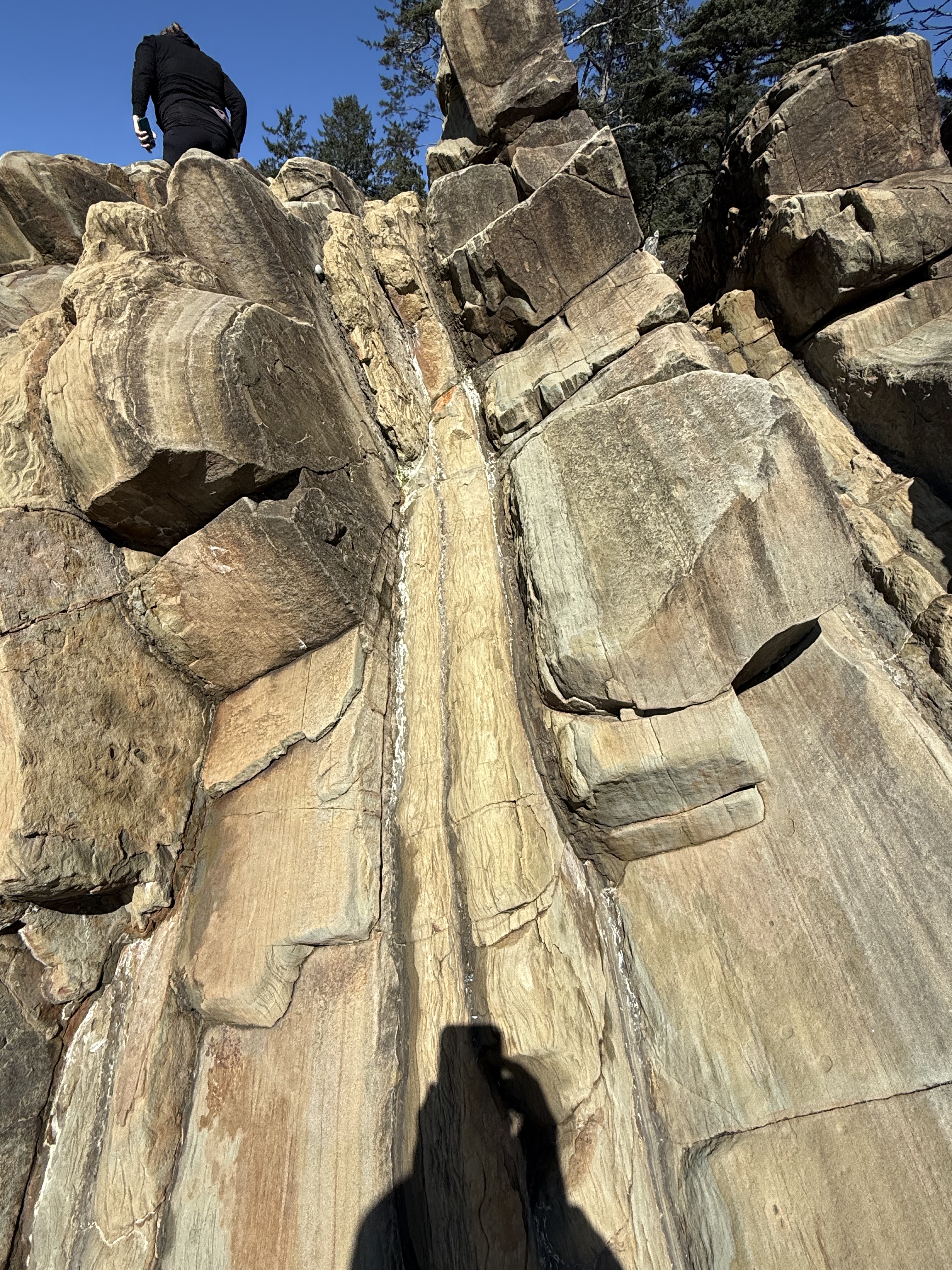
Figure 6. This photo of the Tertiary sedimentary rocks reveals packets of thin-bedded fine sandstone with intercalated dark layers of (presumably) mud. I didn’t see any cross-bedding, which would indicate deposition in a river or nearshore dominated by waves or currents. What is obvious that this ancient (~50-2 Ma) shoreline was receiving sediment from a distant source, probably the volcanic highlands of the modern Cascades (see Fig. 3). Let’s take a closer look at one of those wavy layers.
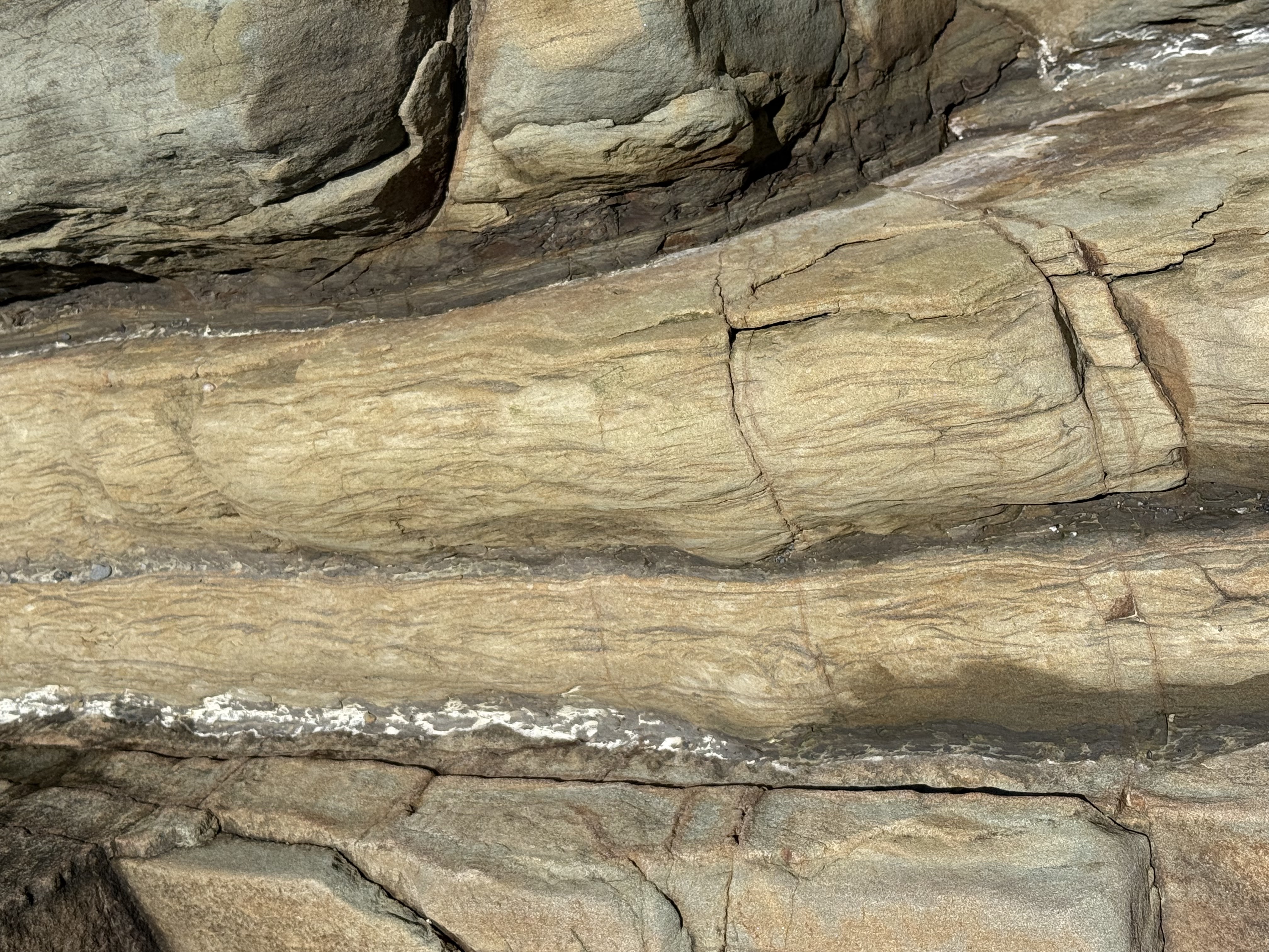
Figure 7. Close-up image of a thin layer (about 3 inches), showing what is called Flasier bedding. This is found in modern environments where high-energy (e.g. waves and tides) periods are interrupted by quiet times during which fine sediment can be deposited between ripples. It is indicative of a shallow marine environment.
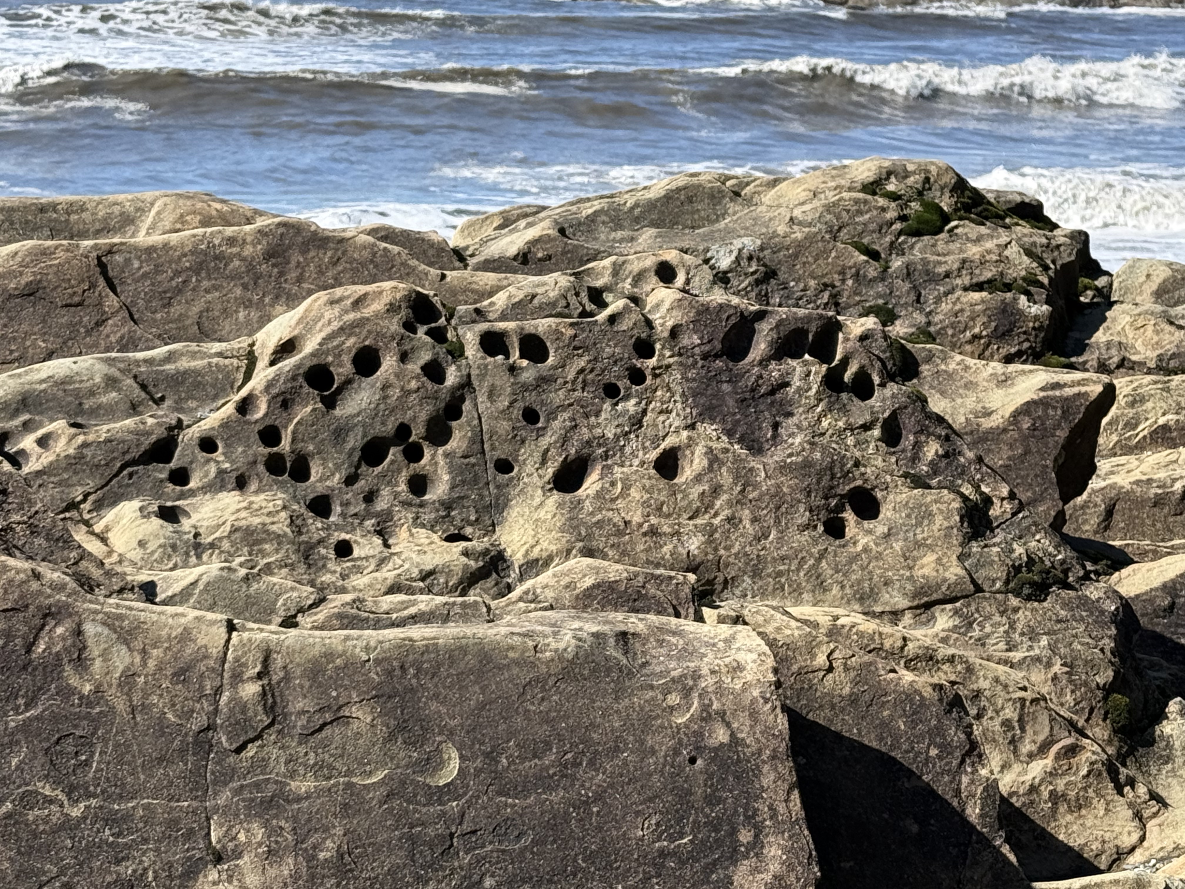
Figure 8. These holes were evident throughout the exposure. They are problematic and probably originated in several ways; however, one plausible explanation is that soft-bodied animals like worms burrowed in the sediments and their burrows filled with sediment with a different composition (e.g. fecal pellets). These channels then preferentially eroded when subjected to the harsh nearshore environment in which they are found. The presence of such holes at the unconformity (see Fig. 5) proves that they predate deposition of the overlying glacial till. Unfortunately, such trace fossils don’t tell us anything about geologic age, only that this seashore was teeming with life.
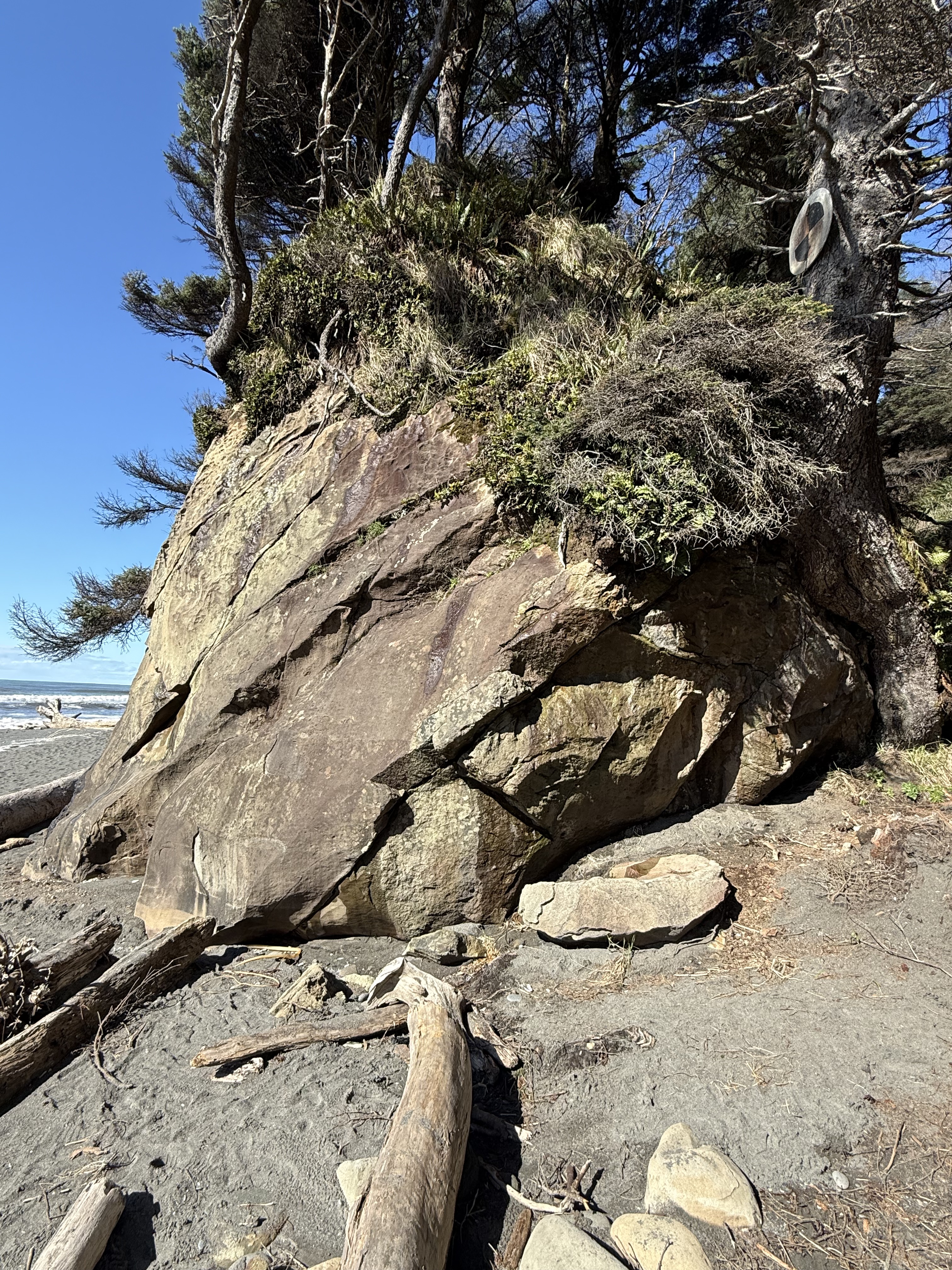
Figure 9. I stopped at another accessible beach a couple of miles south, but still indicated as Site B in Fig. 2, where the rocks were sandstone but with very little clay. The beds seen in this photo were thick (1-3 feet). They were not deposited in a high-energy, environment like those we saw before; they were probably deposited on the shoreface below fair-weather wave base–possibly part of a nearshore bar or barrier island. After deposition and burial, they were tilted less steeply than those seen further north (Fig. 6). The unconformity is seen in the upper part of this image, but it doesn’t seem to have as many rounded cobbles as before (Fig. 5). I have no way of knowing the relative age of these two exposures; this Tertiary rock unit is approximately 3000 feet thick and represents millions of years. All we can say for certain is that this shoreline wasn’t that different from what we observe today. Uniformitarianism in action.
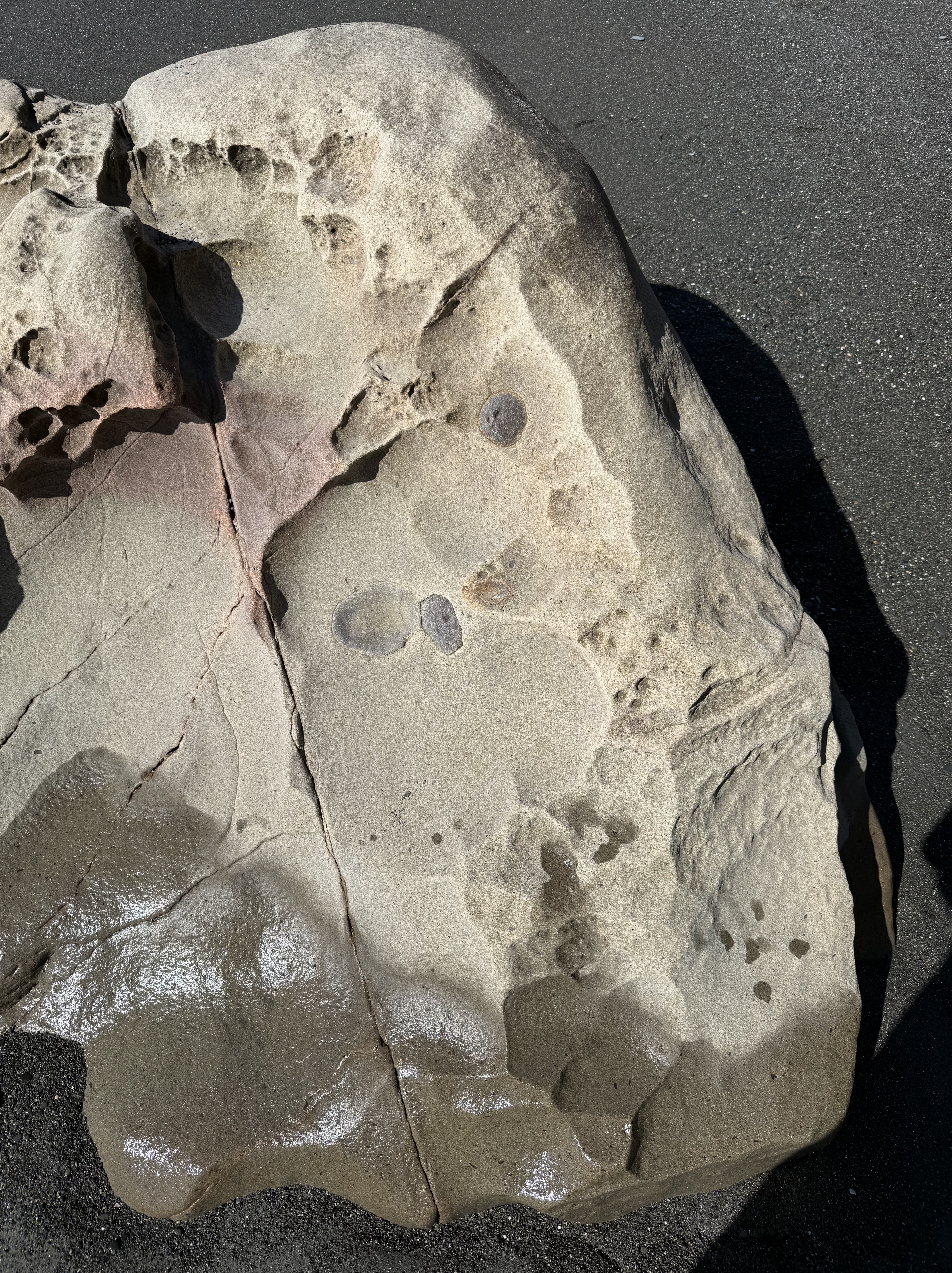
Figure 10. This exposed outcrop within the tidal zone reveals what are probably concretions of iron oxides, formed during early diagenesis. They superficially resemble fossils, but that is not the case. As the sediment was squeezed during burial, incompatible elements like iron formed irregular blobs in an otherwise uniform quartz sand matrix.
Summary
This coastline was part of the Cascadia subduction zone during most of the Tertiary period. Sediment, including a lot of sand, was eroded from rocks being uplifted further inland where volcanism was active, especially during the Eocene (55-35 Ma). Beaches like those we see toady were common, as well as the various depositional environments found along the Olympic peninsula, including fluvial and submarine fans, beaches, and cliffs. But no glacial sediment.
These sediments were buried as more material was removed from the rising orogenic belt, which included granitic rocks with lots of quartz. Eventually they were caught by the complex trench uplift (see Fig. 3) and scraped onto the edge of N. America. This involved faulting primarily, suggesting this was a fairly shallow process (folds occur at depth where rocks are ductile). The tilted rocks were eroded for millions of years; then, about 2.4 Ma glaciers (nothing to do with subduction) covered the region and deposited all kind of sediment: rivers, lakes, undifferentiated till, moraines, etc.
Just as the East Coast of America has been a passive margin for more than 200 my, the West Coast has been a convergent margin. Instead of being steadily worn away by wind and water, these rocks are rising out of the sea at about 2 inches per year. And what a ride it is…

Trackbacks / Pingbacks