
Pinnacle Peak Park: Miocene Andesitic Volcanism
Introduction.
This post examines some of the rocks we discovered while climbing Pinnacle Peak (Fig. 1), a small shield volcano created during the Miocene epoch, between 23 and 5.3 Ma (millions of years ago determined by radiometric dating). The wide range of dates suggests that this volcano remained active for a very long time, producing volcanic material of different types as it released pressure from the magma chamber feeding it. I can’t pin down the dates any better, although they are better known within the geological literature. Thus, my discussion and the model that follows are meant to apply to the entire period of activity.
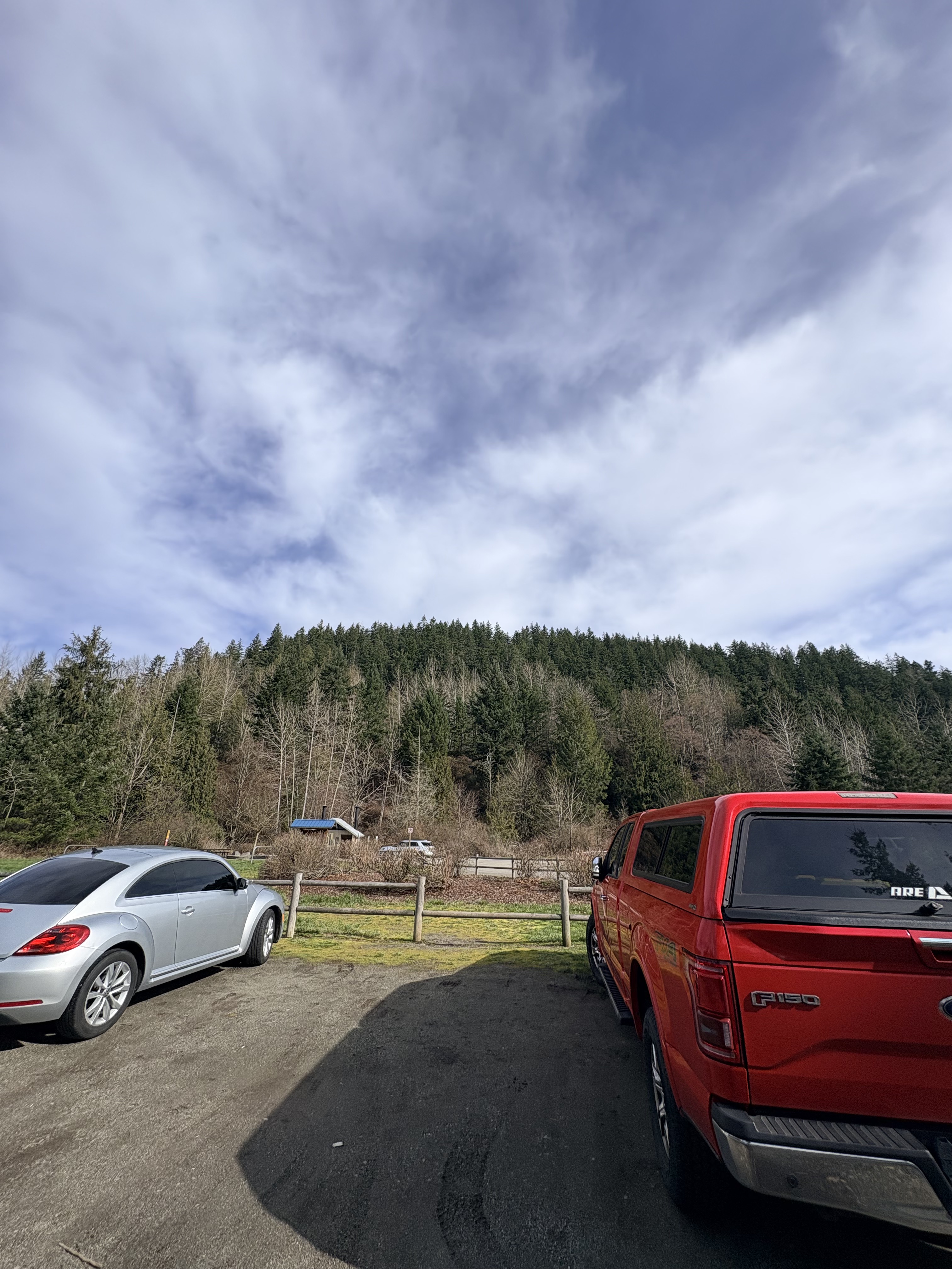
Figure 1. Pinnacle Peak is about 1000 feet in height. This photo reveals the characteristic low profile of a shield volcano, making it appear smaller because the summit is more than a mile distant; however, note that it is slightly asymmetrical because the southern (right side) slope is lower than the north side.
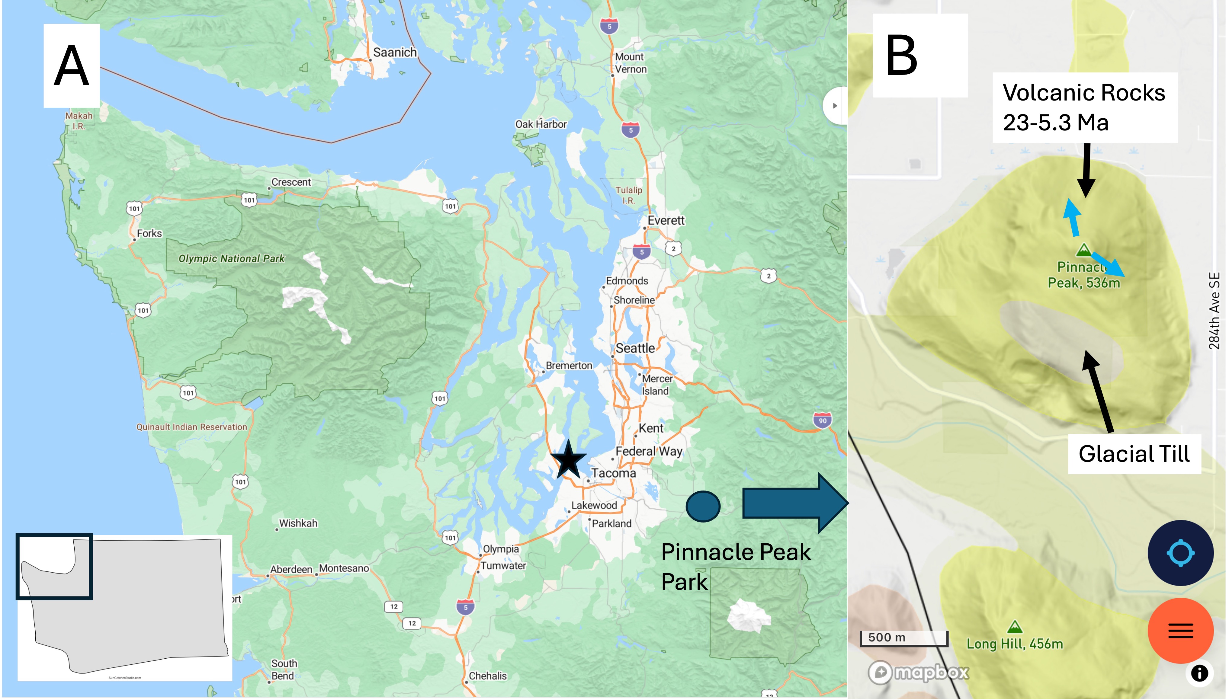
Figure 2. (A) The Pacific Northwest (PNW) base map I will refer to in this series of posts. Tacoma is indicated by a star and Pinnacle Peak park by the circle. It was less than an hour drive on a weekend at 0800; traffic picked up substantially and, by the time we left at about 1130, there was a traffic jam throughout the area because the access roads are small. Go early! (B) The geological map from RockD shows several volcanoes of similar Miocene age standing out in an ocean of glacial till. Note the presence of a deposit of till on the southern slope of the mountain. This was difficult to identify because the main trails followed old logging roads that had been covered with gravel, probably from this till and the White River flood plain below, in which there was active quarrying on the day of our visit. Note the blue arrows at the summit because they will be referred to below.
Observations.
We walked up the Pinnacle Peak Loop Trail counterclockwise, taking photos and noting the geology along the path. However, this is not a geological report but only a casual observation. All dates and rock types are from RockD, a compilation of geological maps produced by uncountable numbers of geologists engaged in active geological field and laboratory research. Thank them for the accessibility of their data, and blame me for any errors in interpreting it.
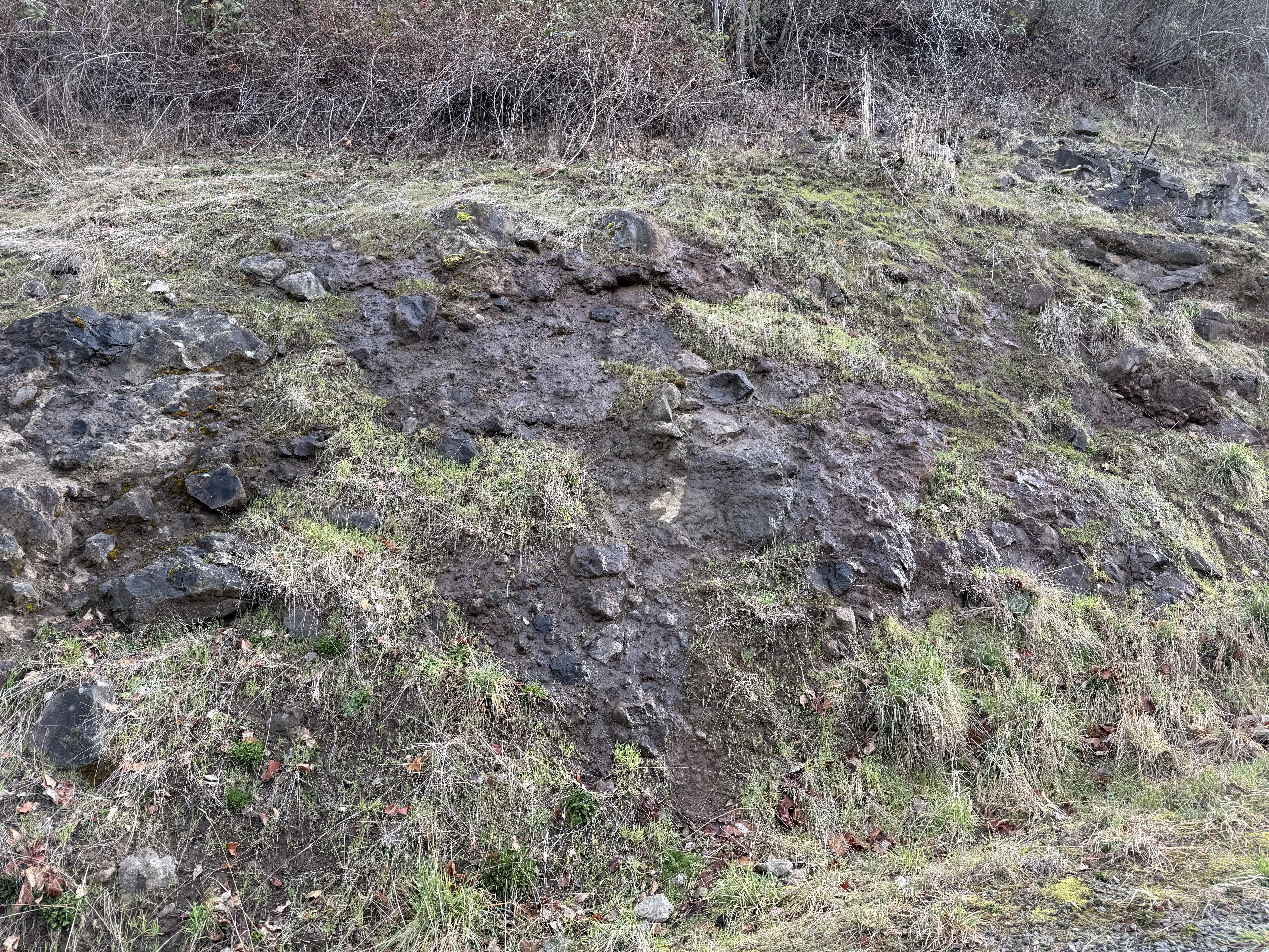
Figure 3. This photo was taken about half-way up the volcano where a road-cut revealed volcaniclastic sediments like we saw at Snoqualmie Falls. This nice exposure reveals a fine matrix of dark material including irregular, but rounded, boulders up to a few feet in diameter. These are volcanic bombs, semi-molten lave blown out of the vent by gas pressure which landed hundreds of feet from the summit.
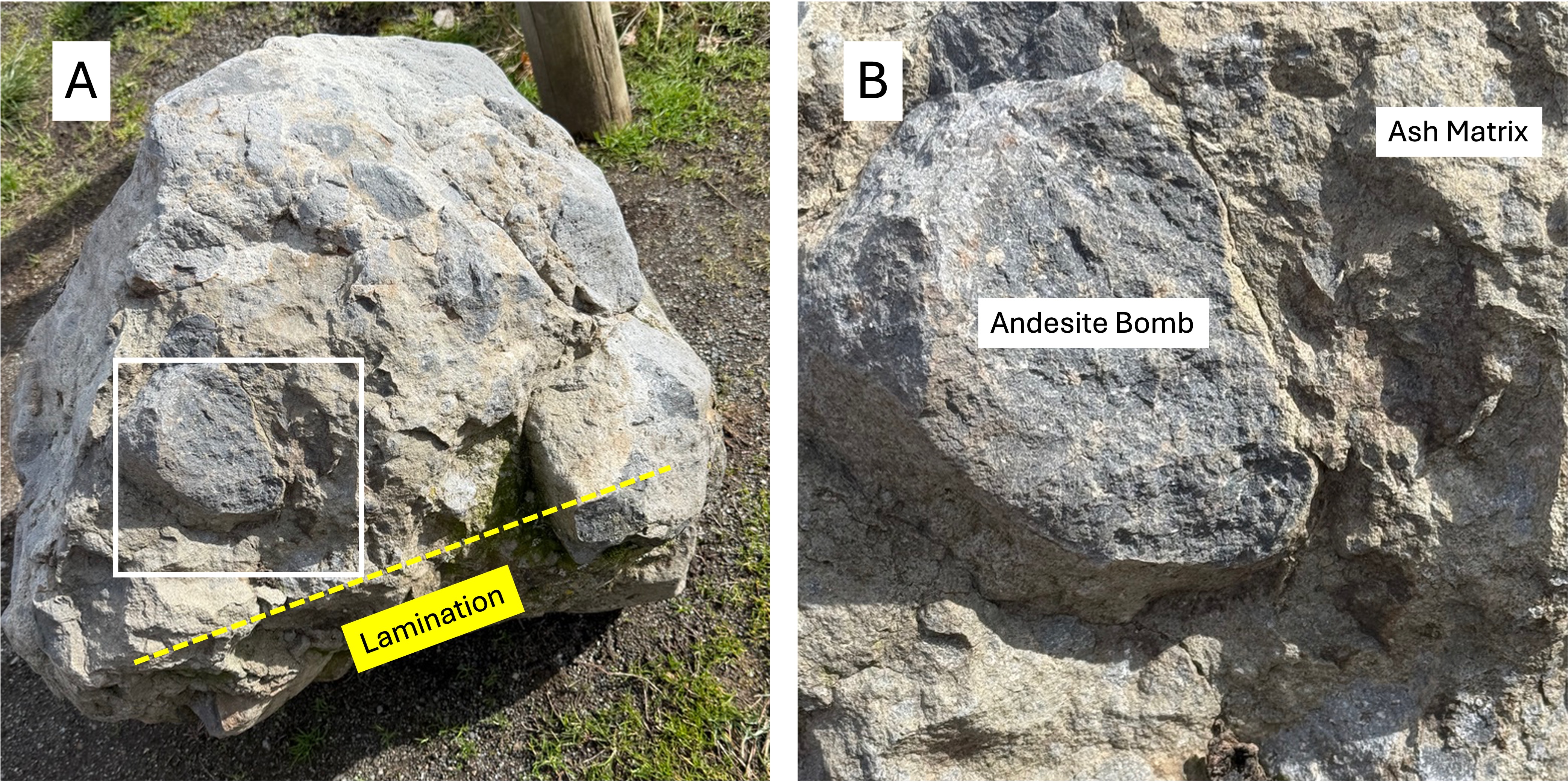
Figure 4. (A) This boulder of volcanic breccia was placed in the parking lot, probably as an example for public viewing. It is about 3 feet in diameter and contains numerous volcanic bombs, as well as fine lamination near what was its original bottom, as labeled in the figure. These would have been layers of ash with alternating chemical properties that gave them different colors. (B) Close-up showing the contrast between the lighter colored ash matrix and an andesite bomb. Imagine this semi-molten, andesite bomb flying hundreds of yards and landing in still-hot ash. The number of bombs visible in (A) suggest that this was part of a very explosive event.
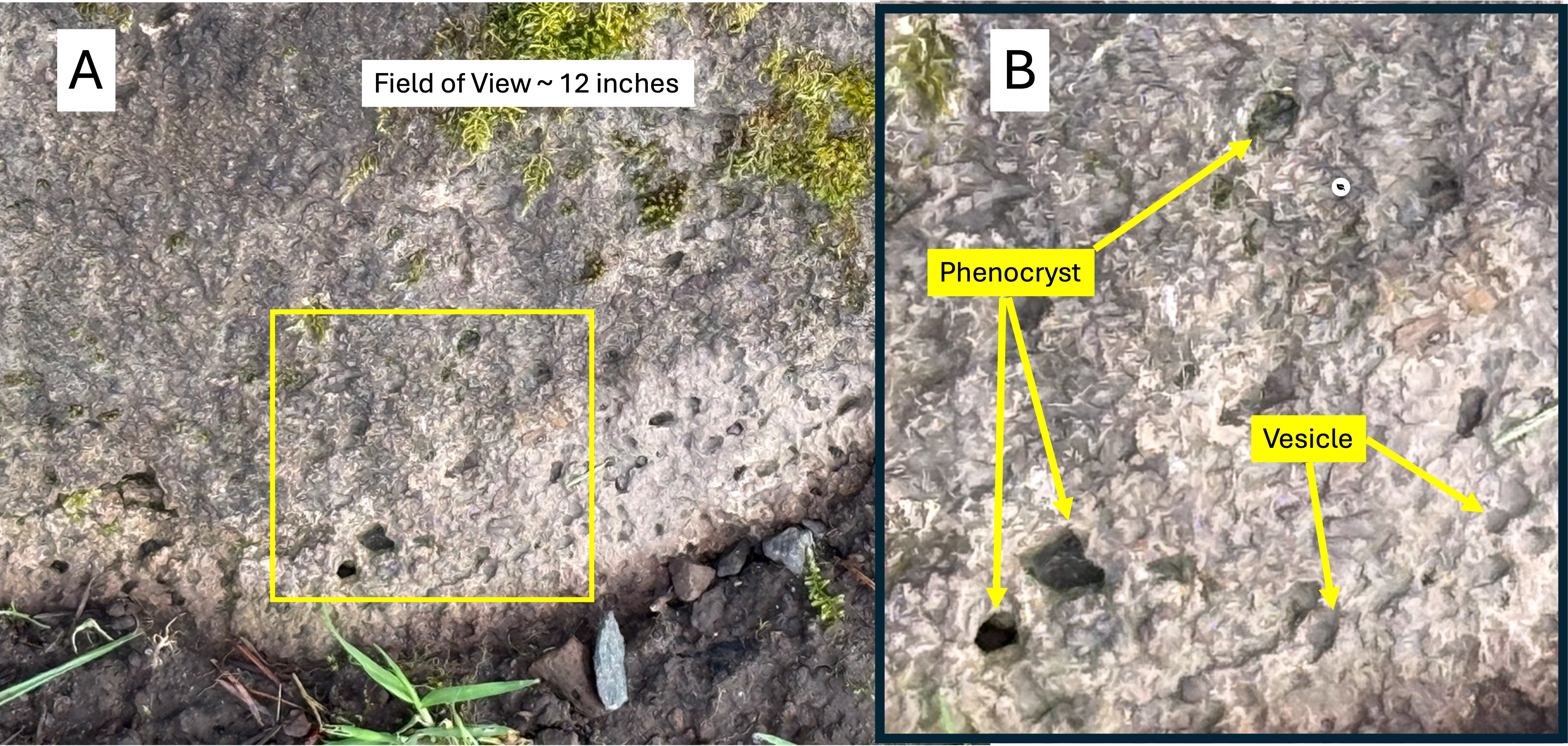
Figure 5. (A) Close-up of a boulder within a semi-hidden exposure of andesite near where Fig. 4 was taken. (B) This close-up reveals phenocrysts (solid mineral crystals) and vesicles (pockets left by escaping volcanic gases). I cannot identify the minerals comprising the phenocrysts, but common ones within andesite are pyroxenes, plagioclase (high-calcium feldspar), hornblende, and biotite. These are all dark minerals that crystallize at higher temperatures than high-silica (Si02) minerals. The specific mineralogy tells volcanologists about the chemistry of the magma chamber feeding the volcano. The vesicles of gas (e.g. CO2, CO, water vapor, sulfur compounds, H2S) are a crude indication of how explosive the magma was; more vesicles implies more explosive potential, especially in andesites, which are more viscous than basalt.
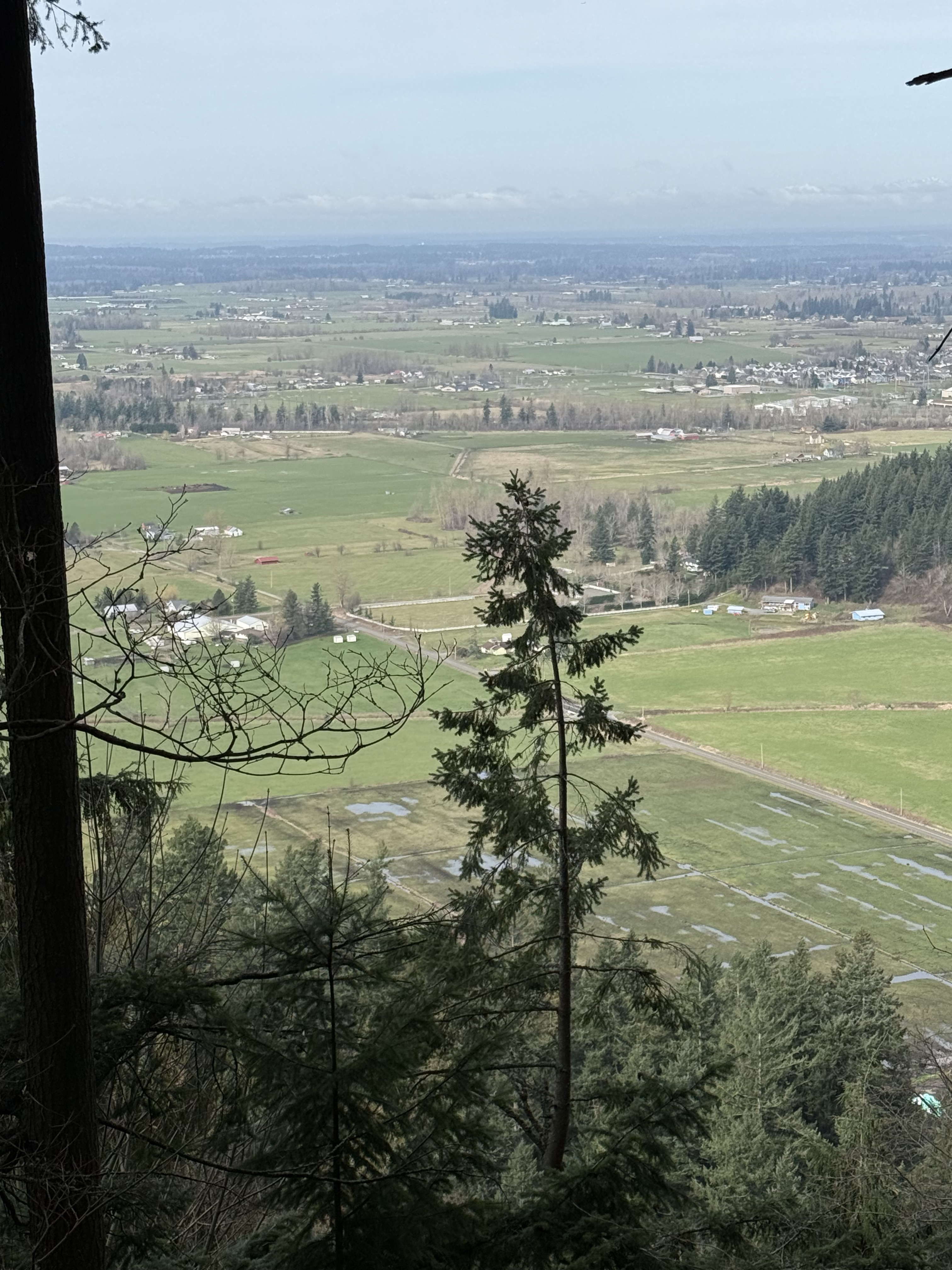
Figure 6. View from near the summit looking south toward the White River. This is a very different perspective of Pinnacle Peak than Fig. 1. The river valley is filled with glacial till (< 1 million years old) that covered all of the volcanic material from the volcano, which stands out today because it was never covered by ice.
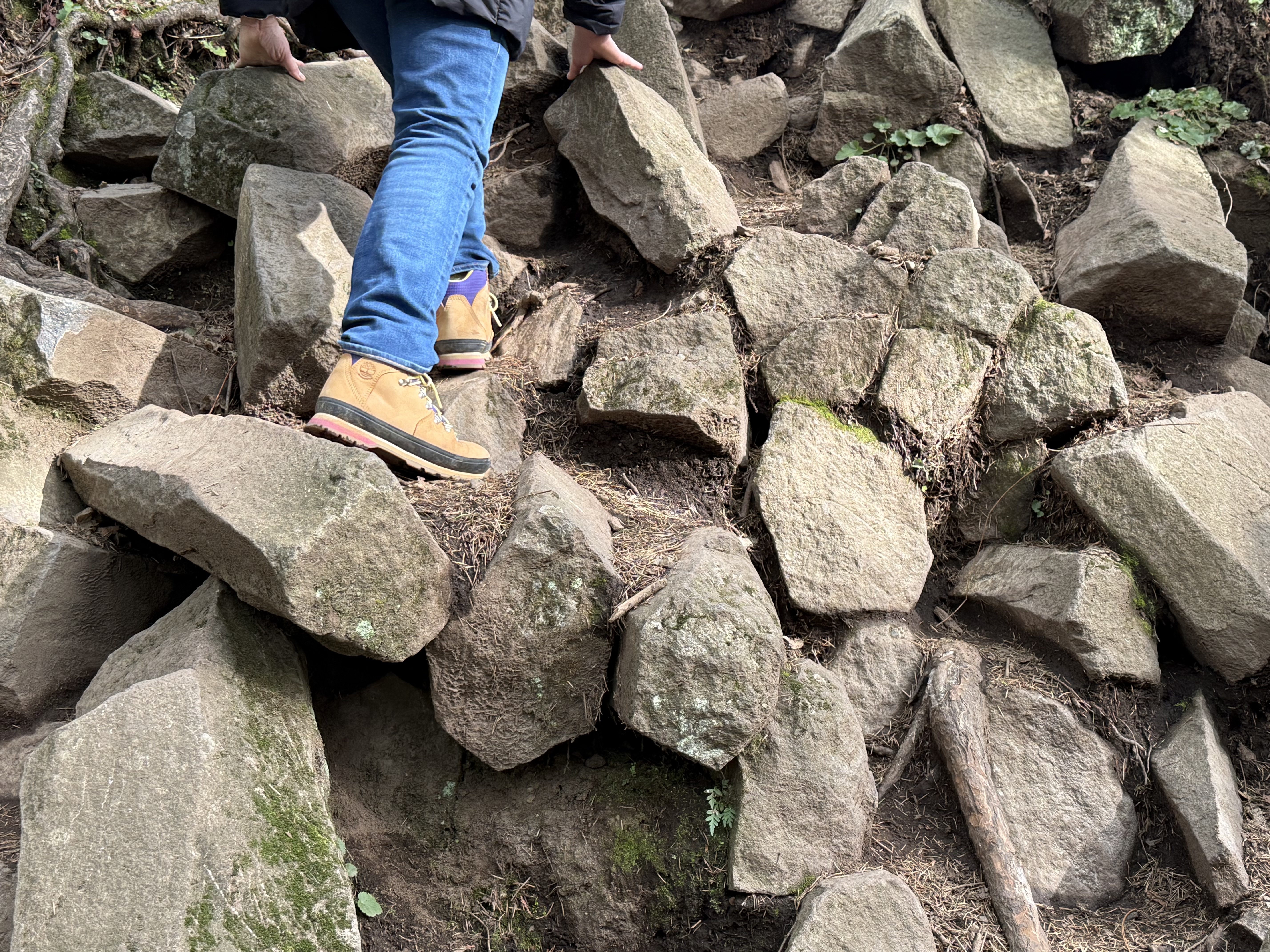
Figure 7. Photo taken on the SE side at the top of Pinnacle Peak (blue arrow in Fig. 2A). These horizontal rocks are not boulders, but instead the ends of columnar joint blocks of andesite. They are less than one foot in diameter; most of them are hexagonal, but irregular shapes are also present. They form when lava cools slowly enough to allow this kind of crystallization to occur, but rapidly enough that the lava doesn’t form massive beds.
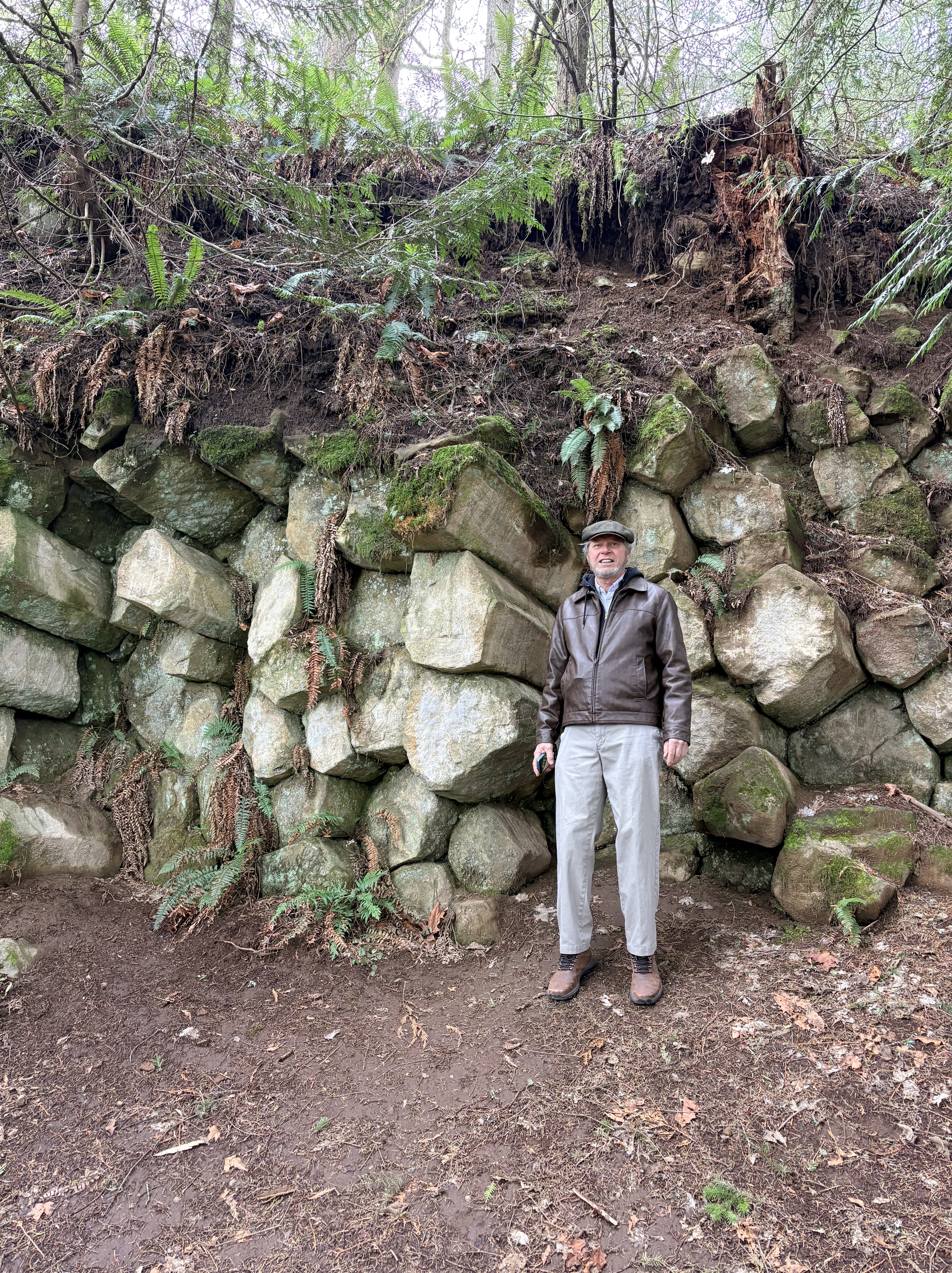
Figure 8. Photo of columnar andesite near the summit on the NNW side. These are much larger in diameter than those seen in Fig. 7. Columnar jointing is usually oriented with the ends vertical, but this isn’t necessarily required because gravity is not the dominant force; chemical bonds between the individual minerals determines the development and size of columnar joints. As long as the “top” of the lava flow (facing the camera in this photo) is exposed to the atmosphere, they can form. I reported on incredible examples of this in my post on Organ Pipes National Park near Melbourne, Australia.
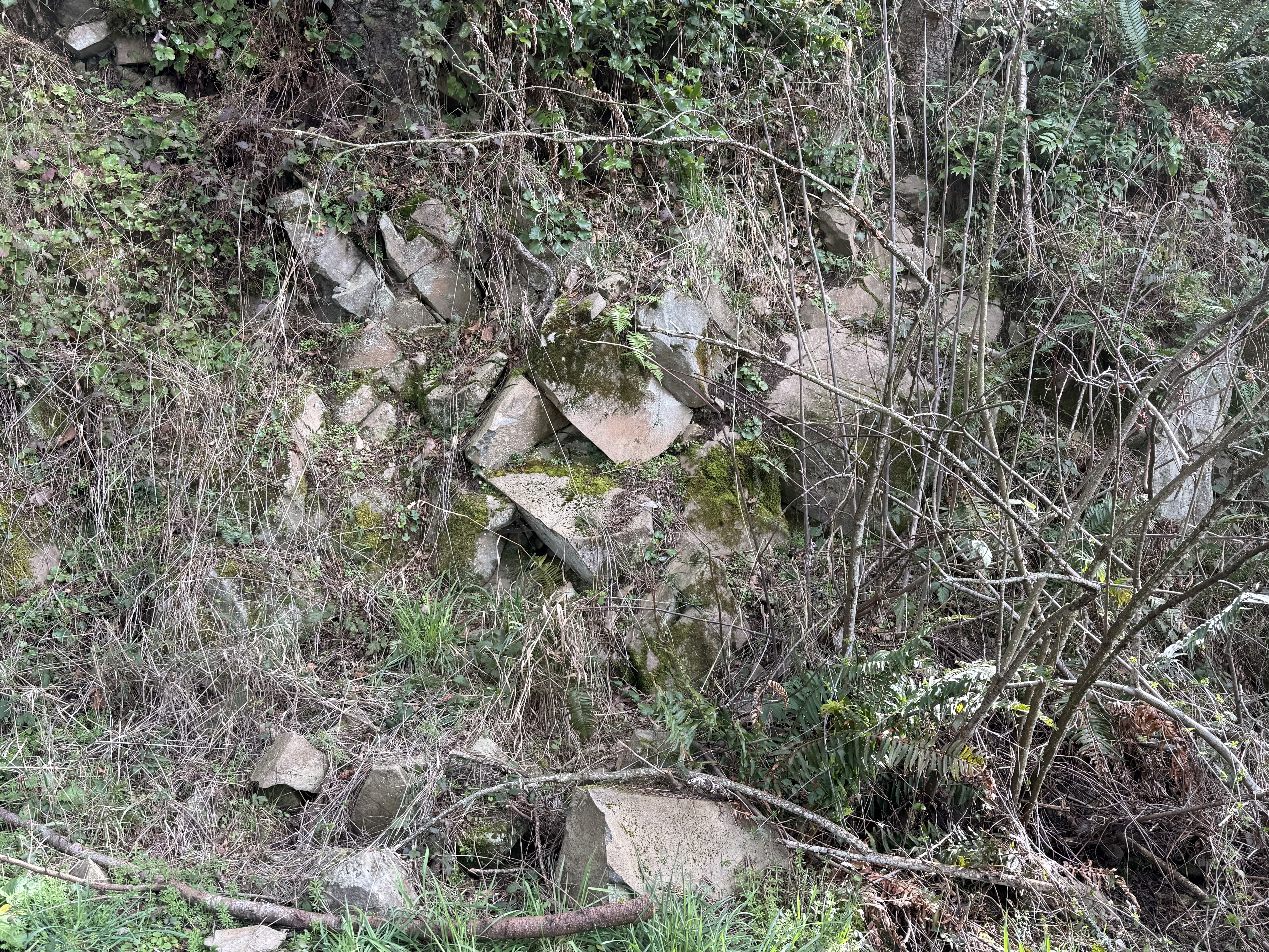
Figure 9. This exposure, from further down the south slope of Pinnacle Peak, reveals blocky lava that seems to be bedded, with bedding planes dipping away and to the right of the camera. No columnar jointing is visible, and the rocks are solid. This could be an outcrop of sandstone if it weren’t for the grayish color. Maybe limestone?
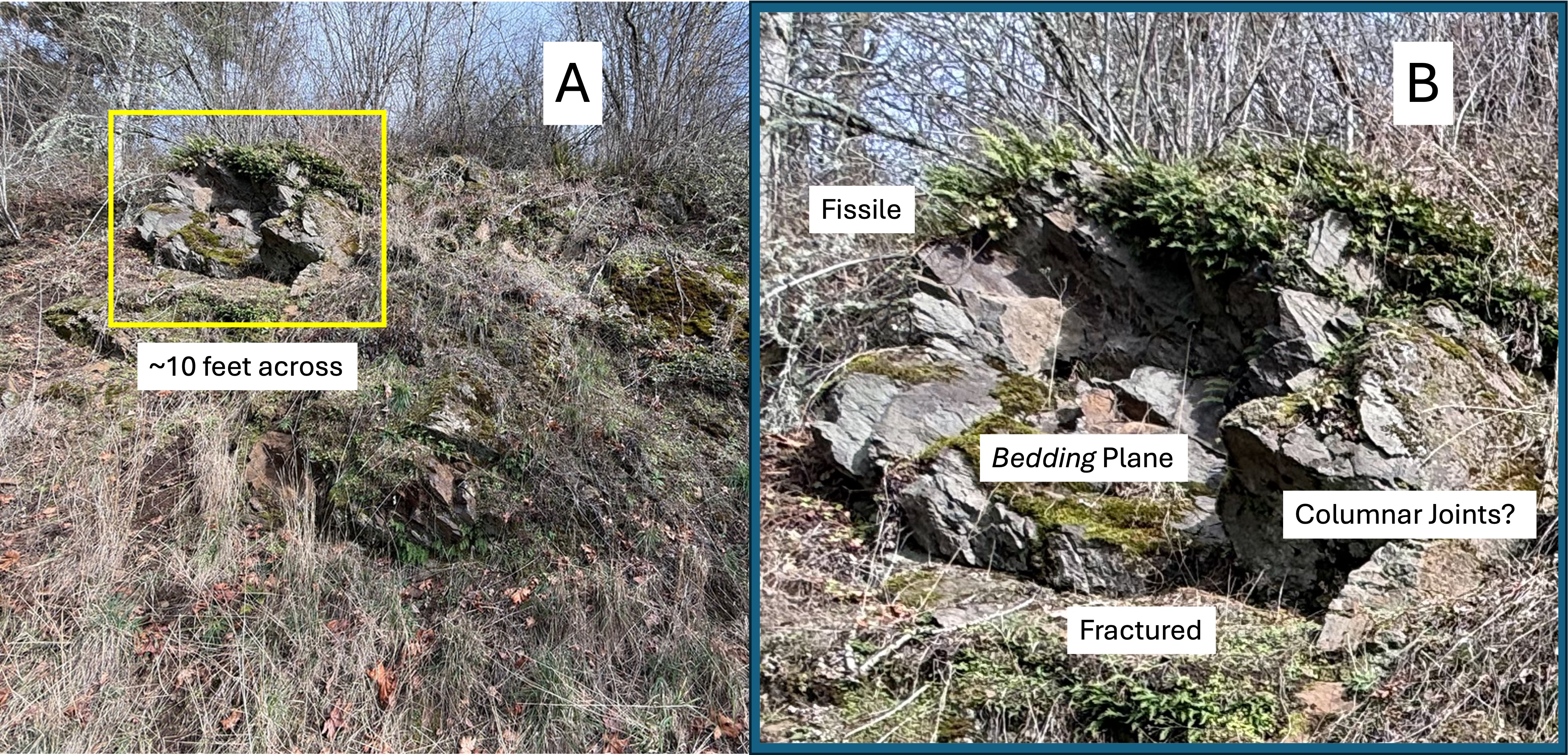
Figure 10. (A) Exposure of andesitic lava that looks much the worse for wear than anything I’ve seen before on this field trip. (B) Close-up of the exposure outlined in (A) that reveals a jumbled mass of lava that reveals several secondary textures: contamination and preferential erosion along “bedding” planes (fissility); irregular and tilted bedding planes; fine-scale fracturing and weathering (fractured); and blocks with a hint of hexagonal form (columnar joints). This was near the bottom of the volcano and the rocks are presumably older than those seen in Figs. 3, 7, 8, and 9; in other words this photo implies that eruption style was not uniform throughout this volcano’s lifetime. I further suggest that, over the lifetime of this volcano’s active period, the magma chamber became more stable, and thus the eruptions more predictable.
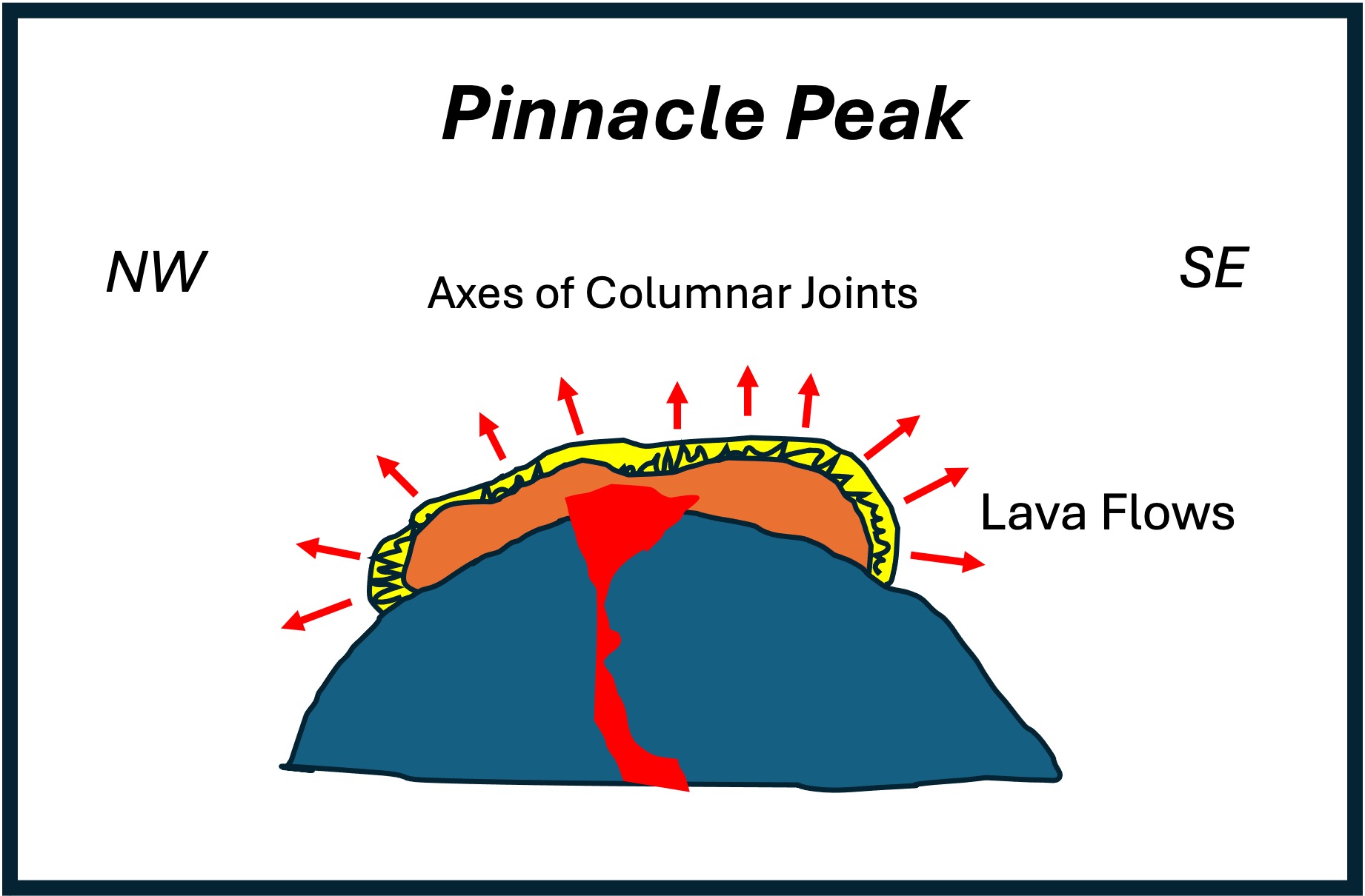
Figure 11. All of the textures, mineralogy, and fabric of the rocks comprising Pinnacle Peak fall within the expected composition of a shield volcano, except for the horizontal columnar jointing seen in Figs. 7 and 8, which point in opposite directions (NW and SE) even though the lava erupted directly from a rather small outlet (~200 feet in diameter). I didn’t understand what I saw at Organ Pipes National Park, but I let it go; now that I’ve encountered similar textures again, I want to have at least a naive understanding of how lava can form structures similar to a wilted plant. This is my model. The purple represents thousands of lava flows, volcaniclastic deposits, etc; the red is the lava just before the eruption(s) represented by Figs. 7 and 8; and the yellow is a thin layer of viscous lava that flowed out over a slightly older deposit. This last eruption wasn’t immediately covered by more lava and it cooled according to the laws of thermodynamics. In other words, it formed columnar joints, which are represented by the squiggly lines. The red arrows point to toward the “top” of the flow at every point; as you can see, the “top” isn’t always pointing towards the sky. This model is based on simple thermodynamics and mineralogy–I assume that the lava is a homogeneous mixture of the components of andesite (e.g. quartz, feldspar, pyroxene), which are cooled only by their exposure to the atmosphere. The different diameters in the columns (compare Figs. 7 and 8) suggests that this is an oversimplification. Nevertheless, it makes sense to me.
SUMMARY.
I had a great time climbing Pinnacle Peak and I learned something new from the rocks that surround and support us. A large mountain range like the Cascades doesn’t appear overnight. Subduction along the NW coast of N. America continued, interrupted by collisions with offshore continents, from 200 Ma to the present, creating multiple mountain ranges which created the Pacific Northwest. A small volcano like Pinnacle Peak would have burned out in a few million years. The range in age is based on stratigraphy, and the absence of funding/geologists to date rocks from every minor volcano in a major subduction zone, leaves me to apply common sense.
Pinnacle Peak erupted about 5 Ma, based on the physical status of the summit. It sputtered for a few hundred-thousand years as the magmatic system decompressed; eventually the magma chamber, or a subsystem of pathways, gave a last gasp. The columnar jointing we saw today suggests that this final eruption consisted of some spitting and then the appearance of timid lava, flowing a few-hundred yards from the summit (Fig. 11). That is what we saw on today’s field trip.
That’s my story…

Recent Comments