
Drive to Adelaide, SA: Quaternary Volcanics
The next few posts are going to document and discuss some of the geology we encountered on a drive from Melbourne to Adelaide, South Australia. The border between states is open now so it was no problem. The total trip is about 450 miles in length. We took three days to make it all the way. This post is going to present our observations from the morning of the first day, to keep the post shorter. I know I get carried away sometimes.
Figure 1 shows the geologic map of the part of Victoria covered on the first day. This post wlll discuss Location 1 only.

The volcanics were erupted over older rocks, in this case Paleozoic sedimentary rocks that had been intruded by granitic magma during the period of mountain building discussed in previous posts. Gold was deposited in fractures and faults at that time. Later, as the mountains eroded, the gold was deposited in rivers and because of its resistance to weathering, and collected in significant deposits. This kind of gold deposit is called alluvial. The Sovereign Hill mine was the site of the richest alluvial gold rush in the world, with one nugget weighing more than 150 lbs.
The location of the original shaft (Fig. 2) is now a tourist site. The underground mine play ran out and less expensive methods became employed to recover the ore.

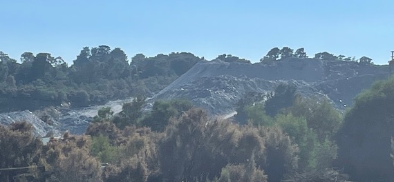
Underground mining produces large piles of ore (Fig. 3), which mark the location of mine entrances throughout the world.
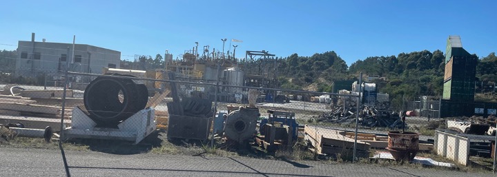
There was a mining project still going on, however, out of sight of the tourists, on the other side of the hill (Fig. 4).

I’m not sure if the operation is working directly on low-concentration sediments or simply created a large basin for the highly toxic waste products produced by acid-leaching methods. We didn’t see any evidence of large earth movers or dump trucks, however. This involves a lot of on-site chemical processing (Fig. 5).
As already mentioned, the gold was located in Paleozoic sedimentary rocks beneath the Quaternary volcanic rocks. As seen in Fig. 1, this was an extensive volcanic field, which implies that there should be volcanoes still to be found because of the young age (< 2 Ma). A topographic map of the area in fact reveals the presence of many volcanoes (Fig. 6).

Here’s what those volcanoes look like from a distance.
Figure 7 shows a large number of volcanoes, like where the most eastward arrow in Fig. 6 is pointing. They were covered in grass and were used for grazing sheep mostly. We couldn’t get access because they were all on private land and, surprisingly for Australia, there was no volcano park or anything…

As seen in Fig. 1, in some locations the older Paleozoic rocks were present at the surface (Dark blue in Fig. 1). The terrain here consisted of rolling hills, occasional ridges, and volcanoes. The ridges may be the surface expression of folds in the older rocks, created when the intrusion responsible for the gold mineralization occurred. That was back about 400 Ma in the past, however. At any rate, Fig. 8 was taken on a downhill slope from one of these ridges, showing an unusually large volcano in the distance, possible the complex near the town of Ercildoune in Fig. 6.

That’s it for this post. We finally drove through the volcanic complex we’d heard about and, although we couldn’t visit any volcanoes ourselves, it was inspiring to drive through so many volcanoes, to imagine what it was like when they were erupting the massive volumes of lava seen in Fig. 1.
Next time, we’ll continue to the west to examine some Paleozoic sedimentary rocks that have been folded and faulted.

Trackbacks / Pingbacks