
Field geology on Hawk Pride Mountain
After rising early and having a camping breakfast of bacon, eggs, and mixed fruit, I set off for the type-locality of the Pride Mountain Formation, which I passed as I arrived at the park. This location is shown in the prologue to this trip. It was easy to locate and I collected some hand samples and took some photos. Here is the official description, which is a compendium of multiple field efforts…needless to say, I didn’t see all of this!

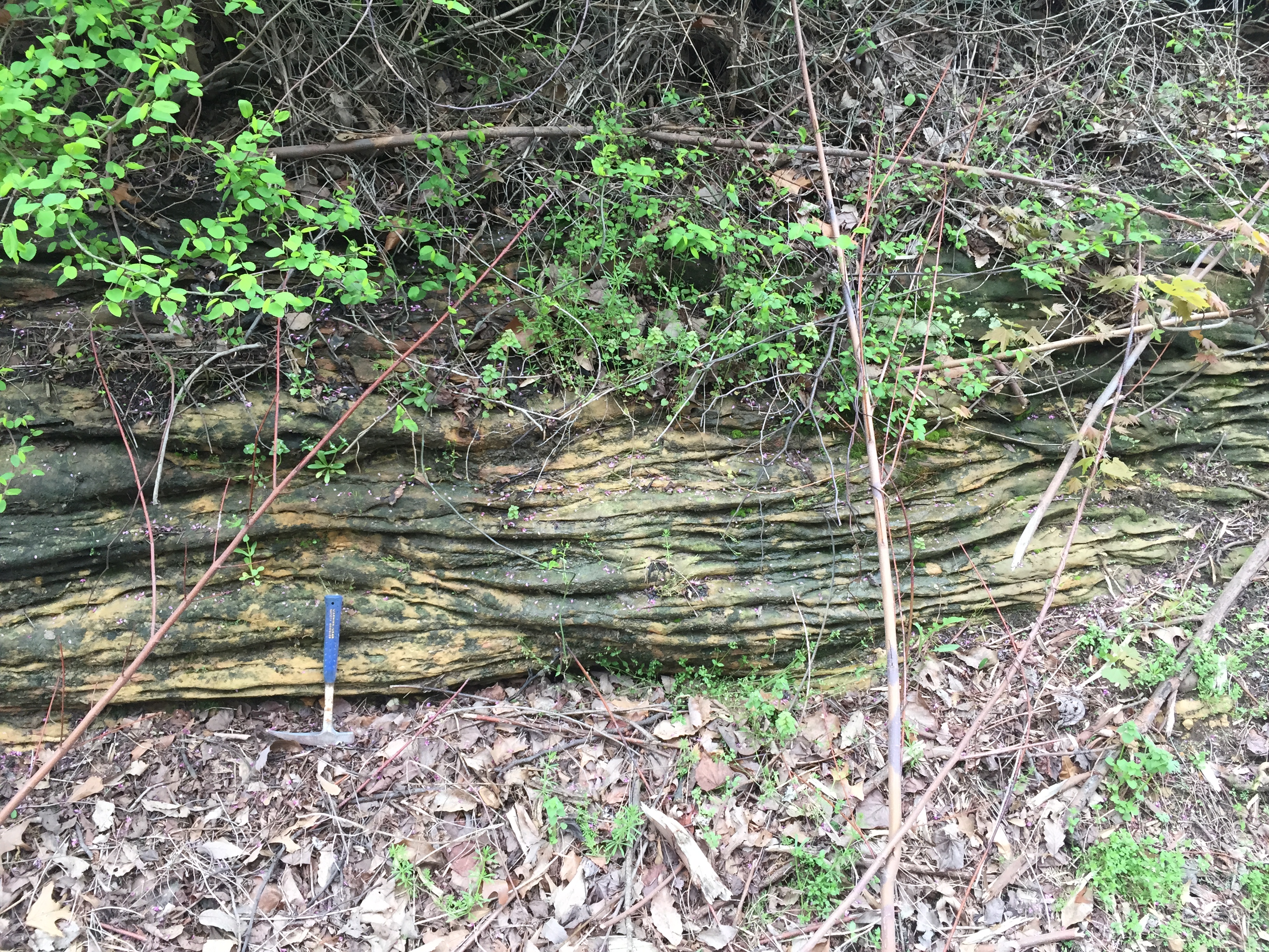
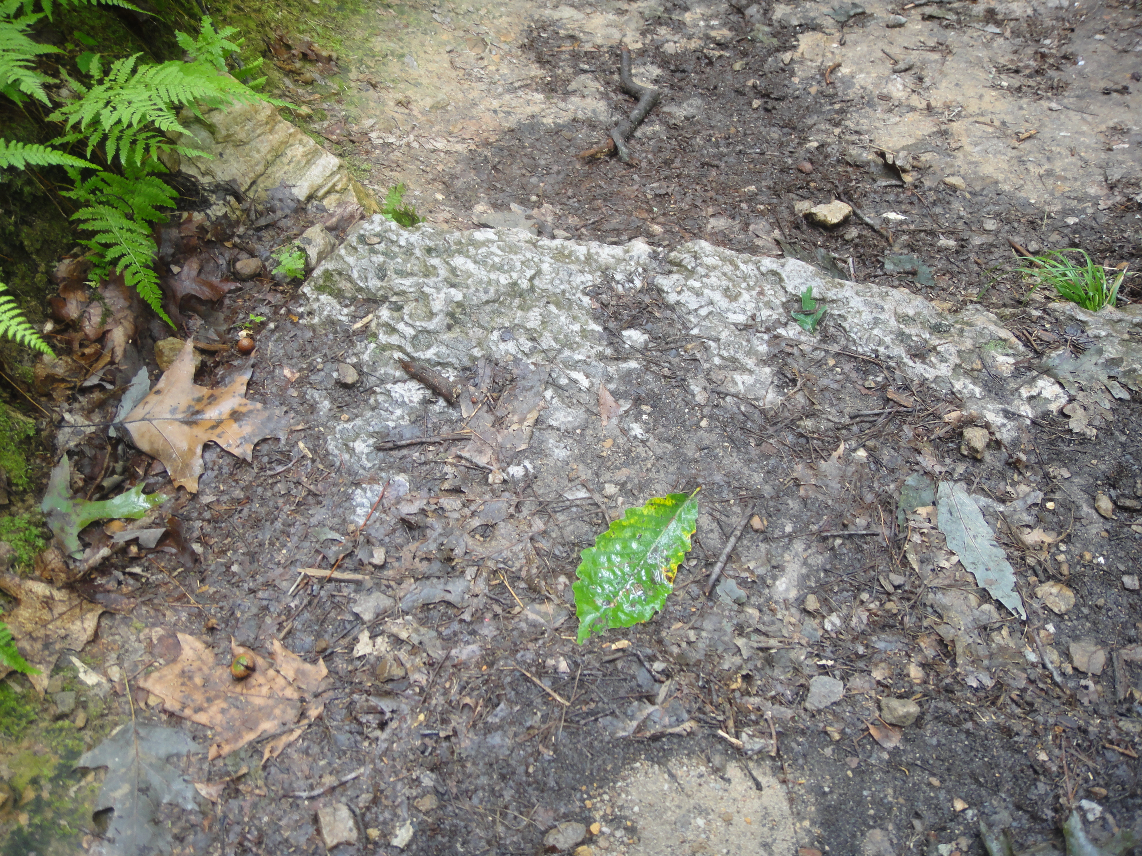
What I did see was dark soil that had eroded from the shale layers within the Mpm (Mississippian Pride Mountain Formation) and sandy layers with both massive and fine layering with cross-bedding. Here are some good images of these features.
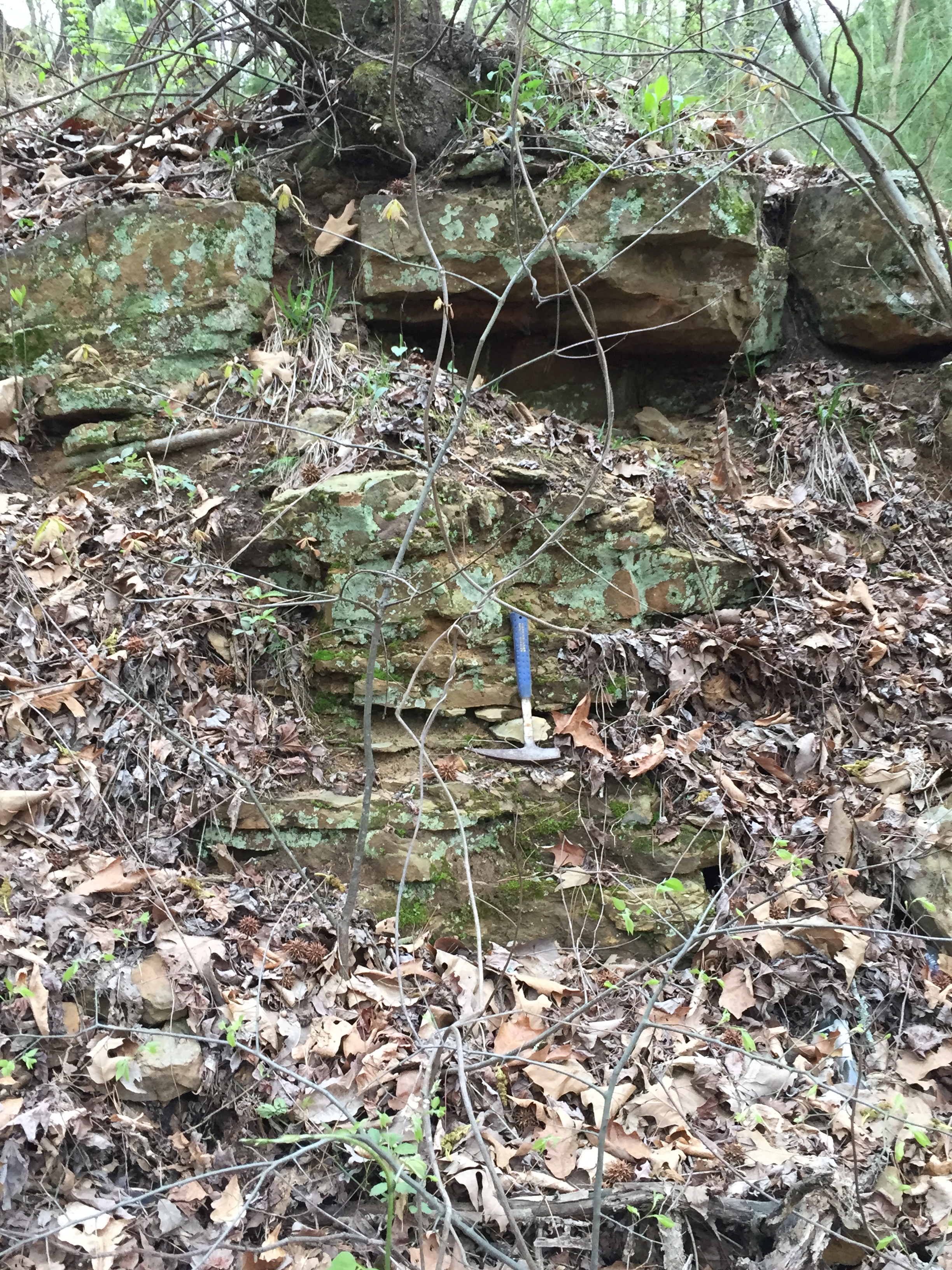
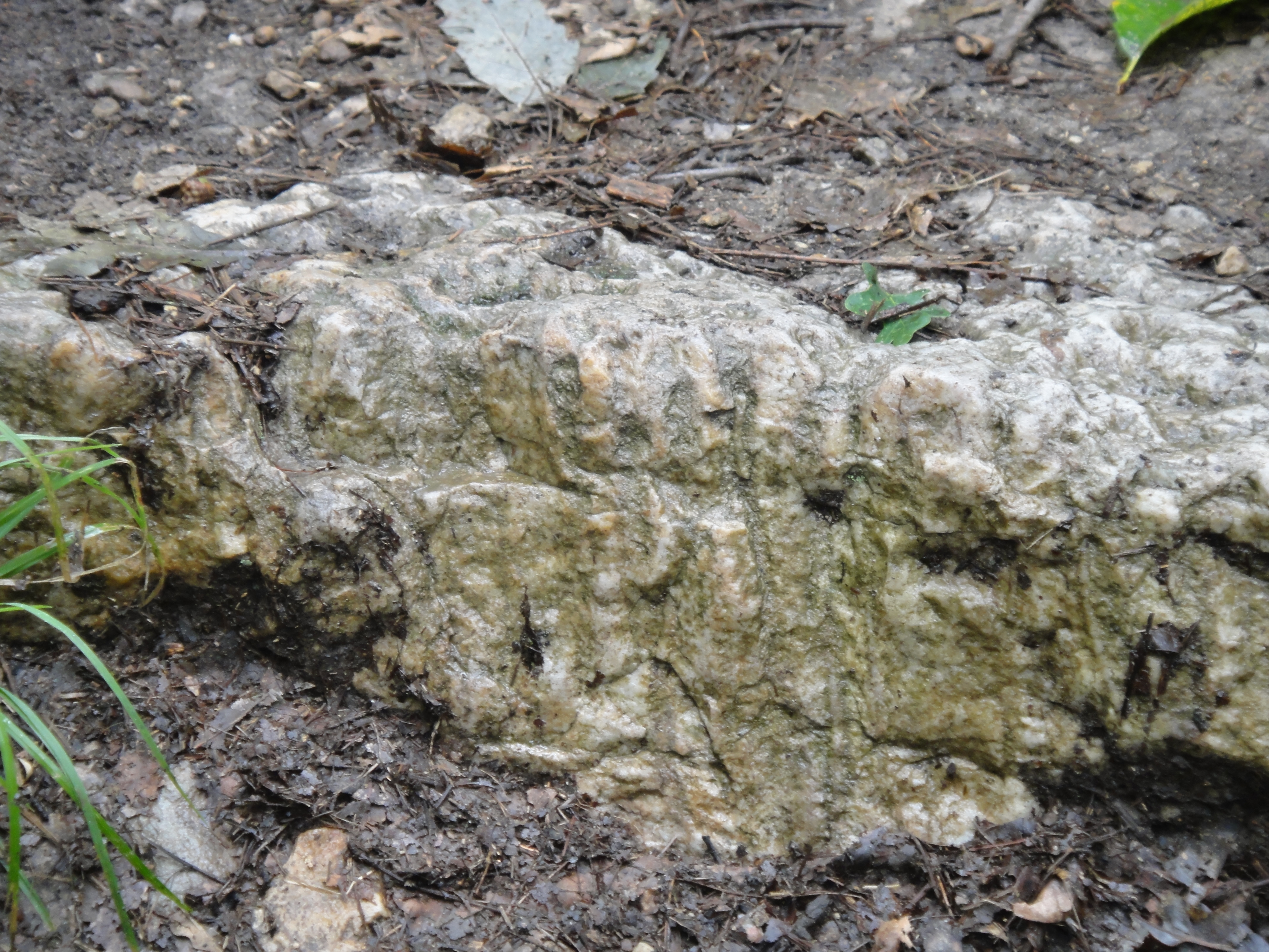
This is a typical shot of the thick beds, but they were not continuous even over 100 feet along the road cut. The next photo shows the cross bedding in thinly bedded sandstones.
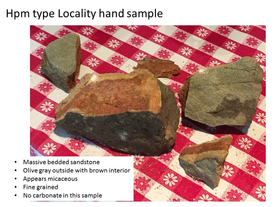
The bedding surfaces (assumed to originally be horizontal) dipped < 5 degrees in a northerly direction. There was no reaction to HCl (weak acid) at this location, so any limestone was either buried by shale (soil) or not present. I collected a hand sample and brought it home for more detailed examination (sounds good, right). The outside was olive colored but the interior is a brown as in the formal description (above photo), and I saw flecks that are probably mica of some kind (i.e. micaceous). Mica is a flaky mineral that reflects light easily.
My next post will move back to the park and the field relations of this formation (Mpm) and the overlying (i.e. younger) Hartsell (Mh)…
Hawk Pride Mountain Off-Road-Vehicle (ORV) Park
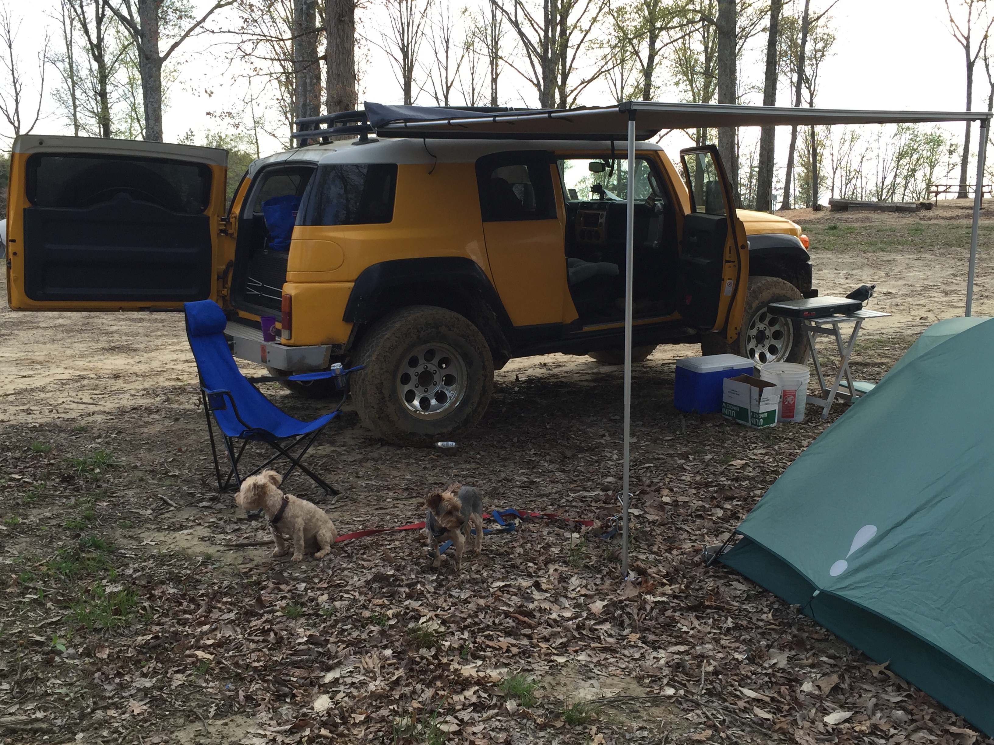
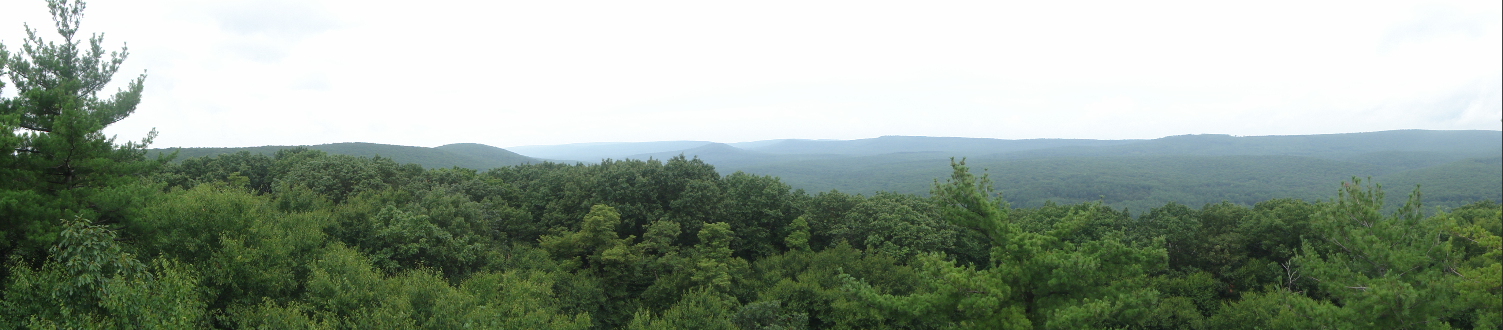
After crossing into Alabama and driving north thru Mississippian (~360-323 mya) sedimentary rocks, I arrived at Hawk Pride ORV park. I set up camp on top of the Upper Mississippian Hartsell Sandstone (Mh hereinafter) as seen in this image.
I will discuss this rock formation more in a later post. I set up my tent and had dinner before retiring early for a day of geology in the morning.
A day’s drive back 330 million years
Today’s post is actually from April 8 but I had to get back to do the necessary reading to make it useful. I drove up on Wednesday before the Mardi Krawl event began to have a fresh start the next day, and took the usual route up I-59 through Mississippi before heading north on US 45 at Meridian, MS. This is a leisurely ride from the coastal plain of Louisiana through the pine hills of SE MS, into the Jackson plain, the north-central hills, Flatwoods, black prairie, and the Tombigbee hills (MS History Now) before crossing into NW Alabama. As these regional names suggest, there is something going on that produced hills and prairies in what we think of as a hilly state. I enjoyed learning at least part of the reason why on this trip.
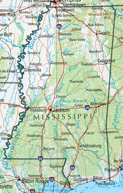
This map of the regions will help in following along. I crossed the Pearl River (still in LA) and immediately began climbing as I drove over Miocene (~23.3 mya) mixed sand and clay sediments on my way to Hattiesburg, MS. The forests were indeed pine woods just like on the coastal plain. There is an unconformity that only careful geologic mapping can identify between these rocks and younger Pliocene (~5.2 mya) sand and gravels. Note that a change from sand and mud to sand and gravel implies that the source of the sediment was closer (i.e. gravel doesn’t travel far in a river). As I approach Laurel, MS, the sediments no longer include gravel.
At this point, my journey through time becomes disjointed because of erosion, which produces unconformities. This erosion results from many processes, including uplift of the crust and changes in climate but I am not going to worry (yet) about that! As I continue traveling up I-59 to the NE, I pass over another missing time period and encounter Oligocene (~35 mya) limestone (somewhat stable ocean) and volcanic ash…volcanism implies uplift usually. Then a lot of sediment is missing when I find myself in Eocene (~56 mya) clay and sand, which suggests a low-energy ocean like the Gulf Coast today. After yet another time interval of erosion, I am driving through older Eocene laminated clay (very calm water) and have a respite from all of this erosion to go back in time to nearshore sandy beaches, until the oldest Eocene sediments are reached after a brief erosional episode…these are fine sands, sandy limestone, and lignite (a burnable organic material, aka brown coal).
I leave I-59 at Meridian, MS, and turn north on US 45, and soon find myself missing time again before driving over Paleocene (~65 mya) sediments containing sand, kaolinite (a pure clay mineral) and clay with bauxite (suggesting a tropical climate…most bauxite today is mined from South America). These (tropical?) sediments are preceded (remember we are going back in time) by clay with sand lenses, like the northern Gulf of Baja, i.e., sand bars on a muddy coast. But then, I drive a little further and a lot of sediment is missing…now I am passing through Cretaceous (~145-66 mya) chalk and chalky sediments. After yet another disruption in my time travel schedule, I am driving over Cretaceous nearshore sediments that include sand, limestone, and chalk (very calm water). At this point I enter Macon, MS, and thankfully drive through slightly older chalk before encountering another missing time interval.
The Cretaceous rocks north of Macon are nearshore sands and clays that suggest tides and waves (e.g., the east coast with its bays and mudflats). Then I arrive in Columbus, MS, and see these nearshore rocks for a while before smoothly passing into clay, then sand, and then gravel before hitting another unconformity. I crossed the AL state line about now and these (fairly) uniform sediments are replaced by Mississippian (~360-320 mya) sediments…I am in NW AL and a more continuous (although older) time interval.
I am not qualified to reconstruct the geography of Mississippi during this ~320 my (million year) interval but I will try anyway because this is not the real reason for my road trip…to go wheeling! I will start at the oldest rocks I encountered in MS/AL, the Mississippian limestones and nearshore sediments. This was an environment not too different from the U.S. east coast today. The missing 175 million years were caused by the erosion of the ancestral southern Appalachian Mtns, when Africa said HELLO to N. America. These mountains must have been huge, like the Himalayas today and not continuous like the Andes, which resulted in different erosion/sedimentation at every location along their front (towards the central U.S.). Eventually, they wore down enough that the erosional products (i.e. sand and gravel) were not themselves eroded. These sediments are seen near the MS/AL border near Smithville, MS.
A stable ocean (i.e. marine) environment did occur and was preserved in the nearshore sediments near Columbus, MS. All the while there were changes in sea level and adjustments in the earth’s crust that led to periodic episodes of erosion, resulting in some of the observed unconformities. The presence of chalk, which results from the quiet accumulation of algae-like plants, indicates stability for long periods of time. In the late Cretaceous, however, there was an uninterrupted shoaling of water depth and a coastal ocean returned (for a while). The sediments then oscillated between these coastal sands and limestones and land-based sediments like lignite and bauxite. All this time the land-mass was shifting northward from the equatorial climate indicated by the bauxites in the Eocene.
Just when all seems set, volcanism began (bentonites are the clays that come from ash layers) even while a quiet ocean was present in MS, as indicated by the limestones near Meridian, MS in Oligocene time. The presence of land-based (i.e. terrestrial) sediments in SW MS during later Eocene (~40 mya?) suggests that equilibrium was approaching this area. The large number of unconformities, however, indicates that erosion was still in charge, as it is today along the entire southern Appalachian Mountains and their descendent plateaus, like the one I will be visiting.
I would like to relate these geologic episodes and their resulting sediments to the geographic provinces identified in MS. This is a difficult task but I will try from the oldest (i.e. NE MS) to the youngest (SW MS). This can be easily accomplished by overlaying the MS geologic map on the geographic province map using GIS software, which I don’t have. The Tombigbee Hills are coincident with the Cretaceous nearshore sediments near Smithville, MS; sands resist erosion better than clays. The Black Prairie is consistent (a wishy-washy scientific word) with the unconformity just SW of Columbus, MS, and that would also explain the Pontotoc Ridge because a pure sandstone layer (like the nearshore sands of late Cretaceous) would be resistant to erosion. Chalk doesn’t weather well and a layer like that between Macon and Columbus would result in a flatter landscape like the Flatwoods.
The North Central Hills province is consistent with irregular erosion of mixed sandy-muddy sediments like those between Macon and Meridian (Paleocene) whereas the Jackson Prairie could be the result of erosion of the mostly muddy sediments (and volcanics, which erode rapidly) that were deposited during the Eocene between Meridian and Laurel, MS. The Pine Hills are another product from irregular (aka heterogeneous) erosion of sandy sediments.
And of course we shouldn’t forget that the earth’s crust is sinking along the Mississippi River for uncertain reasons, causing all of these layers of sediment to dip to the west. You can see my previous post about this.
Mardi Krawl 2015: Prologue
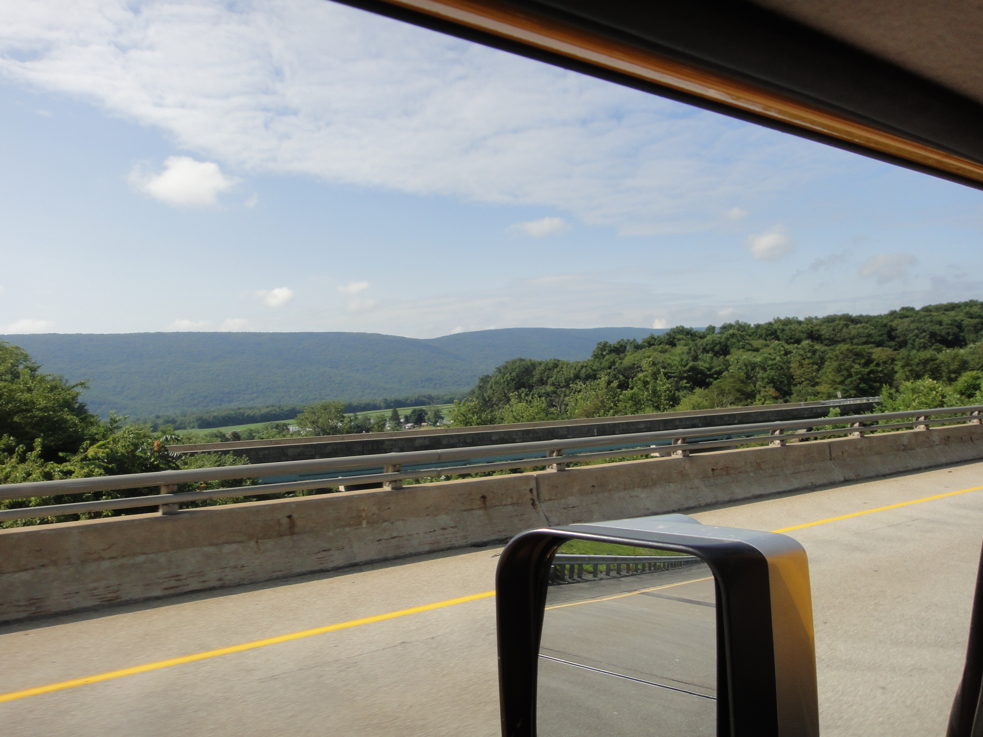
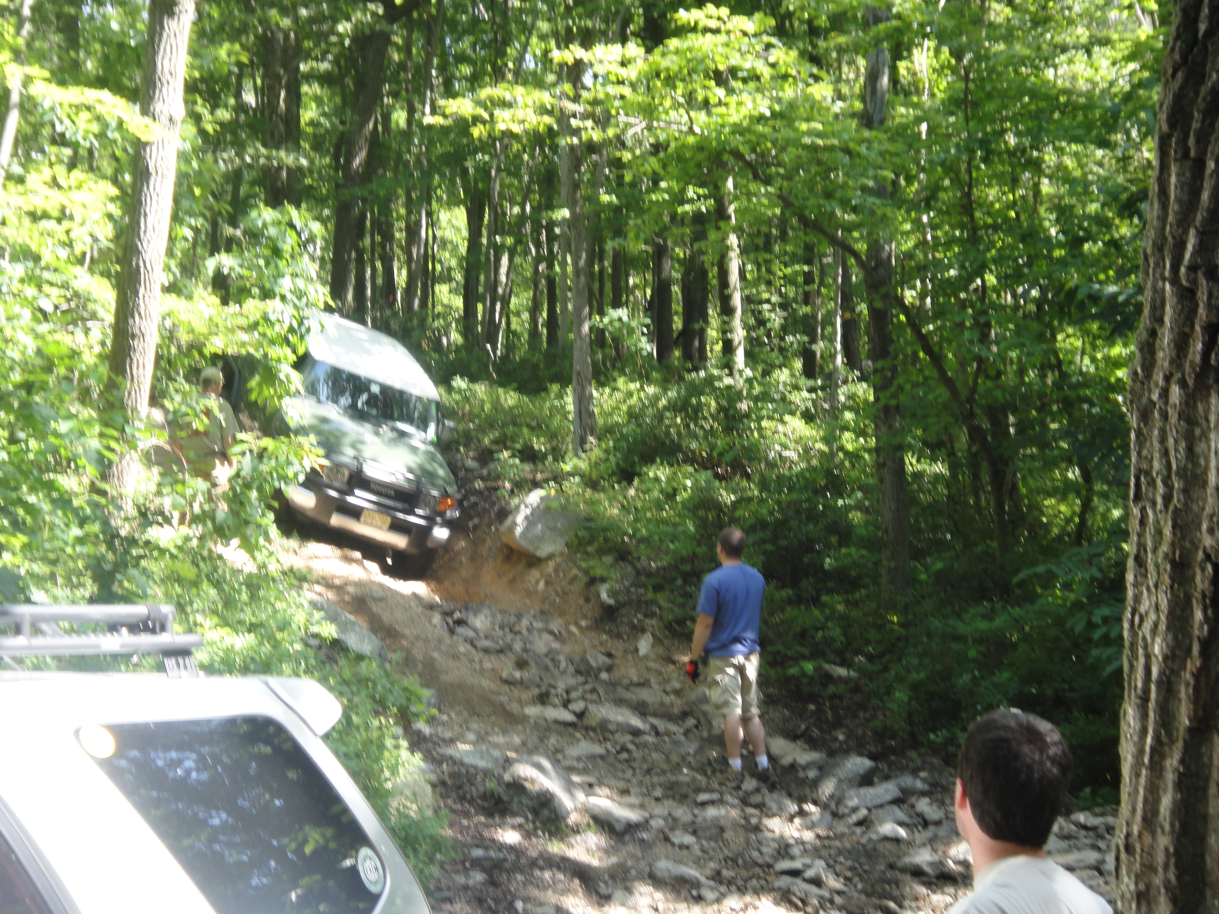
It has been a few months since my last post but I am leaving tomorrow for a return to a favorite southern Off-Road-Vehicle (ORV) park, Hawk Pride Mountain ORV Park, near Tuscumbia/Muscle Shoals, Alabama. It is time for the Louisiana Land Krewsers annual event, the Mardi Krawl. We really get excited about rocks down here Nawlins’ way! It is a seven-hour drive, which is also interesting as we climb from the pine barrens and wetlands of the coastal plain, sandwiched between the Mississippi River Delta and the Pearl River, which drains central Mississippi, into the low plateaus of the southern Appalachians (~800 feet elevation). This post introduces the geology of northwest Alabama as it will be experienced while wheeling in the private park.
The map below shows where we are headed way up north in Alabama. I call the park area the “Study Area” because this is the first time I have an objective and plan to use geologic mapping methods to collect data to be published on this blog. The objective is to find out why the “easy” route up the main park hill is impossible to climb when it rains…it is unbelievably muddy whereas the other side of the hollow is sandy and traversable. I will spend Thursday collecting data about the difference in the rocks (and thus traction) on opposite sides of the valley. I am using basic geologist tools: a description of rocks from this region (Alabama Geologic Survey Circular 140); a 7.5 minute topographic map from USGS; rock hammer; weak hydrochloric acid (i.e. pool acid); a geology compass on my IPhone…I hope, but with a backup home-repair inclinometer and cub-scout compass; antique 10x eye glass (tiny view for individual minerals); and binoculars.

I couldn’t find a real stratigraphic chart for this area, where the exploitable resources are deep underground, so I pieced together this VERY schematic stratigraphy from the AGS 140.

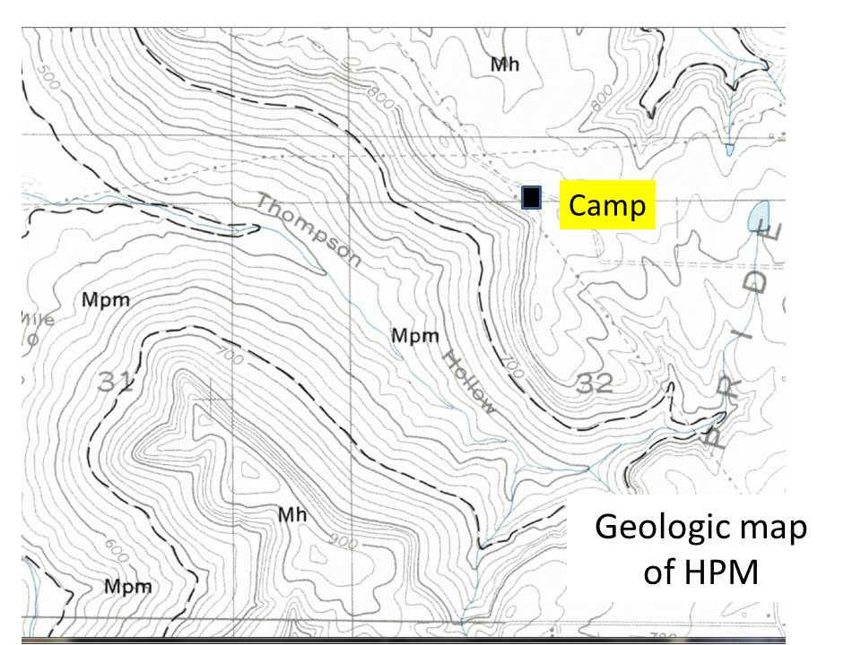
I am going to be focusing my attention during this trip on the Pride Mountain Formation (hereinafter PMF), which has its type locality (i.e. place where it was first described) very near the park. I am going to visit this site because it is located on Hawk Pride Mountain Road, which is how I will drive to the park…easy! I used township-range info from Alabama to find the approximate location, and the description from AGS-140, to find where to look for these exposures.
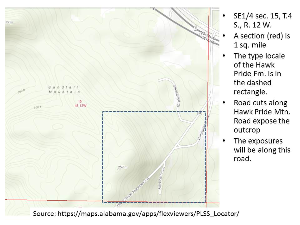
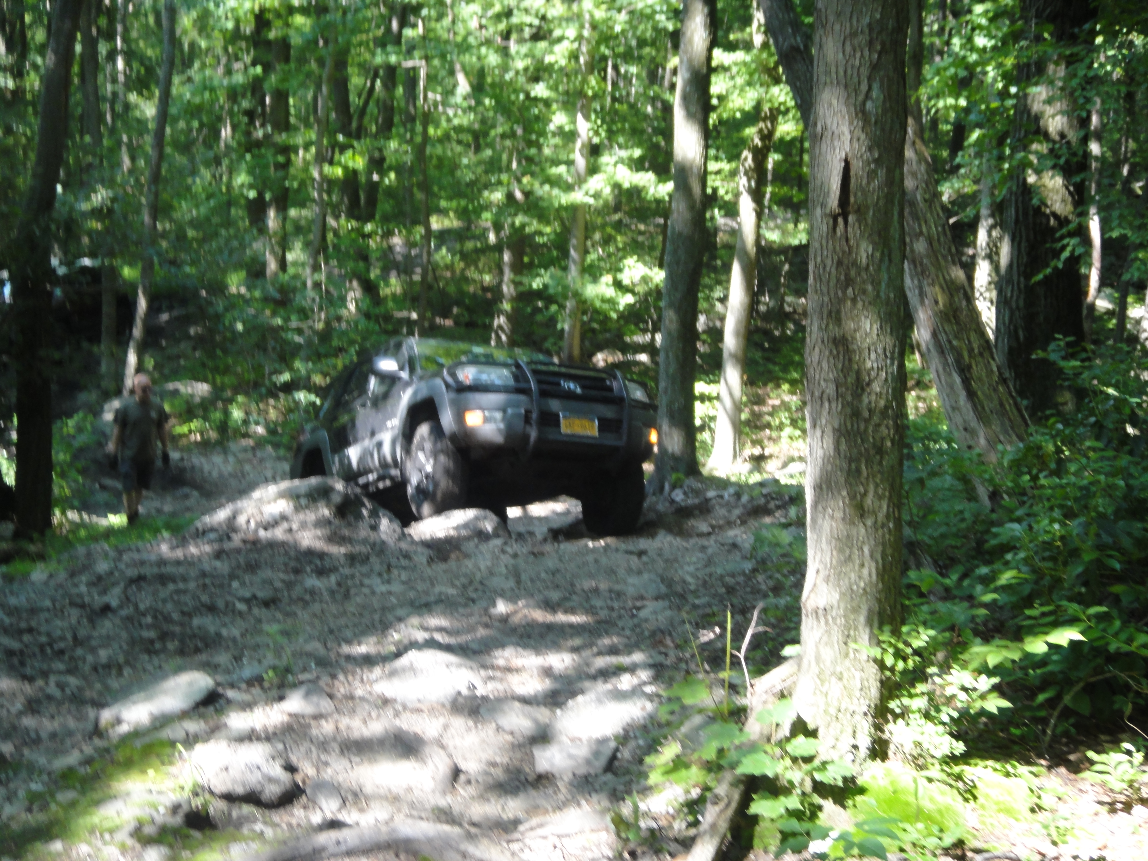
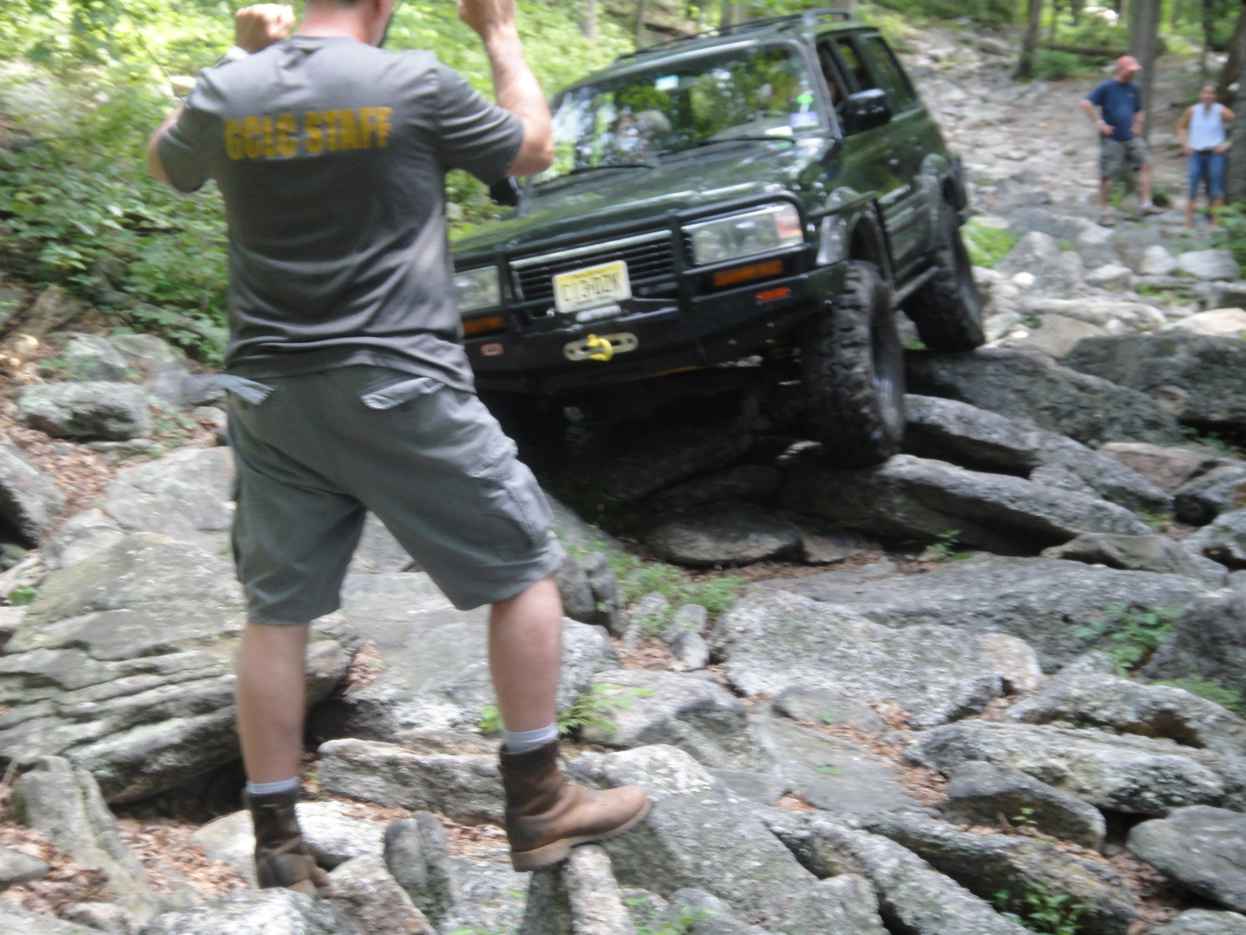
The type-locality is very close to the park (a couple of miles) and it is likely found there as well. The topographic map below shows the proximity of the type-locality and the park, as well as the general topography of the area. This is an erosional terrain and significant faults are probably not present, but we will see! Only the northern end of the park is outlined in the image.
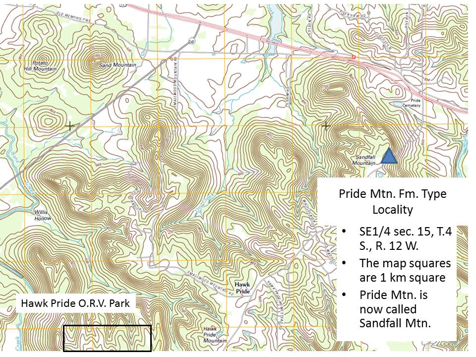
I will be collecting typical geologic data: strike and dip; lithology; and fossils, where they occur; on both sides of Thompson Hollow (see figure below), in order to discover if the shales of the PMF are not as prevalent on the south side of the park.

With these data I hope to identify the formations and any unconformities between them that will help me understand why this park is so difficult to escape when it rains.
Coal Mine Classic: Epilogue
I left Twin Grove campgrounds on Sunday morning and took a detour along US-322 to State College in order to visit my advisor from Penn State, and thereby crossing the Valley and Ridge province from east to west. The rocks of the Pottsville Group are Pennsylvanian age (~320-300 mya), but the rocks get older as we travel westward. This is one of the most beautiful drives I have done, as we follow the Juniata River where it has followed weak points in the crust.
I stopped at a large road cut and collected my Texas-sized hand sample, which is a Devonian period (~420-350 mya) sandstone with a green hue and a combination of striations and minerals that indicate it has been subjected to a large stress from faulting. The texture and color indicate a nearshore marine depositional environment, like a modern beach or shallow water near the coast.

These rocks are exposed in the west because of sliding along deep nearly horizontal faults when Africa collided with N. America, which pushed deeply buried rocks like this westward during which they slid along more vertical faults. This trend continues until we get to Arch Rock, where Silurian period (~445-420 mya) thin sandstone and shale beds are exposed in road cuts. These small folds are superimposed on much larger ones.

The exit to Arch Rock gives a nice view down the valley to the west. The ridges are oriented more to the NE in this location. As we travel westward, they become more north-south.

Finally, we cross the pass at Seven Mountains and drive down into Nittany Valley, which has perfect Ordovician Period (~485-445 mya) carbonate (limestone and dolostone) that are tilted about 30 degrees. Thus, during my two-hour drive I have traversed ~200 million years of sediments, and gone from river/stream sand/shale/coal sediments to the deep sea limestones that were disturbed by the Appalachian Orogeny. And it was all visible to the naked eye!
Coal Mine Classic: Day Four
I used Brian’s tow vehicle (he trailers his trail rig) to get the final ingredient, a piece of 1/2 inch pipe, and joined some Virginia guys for some blue (big tires and lift) on the NE section of the park. The rocks here (still Pottsville Group) had more shale, which weathers to mud, and less coal but more corn fields. I rode shotgun with Patrick in his 80 series Landcruiser (the big, heavy ones from the early 90s), and saw a well-behaved trail dog, Tiki in action.
The good part of riding is that you can get out and take photos of rocks as well as wheeling. This day had some fun trails with needed assistance from crew to get these big rigs through tight spots.

The rocks were quite different as well. This photo shows very large particles (pebbles) in a muddy matrix, which we inferred from several real mud holes on the trails when the mud weathered out to form modern mud holes.

The episodic nature of sedimentation now and 350 mya is seen in this contact between the coarse-grained conglomerate over the silt/mud stone below.

I WISH I weren’t broken for these really great rock crawls over the conglomerate as we climbed up a series of broken ledges.
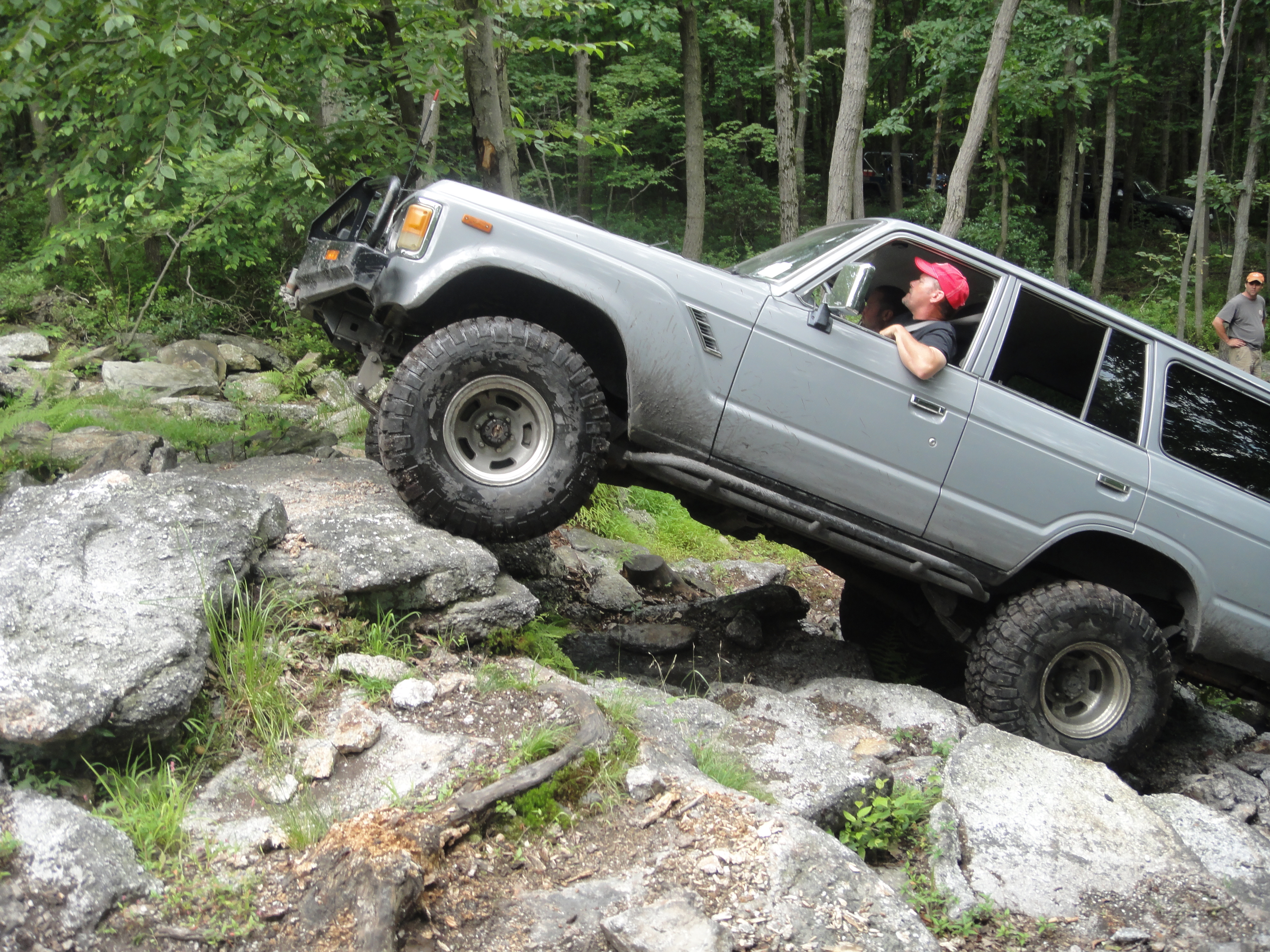
Finally, on BFG (don’t ask me what that means) there was no easy way out!

What a great day of wheeling (but not for me); however, it is a lot of fun to be able to get out of the vehicle and enjoy a different perspective. We all should do it now and then (hopefully, for fun).
Coal Mine Classic: Day Three :-(
I spent today getting the necessary equipment (no new parts) to make my rig (truck) roadworthy and hung around the camp. I met Ed of the Capital City Cruisers and purchased a raffle ticket for a vintage FJ-40 fully restored. It looks like this but with no rust, etc.
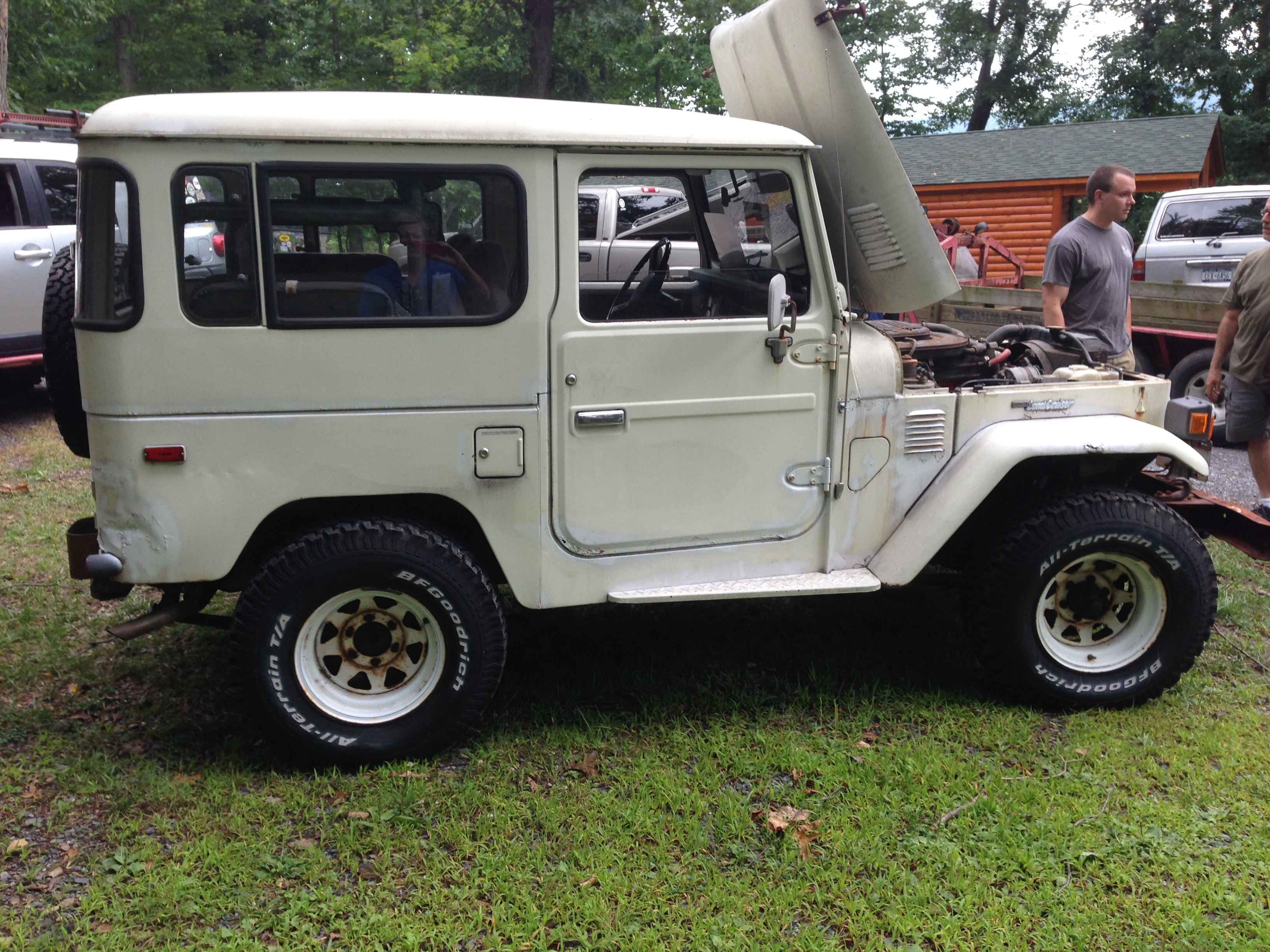
I told everyone that WHEN I win it, I will drive it up next year and go wheeling in it!
Coal Mine Classic 2014: Day Two
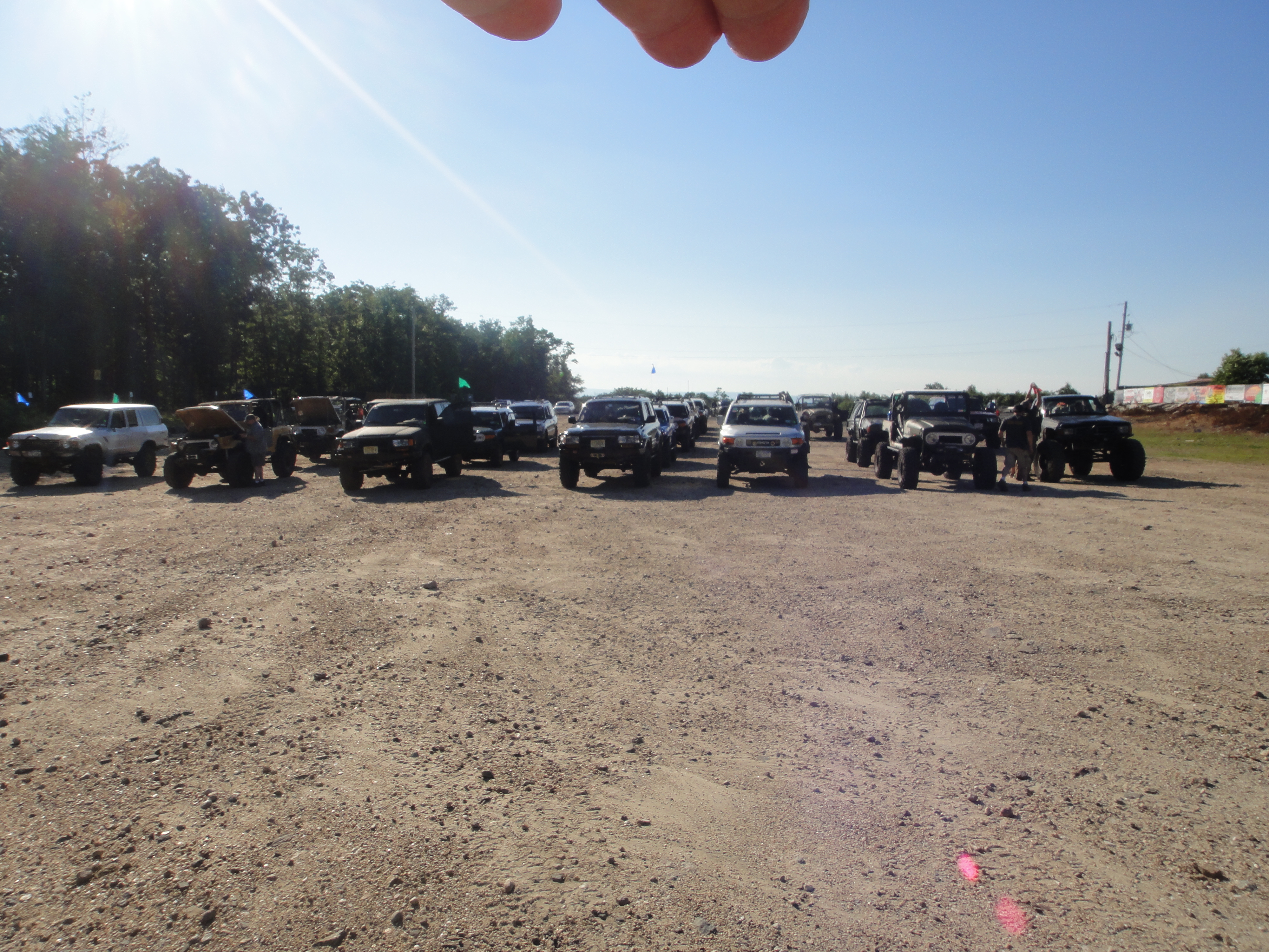
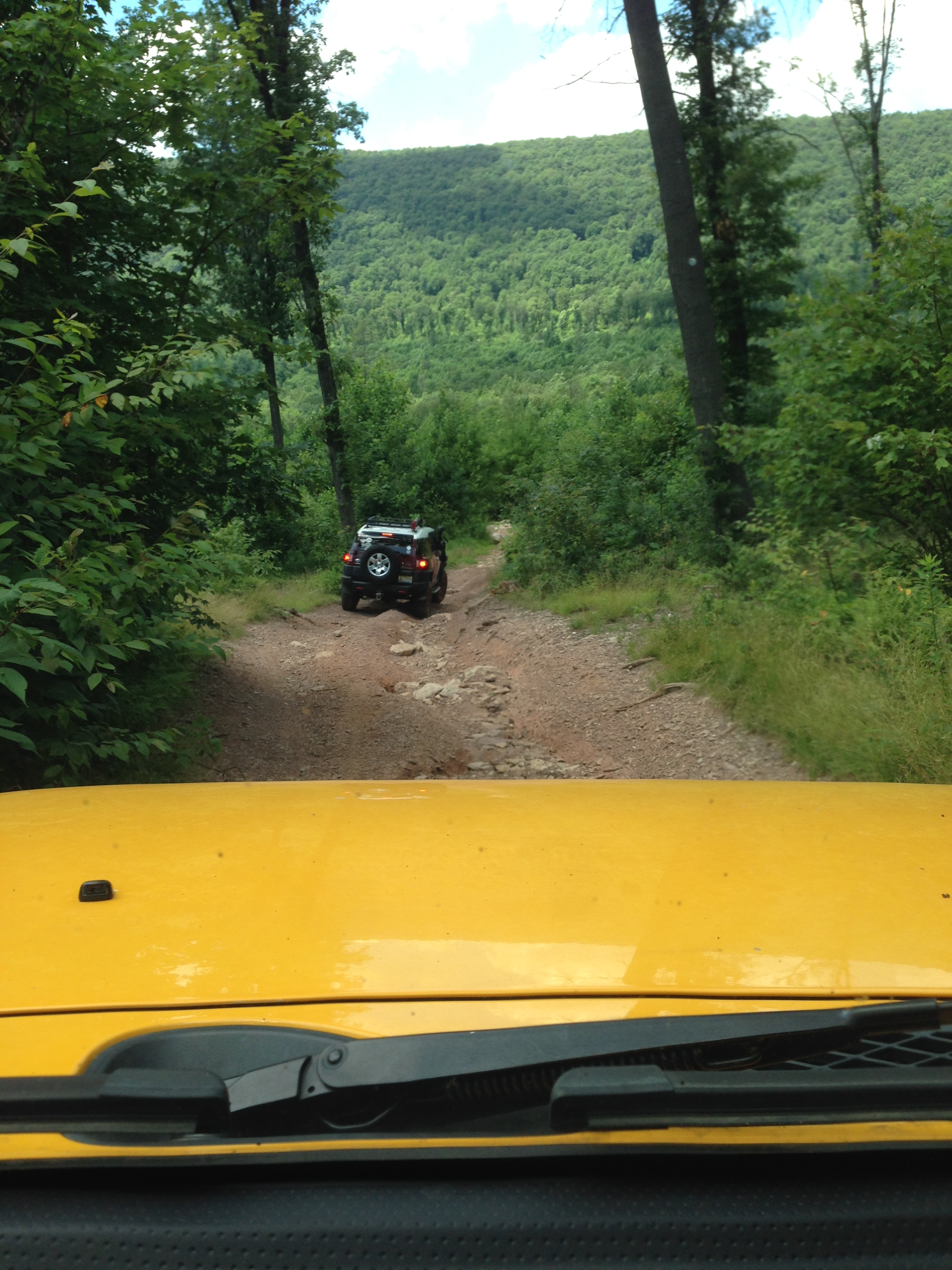
The second day, we split into smaller groups; I went with a “blue” group (big tires and lift) and we went to explore the western part of the park. Here is a photo of the groups lining up to depart.
I was busy driving and didn’t get a lot of pictures, but the trails went over a more conglomerate part of the park with broken boulders and sand between. This means we had different traction on each wheel, which is difficult without locking differentials.
The photo above shows the smaller talus at mixed in with very large boulders as we climb up an old mining trail; however, we leave the trails and just drive over the rocks as best we can. The view from the top is great and worth the effort.
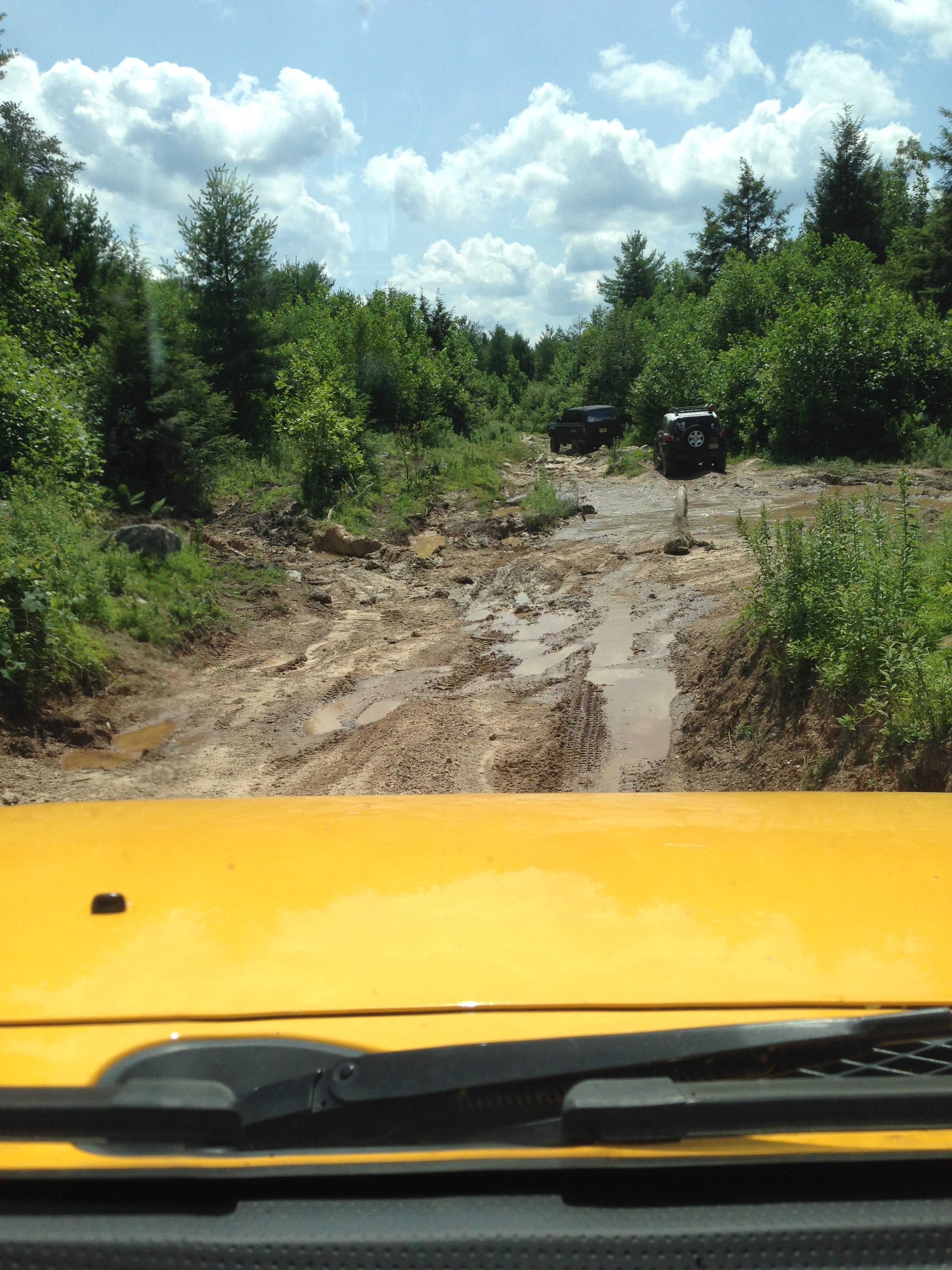
Then we drove down a very steep side of the ridge to a modern creek with real mud (thin) over the rock debris. Water and mud were everywhere, mixed in with boulders to clamber over.
We finished the day with a difficult climb over medium (~2 foot) boulders strewn amongst tree stumps and sand, which was challenging.

I was doing well without locking the rear differential and then….
My steering catastrophically failed (BANG…) and I was dead in the water. Rich and John (pres and vice-pres of the hosting club/ Gotham City Landcruisers) were there within 30 minutes. I was saved by Mark who had an alternator-driven arc welder. He took an hour (he was wheeling on the other side of the park). He welded the busted pieces back together on the trail (side of a mountain) and I was back to camp for dinner.
Coal Mine Classic: Day 1
A few people were ready on the first day so we ran some trails in the Rausch Creek ORV Park that were mixed for stock/big tire trucks. This park is an abandoned coal mine, but there was not enough coal to remove the mountain, which is typical for higher grade Anthracite mines (remember this coal was formed during an orogeny). We drove through some holes that were not (usually) deep, if filled with water, and had a black color that is a dead giveaway for coal dust (not mud).

These got as deep as 30 inches (the trail guides new the depths beforehand). However, there were some very deep holes where the miners had gone looking for a economically viable coal seam. These were unmarked and you don’t want to drive into one.

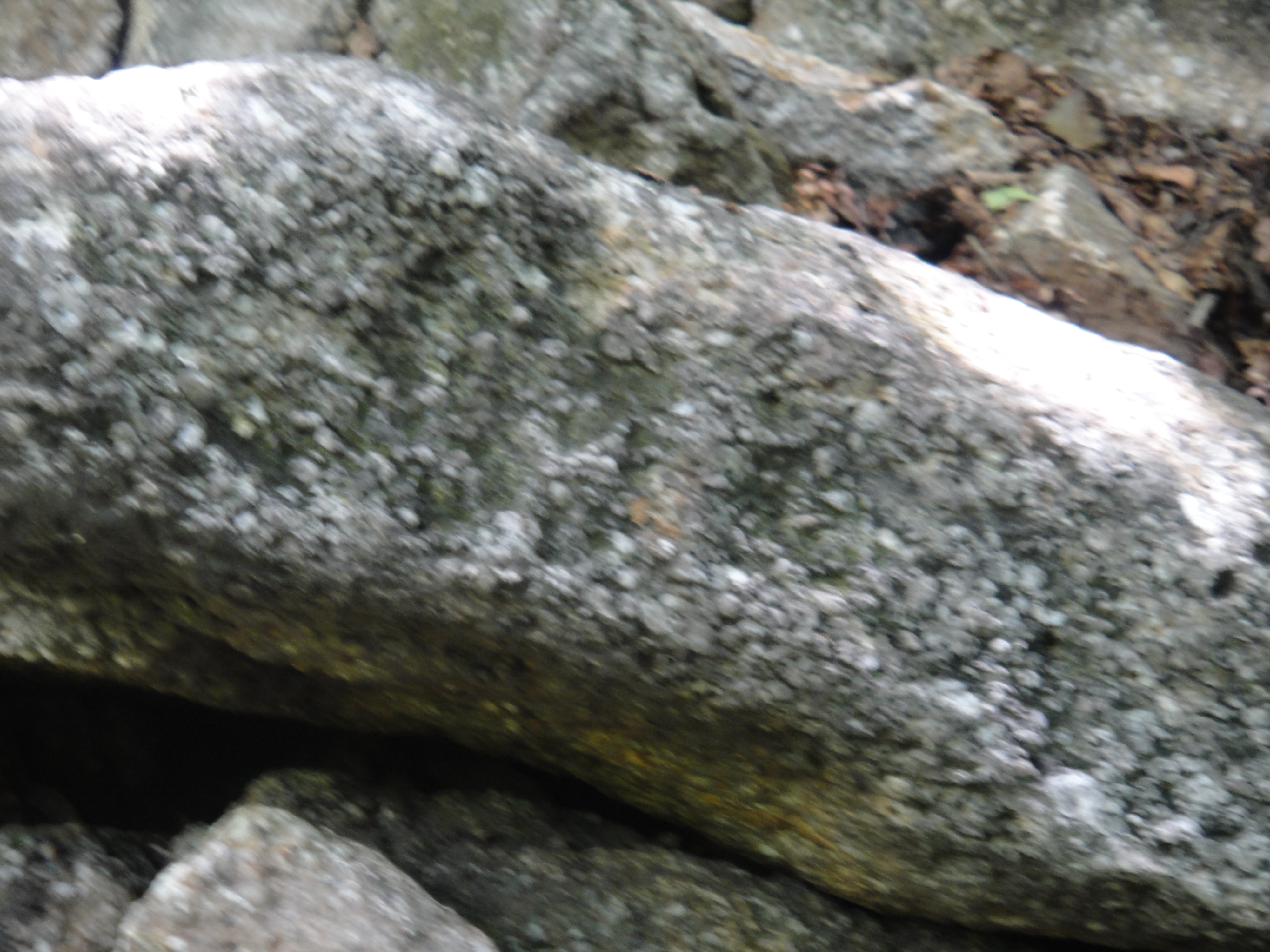
The Pottsville Groups has four main kinds of rock: coal, conglomerate, sandstone, and shale. The conglomerate has large (~.25 -.5 inch) pebbles in a matrix of sand and cement (calcite or silica). This picture shows the texture of these rocks.
Because we were a mixed group of eager-beavers (you just want to go wheeling!), a couple of trucks took a detour to do some rock crawling. The guy in front is the spotter, who tells the driver where to steer.
Eventually, the trail guide stepped it up a notch and we did some blue trails (bigger tires and lift), which freaked out the stock trucks, but they did fine with some help from expert spotters.
Looking forward to Day 2.
Coal Mine Classic 2014: Cumberland Valley/Ridge and Valley
This is a prologue to my short trip today, which will be lengthened by stopping to look at some of the interesting sites described in the Roadside Geology of Pennsylvania (B. B. van Diver, 1990, Mtn. Press, Missoula, Montana).
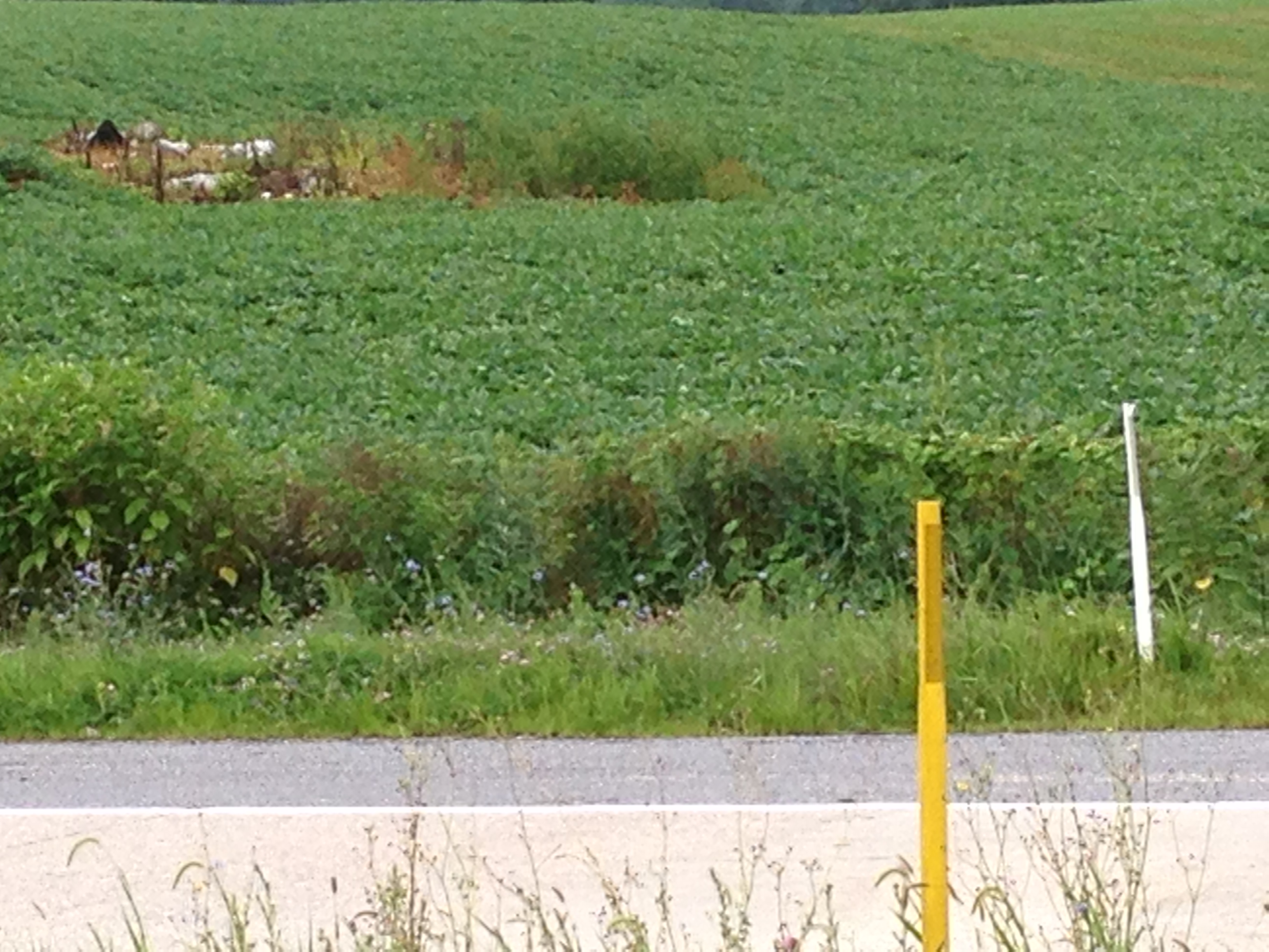
I will be passing through a Karst topography (sinkholes, pinnacles, and springs) from the MD line to mile 17 with the northern terminus of the Blue Ridge to the east. This ridge extends to GA and I have followed it on the previous day. I hope to find Pine Grove Furnace, which was used to produce iron from low-grade ore (limonite). Here is a picture of one of the pinnacles in a corn field.
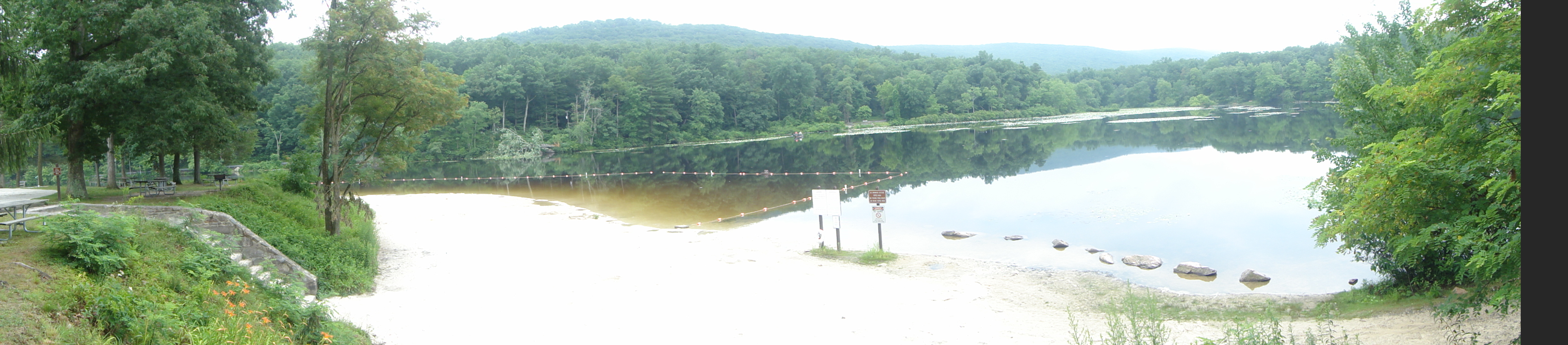
It is the white object. There were others but pics were hard to take from the interstate. I found the sign to Pine Grove Furnace and made a detour to see either the limonite, quartzite, and/or fossils. Here is an image of the lake near the quartzite. These lakes were created all over PA during the depression by the WPA; they are very popular for weekend outings.
I hiked about 1 mile up a steep grade to get these great images of the area and the Precambrian quartzite that was brought to the surface by the tremendous horizontal pressure and resulting uplift of the Appalachian/Alleghenian orogeny when Africa collided with N. America.
This is called “Steeple Pole” but don’t ask me why. It is a highly metamorphosed sandstone that was probably? deposited in either a beach or sand dune environment more than 1.5 billion years ago, which were metamorphosed BEFORE the Appalachian orogeny occurred (~400 my). This stuff is really HARD!

I also found something I didn’t expect to, some fossil burrows from worms (not known in the modern world) in ~400 my sandstones. The first image shows the surface of what would have been the seafloor (shallow) when the creatures were alive.
This image shows a section perpendicular to the seabed. The worm holes are quite visible because it sprinkled while I was hiking and water is excellent for exaggerating the contrast (remember the entrance to Cibola in National Treasure: Book of Secrets?
I didn’t make it toReservoir Park on US 22 for a good view of a water gap through the ridge because I was so hot and tired from the uphill hike to see Steeple Pole that I wanted to stay in the ACd truck! After crossing I-78, I hope to collect some Ordovician (~500 my) fossils at Swatara Gap, and then some Devonian (~400 my) fossils at Suedberg. From there to the campground, there is a good roadcut that shows coal beds in the Catskill Fm. The guide book I have is 30 years old and these fuzzy images of (maybe) brachiopods from the Devonian section are the best I could find before getting to the camp site.
The linear features in the middle are on the shell of a clam in modern benthic invertebrates. These are certainly not modern. I need to start taking the better camera along.

Recent Comments