Figure 1. View looking NW along what’s left of the Ko’olau caldera, after it exploded and was blown into the Pacific Ocean about 1.7 million years ago (my). The cliffs in the distance indicate how elongate it was (see Fig. 2).
Figure 2. Today’s post is. taken from the lower-left part of panel C, northwest of the Koko Crater. The red line is the general outline of the steep NE side of the Ko’olau Range (see Fig. 1). The original size of the Ko’lolau volcano is indicated by the green line in panel A, and the approximate area of the debris avalanche is shown by the dashed line (Nu’uanu Debris Avalanche).
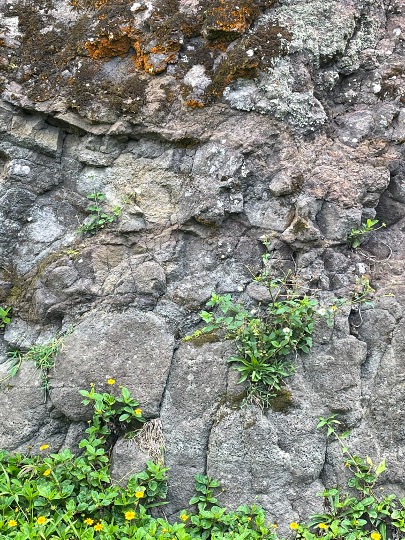
Today, we can see some of these rocks up close. Also, these are not as weathered as we saw previously. The lava flows are well preserved at Nu’uanu Pali park (Fig. 4).
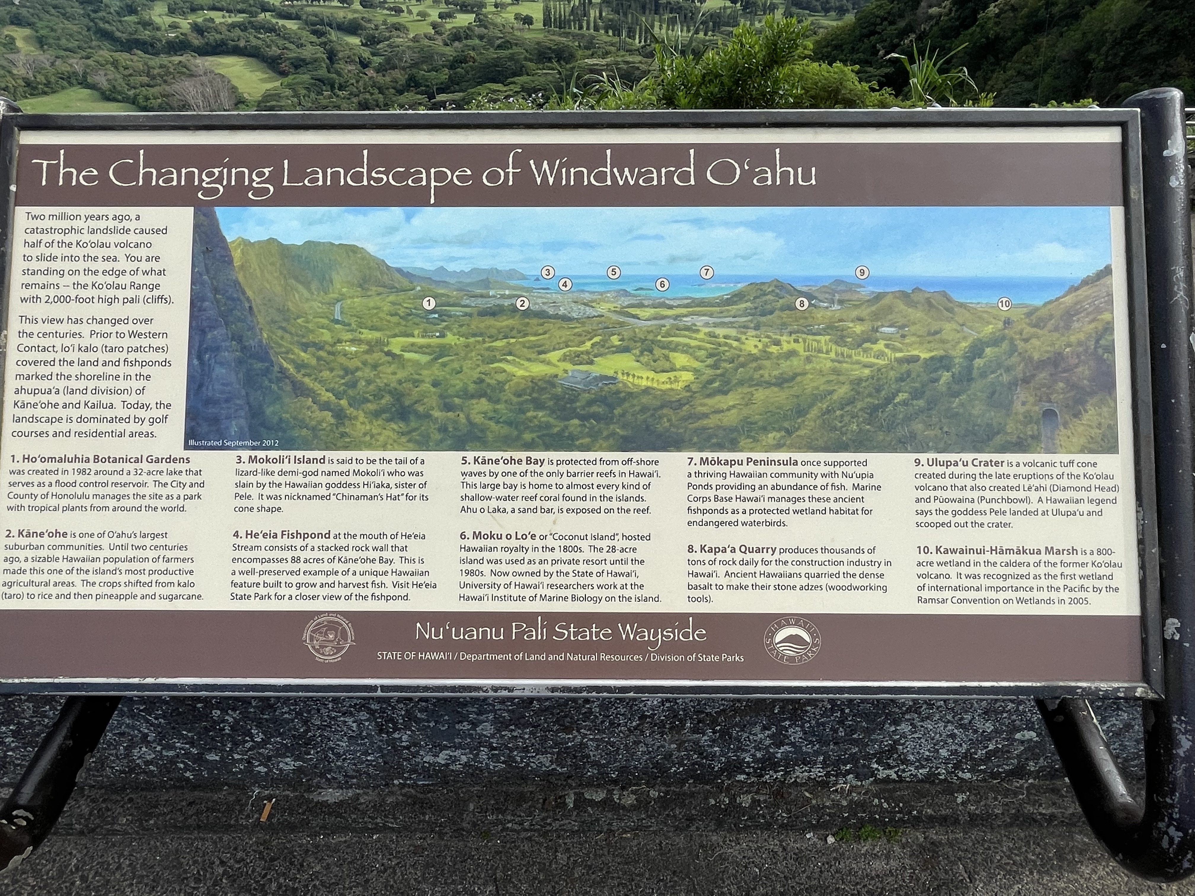
Figure 3. Poster giving some topographic and geological information for the Nu’uanu Pali area.
Figure 4. Approximately 100 feet of lava flows are exposed at the park. This photo shows the excellent preservation of these rocks and the irregular layering typical of basalt flows.
Figure 5. Detail of lava flow. Note the irregular structure reminiscent of pillow lava, vesicles in lower part, and curved and pinched bed with a brighter color in the middle of the photo. (Image is about 12 feet high.)
Figure 6. Road cut in cliff. The road was the original path used until construction of the modern highway. Note the unaltered dark basalt exposed.
Figure 7. Ulupau Crater was created during the rejuvenation phase of Ko’olau volcano, and is contemporaneous with Koko and Diamondhead tuff cones.
This post visited the remains of the Ko’olau volcano, which exploded/collapsed/disappeared into the Pacific Ocean about 1.7 my, leaving a sharp mountain range that was the edge of the central caldera. A much younger tuff cone erupted about 100 thousand-years ago as part of the rejuvenation of the magma chamber. Its last gasp as it were.


Trackbacks / Pingbacks