
Active Delta Accretion at Dash Point State Park
INTRODUCTION
Puget Sound is a complex water body with many channels and bays, all of them within a couple of hours drive from my home in Tacoma. I haven’t posted much about this because I’ve been overwhelmed by so many active sedimentological processes that are neither marine nor fluvial. But I had to say something about what we discovered on this short trip, less than 30 minutes from our house. Because of the bluffs (~300 feet) surrounding Puget Sound, streams draining into the various inlets and bays are short and relatively steep. There are exceptions of course, such as the Nisqually River, which flows from Mt. Rainier to the southern end of Puget Sound; however, short streams are very common although many of them have been incorporated into municipal storm drainage systems. Today, we found one that was in an almost natural state.
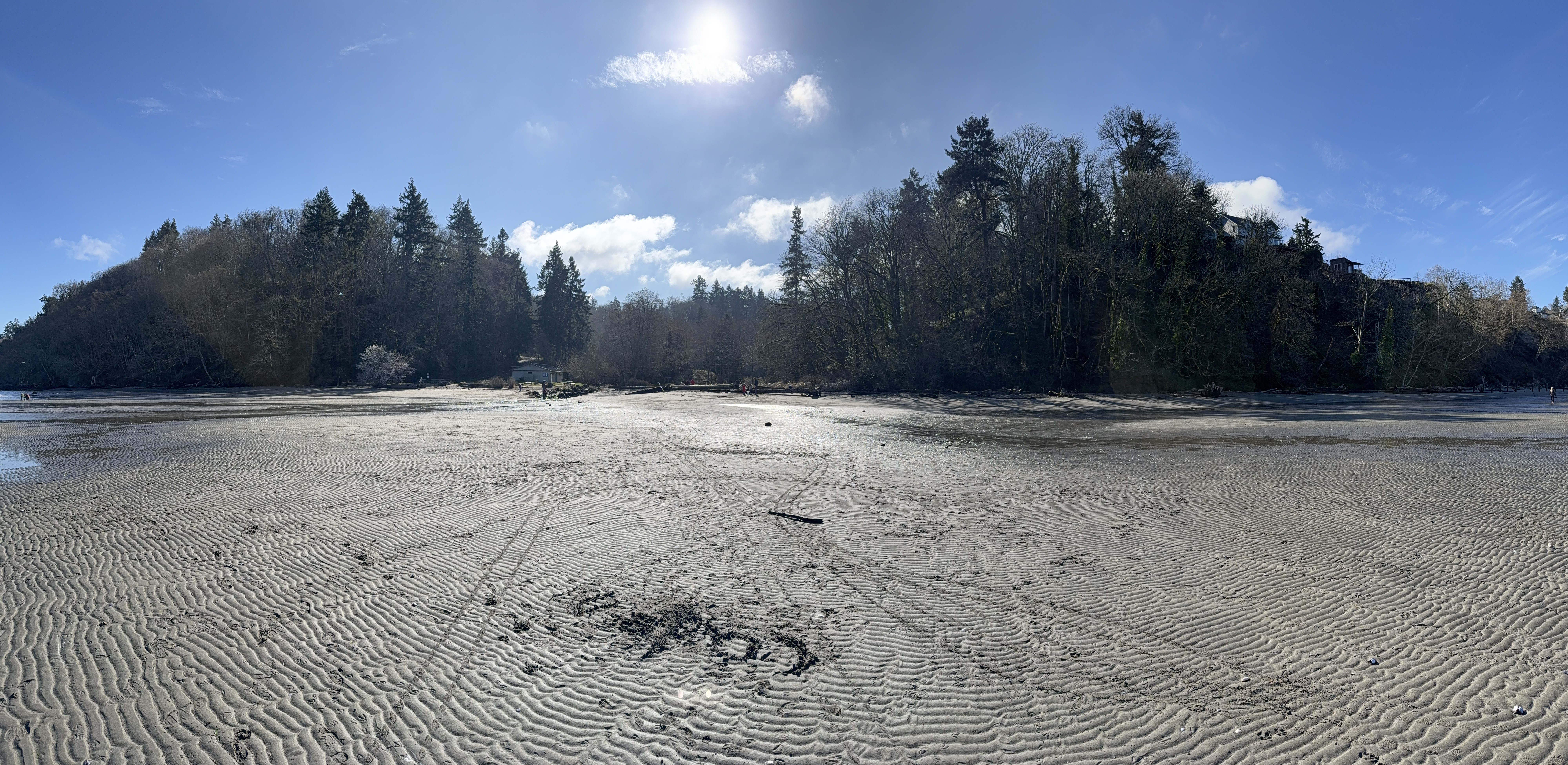
Figure 1. This photo, looking landward from Dash Point beach, says it all: A small stream enters between the two bluffs, each about 200 feet in height, and dumps copious amounts of sand, silt and clay onto a mesotidal shoreline (the tidal range is about 7 feet), where the volume of sediment input overwhelms the nearshore wave and tidal regime to create an expanding delta.
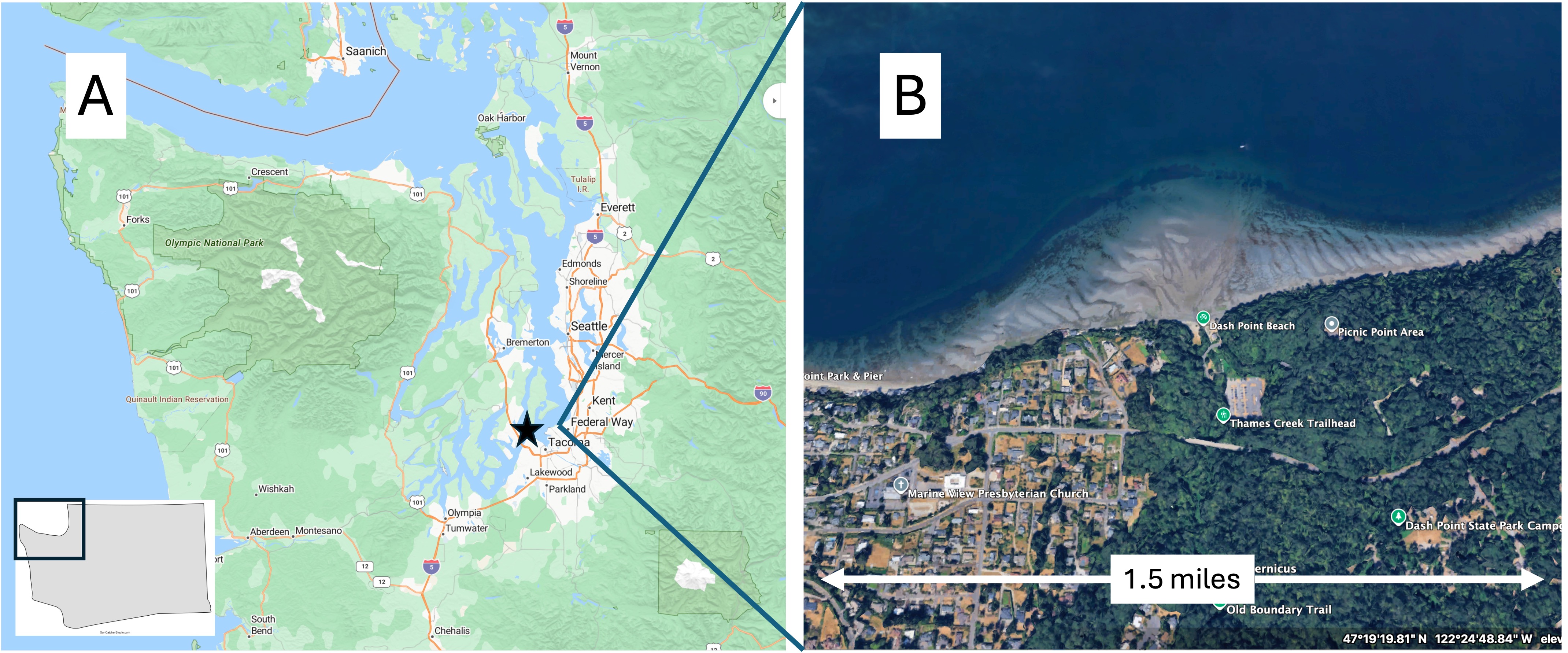
Figure 2. (A) Regional map showing the complex, glacially sculpted, morphology of Puget Sound. The star is approximately where my house is. (B) Google Earth image from about 7000 feet showing Dash Point and the extensive delta being constructed by sediment delivered by a small stream.
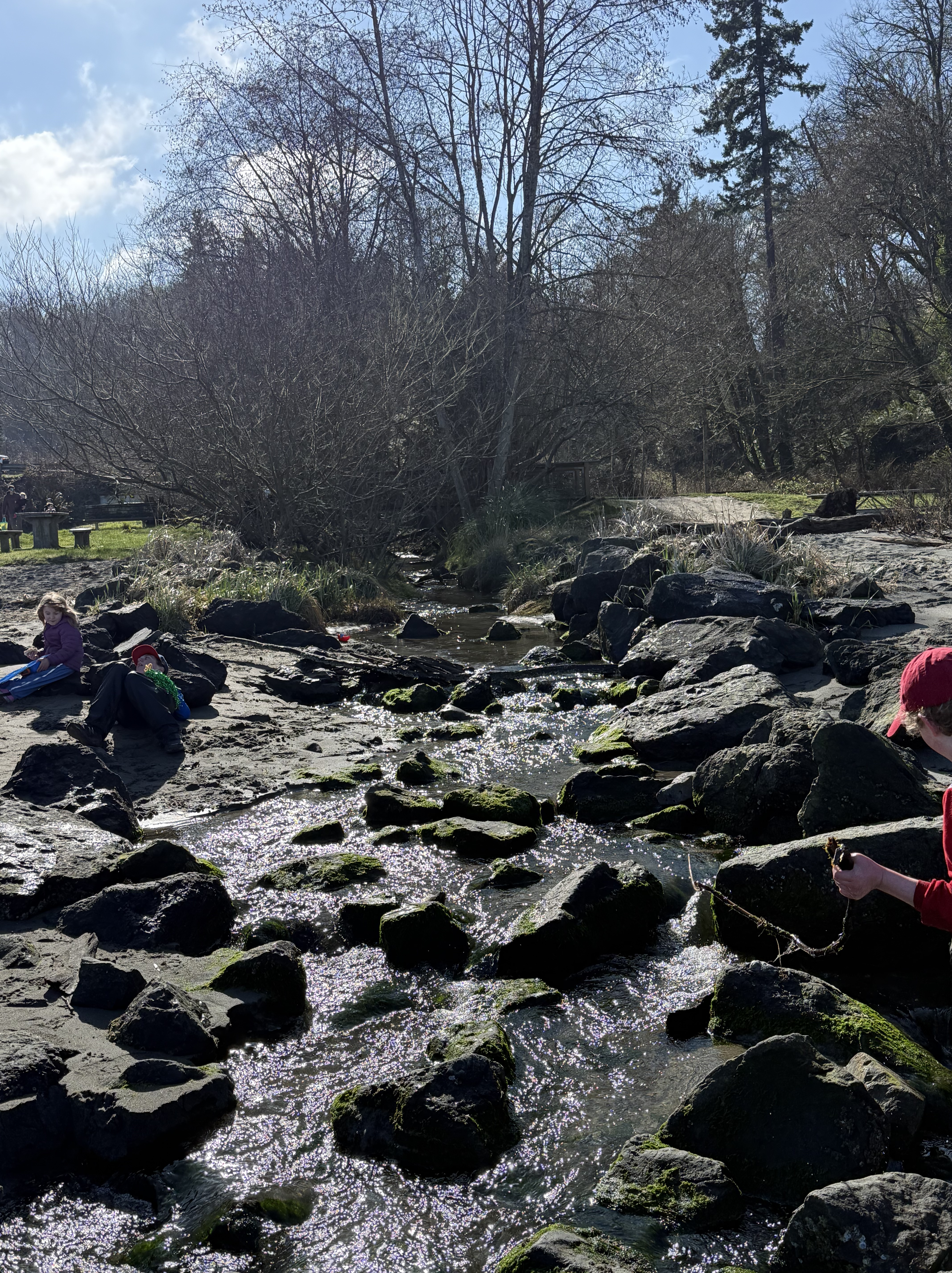
Figure 3. The small stream feeding the delta has been confined to a stone-lined channel. This is the entire inflow. The water looks pretty clear, but appearances can be deceiving in the context of sediment transport. This is a bedload-dominated stream, which means that it is mostly transporting sand and silt, and minimal clay particles. The entire area surrounding Puget Sound is constructed of glacial till, which is mostly gravel and sand. A closer examination will confirm this inference.
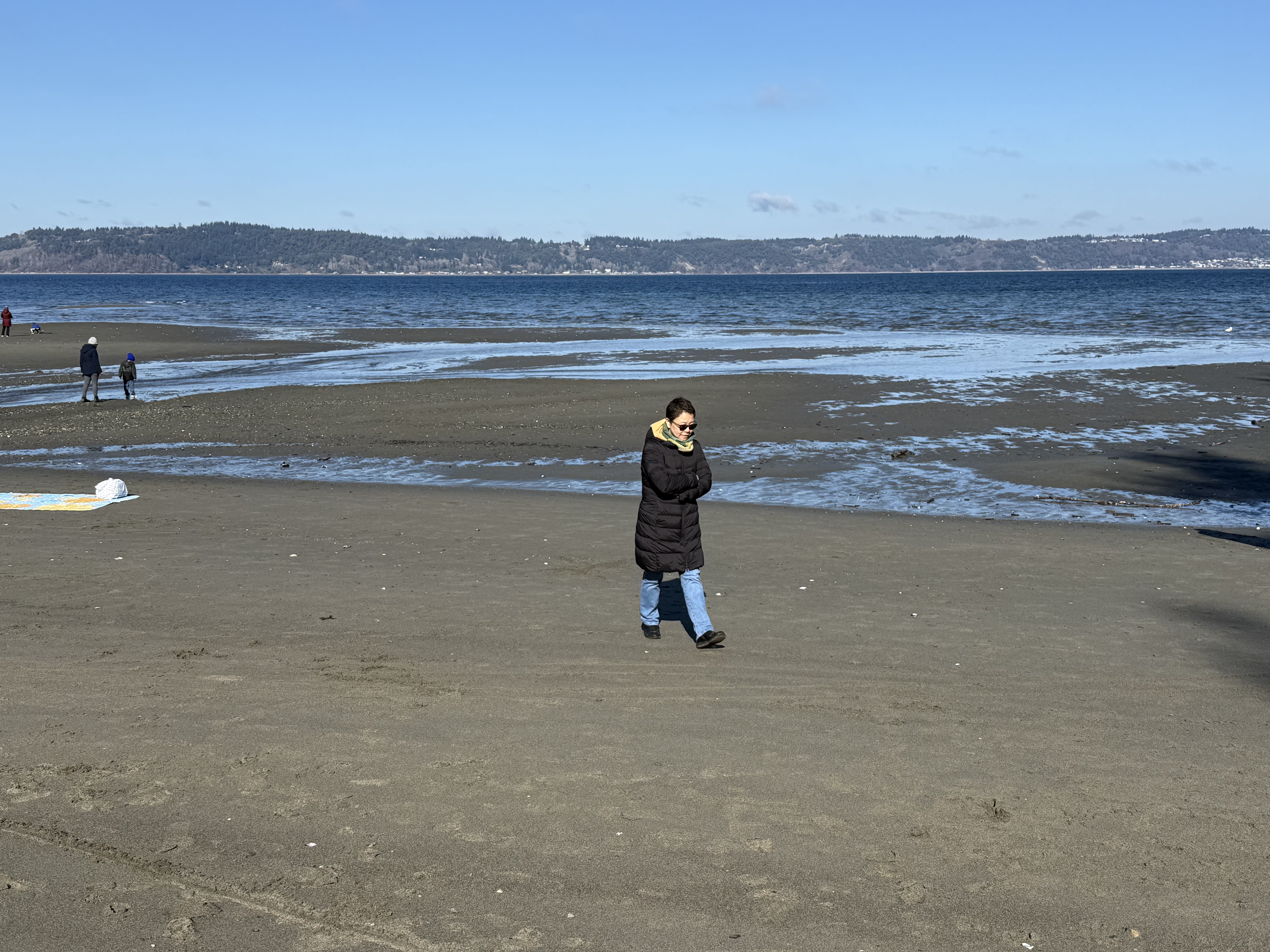
Figure 4. This is the delta seen in Fig. 2B during an ebbing tide that is near its minimum. The expanse of the delta, at approximately the same tidal height, is seen here at ground level, revealing tidal channels and swales; but the surface is sand and silt with minimal clay restricted to the swales, like those seen in the middle of this photo.
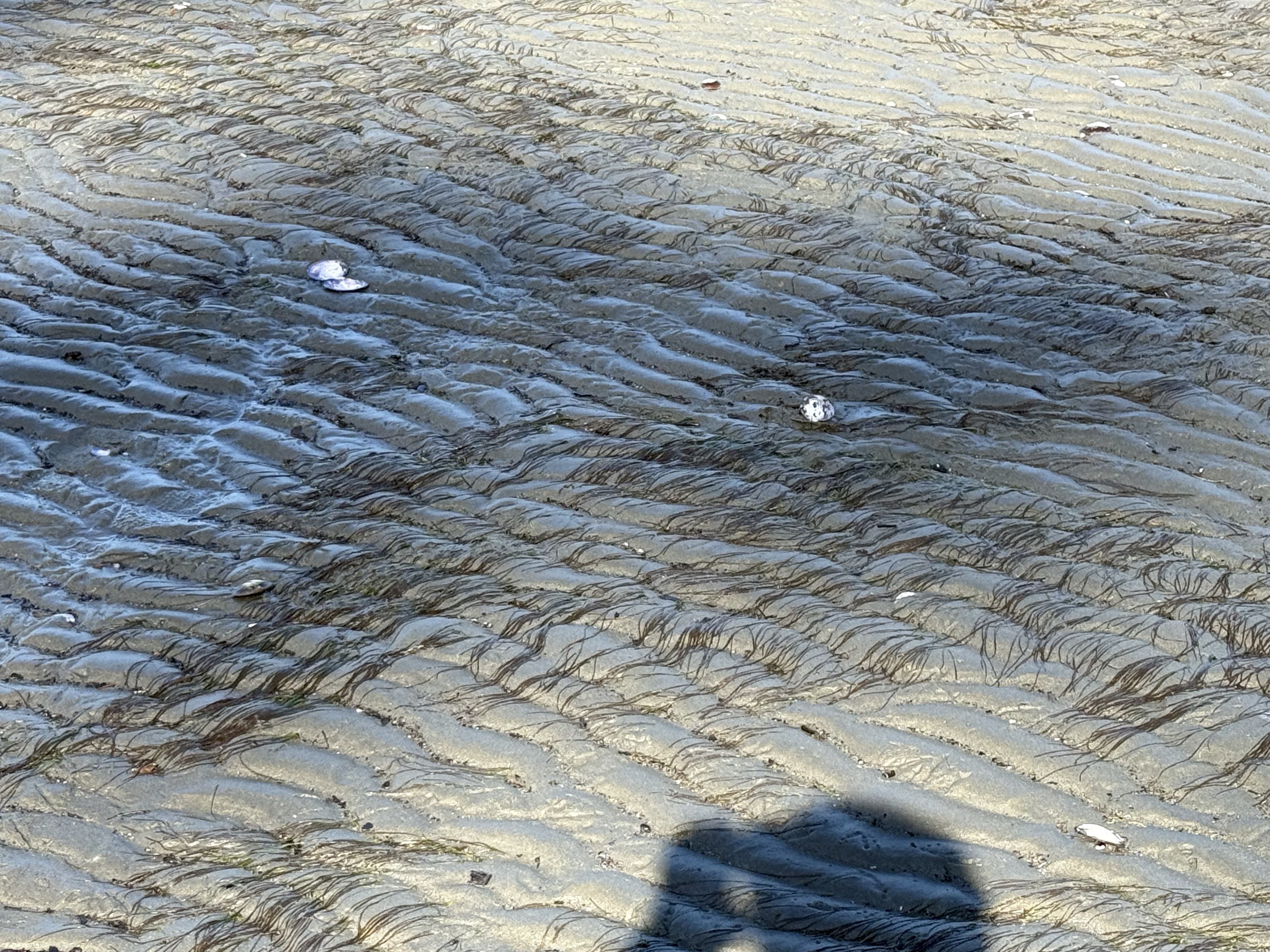
Figure 5. The flattened sea grass serves as a current indicator that perfectly matches the ripple orientation. Note that the tops of the ripples are flattened by the high velocity of the ebbing tide. Waves weren’t very large on this particular day.
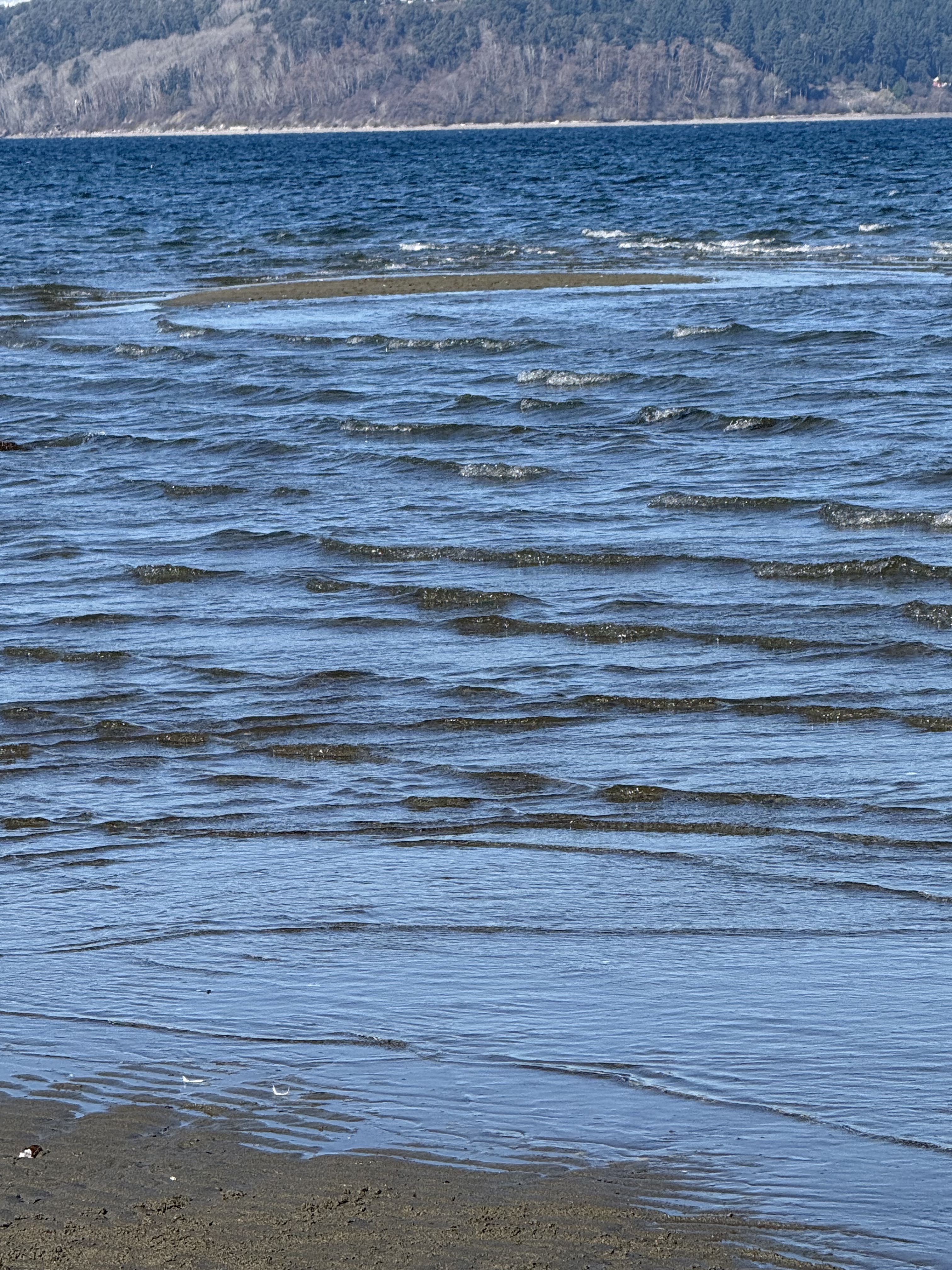
Figure 6. Sand bars are constantly being created and destroyed at the fringe of the delta, probably in seasonal cycles. I don’t know where a late February date fits into this cycle. Perhaps I’ll need to return in the summer.
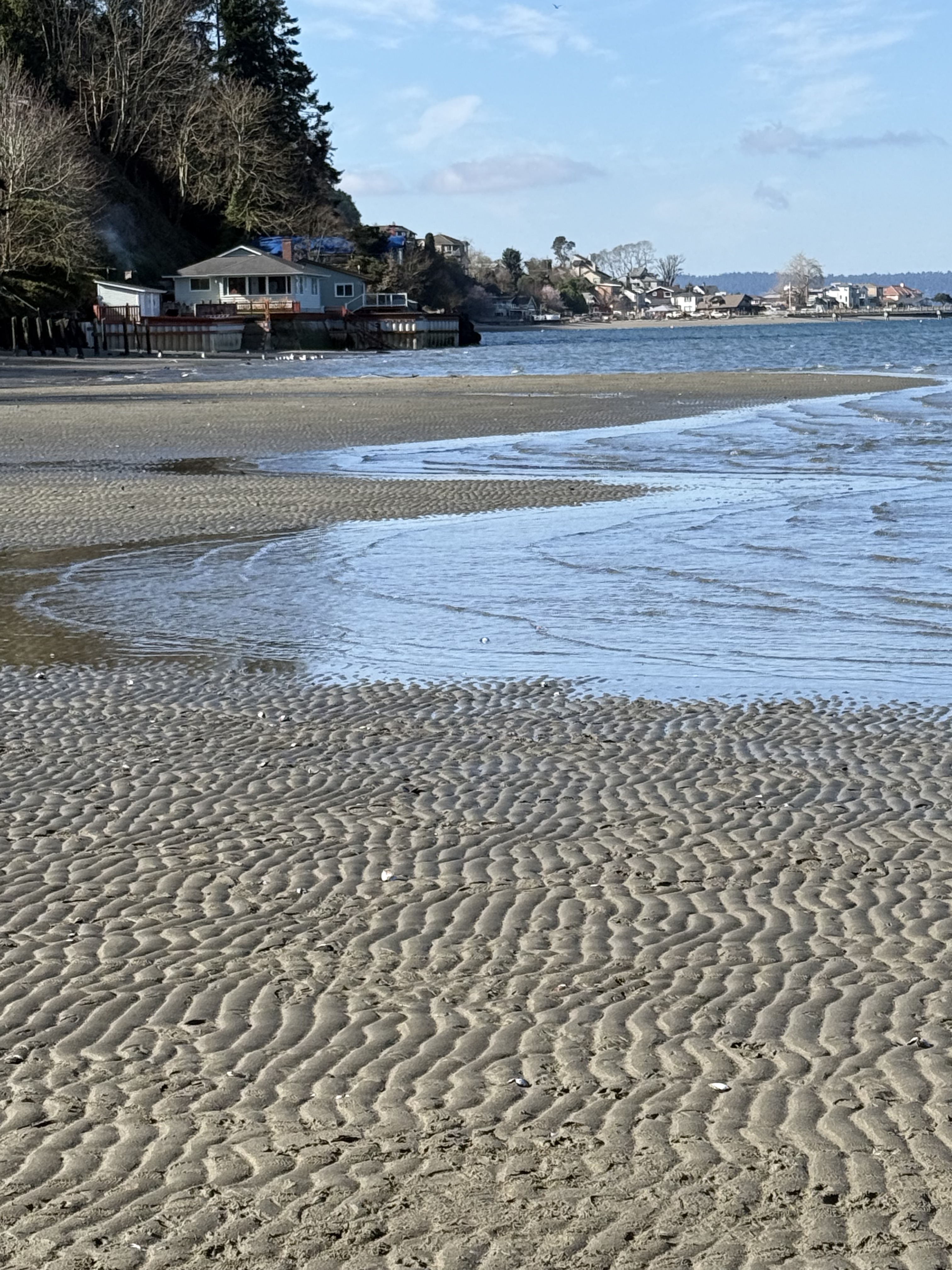
Figure 7. The delta was less symmetric on this February day than the undated image in Fig. 2B. This image looks to the west. It reveals multiple shore-perpendicular sand bars, until the delta is interrupted by shoreline development. Nothing like this was present on the eastern side of the delta on this day. The sediment supplied by the stream in Fig. 3 is being transported westward in this shallow water, but not by waves like we saw on this day, which are perpendicular to the shore.
SUMMARY
Dash Point beach provided a great opportunity to study nearshore sedimentology. Just look at those ripples in Fig. 7! Despite being created and destroyed twice a day, we find rocks preserving similar ripples throughout geologic time.
With so much gravel in the Puget Sound area eroded from the glacial till (gravel and sand), it was exciting to see finer grained sedimentation occurring in real time. Gravel beaches are uncommon in the geologic record whereas rippled, sandy beaches are very common; after all, the previous source of this sand and silt was a glacial till, itself the product of erosion by ice and fluvial transport during the previous twenty-thousand years.
Material is recycled by our tectonically active planet.
Earth abides…

Trackbacks / Pingbacks