
Coast to Coast
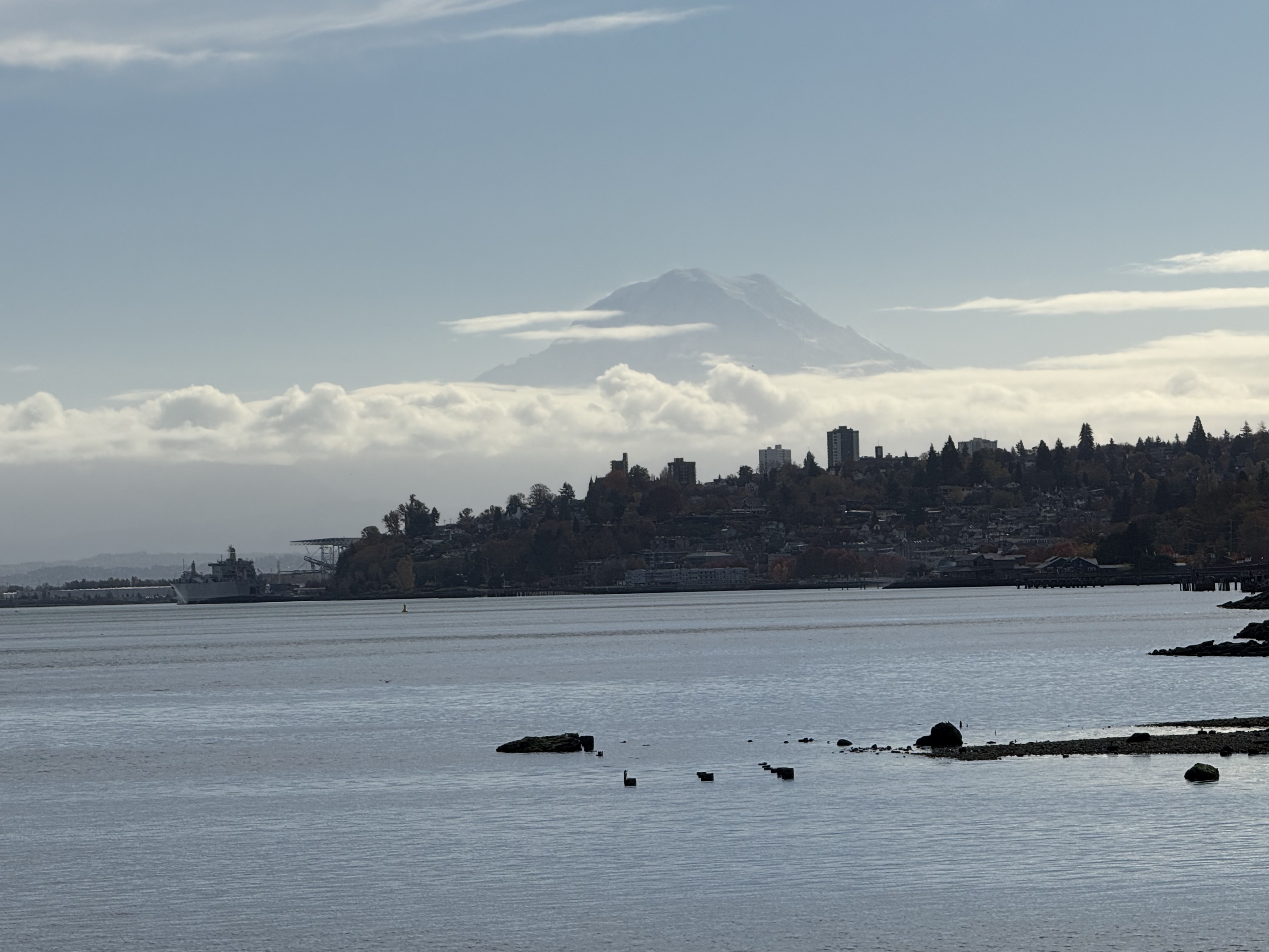
Plate 1. We’re not in Northern Virginia anymore!
I’ve relocated to the west coast–Tacoma, Washington to be exact, and that active stratovolcano looming in the background is Mt Rainier (aka Tahoma as it’s known to the indigenous people). The pristine water body is Commencement Bay at the southern end of Puget Sound. Mt Rainier is 14410 feet high, which makes it the most topographically prominent mountain in the lower 48 states; for scale, it is 43 miles from Tacoma, yet dominates the SE horizon. How did it come to be so close to the coast and yet so tall? Before I answer that question, let’s recap the geological story of NoVA that I pieced together over the last four years.
Over a billion years ago, NoVA was submerged beneath an ocean or marginal sea. Distant mountains eroded rapidly in a time before land plants. Vast quantities of sediment accumulated in layers of erosional debris that were subsequently buried by younger sediment. Between a billion and five-hundred million years ago, these sediments became rocks that were subsequently deformed as continental plates collided. They didn’t melt, however, and survived the cataclysm relatively unharmed, becoming schist and related metasedimentary rocks.

Plate 2. This schematic cross-section of the US East Coast is representative of NoVA. It shows the final closing of the Iapetus Ocean (forerunner of the Atlantic), which would have produced immense quantities of terrestrial sediments (e.g. the Devonian Catskill Delta in panel B). Unfortunately, these river and lacustrine sediments were subsequently eroded in NoVa as the ensuing mountains grew in size (panels C through E). They are today preserved in western New York State and eastern Pennsylvania. What survived in NoVA are older metasediments, ranging from ~1200 to 500 Ma, which were buried beneath the material eroded along the western margin of this figure (the yellow areas). Some Devonian intrusive rocks, intruded into older metasediments, survived along the Potomac River.

Plate 3. This reconstruction of the supercontinent, Pangea, coincides with Plate 2E. The square indicates NoVA. Pangea began to crack apart ~210 my ago, split by a spreading tectonic plate boundary, and for the last 200 million years, the older rocks have been slowly working their way to the surface as younger rocks were removed by erosion. They are now exposed to the elements and are weathering to form new layers of sediment in the Atlantic Ocean, beginning a new cycle.
What about the northwest coast, Tacoma and Seattle, you may ask?

Plate 4. This beautiful schematic cross-section represents the consensus opinion of geologists familiar with the Cascadia region. Tacoma lies at the northern end, near Mt Rainier. I will refer to this image frequently in my following posts. Study it a moment and you will realize that the geologic situation is similar to that presented in Plate 2A and B, but on the eastern (right) side of the closing ocean basin, i.e., the Pacific Ocean.
The Coast Range (including Olympic peninsula) is part of the accretionary wedge of a subduction zone, and Puget Sound lies within the forearc basin. In other words, I have moved from an extinct collisional tectonic regime to an active SUBDUCTION zone; Mt Rainier (Plate 1) is the tip of the geological iceberg, leaking sweat from the partially melting Juan de Fuca tectonic plate.
I hope you join me on this new geological adventure into the past…

Trackbacks / Pingbacks