
Geological Cycles at Wolf Trap National Park

Figure 1. (A) Wolf Trap National Park for the Performing Arts is located about twenty miles west of Washington DC, near several parks I’ve discussed in previous posts, especially Great Falls National Monument. The geology of the area is dominated by Neoproterozoic-to-Cambrian (1000 – 511 Ma) metasedimentary rocks that originated in oceanic environments near rapidly rising mountains (e.g., a volcanic island arc). The dates are from the time of metamorphosis, which is why they give such a long time span. Taking into account the accuracy of the dates in general, this region was undergoing erosion with the resultant sediment buried in marine trenches, probably near a subduction zone, for hundreds of millions of years. The majority of the material would have been mud. There would have been hiatuses (perhaps an ocean basin briefly emerged), but such detail is lost to us after so long. (B) This map of Wolf Trap Park shows the trail we followed. The map doesn’t show topography, but the ridges are short, with maximum relief less than 100 feet. Wolf Trap creek enters from the west (left side of panel B) and flows through a wetland area (indicated by blue ellipse) before meandering a little and following the east side of the valley.
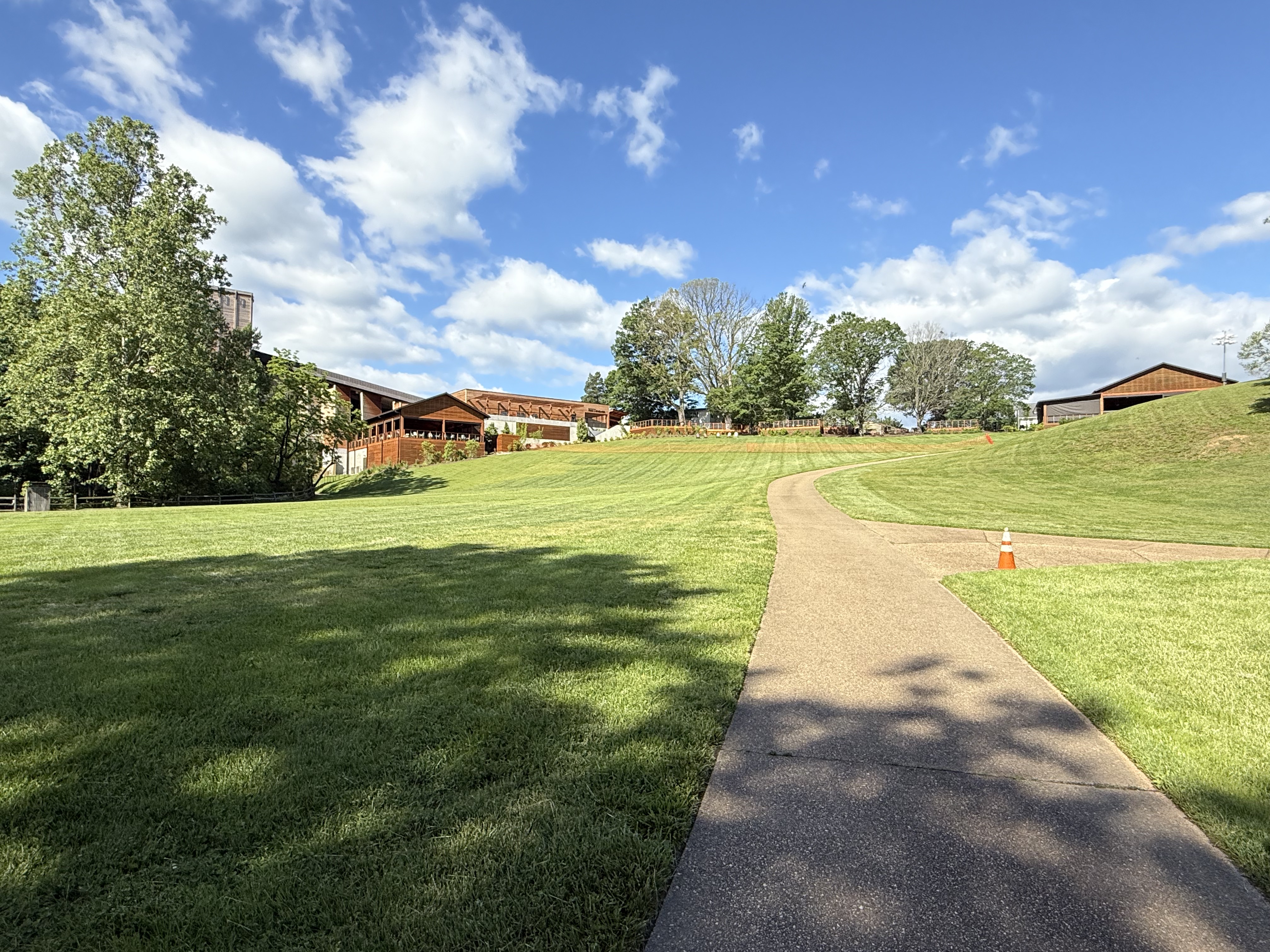
Figure 2. View of Filene Center from the SW side of our trail loop (see Fig. 1B), showing typical topographic relief at Wolf Trap park.

Figure 3. View of Wolf Trap creek where it enters the valley (Fig. 1B), showing boulders of Precambrian schist to be blocky–eroded nearby and gravitationally slid into creek but were not transported. These recently exhumed blocks are covered by Quaternary fluvial sediments, which are visible along the left side of the creek.
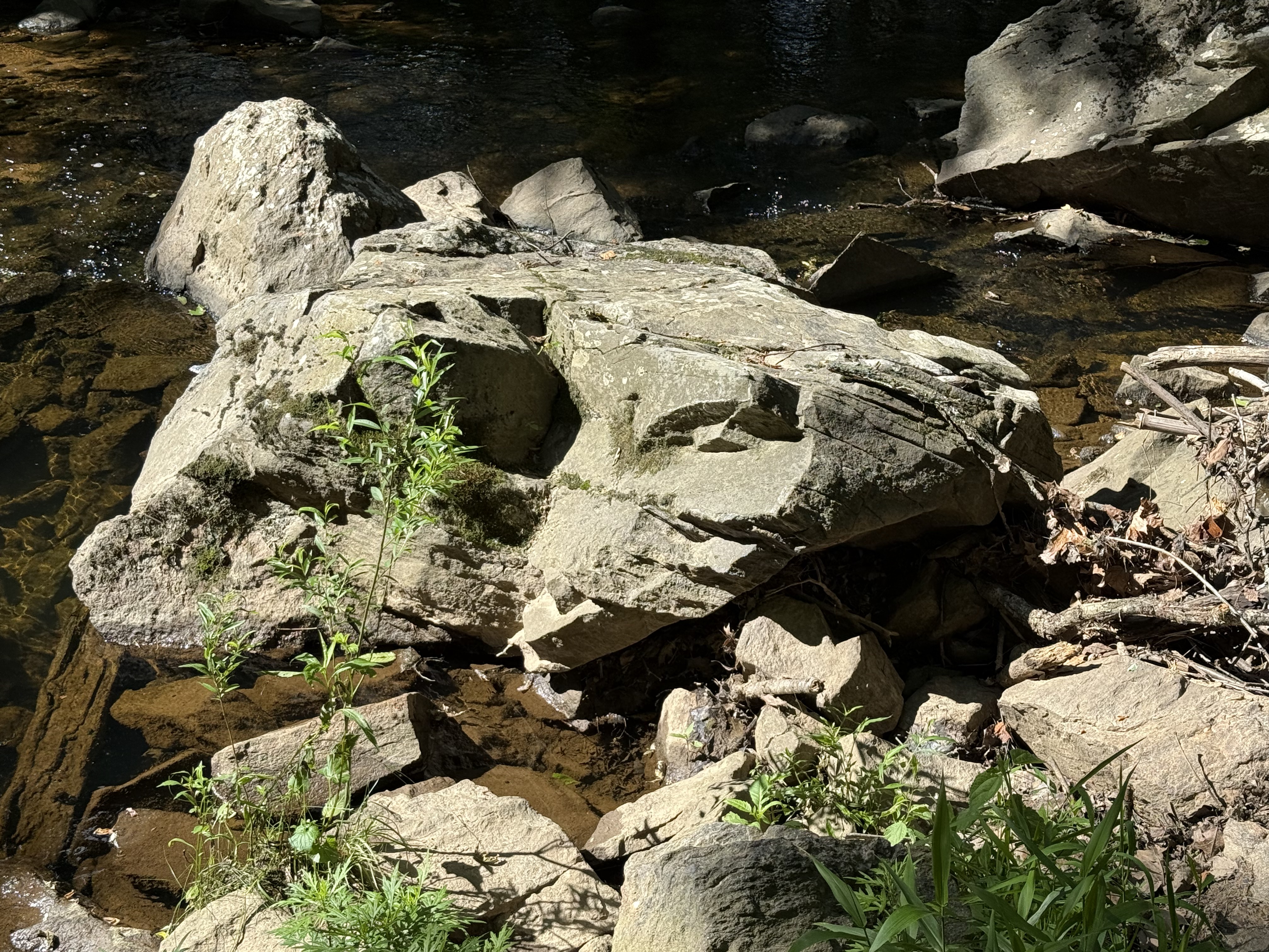
Figure 4. Large block (less than 6 feet in diameter) of schist that has been moderately weathered in place. Note the thin bedding (fissility) between thick layers with a conchoidal fracture pattern (center of image). This is the upstream side, which is pockmarked by rolling and bouncing boulders during high water. Mud becomes schist when buried deeply, retaining the lamination of the original fine-grained sediments, but remineralizing to familiar clays easily at the surface. Mud to schist to mud.

Figure 5. Meander in Wolf Trap creek along the north side of the park (see Fig. 1B), where a shallow pool of quiet water collects between runs (turbulent creek segments).

Figure 6. View looking upstream from a pedestrian bridge crossing Cthse Spring Branch, a tributary crossing our trail (dash line in Fig. 1B) before it joins Wolf Trap creek (NE side of trail in Fig. 1B). The boulders are smaller than downstream (Figs. 3 and 4), and their long axis are aligned with the stream flow. These angular blocks are sliding along on a stream-bed comprising miniature versions of themselves (note the clear view of the bottom in center of image). Even gravel and pebble-sized particles are platy because of the characteristic fissility of schist.

Figure 7. This photo dramatically reveals the effect of water on erosion.

Figure 8. This image is one I’ve seen too often here in northern VA. The sewer systems frequently follow streams because they are low points and run downhill (a good property for a sanitary system). However, when stream levels exceed expected values, the system is compromised and raw sewage can be released into the environment.
Summary. Over a billion years ago, this area was submerged beneath an ocean or marginal sea. Distant mountains eroded rapidly in a time before land plants. Vast quantities of sediment accumulated in layers of erosional debris that were subsequently buried by younger sediment. Between a billion and five-hundred million years ago, these sediments became rocks that were subsequently deformed as continental plates collided. They didn’t melt, however, and survived the cataclysm relatively unharmed, becoming schist and related metasedimentary rocks. For the last 200 million years, they have been slowly working their way to the surface as younger rocks are removed by water erosion in streams like we see all throughout NoVA. They are now exposed to the elements and are weathering to form new layers of sediment in the Atlantic Ocean, beginning a new cycle.

Recent Comments