
The Adelaide Superbasin
The terminology and nomenclature used in geology change constantly, just like in every other discipline. Thus, what was originally a geoscyncline, became a rift complex, and is now a superbasin. I guess that being bigger is better than being complicated. Adelaide is in the Wild West of Australia. Because of the name change, this post is about the Adelaide Superbasin (Fig. 1).
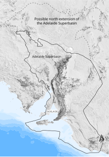
It isn’t possible to describe hundreds of stratigraphic formations in a blog post, so I’ll do as I always do and describe what I saw with my own eyes. I couldn’t find a geological map of South Australia, so I’ve compiled a schematic map of the the region (Fig. 2).

The Starting Point (Fig. 2) was reached after crossing the Murray River at Murray Bridge(Fig. 3), a view not unlike entering the Rio Grande Valley at Las Cruces.
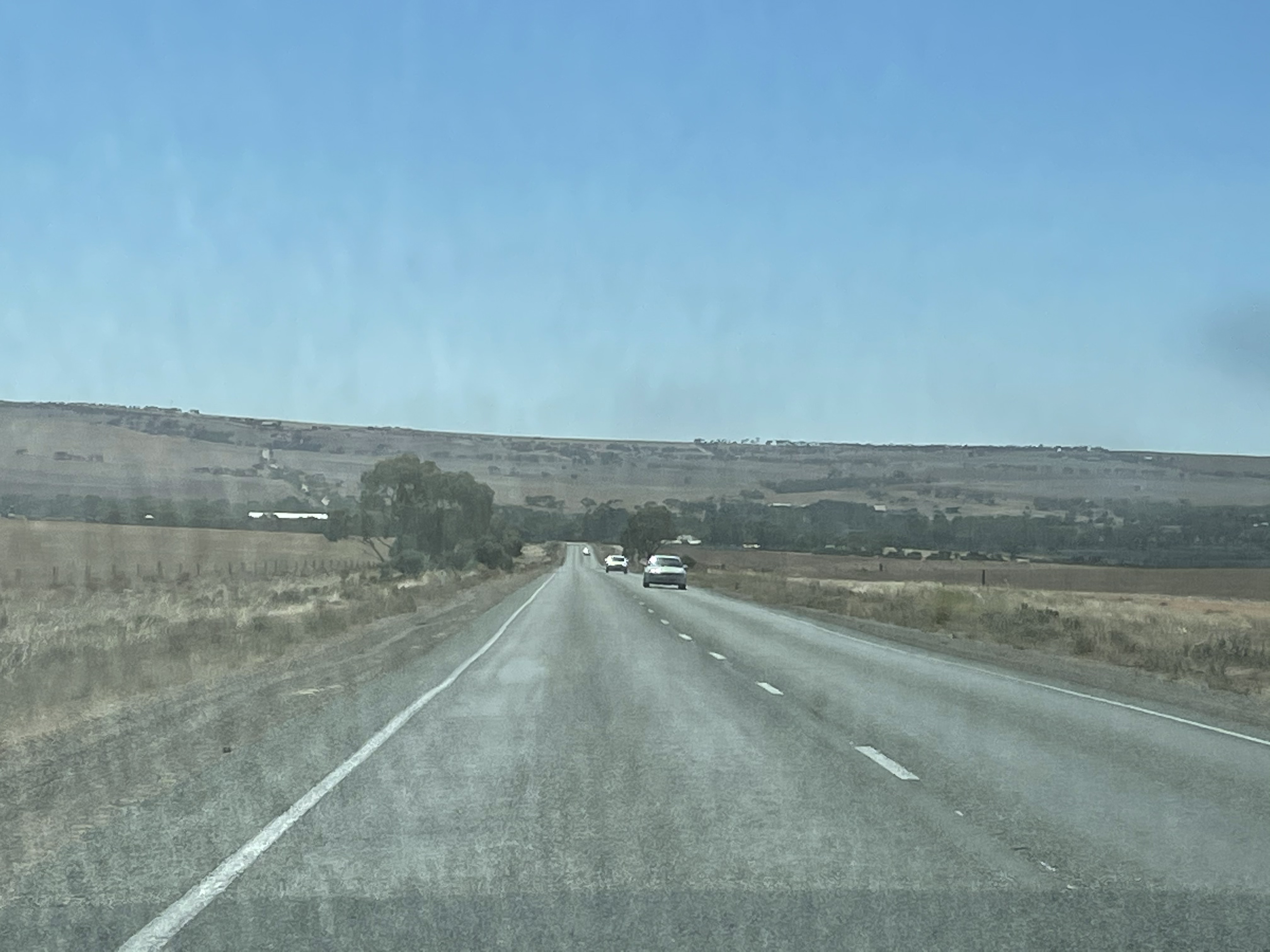
The Murray River was the lifeline for the agricultural regions of South Australia until the1940s, when rail and trucks finally became more profitable. The river remains a center of transportation and tourism (Fig. 4).

The Murray River is also a major source of water for the region. Large pipes followed the highway, leading in different directions, unimpeded by the Flinders Range (Fig. 5).

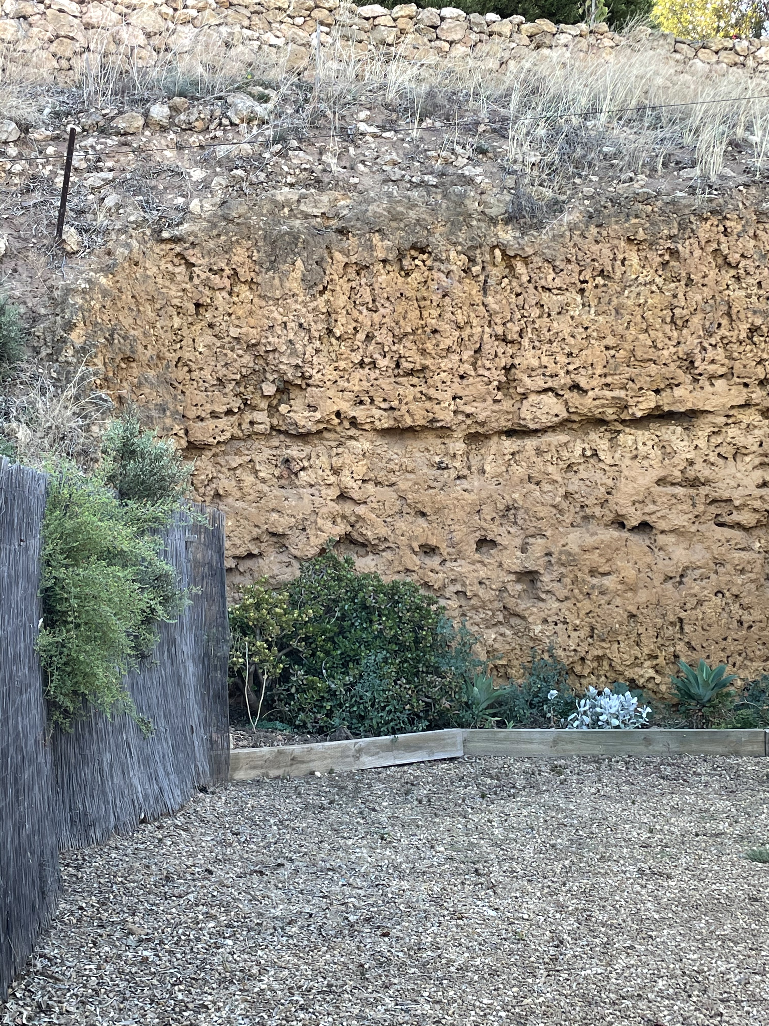
Now we’re ready to begin our journey, at the east side of the rectangle outlined in blue from Fig. 2. Erosion along the banks of the Murray River exposes Cenozoic (66-0 Ma) sedimentary rocks that are poorly consolidated but resistant in the low rainfall of this region (Fig. 6).
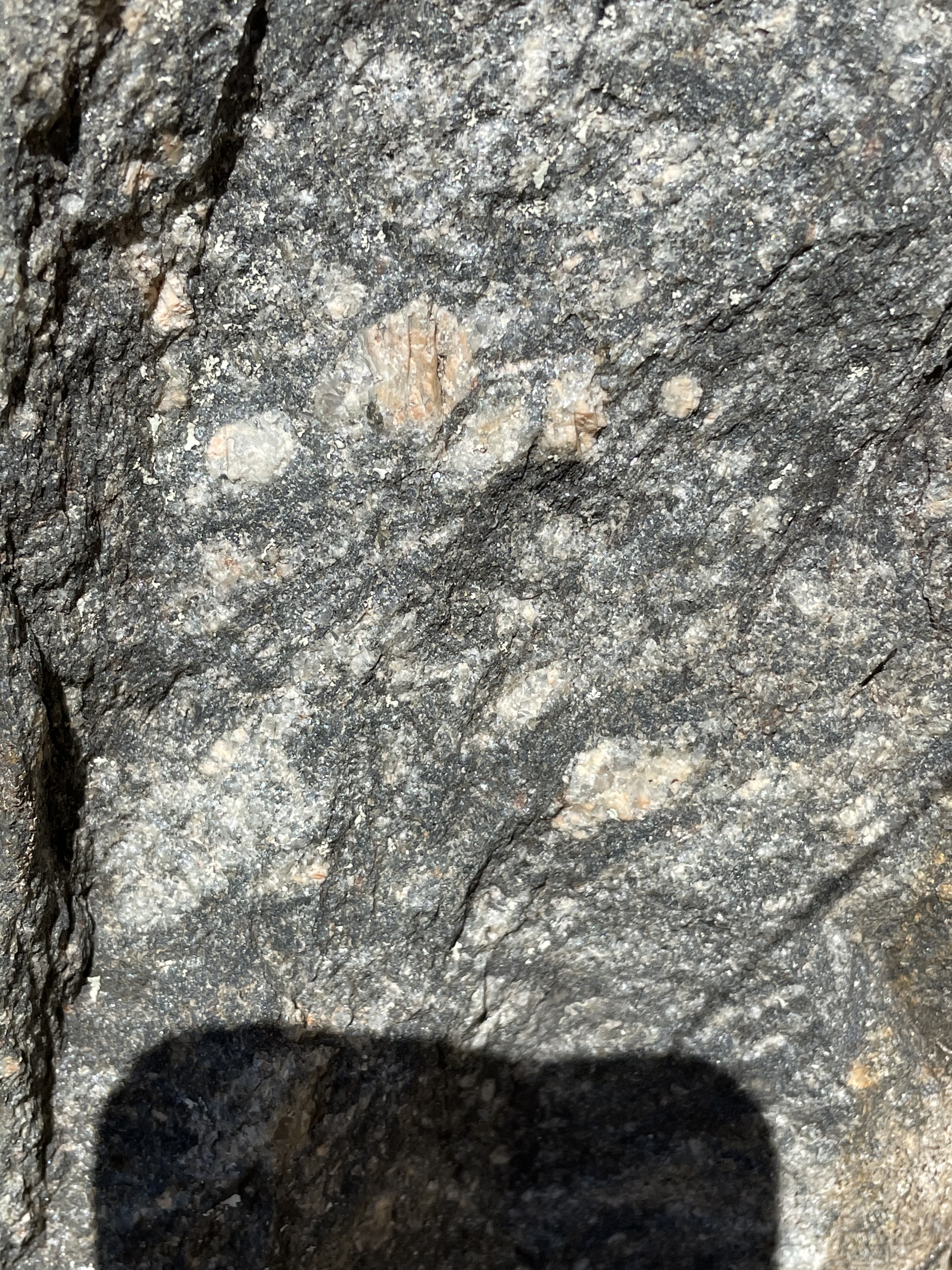
Heading WNW from the “Starting Point,” our path took us over some rolling hills capped by rounded exposures of what turned out to be alkali granite (Fig. 7), which is about 500 Ma old.

Viewed up close, this rock consists of quartz and alkali feldspars (i.e. albite and orthoclase), with minor biotite (Fig. 8).

This rock appeared capping hills but formed no cliffs or ledges. Within a mile of this outcrop we found the country rock (Fig. 9), Neoproterozoic to Early Cambrian (541-509 Ma) sedimentary siliciclastic rocks.
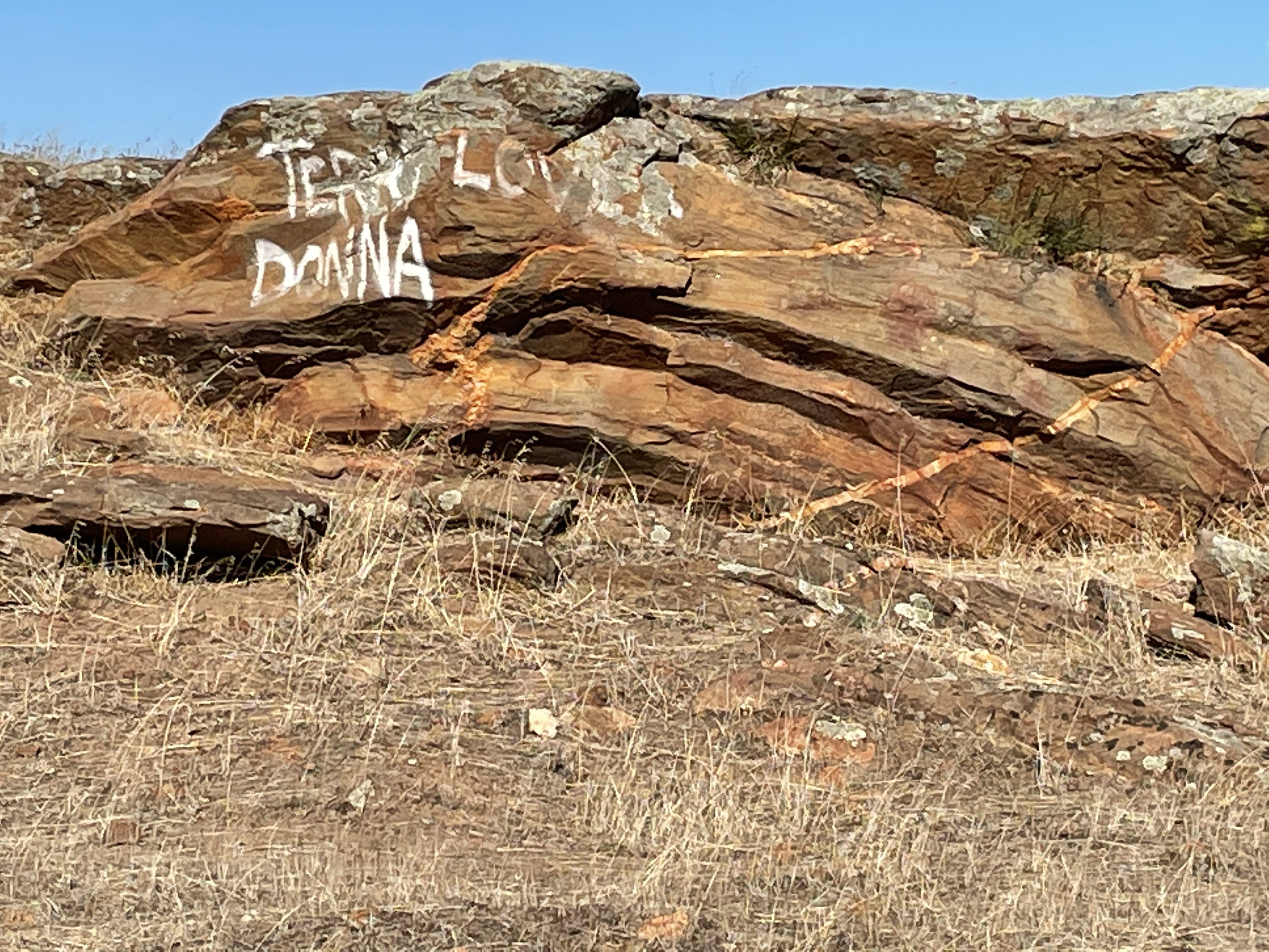

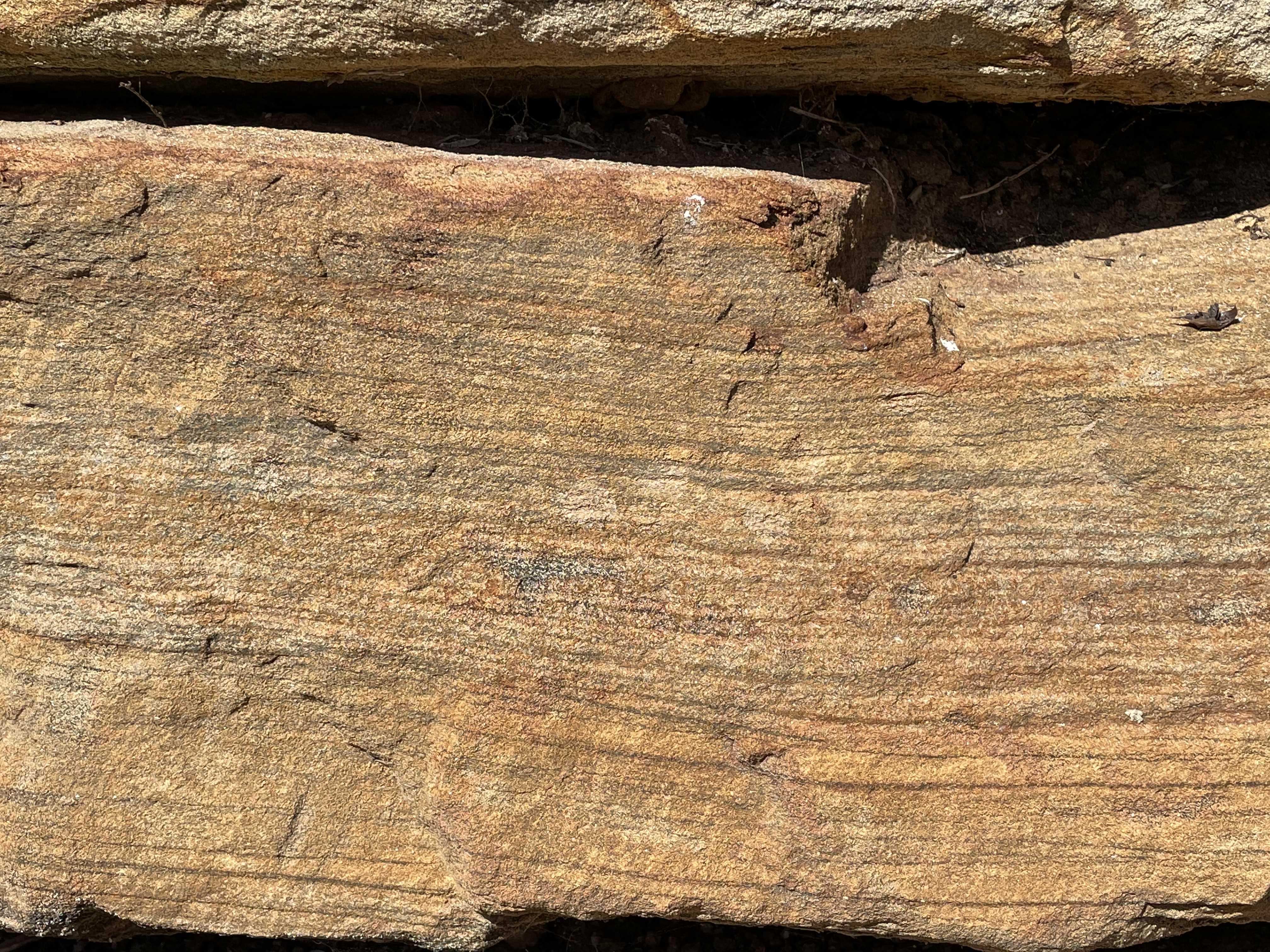
These exposures appear to retain their original sedimentary texture, comprising thin bedding and lamination. However, they are very near exposures of younger granite, which suggests an intrusive relationship during metamorphism. Note the dip of the beds in Fig. 9.
A freshly cut block (to make room for a fence) reveals foliation that suggests high-pressure metamorphism (Fig. 10).

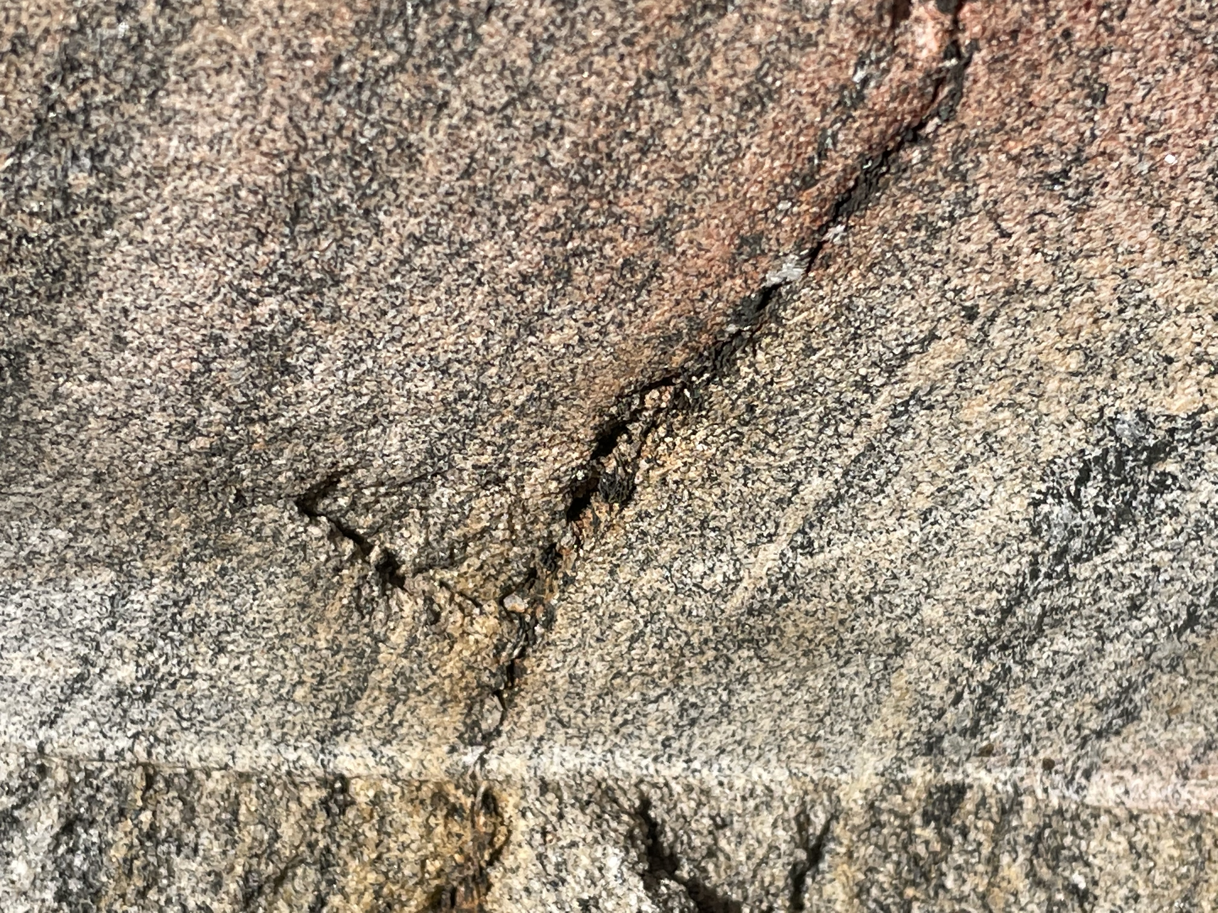

The foliation seen in Fig. 10 is bordering on gneiss, which isn’t formed until the minerals are near their melting point, which is consistent with the proximity of the Palmer Granite pluton (Figs. 7 and 8). Taken together, these rocks indicate deposition in a nearshore marine environment between ~540 and 510 Ma, burial to great depths, and intrusion of a granite magma about 500 Ma. This was an orogeny.
Traveling west (see blue-outlined inset in Fig. 2), we entered a canyon with exposures of metamorphosed sedimentary rocks (Fig. 11).


The range of sediments and their metamorphic grade seen in Fig. 11 span 1900 million years. They are exposed because of a major N-S fault running along the Flinders Range. The oldest (Figs. 11C, D, and E) are metasediments with foliation that were deposited between 2500 and 1000 MA.
The exposures in Fig. 11 A and B are from the Burra Group of Cryogenian age (720-635 Ma), long before the Keynes Subgroup sediments (Figs. 9 and 10) were deposited.
The Burra Group has a diverse lithology: laminated siltstone; sandstone with heavy-mineral lamination (e.g. from a beach), comprised of quartz and feldspar, with cross-bedding; dolomite (a carbonate); blue-grey to pale pink; containing lots of clay and lenticular (i.e., many lens-shaped bedding structures). Note that all of these sediments are indicative of a passive margin, not an orogenic belt experiencing rapid uplift and the deposition of immature sediments like graywacke and turbidites.
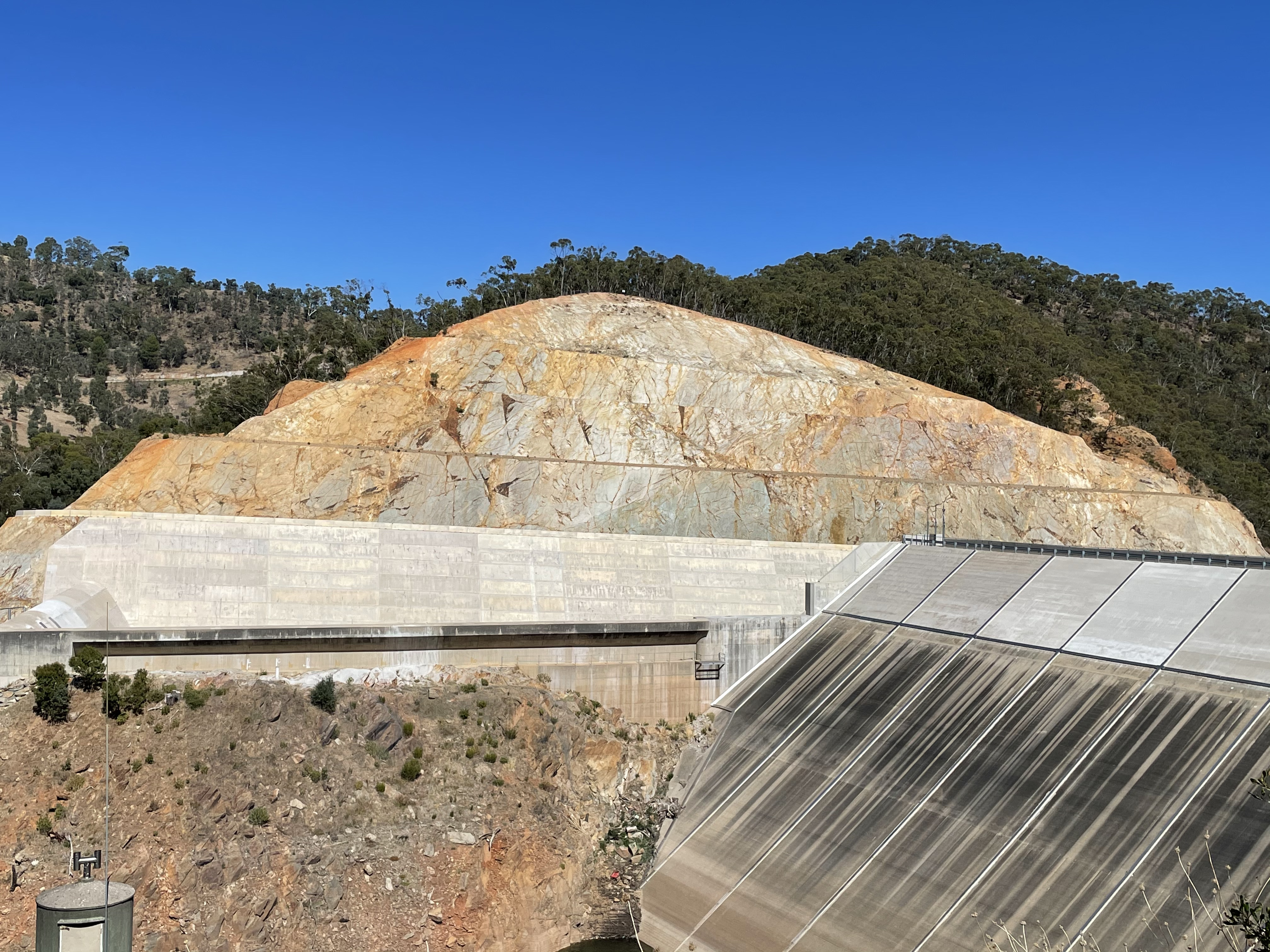
We followed Kangaroo Creek Reservoir (Fig. 12) to its outlet, where a large cut had been made, exposing two sides of a major fault.

The road along the west side of Kangaroo Creek (Fig. 12) had been following the fault, taking us into sediments of the Emeroo Subgroup (720-635 Ma), the same age as the Burra Group but containing only quartzite (metamorphosed sandstone), sandstone, dolomite, and conglomerate. Road cuts reveal the rock textures associated with a fracture zone (Fig. 13).


The major fault that runs the length of Kangaroo Creek Reservoir is exposed at the reservoir’s outlet (Fig. 14).

Note that the rocks in Fig. 14B are darker than those on the south side. Both sides of the fault expose rocks from the same stratigraphic formation but within different units. The south side (Fig. 14A) could be either quartzite or possibly dolomite because both can have a similar color. No exposures were available for close examination, however, so I’m going to put my money on dolomite. Such a large exposure of quartzite, from my experience, would either show bedding or be massive, whereas there are irregular lineations in this exposure. Dolomite is a carbonate mineral, formed by the recrystallization of the original calcite that would have formed marine animal shells in the ancient seas. The transformation from calcite to dolomite during diagenesis is not well understood. Thus, it can take many forms whereas sandstone is quite limited.
No report in Australia would be complete without the final photo from a beach. We ended up on the main public beach serving the Adelaide region (Fig. 15), to discover that it is a disaster compared to the “unimproved” beaches we’ve seen elsewhere in our travels.

The groin in the distance prevents sand being transported to this beach by waves and so it is starved of sediment. Thus, the nearshore bars and high berm to the left of the image. The beach face had a large component of fine-grained sediment as well. The beach was less than a mile long, terminating at the west end at an opening to a lagoon.
Summary
This is the last post from our trip to Adelaide, so I’ll summarize the geologic history briefly.
Between 2.5 and 1 billion years ago, South Australia was a passive margin (like the East Coast of the U.S.) and a variety of sediments accumulated in every imaginable coastal environment. Then there was a hiatus of about 300 million years, indicated by an unconformity between the Barossa Complex and Burra Group. A lot can happen in 300 million years, including an orogeny and subsequent uplift and erosion of the sedimentary record of such an event.
Between 720 and 635 million years ago, this region was a passive margin again, receiving similar sediments as a billion years earlier. These sediments were deposited on a surface that represented 300 million years of lost time. I didn’t find any dating of the orogenic event that produced the metamorphism seen in Figs. 11C, D, and E. Maybe it occurred during that missing interval or maybe…
The Delamerian Orogeny lasted from ~515 to 490 million years ago, long after the Burra group sediments had been buried and lithified.
The youngest Paleozoic sediments (the Keynes Subgroup, Figs. 9 and 10) were deposited between ~540 and 510 million years ago, overlapping slightly with the Delamerian Orogeny. However, the 105 million year hiatus between the Burra Group and the Keynes obscures a lot. For example, a little over 200 million years ago, North and South America were connected to Eurasia and Africa. Like I said, a lot can happen in a hundred million years.
At any rate, a series of granitic intrusions occurred, pushing their way into older sedimentary rocks, about 500 million years ago. This led to more metamorphism and deformation, probably associated with the Delamerian Orogeny.
Erosion followed until the Cenozoic (less than 68 million years ago), when terrigenous sediments accumulated everywhere, as revealed along the Murray River (Fig. 6).
Within the last couple of million years, Australia drifted over a mantle plume and volcanism began in Victoria, several hundred miles to the east near Melbourne, producing vast sheets of basalt.
This story is missing a lot, which we saw on previous trips. I’ll tie them together in a later post.

Recent Comments