
Cape Flattery: Conglomerates at the End of the World

Figure 1. I ran out of road and land, ending up at Cape Flattery on the Makah Reservation. This is Location D in Fig. 2. A half-mile hike down a boardwalk took me to the end of the world, where the cliffs are about 80 feet above sea level. This photo is looking northward towards Vancouver Island, Canada, in the distance. Wave action has cut a wave terrace, a seen in the center of the image, and a series of sea caves.
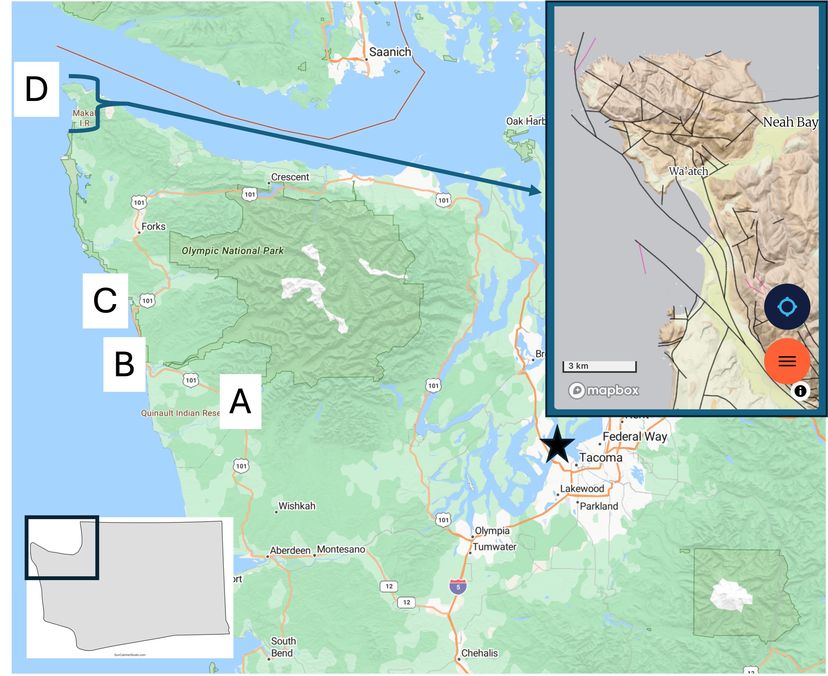
Figure 2. Today’s post takes us to Site D, which is shown in a geologic map from Rock D in the inset map. The rocks are a mixture of sandstone and conglomerate of Eocene age (56-34 Ma). This is the same time that the lower Cascades were being created east of Puget Sound. Note the large number of faults (thin lines) shown in the inset map. Many of these are strike-slip faults with motion of the opposing crustal block to the left, which would explain why the sedimentary layers in seen in Fig. 1 are almost horizontal, dipping slightly towards the sea.
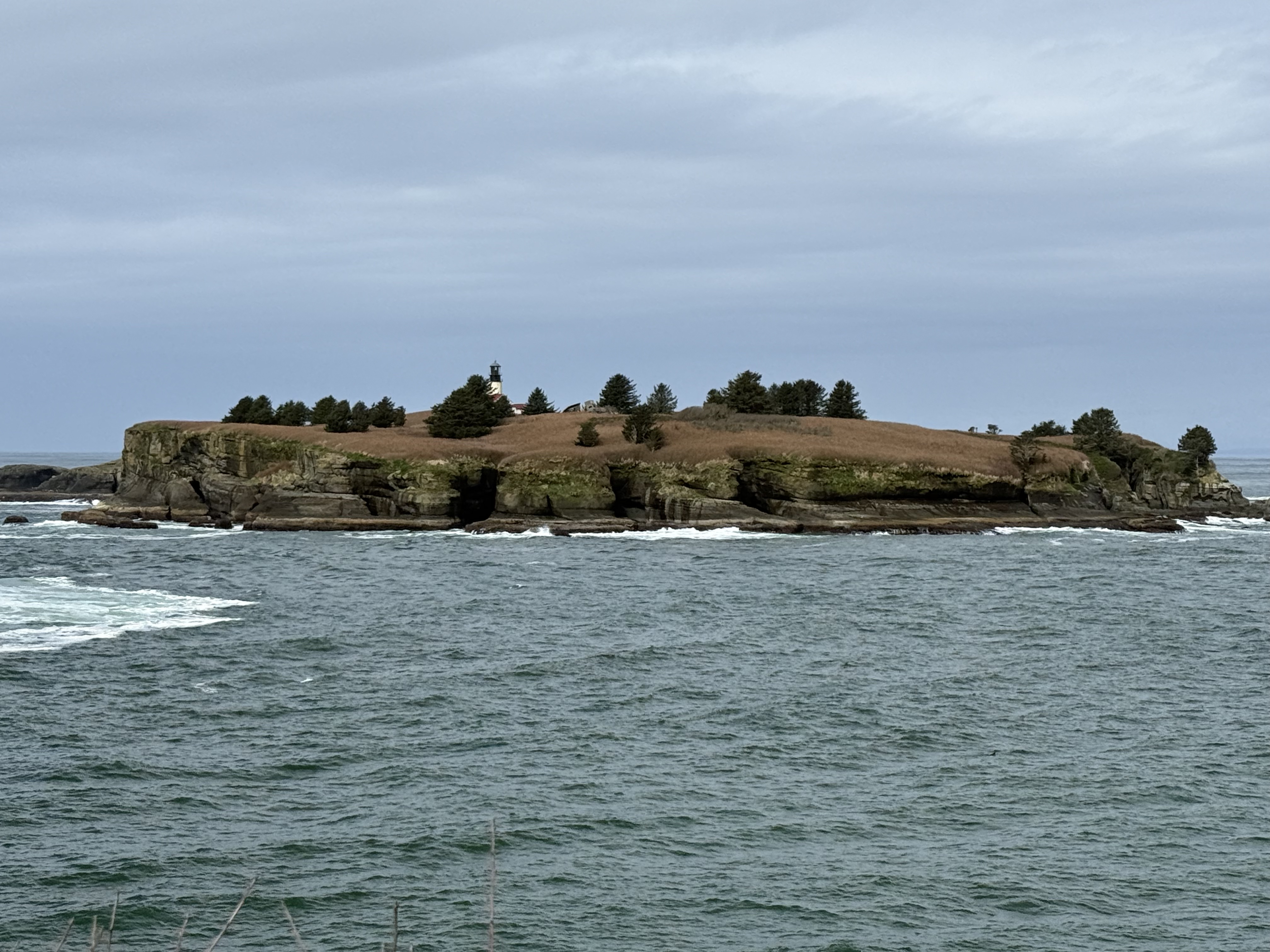
Figure 3. The sea stacks seen further south have been replaced with rocky islands like Tatoosh Island, which has a light house. Pacific Ocean seafloor (Juan de Fuca tectonic plate) is being actively subducted along the Washington-Oregon coast at about 2 inches/year, but the plate tectonic geometry is complex in this area. This could partly explain the large number of faults seen in Fig. 2 as well as the high elevation of bedrock. Maybe.
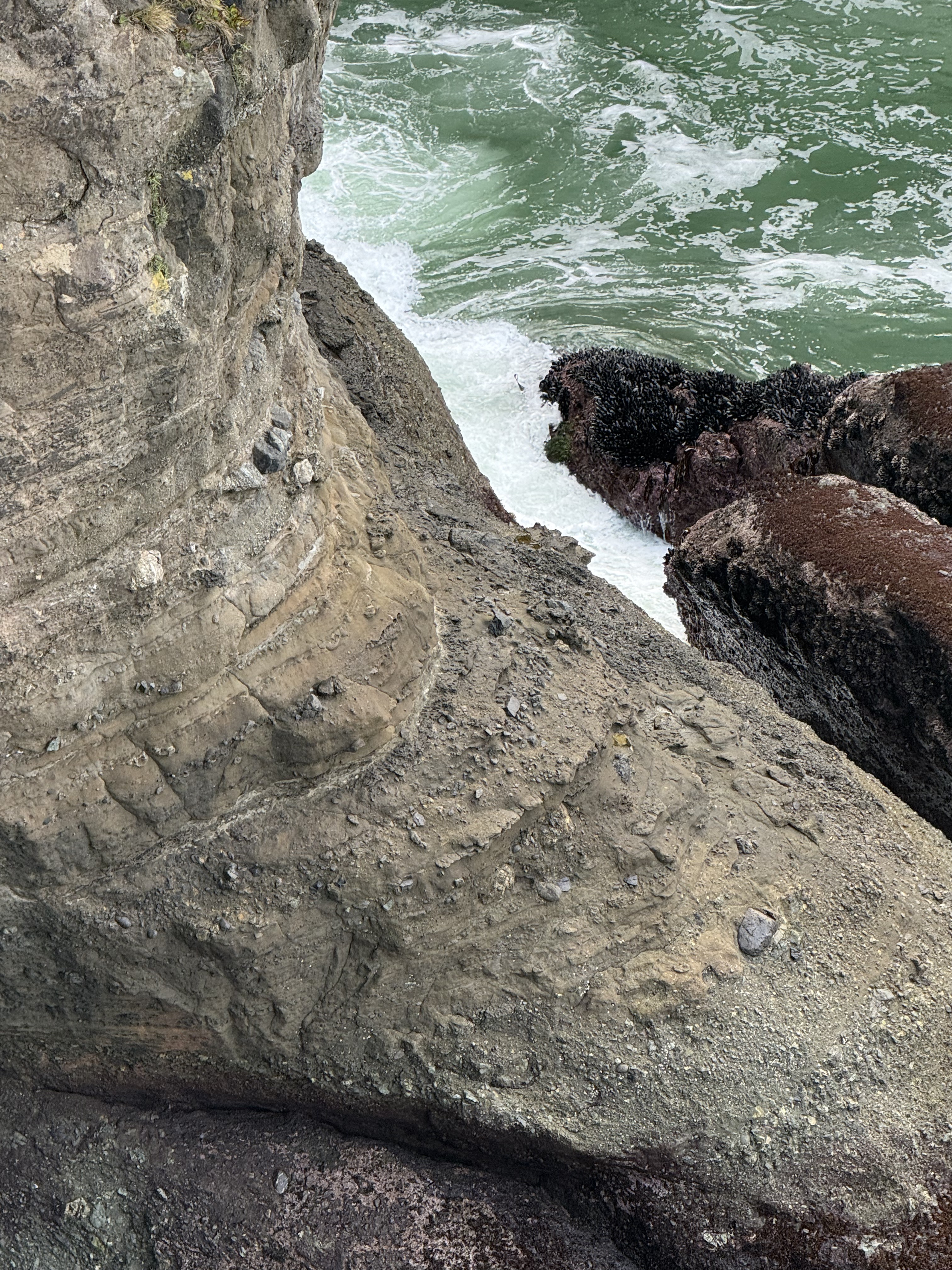
Figure 4. This photo was taken looking down towards the wave-terrace on the south side of the lookout point. For scale, the largest boulders are a couple of feet long, based on exposures at the surface of the trail. This is a textbook tectonic breccia. However, note that most of the rock fragments are rounded, so they have been transported some distance before reaching their final resting place. Some of the layers are relatively uniform with a few large boulders whereas others resemble the cobblestones we saw at Ruby Beach. Each bed might represent a single depositional event (like a landslide) or accumulation over years. These are marine rocks, deposited on a submarine fan, probably as turbidity flows. The process that created them is occurring now a few miles offshore, where the rocky outcrops we saw are eroding and supplying large and small fragments to a steep continental shelf.
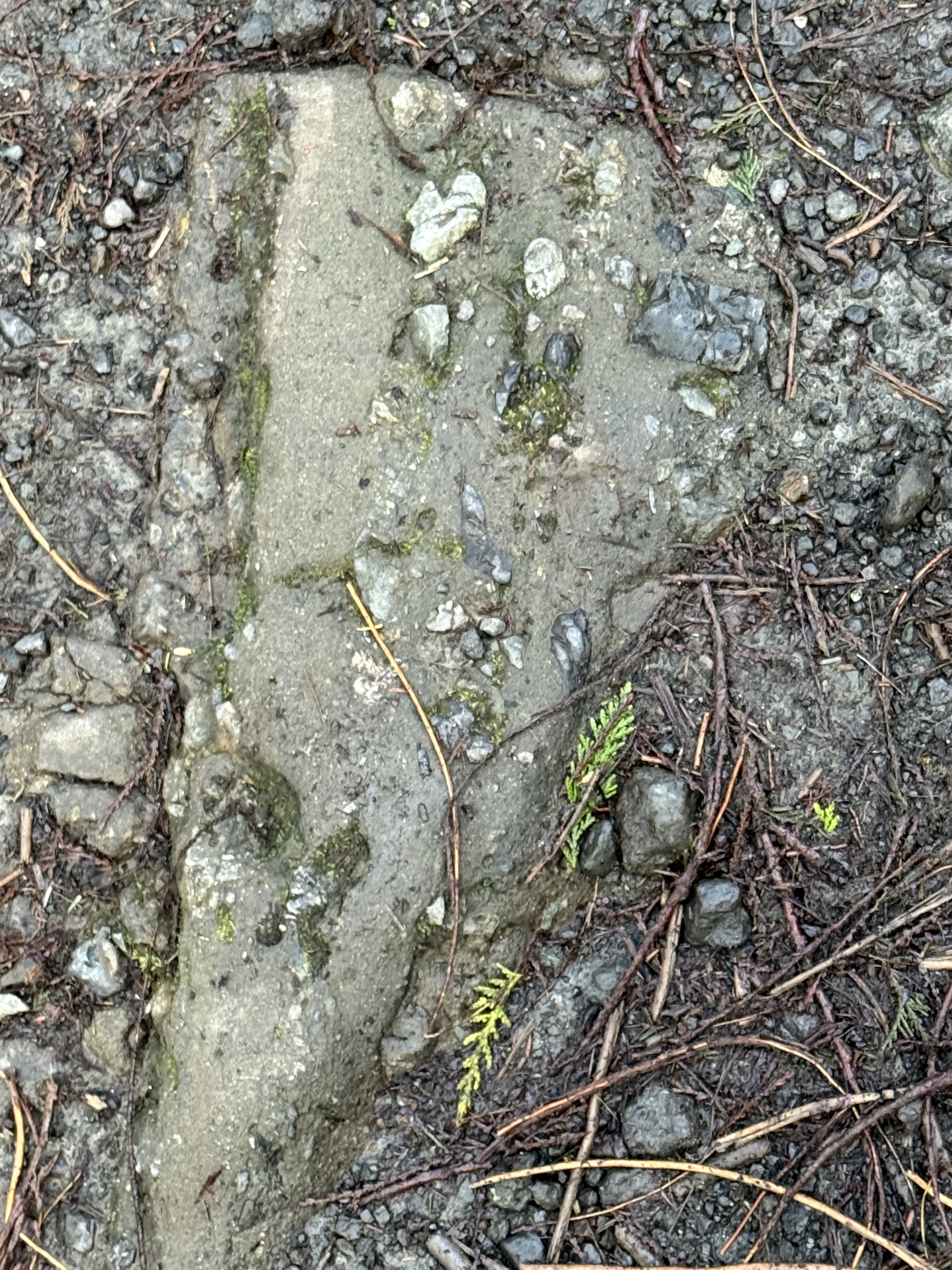
Figure 5. This image looks like run-of-the-mill gravel like you see on pathways and drives, but it is Eocene rock, and I mean solid rock (Note the large, gray piece protruding from the cliff in Fig. 4). This angular slab is about a foot in length. There is no Pleistocene glacial till in this area, even if the ground looks the same. This is a picture frozen in time, where an angular piece of what looks like sandstone, but could be andesite, slid downslope along with smaller fragments.
Summary.
This is the last of my geology posts from a weekend excursion along a hundred-mile stretch of the Washington coast. This is a high wave-energy coast with a tidal range of about 10 feet, the beaches covered with sand and cobbles. Sea stacks protrude from the beach, culminating in cliffs made of 50 Ma conglomerates. Beneath our feet, ocean crust was being subducted at several inches per year, feeding a system of magma chambers that are actively venting through volcanoes like Mt. Saint Helens, Rainier, and Mt. Baker. Rainfall drops along this coast at up to 12 feet per year, feeding streams that carry immense quantities of sediment into the trench created by the subducting ocean crust.
Geology doesn’t get any realer than this…
Tectonic Breccia at Ruby Beach
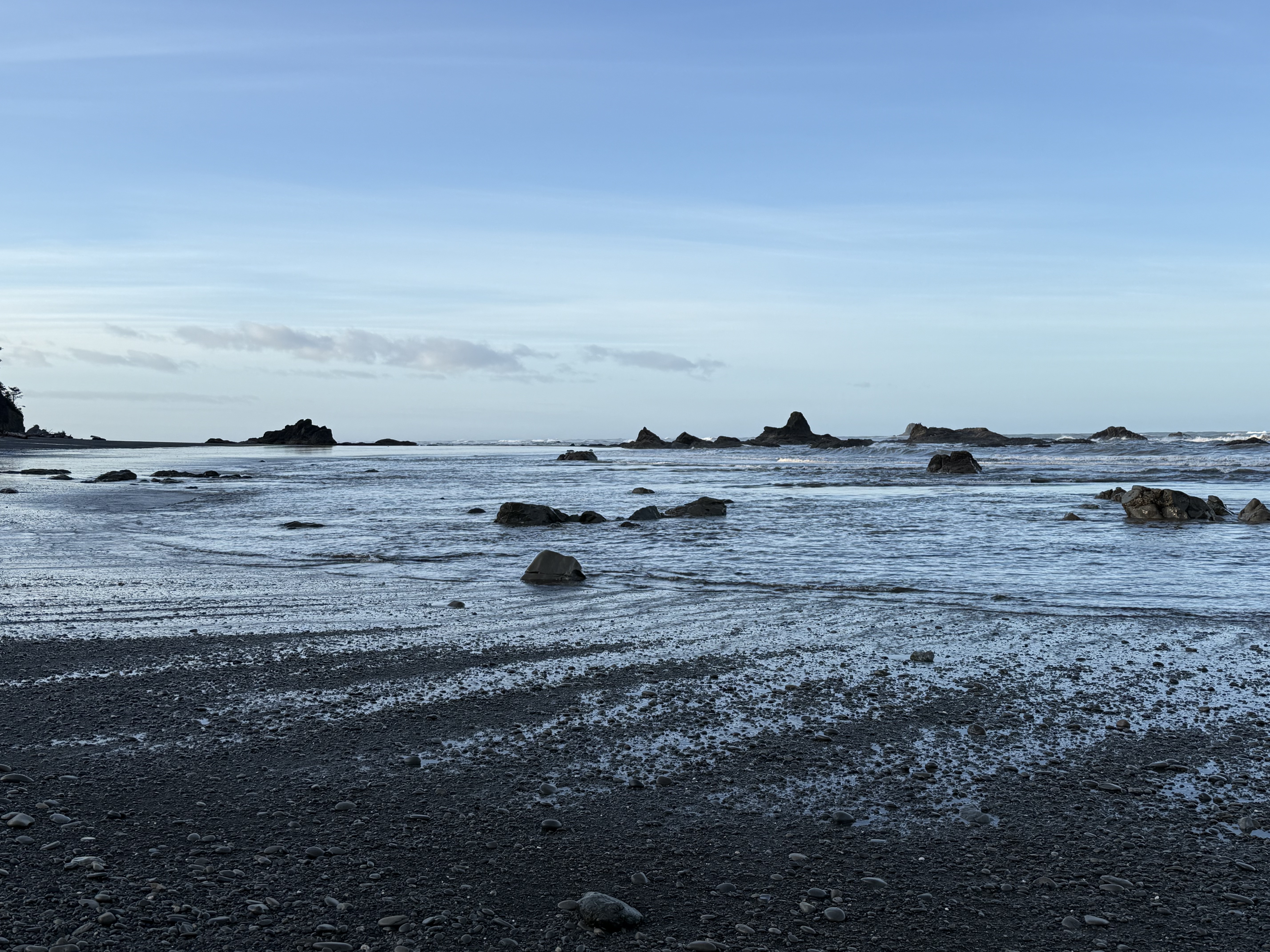
Figure 1. Ruby Beach is located about 10 miles north of Kalaloch Beach (Point C in Fig. 2), but the coastal morphology has changed substantially. This photo was taken at sunrise during low tide, exposing many outcrops of basement rock, which is the same unnamed sandy rock formation we saw before, but its composition has changed.
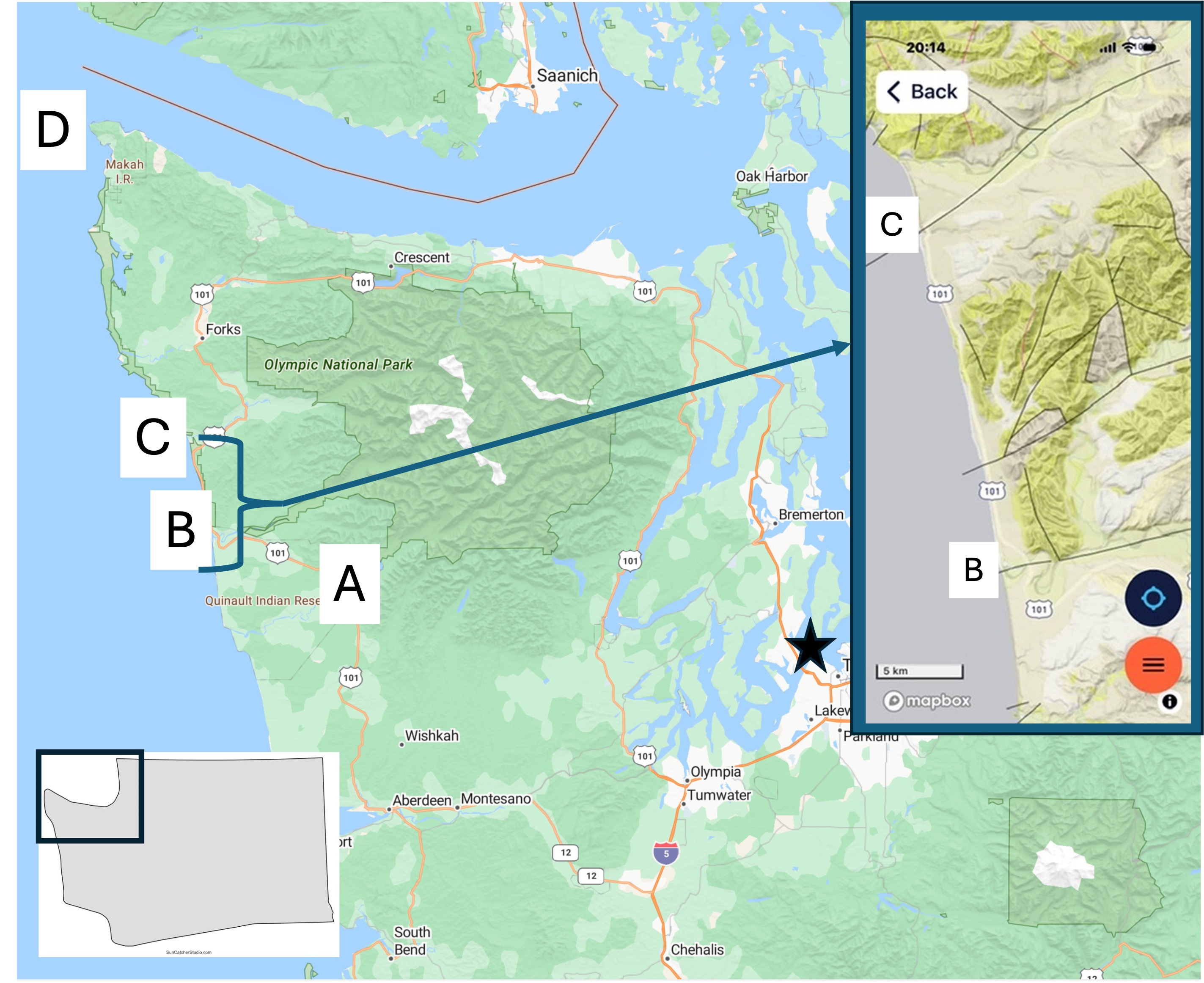
Figure 2. Today’s post describes the coastal geology at Site C. I’ve already discussed the Quinault Rainforest and Kalaloch Beach. I will focus on what is different from the previous post. The inset geologic map from Rock D will be referred to below.
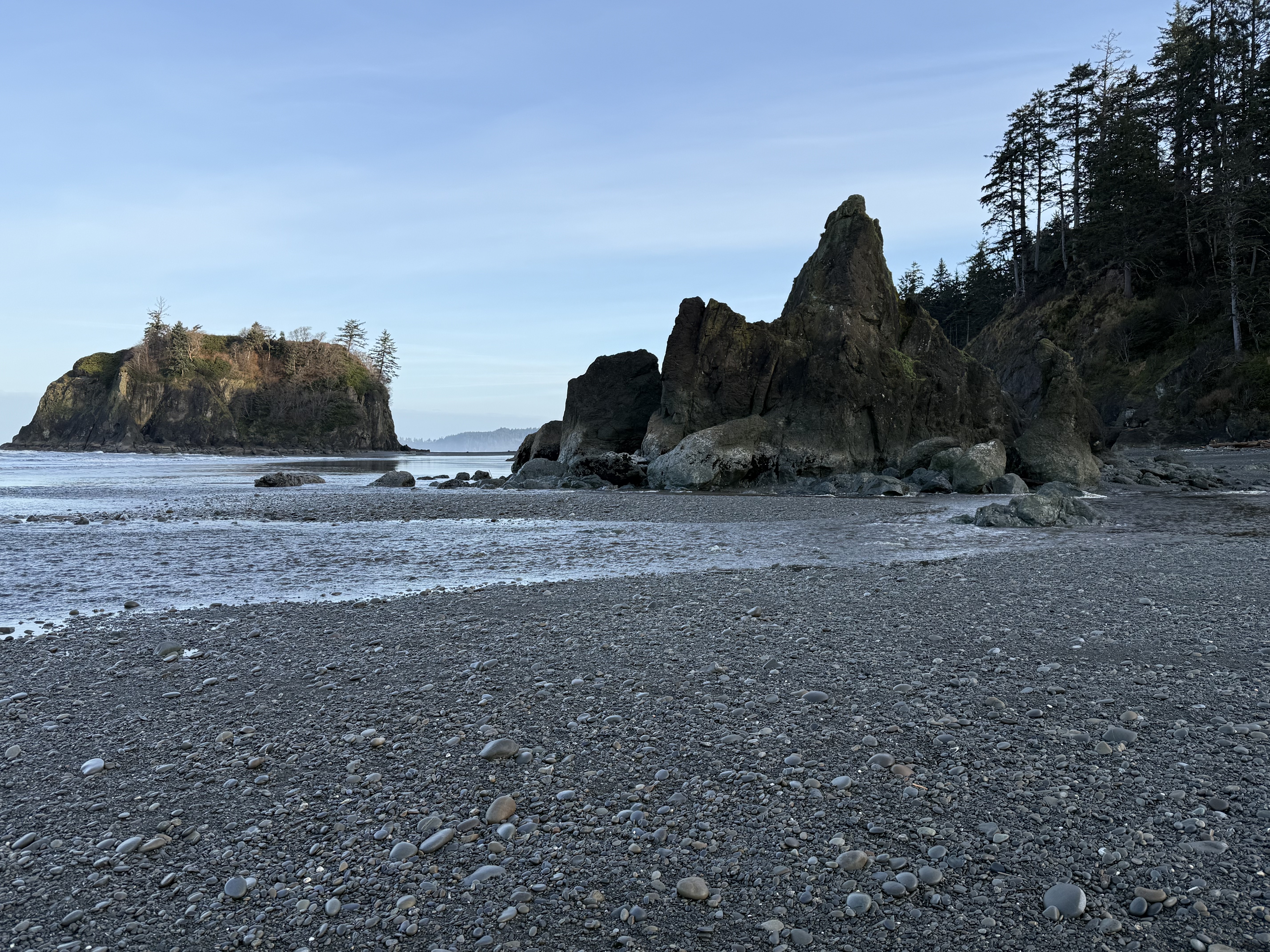
Figure 3. Basement rock of general Tertiary age (66.5-2.4 Ma) is more exposed here although it is overlain by Pleistocene glacial sediments. This photo shows a rocky island that can be reached at low tide, and a promontory. The beach is composed of rounded cobbles in a matrix of sand, silt, and some clay. The finer sediments are restricted to the lower swash zone (Fig. 1).
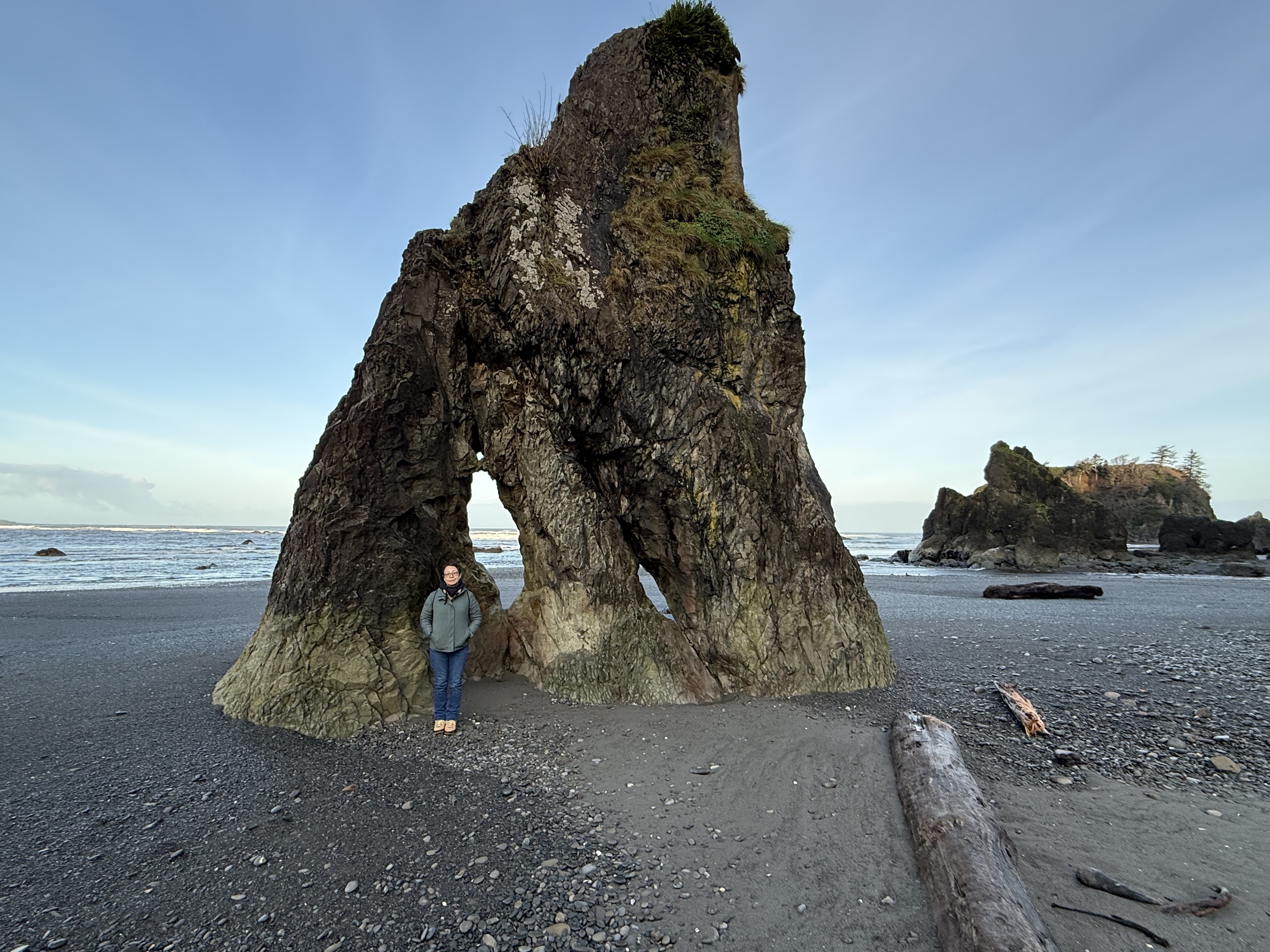
Figure 4. This is a sea stack, a standalone rock pillar. The beach is a thin veneer spread across a rocky basement that is more irregular than we saw at Kalaloch Beach, where the outcrops resembled a wave-cut platform more than we see here. The first thing that occurs to me is that this area hasn’t been exposed to the erosive power of waves for as long an interval. Maybe. Let’s take a look at the inset map of Fig. 2. The black lines represent geologic faults, where rocks have been displaced by tectonic activity. Note that the stretch of coast we’re concerned with is bounded by faults perpendicular to the coast. Furthermore, there is another fault separating Sites B and C. I should take a moment to point out the relationship between faults and river valleys: faults create weak zones within the crust, which are exploited by erosional forces like water and glaciers. Thus we see valleys at both B and C; however, the intervening fault is part of a complex fault system that appears to have led to less surface erosion. Faults cannot be directly dated, only indirectly by the age of the rocks they displace, and in this case those rocks are themselves difficult to date. Thus, it is possible that vertical movement, even a few hundred yards, could have made this beach more irregular than Kalaloch Beach only a few miles to the south–on the other side of a fault. Plausible, but don’t bet your retirement on my hypothesis.
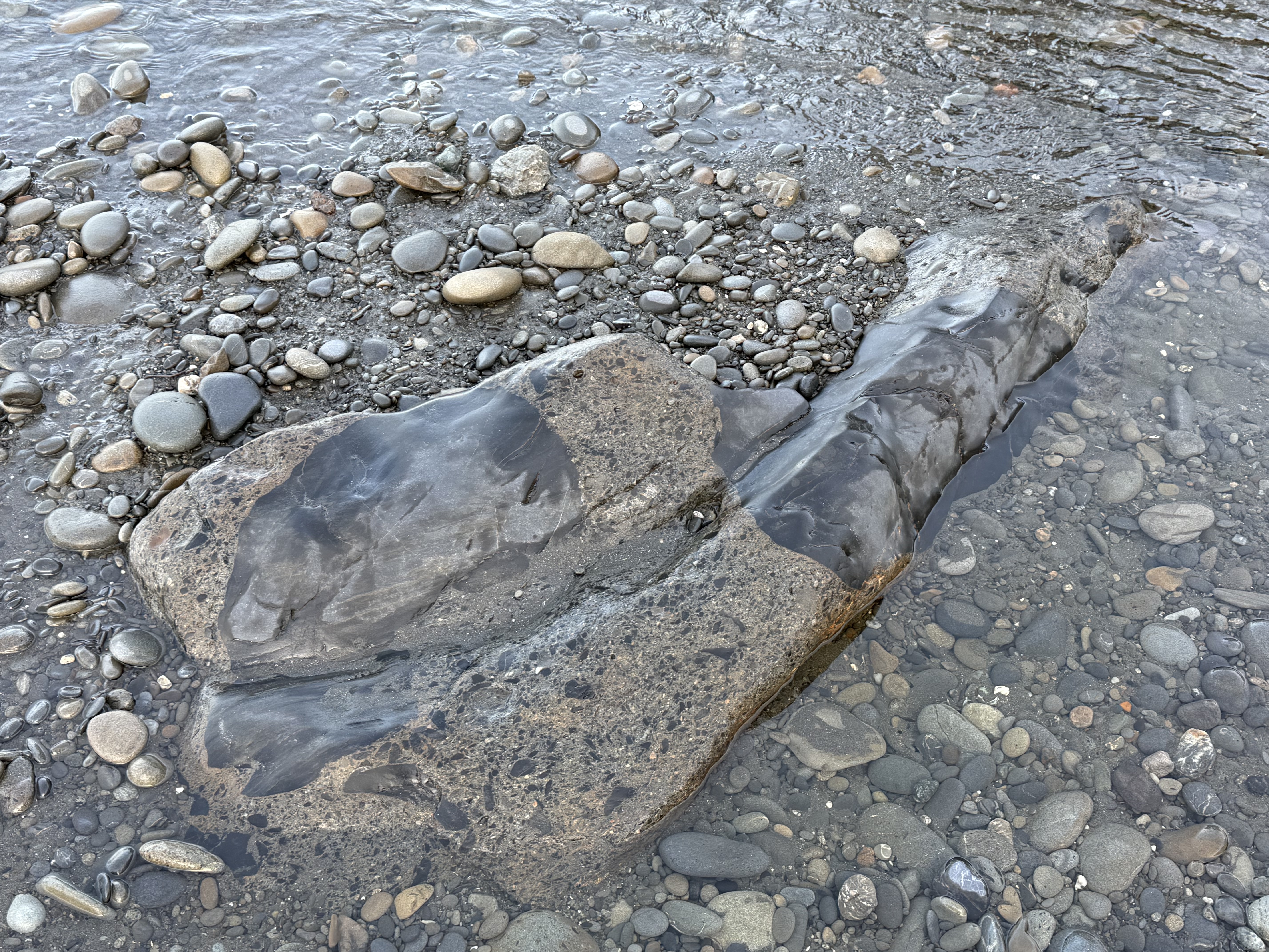
Figure 5. Back to the rocks. This photo puzzled me because I’m not an experienced field geologist, despite my regular posts; however, CoPilot came to the only plausible conclusion: the primary material here is a breccia/graywacke; the smoother material is calcite filling fractures that occurred during faulting (see Fig. 2 inset). We must ALWAYS remember that a sedimentary rock’s history isn’t confined to deposition; a lot happens during burial to many miles and subsequent exhumation and deformation.
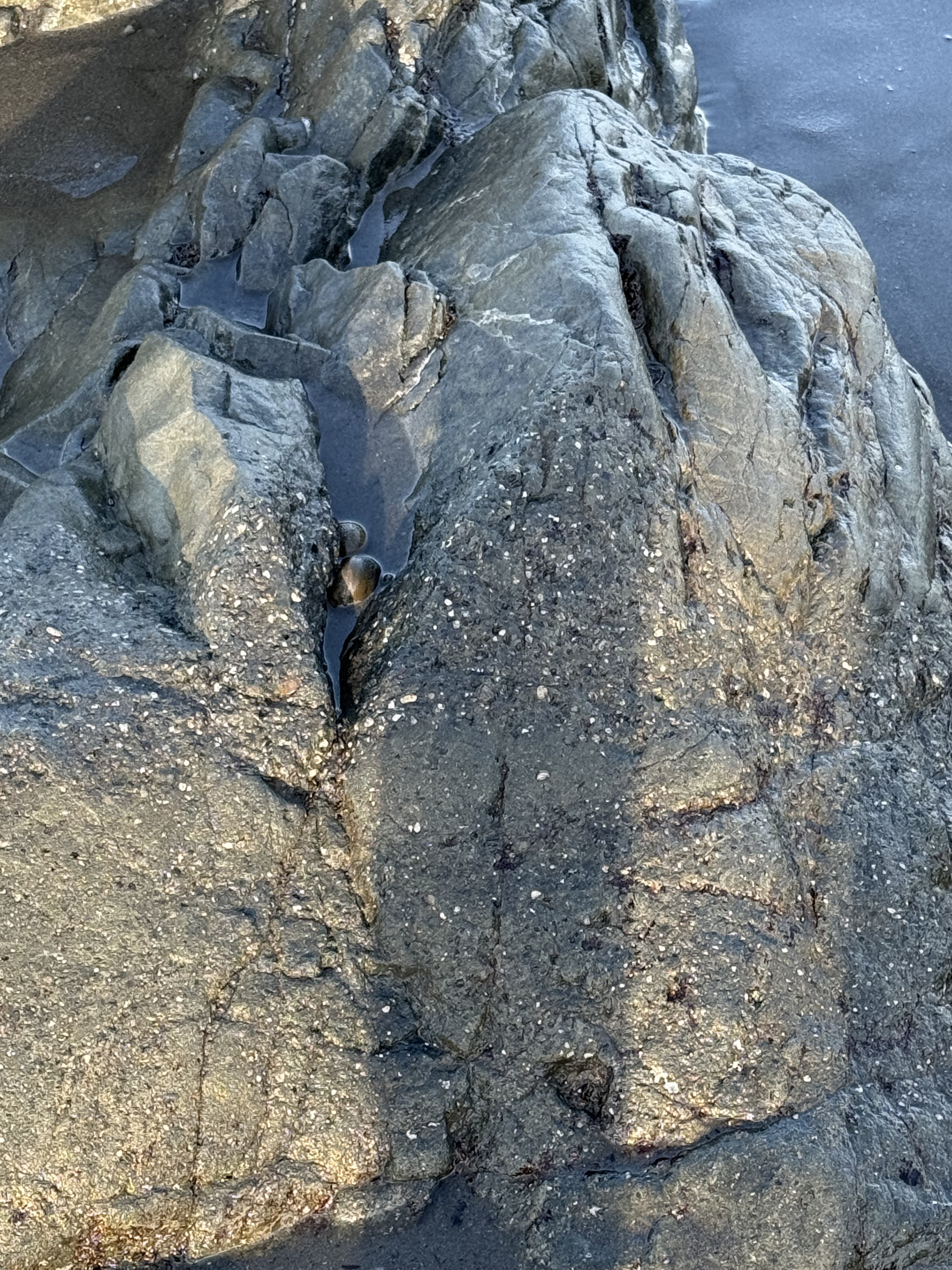
Figure 6. This photo shows a typical graywacke texture with layering, as you might expect with episodic deposition of event beds (e.g. turbidites on a submarine fan); but the upper part of the image is similar to Fig. 6. I asked CoPilot about the source of so much Calcium and I agree with its answer: Some of the Calcium came from marine invertebrates living in the area, but the bulk arrived later, when the sediments were buried deep (several miles) within the accretionary wedge where Calcium is released from minerals like feldspar. It’s really hot down there and the pressure is INTENSE.
Summary.
Not only was Ruby Beach a beautiful area on a cool winter/spring morning, it gave us more insight into the complex life of the earth’s crust. These rocks were probably deposited as poorly sorted graywacke on a steep continental margin overwhelmed by sediment eroded from the rising Cascades (more than likely the Eocene, 56-34 Ma). They were buried for a few million years, before being scraped off the subducting oceanic crust and filled with hot fluids that originated from deeper within the accretionary prism. They were never so humiliated that they became melanges but it was a pretty rough ride, even for a rock.
To put this all in perspective, dinosaurs had just gone extinct (~65 Ma) when all hell broke loose and the Cascades Subduction Zone became very active about ten-million years later; the earth became hot as hell, mammals and birds were beginning to get their legs and wings. While the ecosystem changed dramatically, these rocks were being ground up and spit out by the earth because they were stuck on the end of its tongue. We hominids didn’t come along until these rocks were exposed to the vagaries of the weather and had eroded for a VERY long time.
Try not to laugh at the punch line: Our entire history is contained in the Pleistocene glacial sediments overlying these fairly young sediments.
It boggles the mind…
Survey of Coastal Geology of Point Loma, California
This report is from nine years ago, when I was in San Diego. I never got around to posting it on Rocks and (no) Roads, but I’m sharing it now because it dovetails nicely with the coastal geology of Washington.
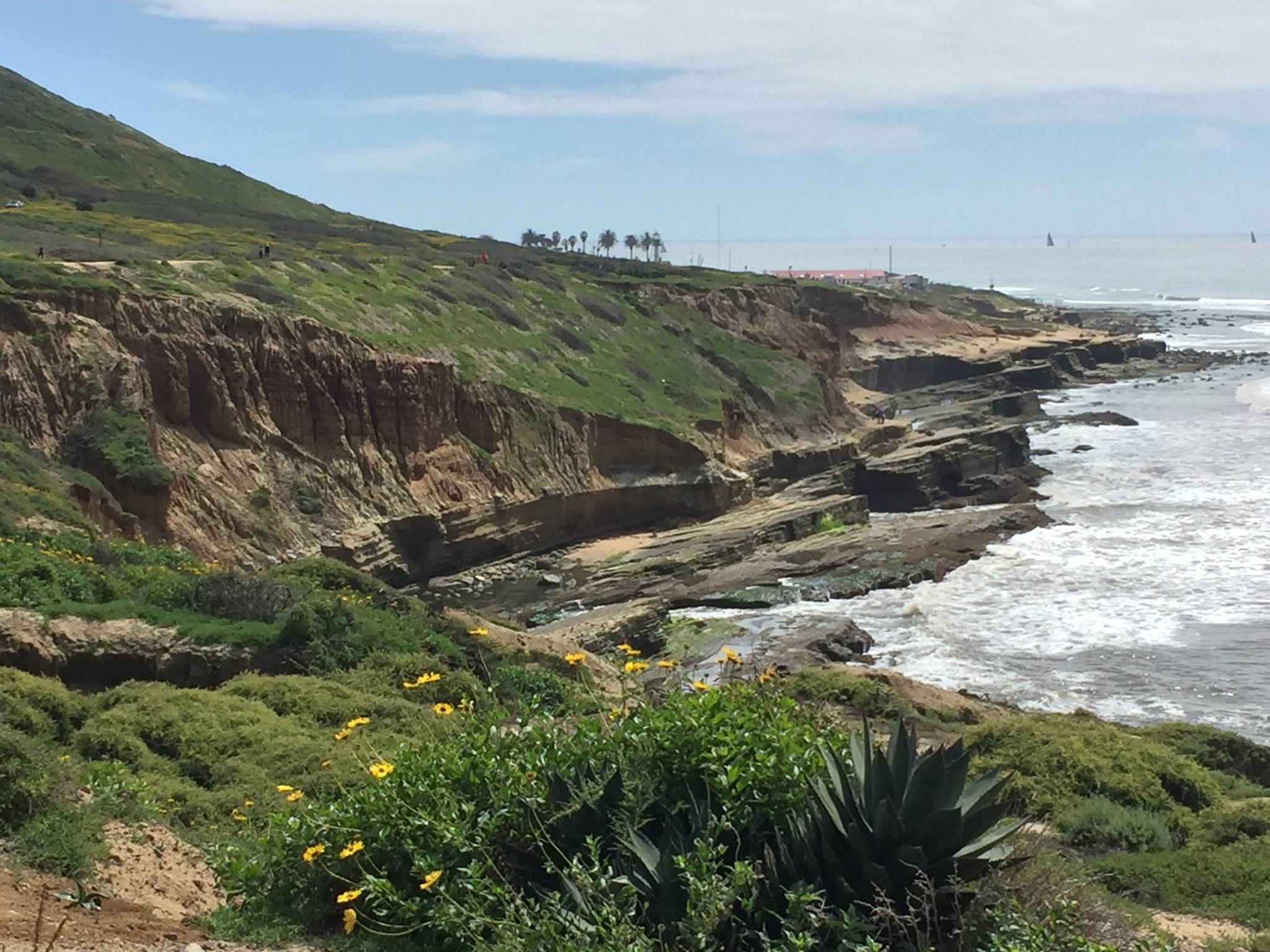
Figure 1. Point Loma is defined, stratigraphically, by: 1) Late Cretaceous (100-66 Ma) Point Loma and Cabrillo Formations (~600 feet thick), pale yellow sandstones with gray siltstone and conglomerate; and 2) Middle-Late Pleistocene (774-11.7 Ka) reddish siltstone, sandstone, and conglomerate. The older rocks are dipping about 10 degrees to the left (east); an angular unconformity separates them from much younger Pleistocene deposits, which are horizontal. This unconformity is about 60 feet above current sea level, but it is a moderately complex relationship.
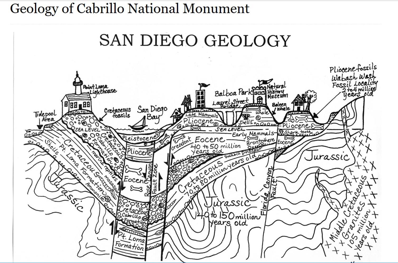
Figure 2. This idealized cross-section across Point Loma reveals complex, subsurface geology, including folds in the Jurassic rocks, which are unconformably overlain by the Cretaceous Pt. Loma and Cabrillo formations. Normal faults, indicated by arrows, have lowered younger rocks in a graben to form San Diego Bay, leaving Point Loma peninsula standing alone. Note that Pleistocene sediments are located along the seaward margin of the peninsula as well as at the tops of the ridges. This occurs because younger material was deposited on wave-cut benches that developed as sea level fluctuated, in addition to regional uplift rate of 4-8 inches/thousand years (0.1-0.2 mm/year).
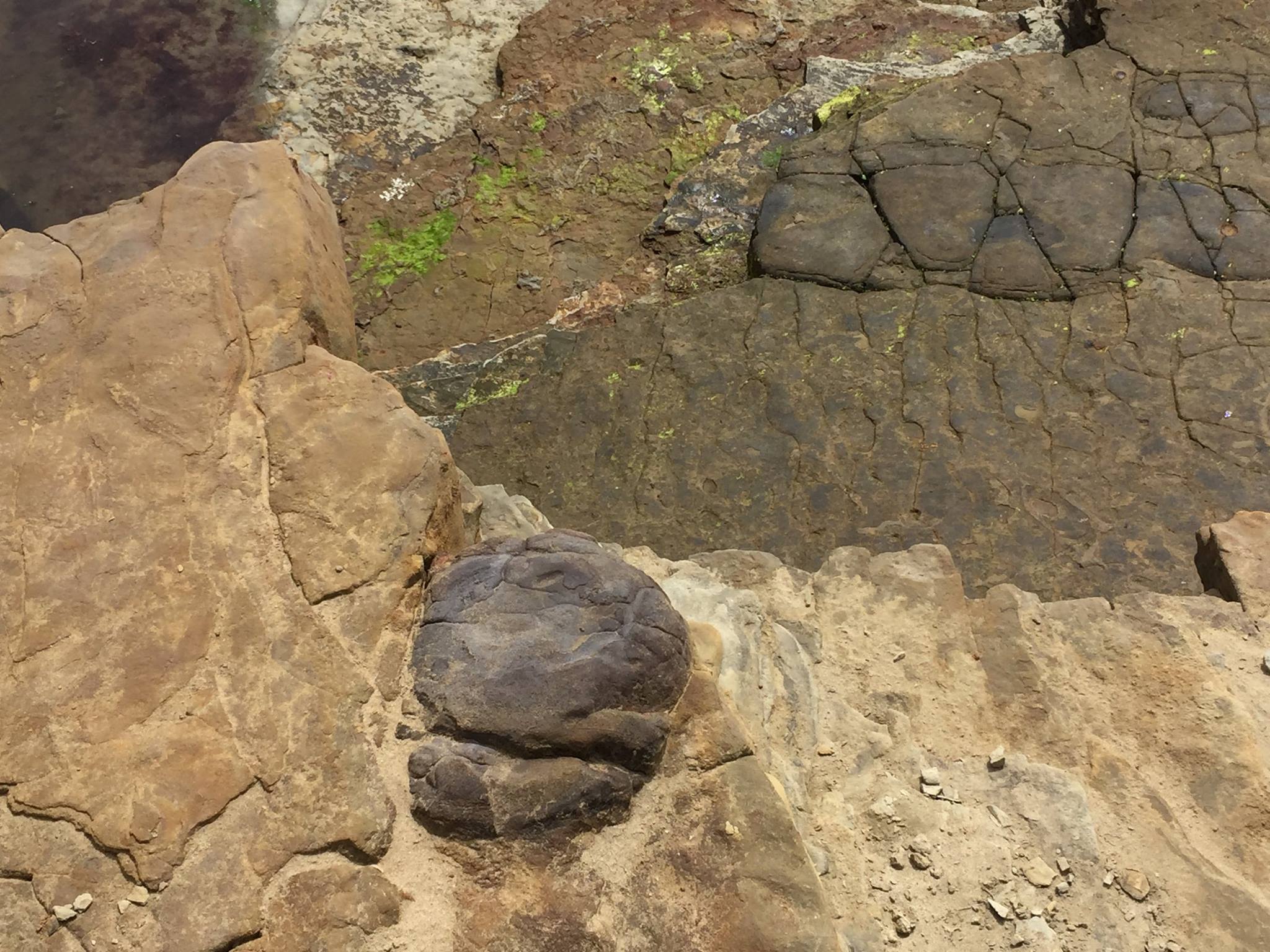
Figure 3. Bedding surface of Pt. Loma Formation sandstones near sea level. The dark boulders are part of the rock rather than lying on the surface. They have been interpreted as basalt flowing into the sea from a nearby volcanic vent. I observed large erosional remnants of lava flows in other parts of these rocks along the coast.
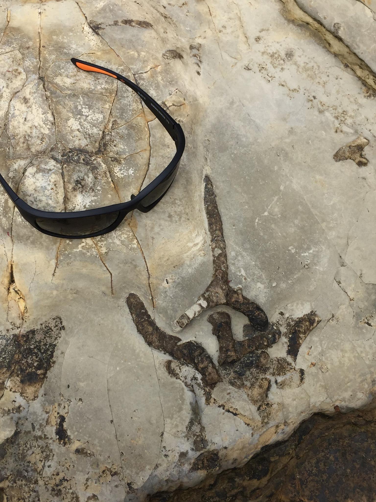
Figure 4. Trace fossils of worm burrows (e.g. Skolithos) on the bedding surface a few feet above sea level. They were very common and well preserved. They can’t be used to date the rocks but they are indicators of a low-energy environment, probably below fair-weather wave base or maybe within the swash zone. I saw no evidence of cross-bedding.
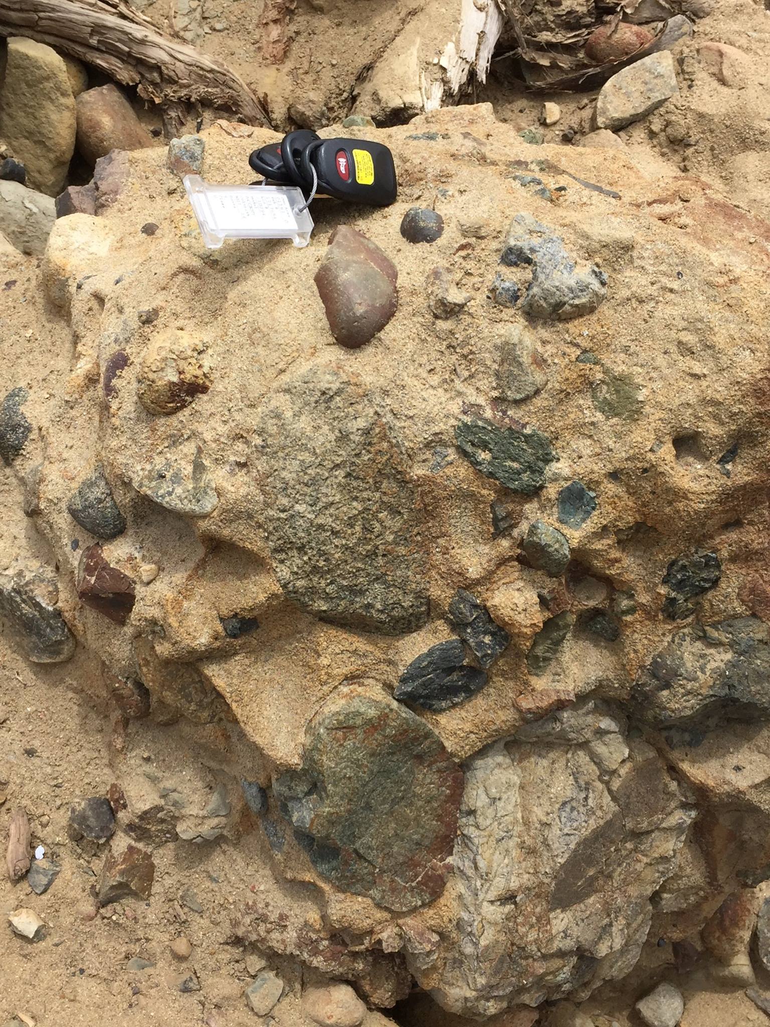
Figure 5. Photo of well-cemented conglomerate boulder lying loose near sea level. I don’t think this is Pleistocene because it is very well cemented (literally hard as a rock) rather than being friable, which is more common with younger rocks. Thus it is probably Cabrillo Formation. There were no worms burrowing on this beach! The clasts are not all rounded, but many are highly angular; thus, it might be classified as a breccia. This is a significant difference because conglomerates are deposited some distance from their source, after the rocks have been broken and rounded to a relatively uniform size. Breccias, however, collect near steep slopes and the rocks are irregular in shape and size; these rocks indicate a nearby highland. The clasts include, by my estimation: basalt; granitic intrusive rocks; metamorphic rocks; and of course a plethora of sand-sized quartz as the matrix.
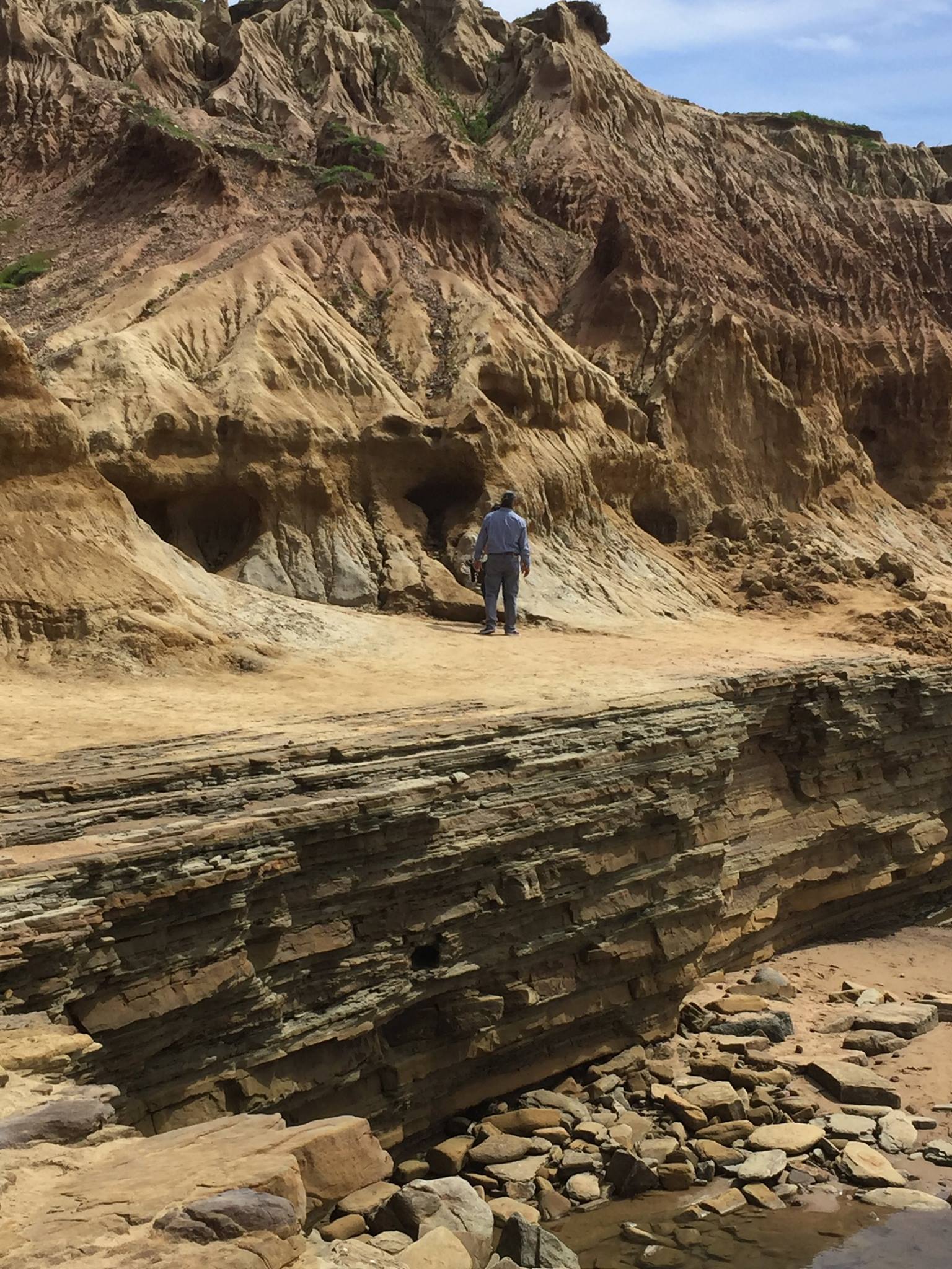
Figure 6. The man is standing on a wave-cut terrace about 20 feet above the high tide line. The angular unconformity is present at this location because Pleistocene sediment was deposited on this erosional surface, even though the older rocks are present at a higher elevation, as indicated in Fig. 2.
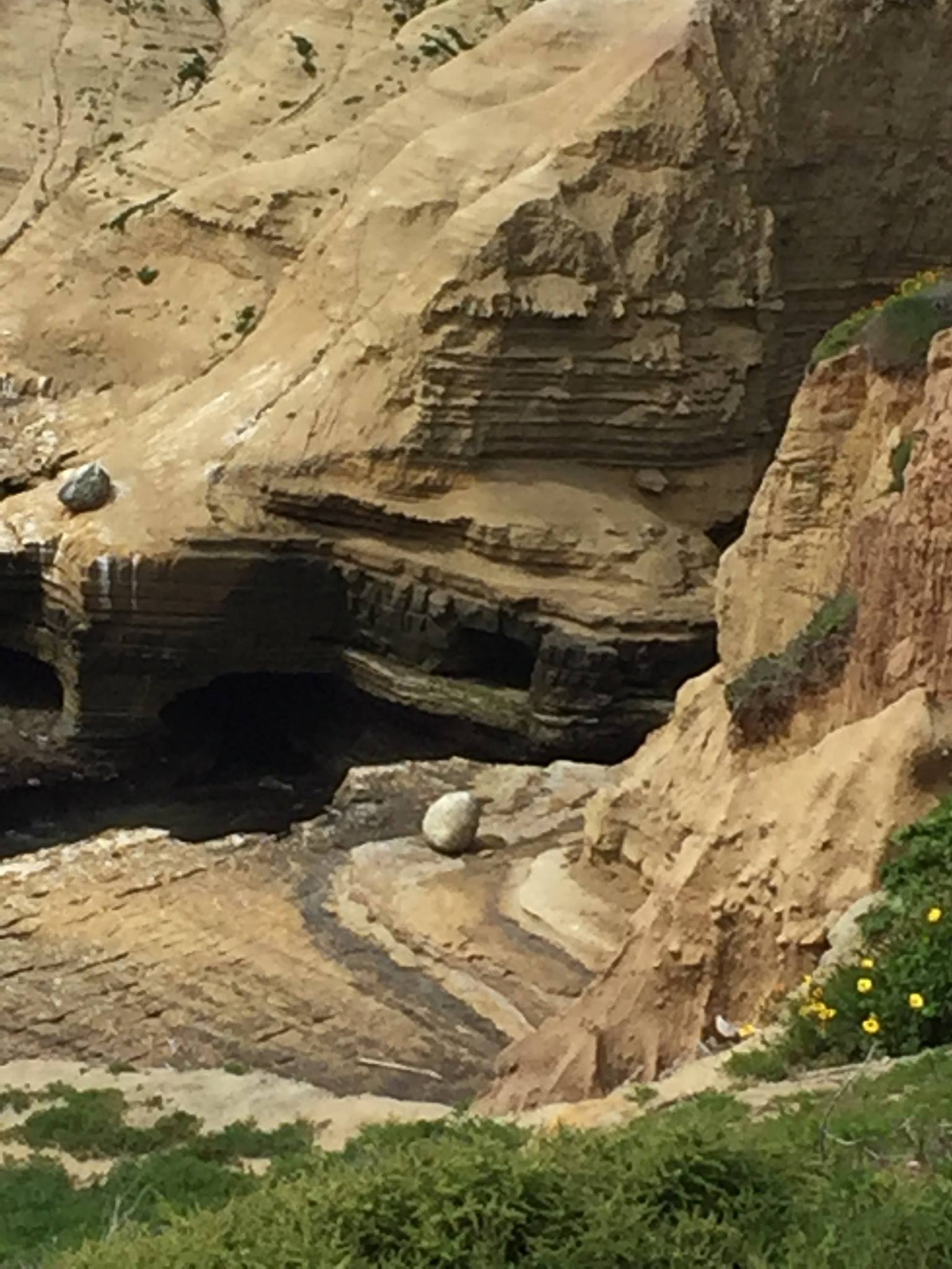
Figure 7. The sea cave was closed because of recent rockfalls from the cliff. Nevertheless this photo shows the change in bedding style, from massive in the lower (Pt. Loma Fm) rocks to thinner bedded in the Cabrillo sediments. The total thickness of these formations is approximately 200 m (~700 feet); using a bulk depositional rate guesstimate of 1 m/ thousand years, they could have been deposited in as little as 200 thousand years. My point is that, whatever time interval they represent, something was happening that supplied volcanic rocks and a variety of rock fragments that indicate unroofing of a batholith. That something involved tectonic uplift, which has decreased substantially in modern times.
Summary.
I wanted to revisit this field trip because the Cretaceous world in which the Pt. Loma and Cabrillo sandstones were deposited was similar to the Tertiary environment in which the rocks we saw at Kalaloch Beach were first laid down. In fact, the entire west coast of N. America has been part of a convergent plate boundary for more than 200 Ma, but subduction is not uniform in time or space.
Between 100 and 66 Ma, sandy sediment was being deposited on this coastline, culminating in tectonic uplift and volcanism. This was followed by sixty million years of erosion. That’s a long time. During this lengthy interval, subduction ended here when the oceanic spreading axis was subducted and a transform fault developed about 10 million years ago. The N. American and Pacific tectonic plates are now moving horizontally past each other, whereas the Cascadia subduction zone remains active.
There are no active volcanoes in Souther California because there is no subduction, but evidence for them is apparent. Ancient San Diego was very similar to modern Kalaloch Beach and other locations I will explore in the next few posts…
Coastal Geology of Kalaloch Beach
This report is the geology supplement to my general post about the Olympic Peninsula. It focuses on the geology of the beaches because, to be honest, Quinault Rainforest was impenetrable, physically and geologically, without massive logistical planning and support. What I found was more than I expected.
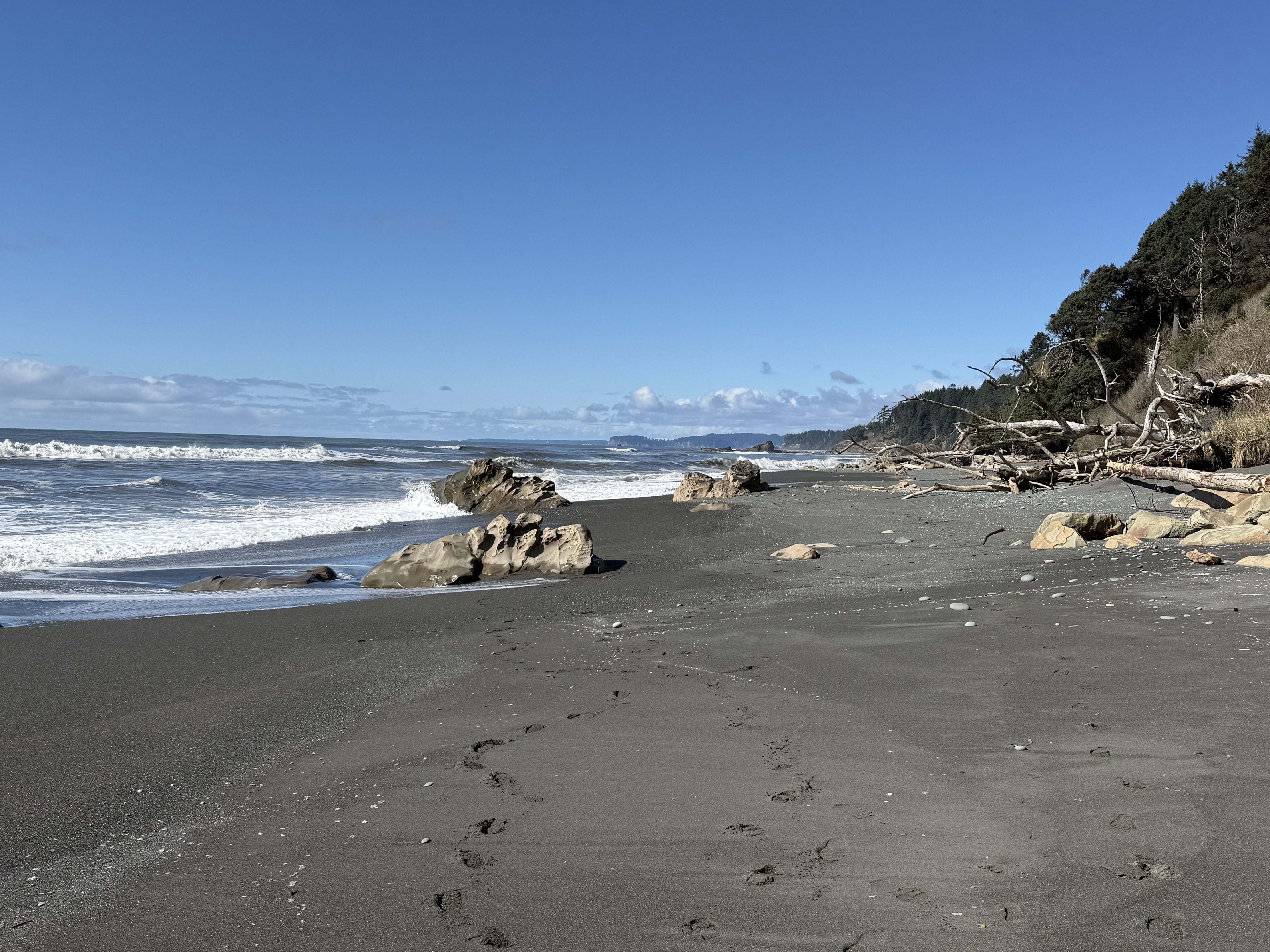
Figure 1. Photo looking north along Beach 4 at Site B in Fig. 2. The tidal range is about 10 feet here and the primary sediment consists of sand with a substantial mud component. The rocks seen in this image are bedrock that protrudes above the veneer of beach sediment. The cliffs to the right comprise glacial till that is less than 2.4 my old (Ma hereafter) deposited by glaciers during the Quaternary geological period. This photo was taken near low tide. The dark color of the beach surface is caused by the relatively large clay component (i.e. mud).
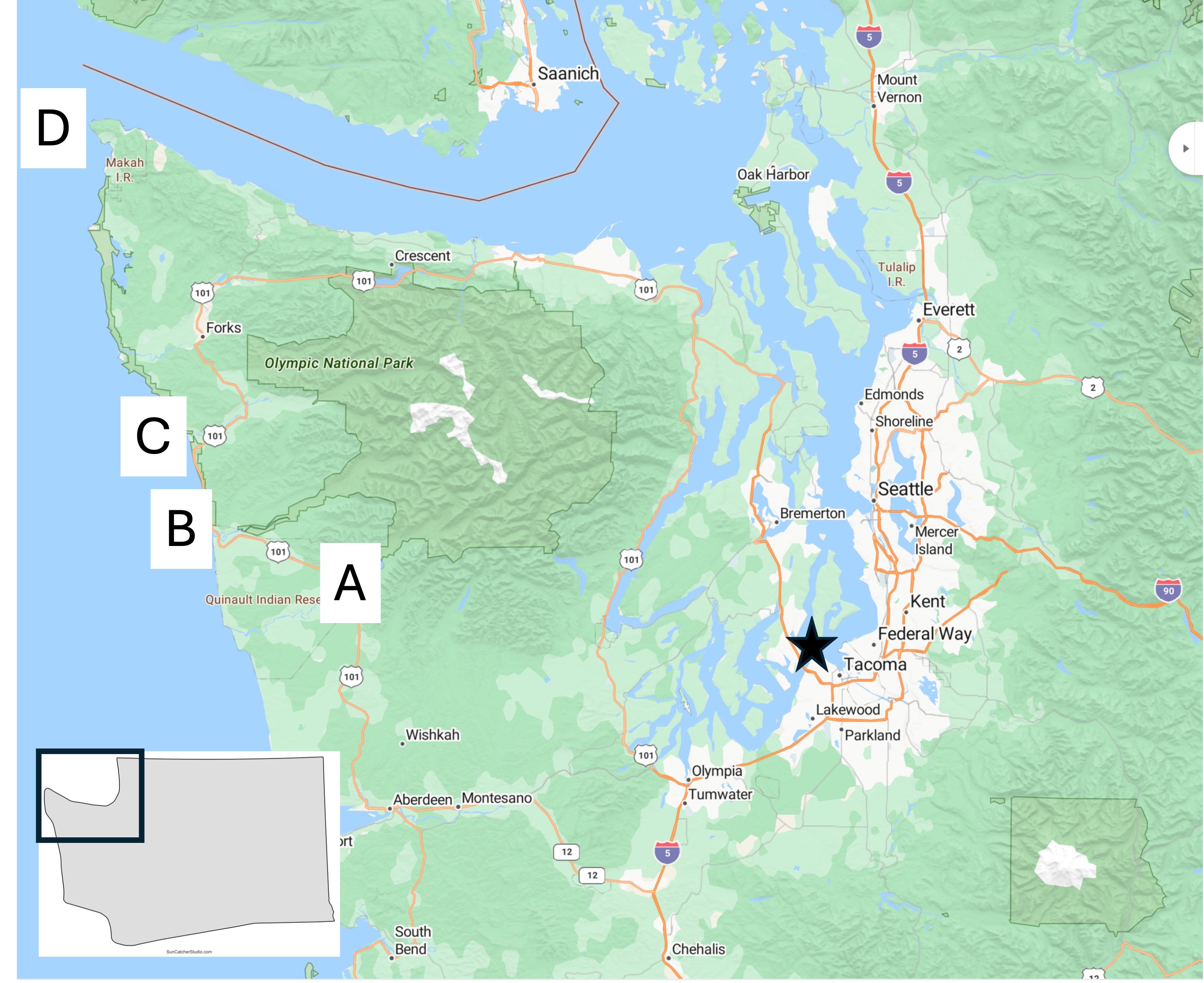
Figure 2. Location map of today’s field area, which will focus on Site B.
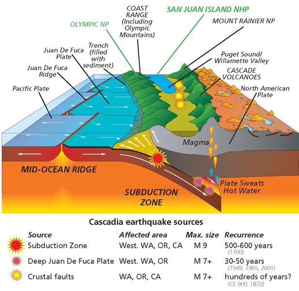
Figure 3. Schematic of the Cascadia Subduction Zone as it appears today. The Coast Range, which includes the Olympic Mountains, consists of sediments and volcanics that have been scraped off the subducting ocean crust. The white arrows at the front of the image don’t reflect the actual geometry of these sedimentary rocks. We’ll get to that in a minute. Today’s post will focus on these sediments and discuss their original depositional environment during the Tertiary period (~65.5-2.4 Ma), as well as evidence for structural deformation.
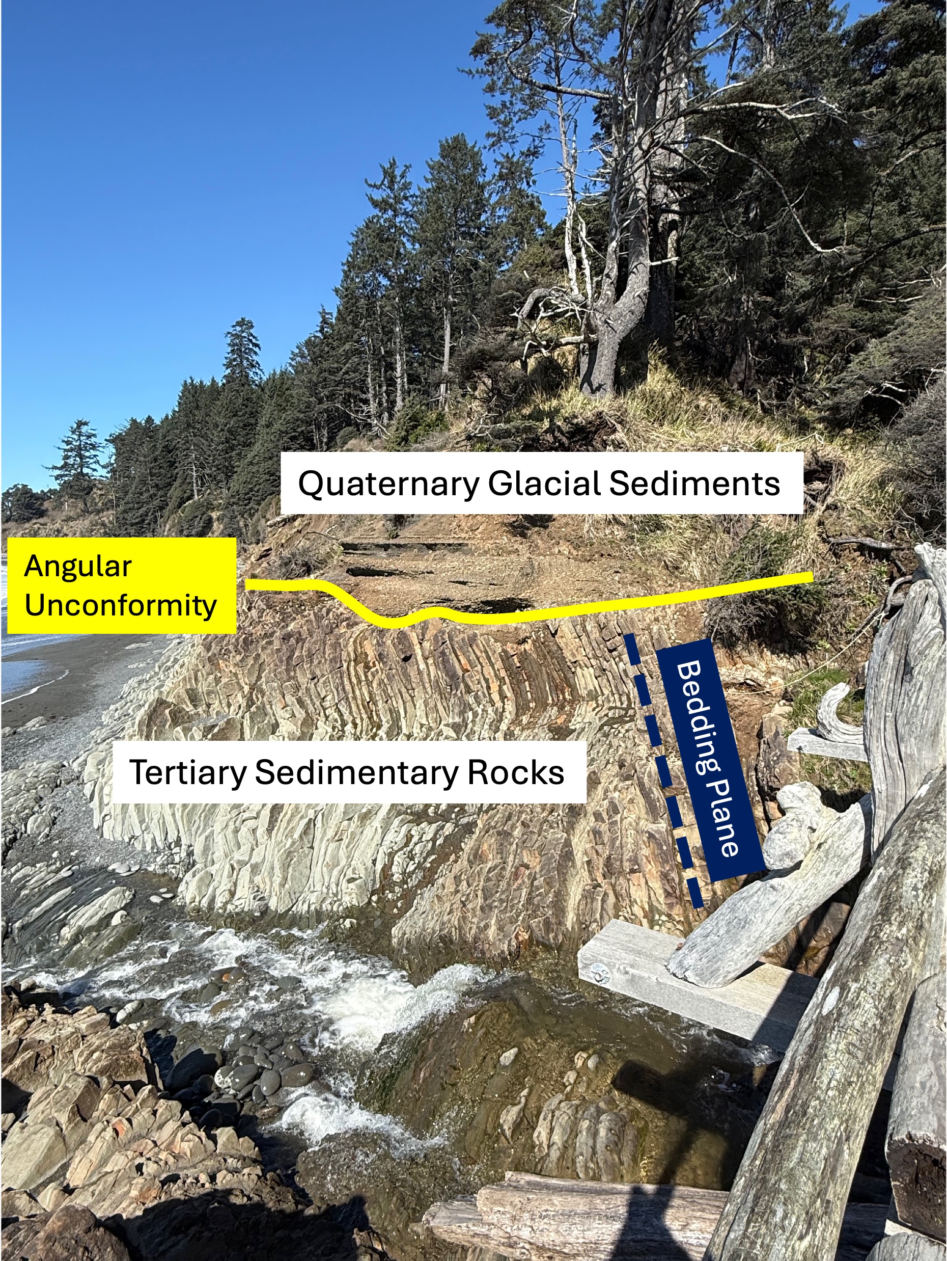
Figure 4. This photo has been marked-up to highlight what might not be obvious to a non-geologist. First, older sedimentary rocks have been tilted to a high angle (dark blue bedding plane line) by faulting, as suggested in Fig. 3, and exposed to erosion at the surface. This erosional surface is shown by the yellow line. These Tertiary sediments were buried several miles beneath the ocean surface where the grains were cemented by heat and pressure. We don’t know exactly when this occurred or how long this process took, but they were later overlain by younger glacial sediments during the Pleistocene epoch (2.4 Ma to present). The age of sedimentary rocks can’t be pinned down unless they contain material datable by radiometric methods or, more qualitatively, by the fossils they contain. Sandy sediments don’t contain fossils very often and I didn’t find any radiometric ages in either Rock D or the USGS geologic map, so I guess the Tertiary date is the best we can do for now.
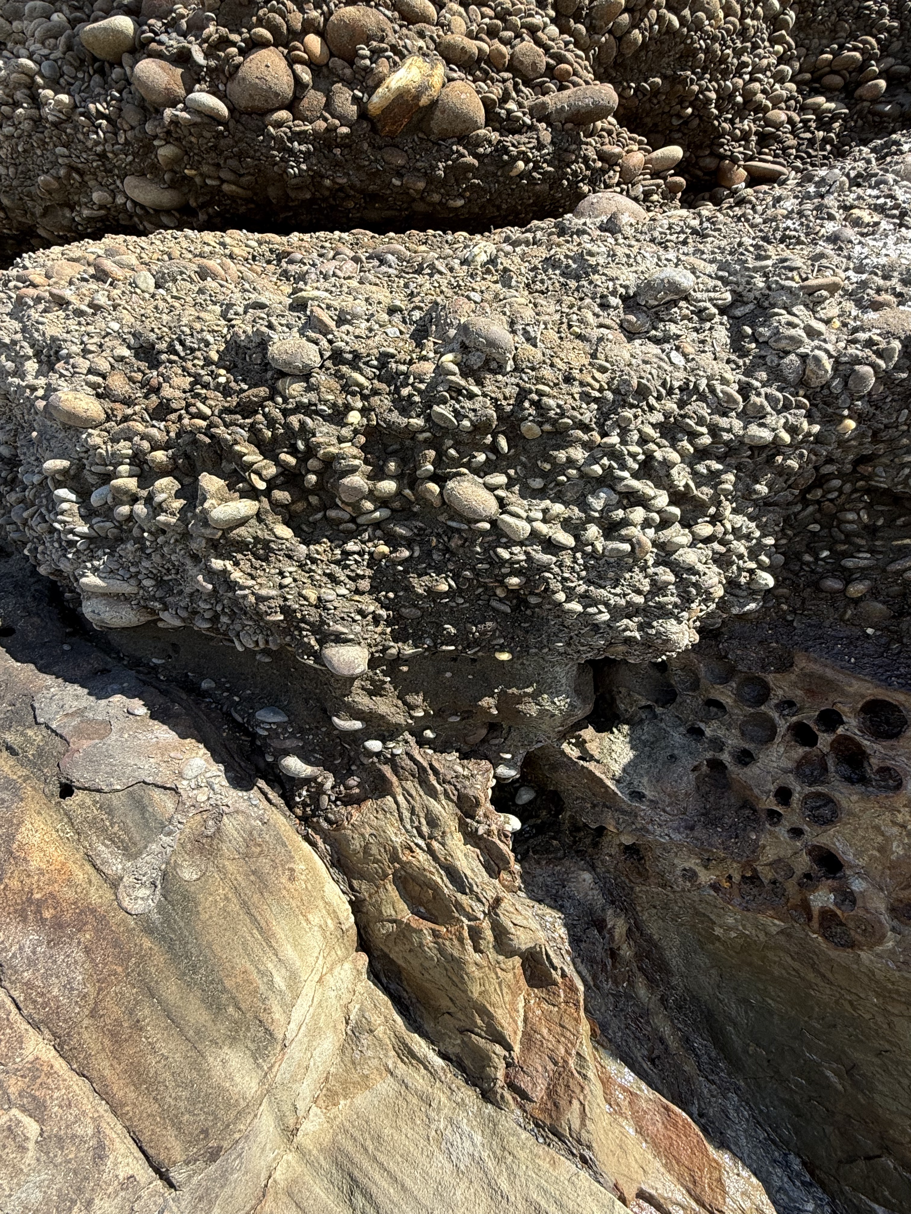
Figure 5. Close-up photo of the contact between the Tertiary rocks and the glacial till. Note that the cobbles aren’t falling out of the fine matrix sand and clay; this is because these young (>2.4 Ma) conglomerates have been partially cemented and, in fact, they were stuck to the older rocks below. This photo tells us a lot: 1) the older rocks were tilted at depth (maybe a mile or more) and then pushed upward as suggested in Fig. 3 until they were exposed to the atmosphere; 2) in a very short time they were covered by cobbles (~2 inches or less) that had already been rounded in a river, which takes several miles of transport; 3) the type of sediment varied rapidly, from coarse sand to cobbles, probably within decades if not years, due in part to periodic changes in surface drainage (e.g. the advance and retreat of glaciers); 4) this is a good example of the principle of Uniformitarianism–the present is the key to the past: we see similar processes occurring today along the many streams and rivers draining the Olympic Mountains. But what about those pesky Tertiary sandstones?
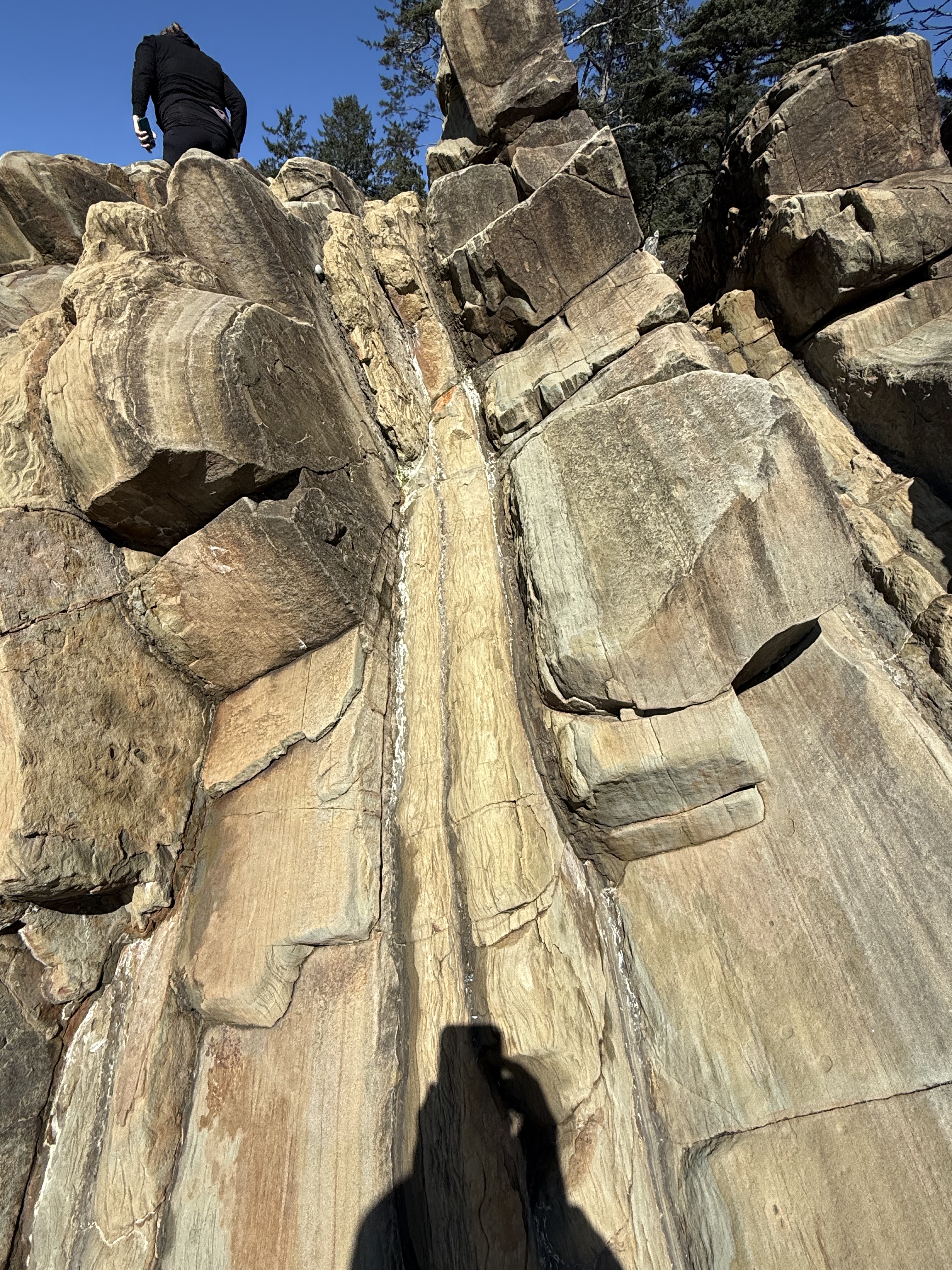
Figure 6. This photo of the Tertiary sedimentary rocks reveals packets of thin-bedded fine sandstone with intercalated dark layers of (presumably) mud. I didn’t see any cross-bedding, which would indicate deposition in a river or nearshore dominated by waves or currents. What is obvious that this ancient (~50-2 Ma) shoreline was receiving sediment from a distant source, probably the volcanic highlands of the modern Cascades (see Fig. 3). Let’s take a closer look at one of those wavy layers.
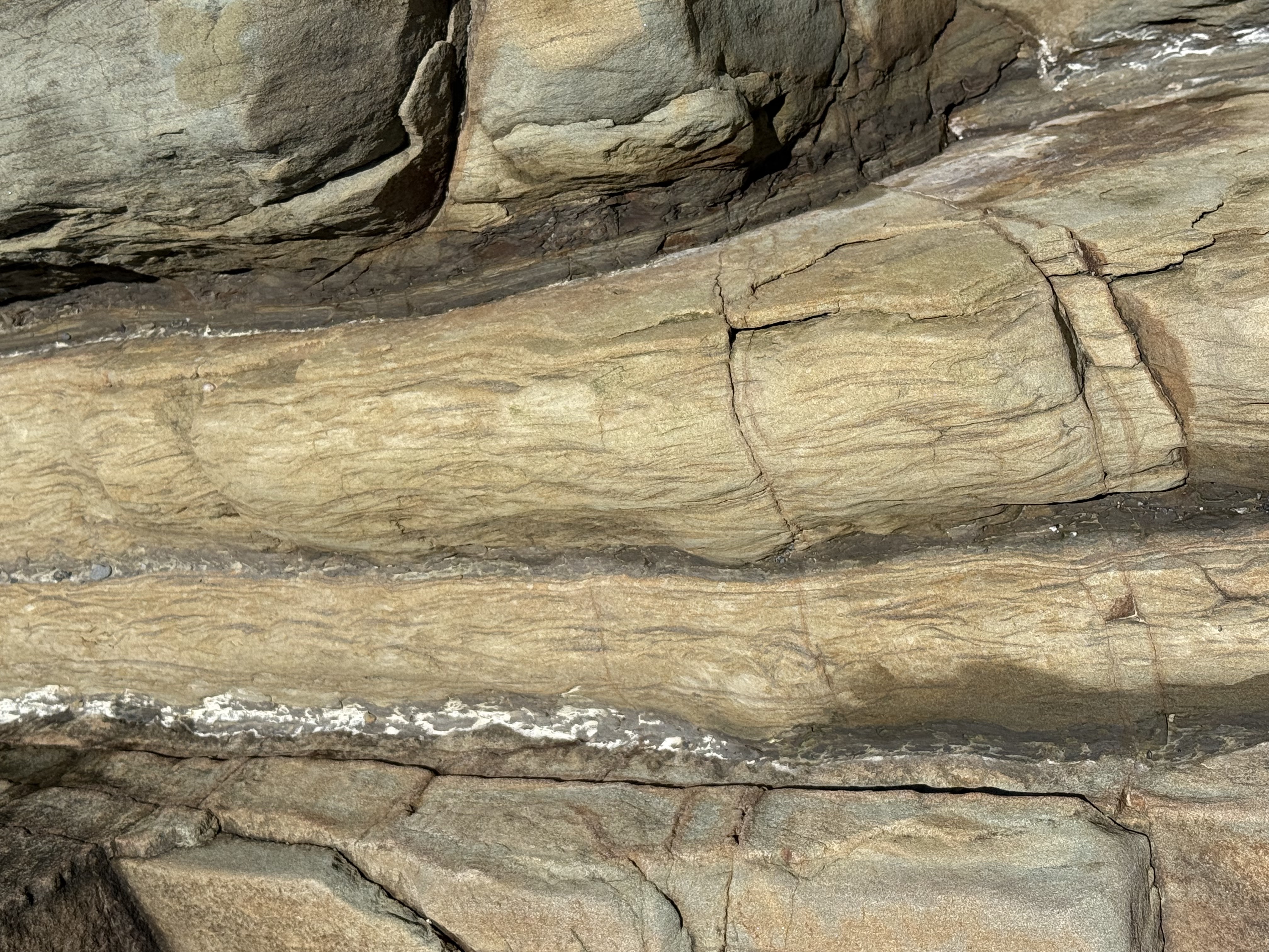
Figure 7. Close-up image of a thin layer (about 3 inches), showing what is called Flasier bedding. This is found in modern environments where high-energy (e.g. waves and tides) periods are interrupted by quiet times during which fine sediment can be deposited between ripples. It is indicative of a shallow marine environment.
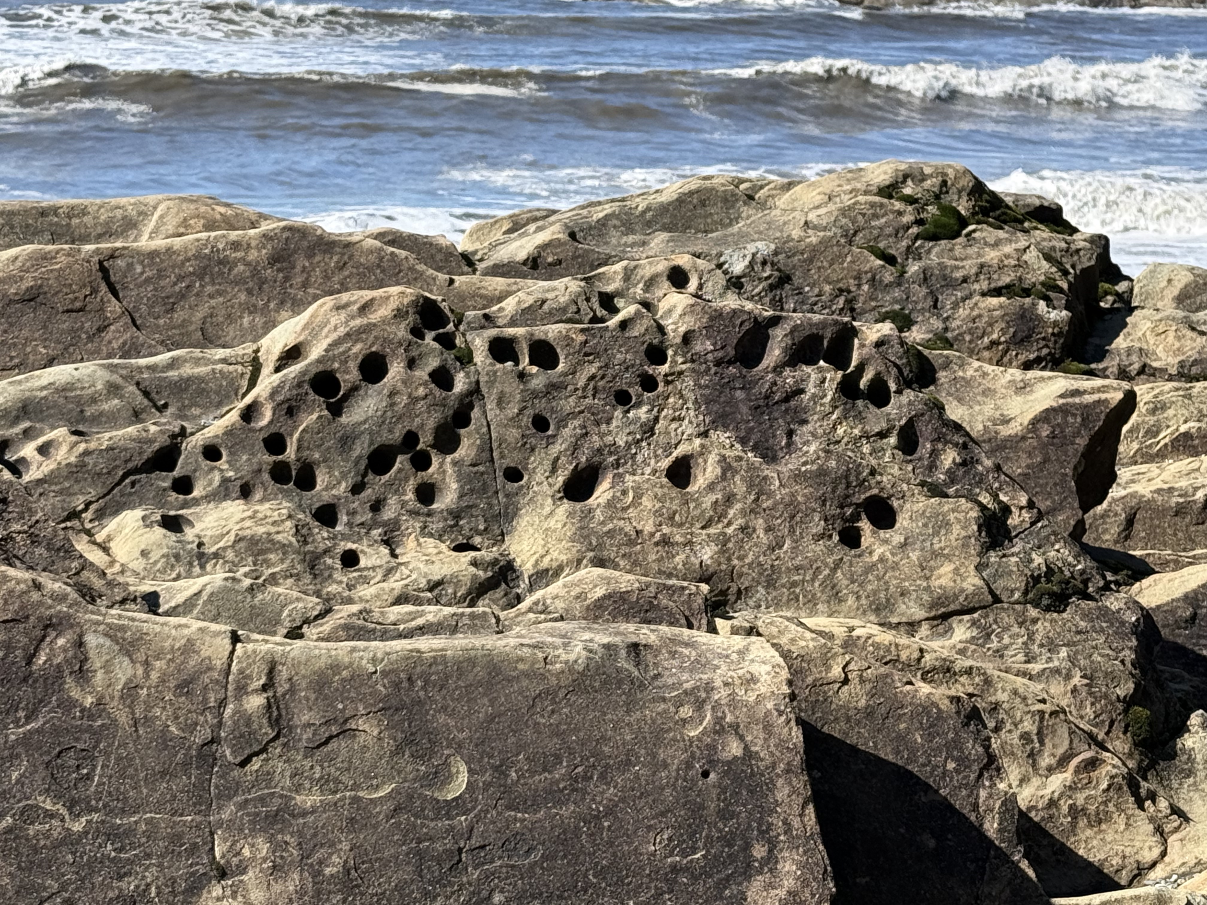
Figure 8. These holes were evident throughout the exposure. They are problematic and probably originated in several ways; however, one plausible explanation is that soft-bodied animals like worms burrowed in the sediments and their burrows filled with sediment with a different composition (e.g. fecal pellets). These channels then preferentially eroded when subjected to the harsh nearshore environment in which they are found. The presence of such holes at the unconformity (see Fig. 5) proves that they predate deposition of the overlying glacial till. Unfortunately, such trace fossils don’t tell us anything about geologic age, only that this seashore was teeming with life.
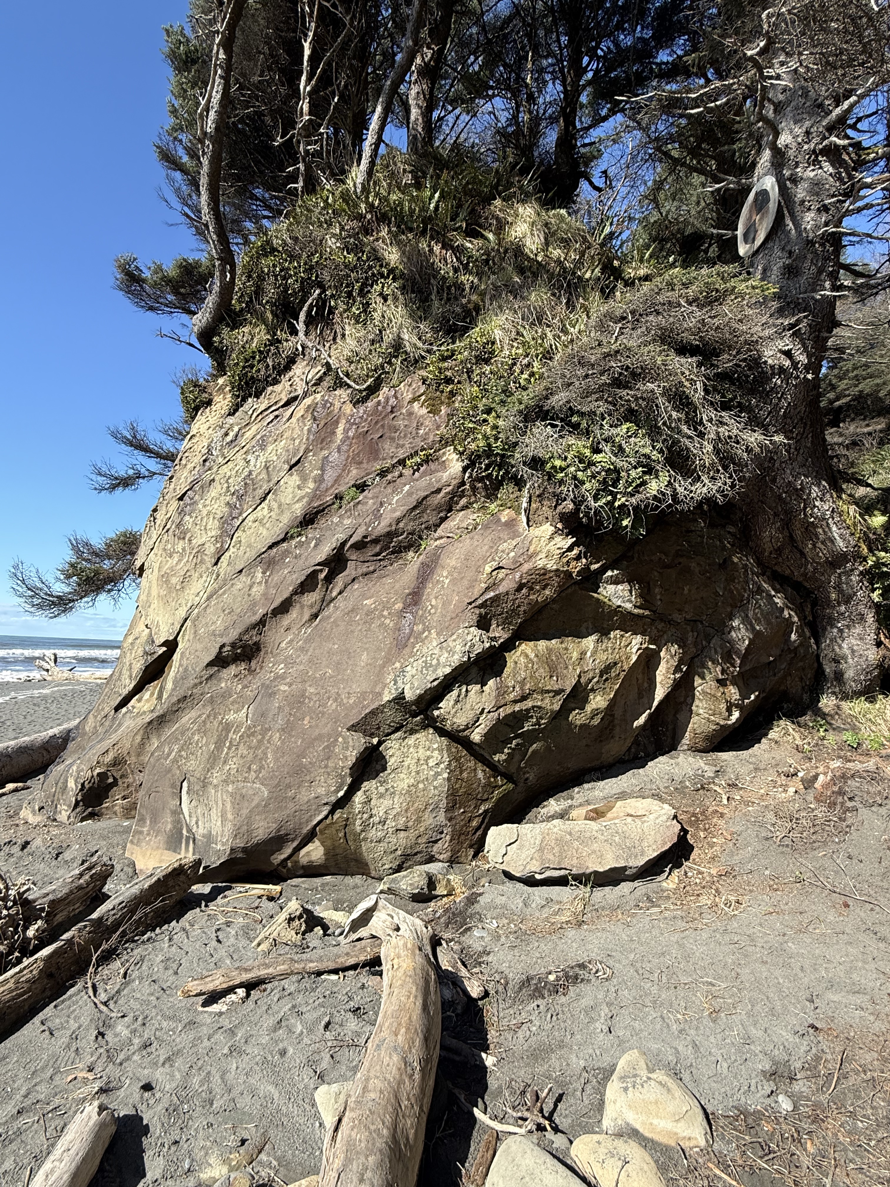
Figure 9. I stopped at another accessible beach a couple of miles south, but still indicated as Site B in Fig. 2, where the rocks were sandstone but with very little clay. The beds seen in this photo were thick (1-3 feet). They were not deposited in a high-energy, environment like those we saw before; they were probably deposited on the shoreface below fair-weather wave base–possibly part of a nearshore bar or barrier island. After deposition and burial, they were tilted less steeply than those seen further north (Fig. 6). The unconformity is seen in the upper part of this image, but it doesn’t seem to have as many rounded cobbles as before (Fig. 5). I have no way of knowing the relative age of these two exposures; this Tertiary rock unit is approximately 3000 feet thick and represents millions of years. All we can say for certain is that this shoreline wasn’t that different from what we observe today. Uniformitarianism in action.
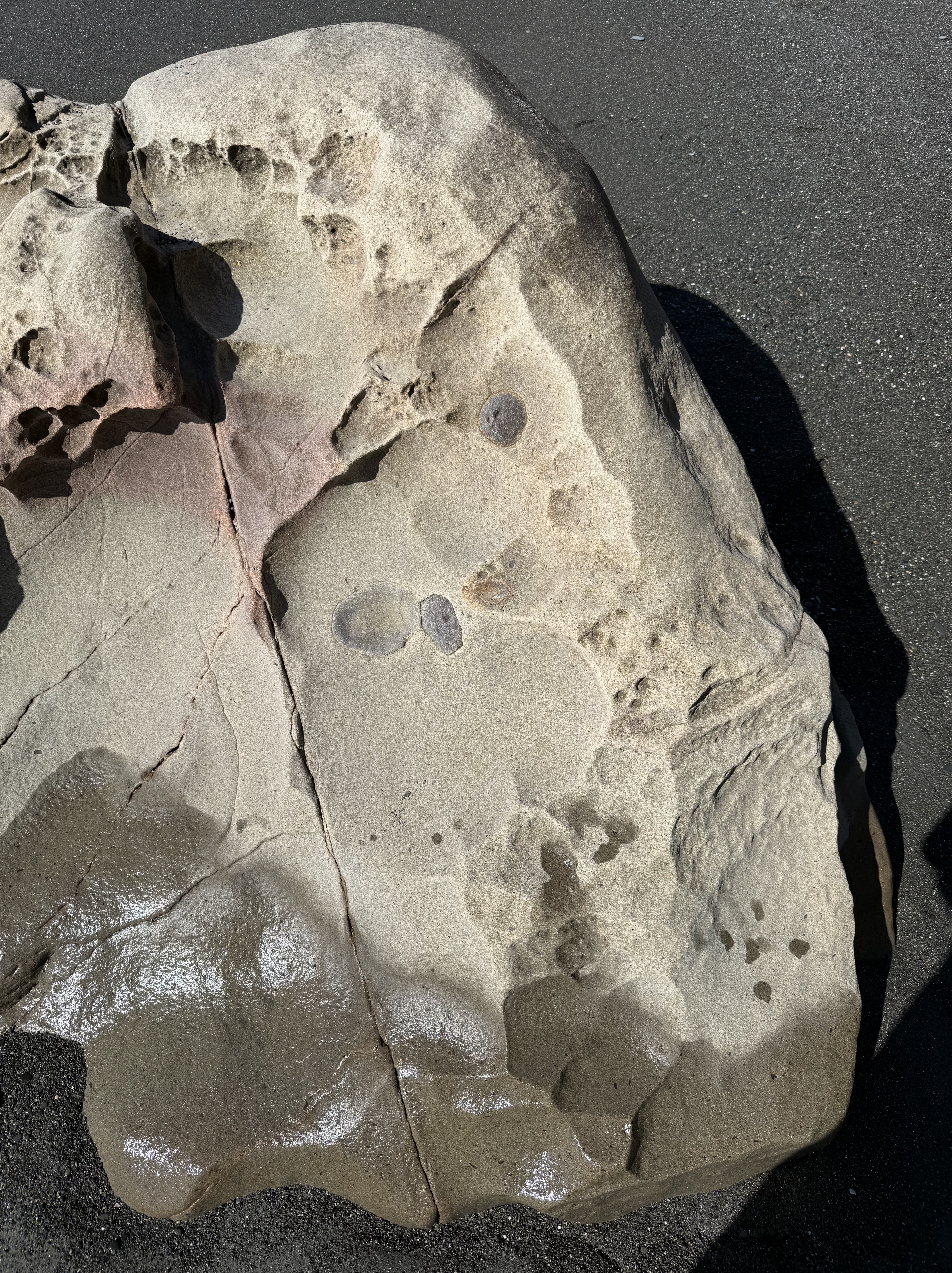
Figure 10. This exposed outcrop within the tidal zone reveals what are probably concretions of iron oxides, formed during early diagenesis. They superficially resemble fossils, but that is not the case. As the sediment was squeezed during burial, incompatible elements like iron formed irregular blobs in an otherwise uniform quartz sand matrix.
Summary
This coastline was part of the Cascadia subduction zone during most of the Tertiary period. Sediment, including a lot of sand, was eroded from rocks being uplifted further inland where volcanism was active, especially during the Eocene (55-35 Ma). Beaches like those we see toady were common, as well as the various depositional environments found along the Olympic peninsula, including fluvial and submarine fans, beaches, and cliffs. But no glacial sediment.
These sediments were buried as more material was removed from the rising orogenic belt, which included granitic rocks with lots of quartz. Eventually they were caught by the complex trench uplift (see Fig. 3) and scraped onto the edge of N. America. This involved faulting primarily, suggesting this was a fairly shallow process (folds occur at depth where rocks are ductile). The tilted rocks were eroded for millions of years; then, about 2.4 Ma glaciers (nothing to do with subduction) covered the region and deposited all kind of sediment: rivers, lakes, undifferentiated till, moraines, etc.
Just as the East Coast of America has been a passive margin for more than 200 my, the West Coast has been a convergent margin. Instead of being steadily worn away by wind and water, these rocks are rising out of the sea at about 2 inches per year. And what a ride it is…
The Olympic Peninsula: Quinault Rainforest to Cape Flattery
This is the first in what I hope will become a regular series of blogs from my travels around the Pacific Northwest (PNW) as well as trips throughout the world. This series accompanies my main blog, Rocks and (no) Roads, which reports on the geology of various places to which I travel. You could see I’m expanding my horizons; in addition to posting about general sights in this post, I will also be including environmental and ecological observations that are of interest to me. My background is in geology, but I’ve become aware of a lot more since moving to the PNW. So this is a learning experience, thanks in large part to the availability of expert assistance from CoPilot, Microsoft’s version of ChatGPT. I’ll be turning to it to identify plants and evidence of animal activity in future posts.

This is the base map I’ll be using in many of my posts from the PNW. The star indicates my base in Tacoma. Today’s post describes a two-day trip to circumnavigate the Olympic Peninsula. Although this area is the wettest in the contiguous United States, with annual rainfall up to twelve-feet, it was clear for the duration of my visit. The labeled areas indicate where the photos described below were taken.
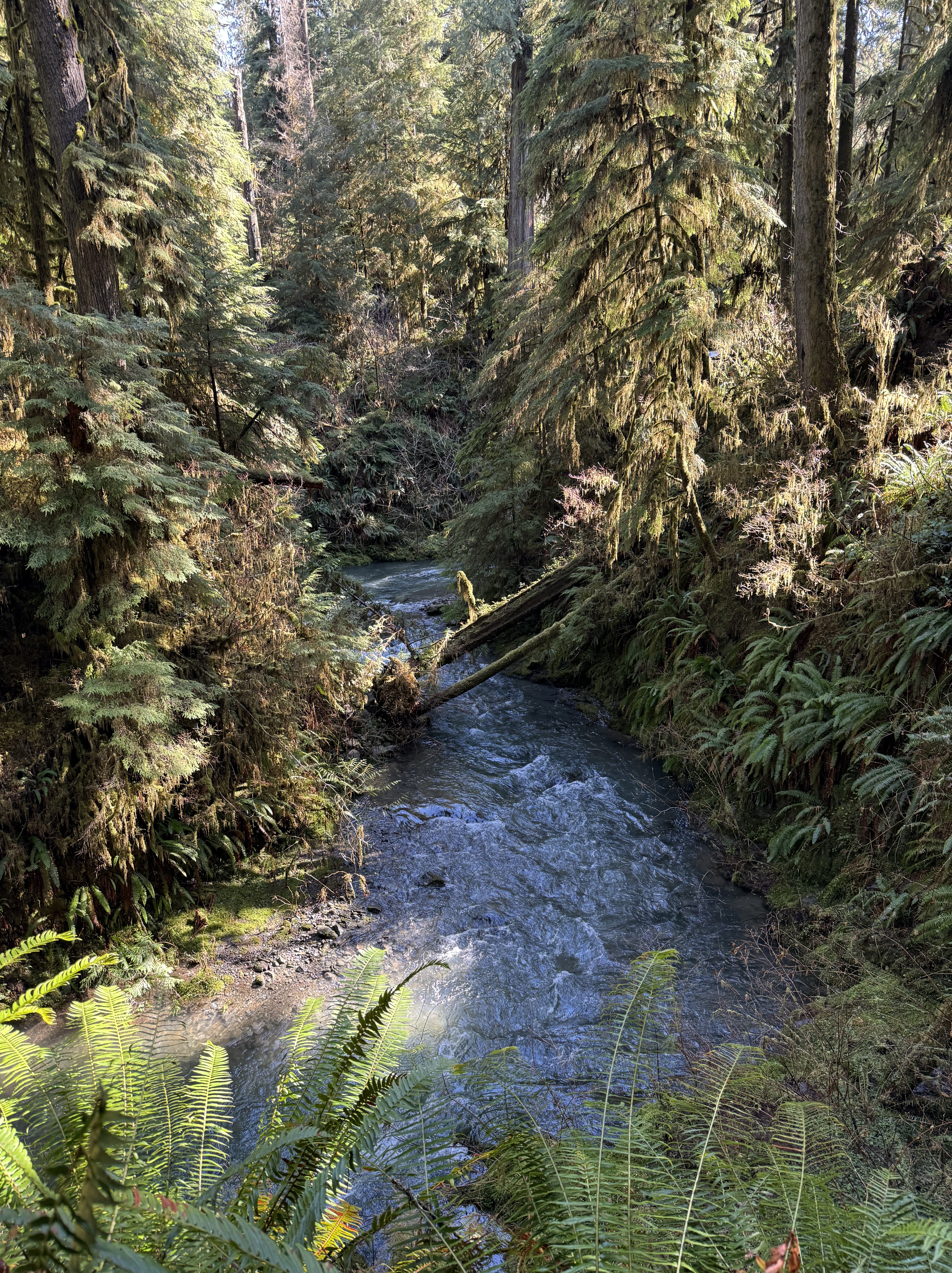
Location A: Quinault Rainforest. Photographs can’t do justice to the experience of being surrounded by a temperate rainforest. There are many trails of different lengths, but I followed a shorter one (about one mile) that followed Willaby Creek for a while before turning into the depths of the forest. This image shows the creek rushing by about 50 feet below the trail as it races to the south shore of Lake Quinault.
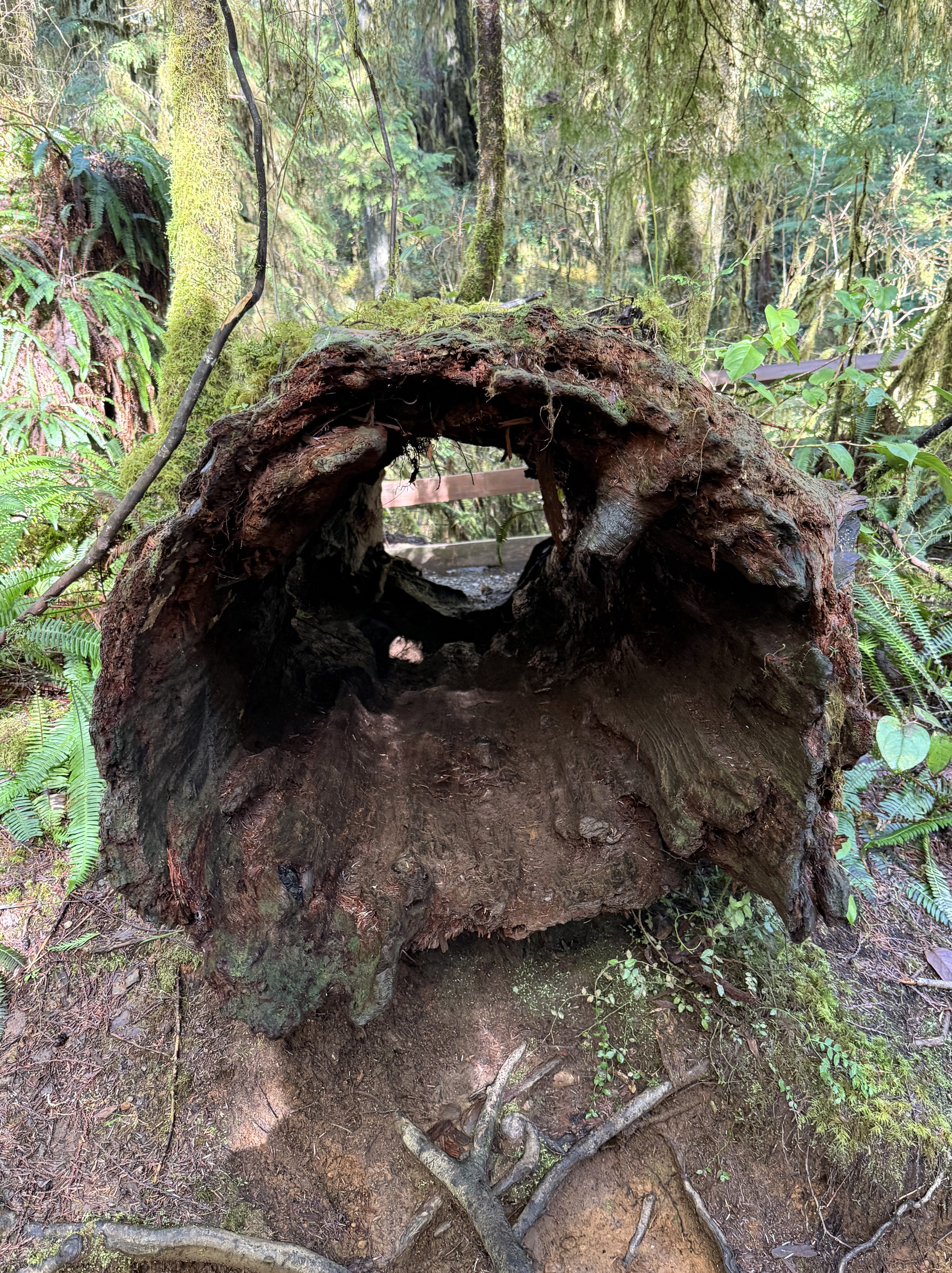
Location A: Quinault Rainforest. This rotted log is about six-feet in diameter. It is representative of the ongoing decay and rebirth of the forest. I’ll talk more about that in another post. Note the ferns growing out of the decaying wood.
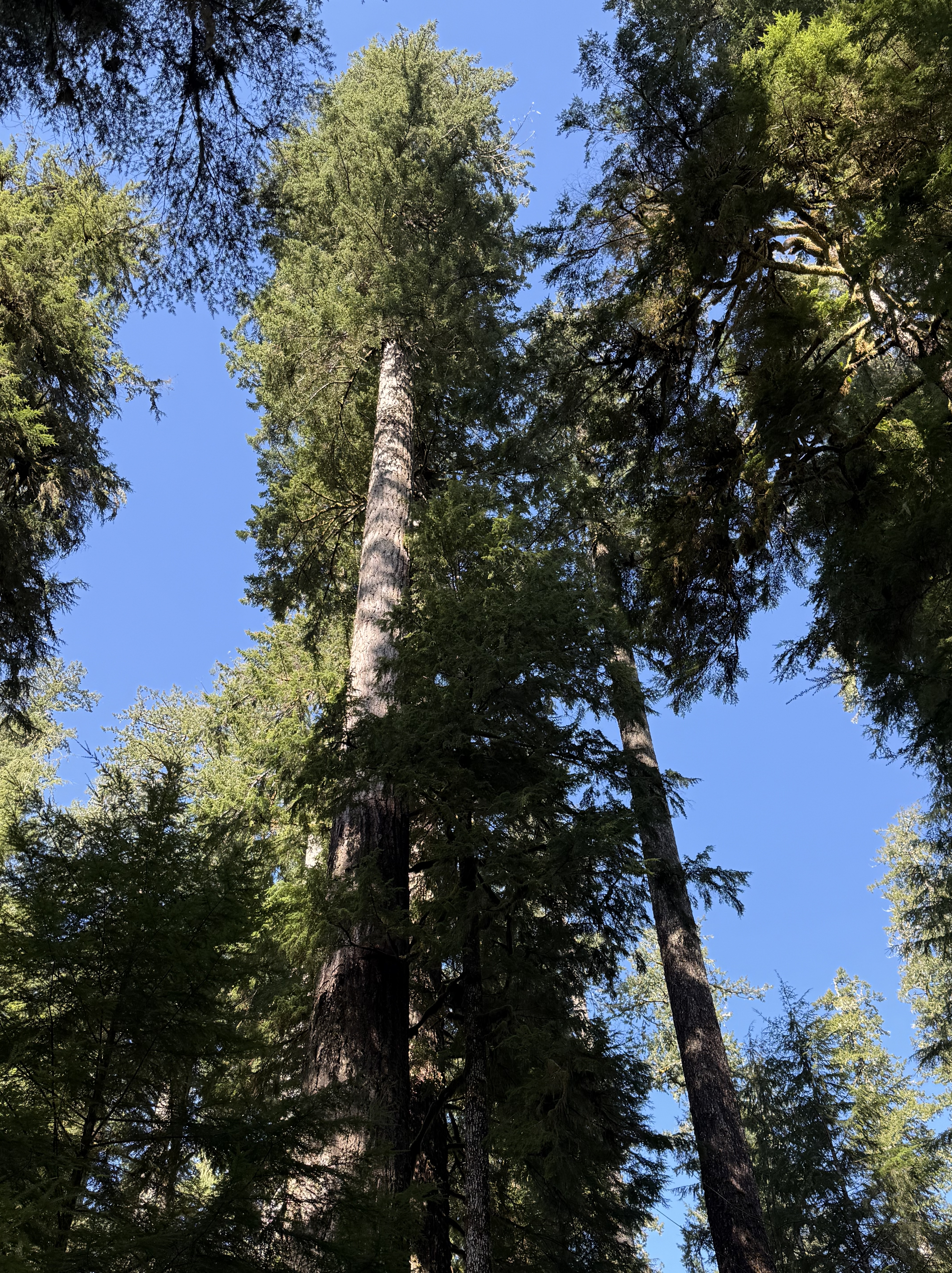
Location A: Quinault Rainforest. There are at least half-a-dozen species of giant evergreen trees in the rainforest, and I can’t identify any of them; but CoPilot suggests it might be a Coast Redwood, part of a local population found in this area. This example is typical in an area known for its “Champion Trees”. We’ll get to that in the next photo.
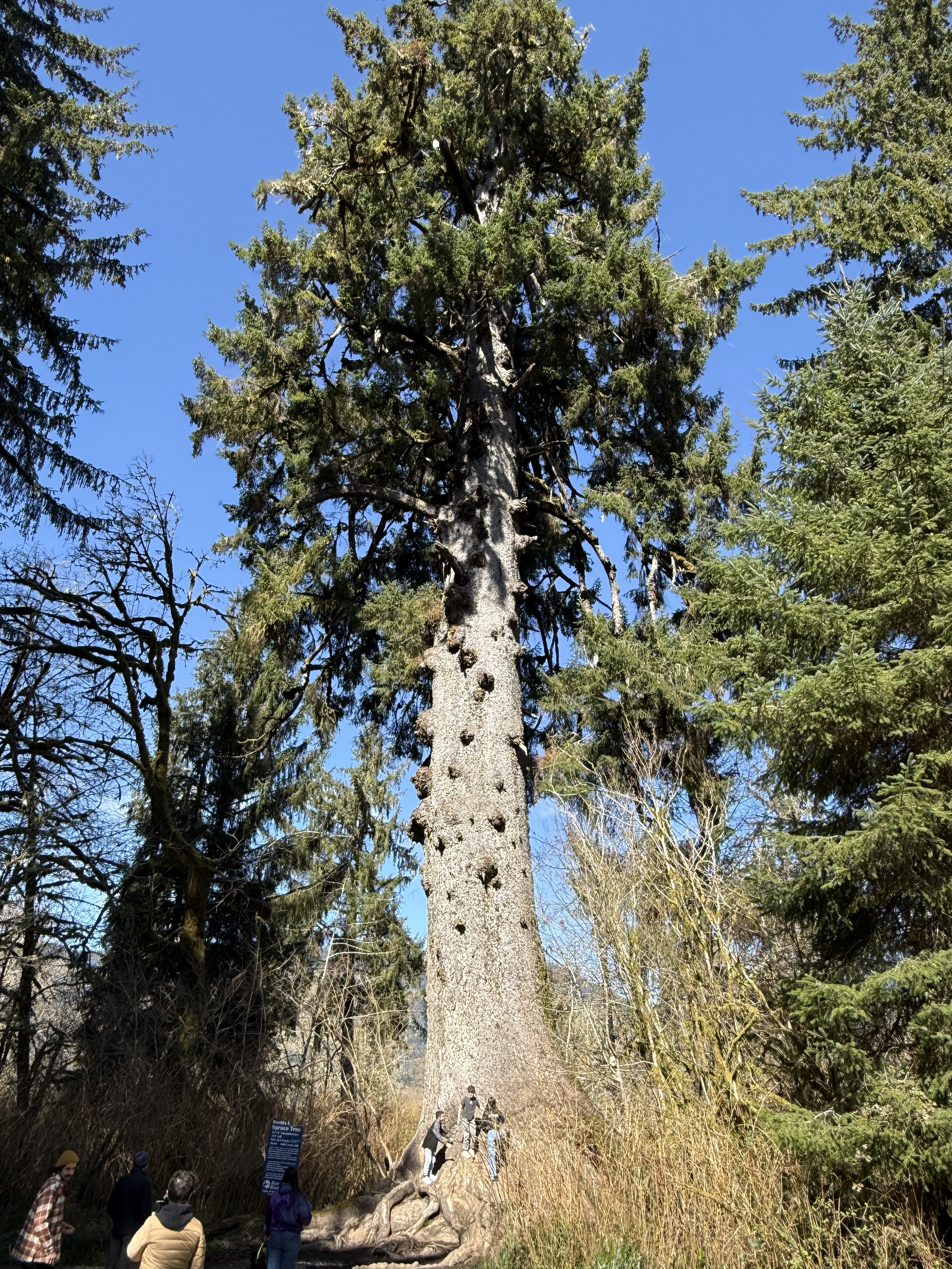
Location A. Quinault Rainforest. This is the world’s largest Spruce tree. It is 191 feet tall and about 1000 years old. It is one of the six champion trees located in Quinault Valley. The other champion trees are: the world’s largest Western Red Cedar, Douglas Fir, and Mountain Hemlock; and the largest Yellow Cedar and Western Hemlock in the U.S. This tree is growing in a wetland area at the NE end of Lake Quinault.
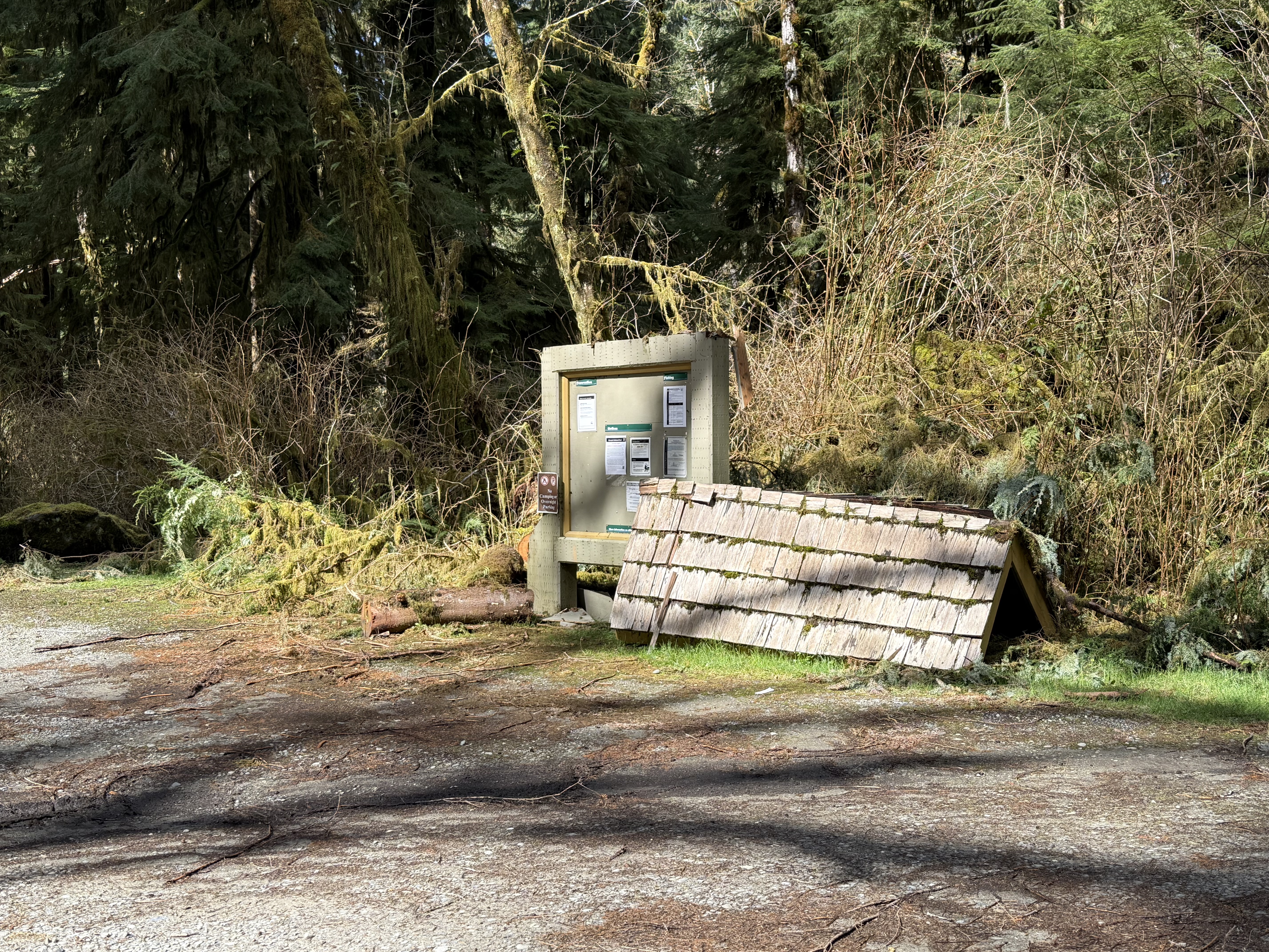
Halfway between Sites A and B. During my day-trips around the area, I’ve noticed a what appears to be a regional interest in post-industrial art, including but not limited to large concrete facilities that have been left to decay in place, as well as small sculptures and other curiosities scattered throughout the cities and forests. I don’t know if this is intentional or not: the roof of the information board collapsed (no doubt because of 12 feet of rain per year) and was set aside, possibly as a monument to nature?–or evidence of the poor funding and mismanagement of the National Park Service.
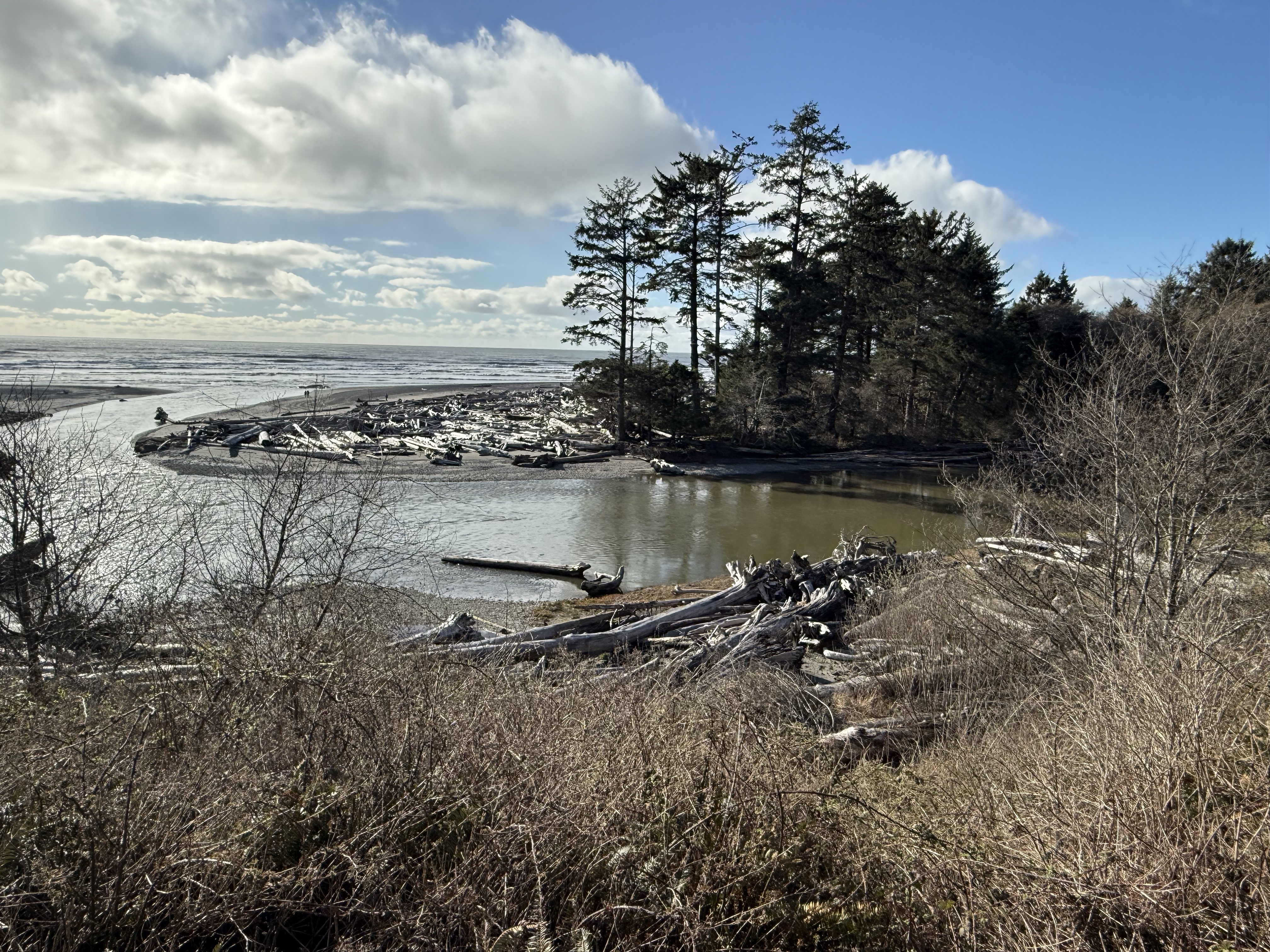
Location B: Kalaloch Lodge. This is the view from the deck of the lodge where I spent the night. Kalaloch Creek meanders as it approaches the coast and enters the Pacific Ocean here. An impenetrable pile of driftwood (actually logs and entire trees) has collected on a sand spit deposited on bedrock.
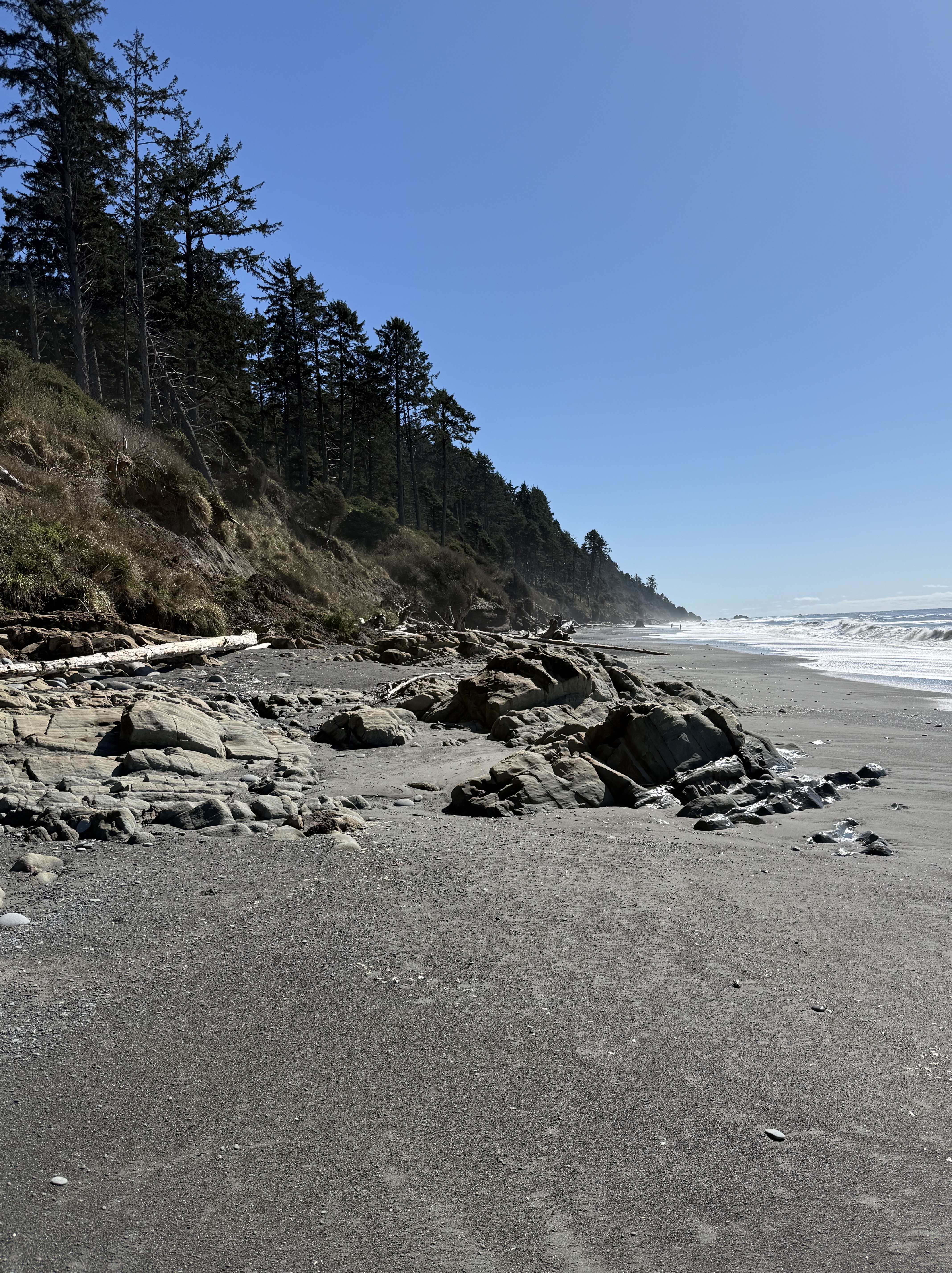
Location B: Beach 4 at Kalaloch. Steep bluffs of glacial till front a wide beach with many exposures of rock, which I’ll discuss in my next post.
Location C: Ruby Beach. This was the last beach before US 101 turned inland for ten miles. I took a video because a series of photos can’t possibly convey the beauty of this location as the sun was rising. Note all the rocks protruding from the water at low tide. The rocks are rising from the earth as we make our way north.
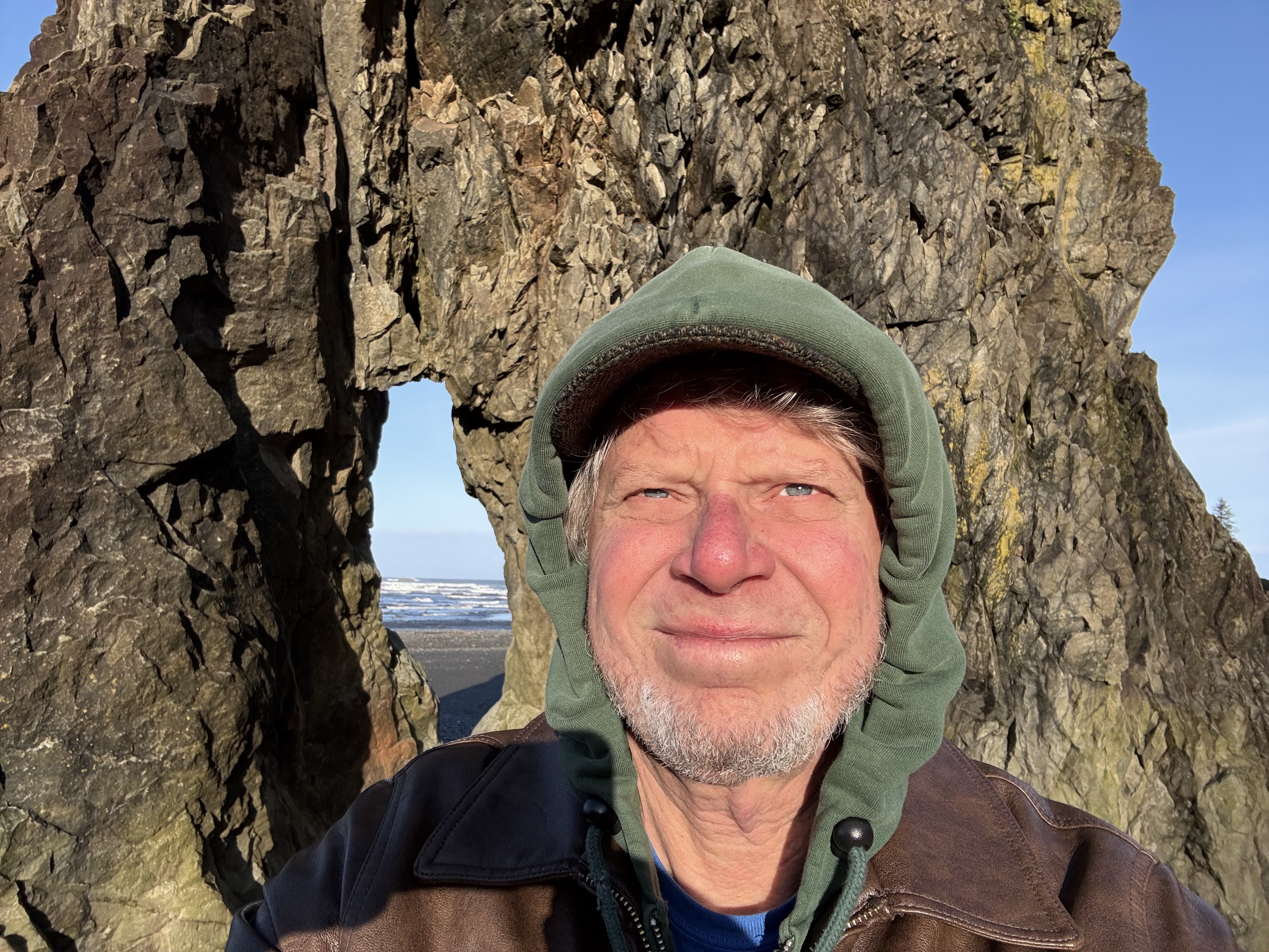
Location C. This selfie demonstrates how chilly it was, with the temperature below 40F. Rock formations like this are called stacks; they are erosional outliers as the coast recedes over millions of years, pounded day and night by rocks carried by waves; and tides that exceed nine feet–twice a day! You have to time your visit accordingly or all you’ll see is water.
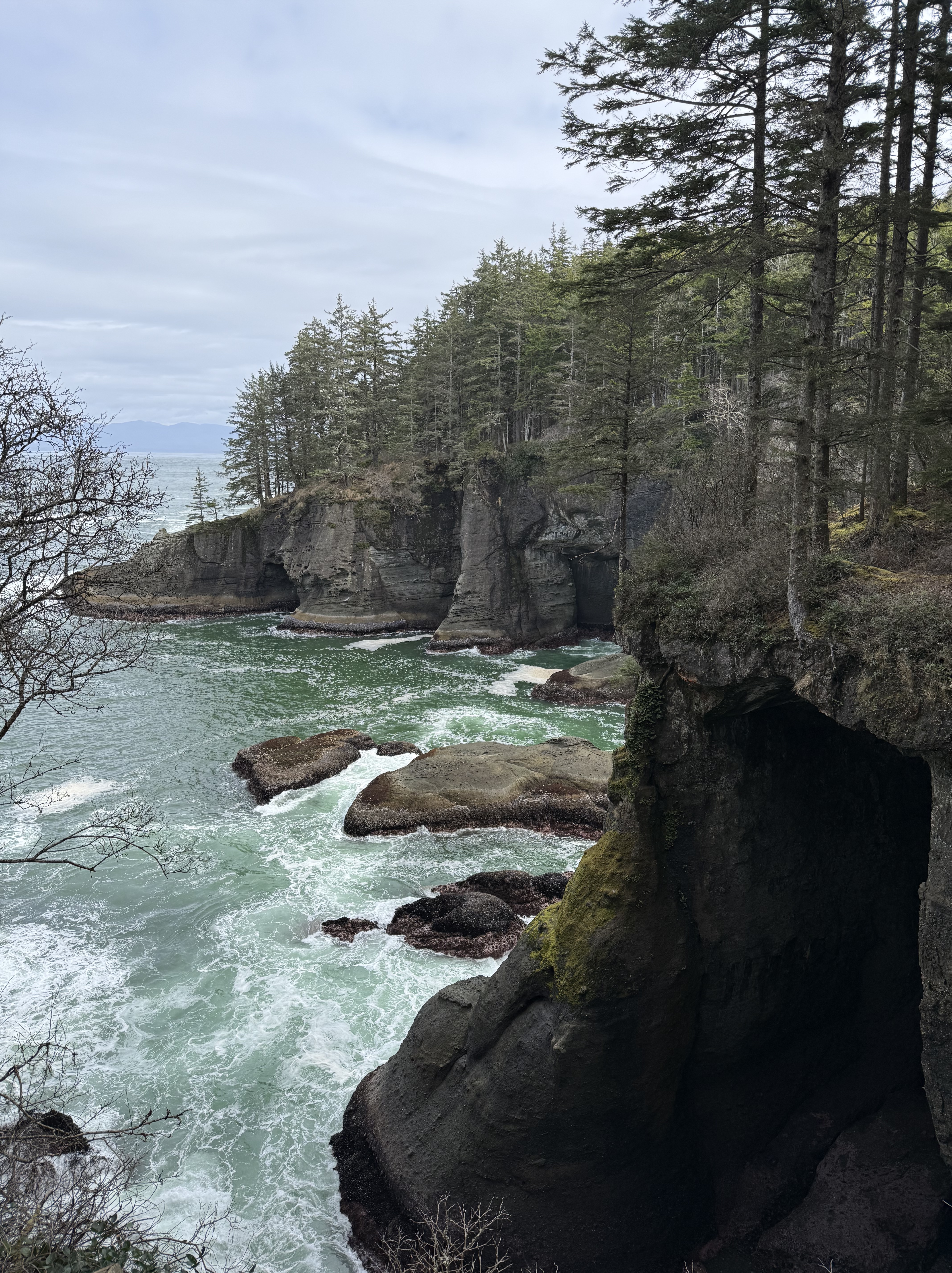
Location D: Point Flattery. This is the extreme tip of the contiguous United States. The bedrock we saw further south, at Ruby Beach, now forms wave-cut cliffs that tower 40-80 feet above the waves. The top of the bluffs is 330 feet above sea level. The view from the catwalks is breathtaking. Vancouver Island, BC, is visible in the background, with peaks around 6000 feet.
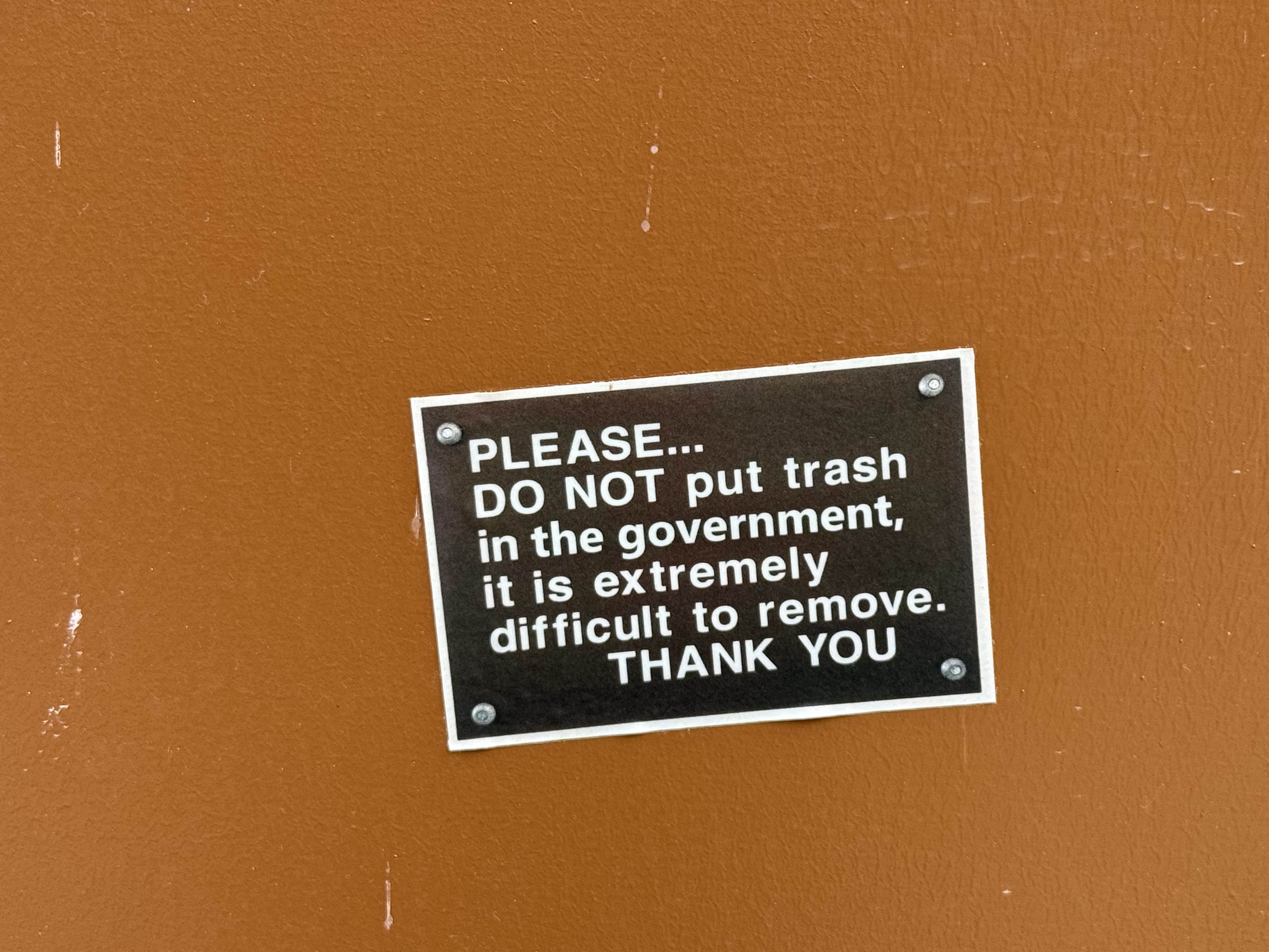
More PNW Humor. All of the toilets we saw along the coast were constructed over septic tanks, with warnings about what to put in them. Someone with a sense of humor modified just one word of the official message…
If you get the chance, I strongly recommend visiting Olympic National Park, but you’re going to want to spend a week unless you live nearby in the PNW.
America’s Car Museum
This is the main repository of the Lemay collection of automobiles.
I’m going to have to pay it another visit…
The Museum of Flight is a Smithsonian-like Experience
These are several posts from Facebook that I wanted to share with aviation enthusiasts who don’t happen to live in the Seattle area.
There was a covered outdoor pavilion with a collection of bombers and commercial aircraft. I wish I’d taken more photos…
The WWI collection is amazing!
I definitely should have taken more photographs. The memorabilia on display with the aircraft from WWII was fascinating in its own right. I have to go back…

Recent Comments