
Hemlock Overlook Regional Park: Proterozoic and Cambrian Metasediments

Figure 1. View looking upstream at the confluence of Bull Run and a minor tributary that is examined in this post (see Fig. 2 for location). The morphology of this area is typical for Northern Virginia’s Piedmont region; ridges and small plateaus dissected by many, irregular, often meandering streams, most of which flow into the Potomac River. Basement rocks are weathered on the ridges and are only visible along the streams which have deposited tens of feet of mixed sediment. The flood plain is several hundred yards wide in some locations, consisting of mud and silt; cobbles and some sand line the active channel, forming bars like those seen in this image.
Figure 2. This map shows the area I have been exploring in recent posts. Hemlock Overlook Park is circled. Note that the study area is less than 10 miles from Bull Run Fault (dashed line), and an area we studied previously (indicated by the purple circle to the left of the map).
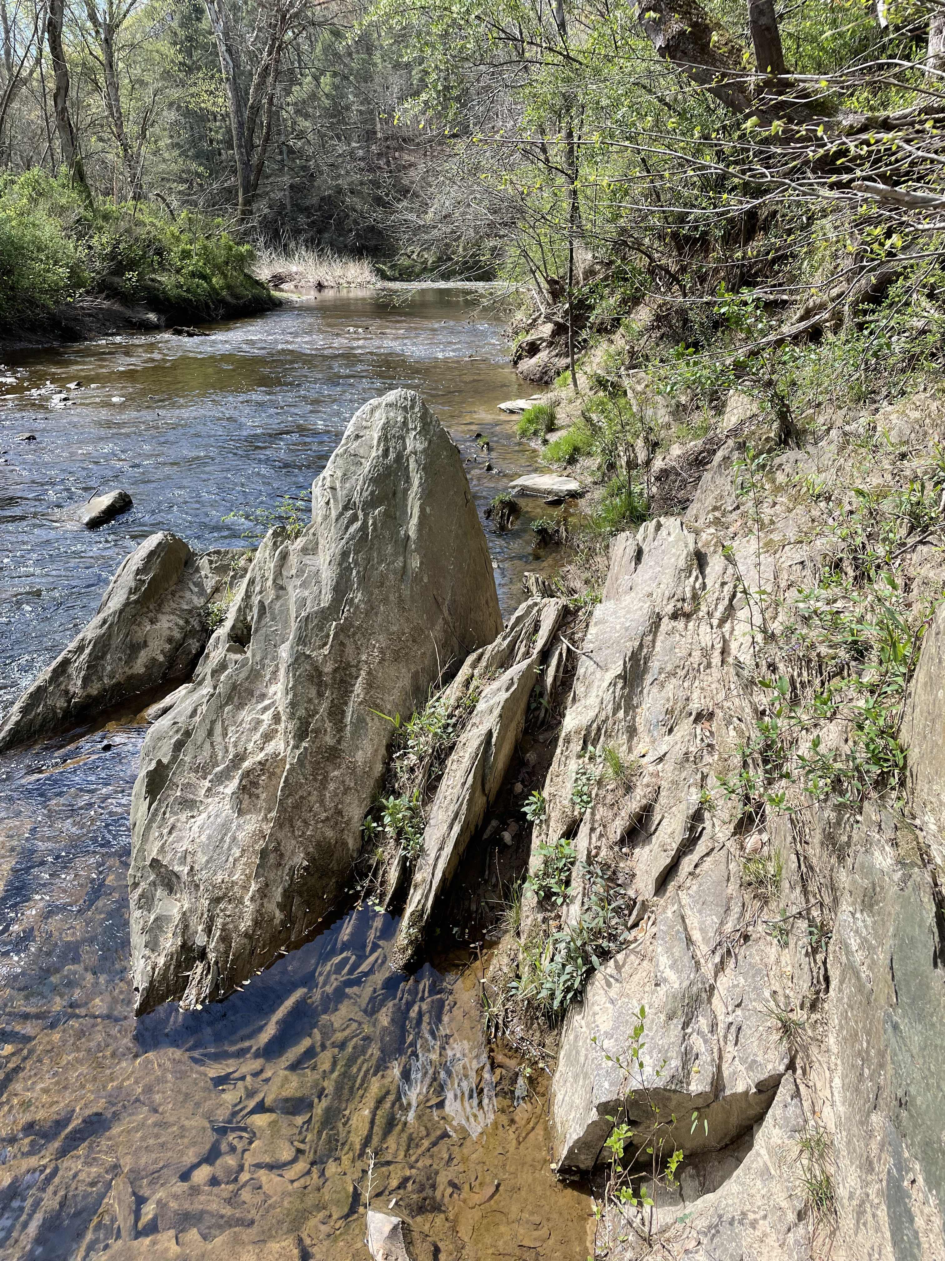
Figure 3. Photo of metasedimentary rocks exposed along the tributary creek shown in Fig. 3. These rocks have been rotated approximately 90 degrees and are vertical, with a northerly strike (not measured). They are fine grained and thin bedded, with thin layers weathering (fissile) in various locations within the study area.

Figure 4. Geologic map from Rock D of the study area. The blue dot is the location of Fig. 1. The green shade represents Cambrian metasediments (538-485 Ma). The lighter area is Proterozoic schist (1000 – 511 Ma). Our route followed Bull Run south (blue meandering line along right side of map).
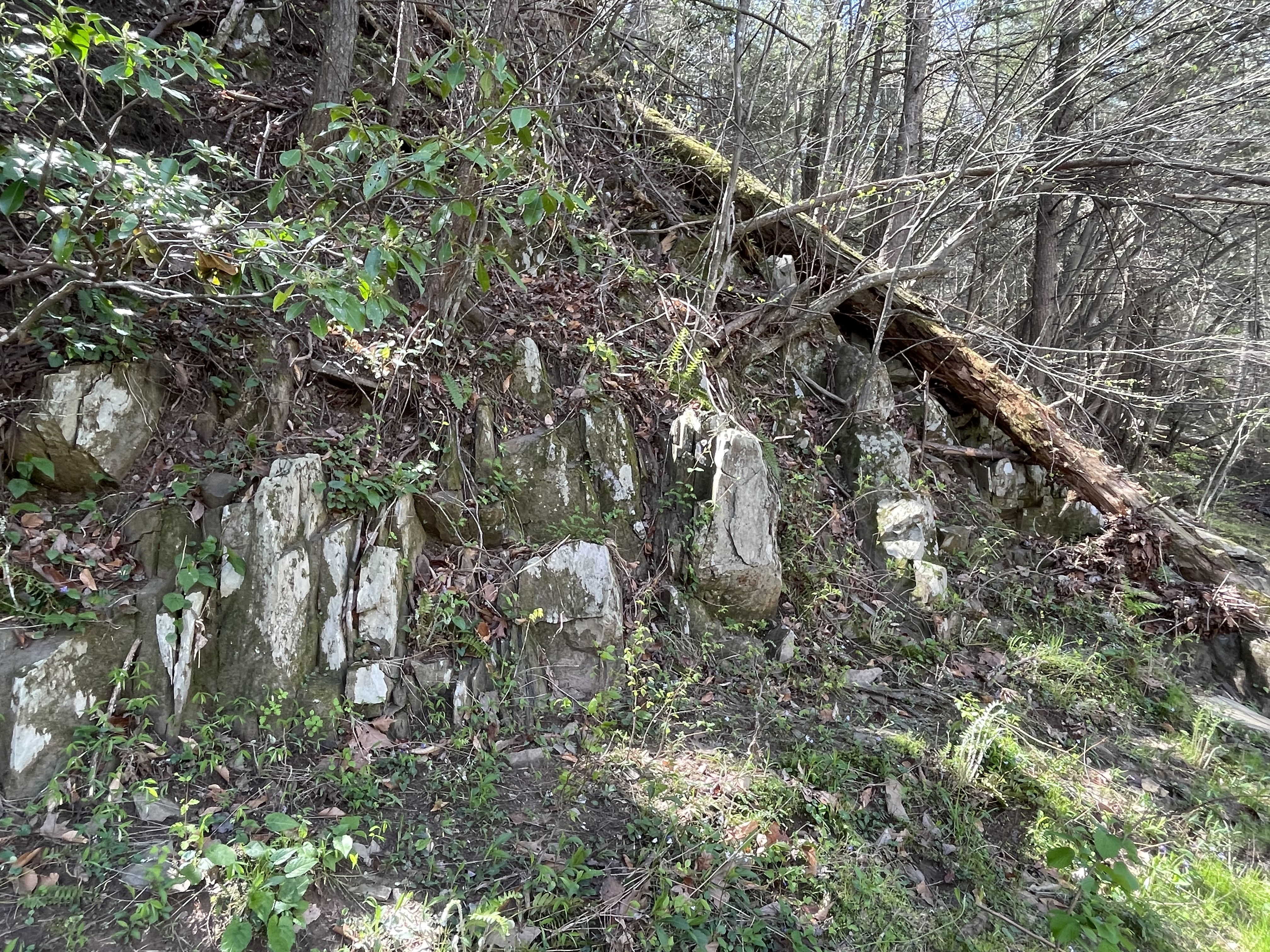
Figure 5. Photo taken further to the south along Bull Run (see Fig. 4), where the rocks aren’t as weathered as further upstream. Their metamorphic grade is increasing as well.
Figure 6. When we entered the Neoproterozoic schist (light-shaded area ~800 m south of the blue dot in Fig. 4), the river channel narrowed, which allowed the construction of the first hydroelectric dam in the region. Note the vertical schist exposed on the other side of Bull Run.

Figure 7. Photo taken several hundred yards south of Fig. 6, showing the resistance of the schist to erosion. This rock hasn’t weathered much and appears to be a massive layer, but looks can be deceiving when dealing with rocks in the wild.
SUMMARY.
The rocks we saw today are typical for this region: a period of mud accumulation in deep water, burial many miles beneath the surface; the older (and more deeply buried) sediments were transformed into schist while the younger rocks were heated less under less pressure. The higher-grade metamorphic rocks (i.e. schist) are stronger and more resistant to weathering, creating a narrow canyon that allowed a dam to be constructed.
This was a continuous orogenic event that lasted from about one billion years ago to 500 million. Needless to say, there is more here than meets the eye, but the rocks are not library books …

Recent Comments