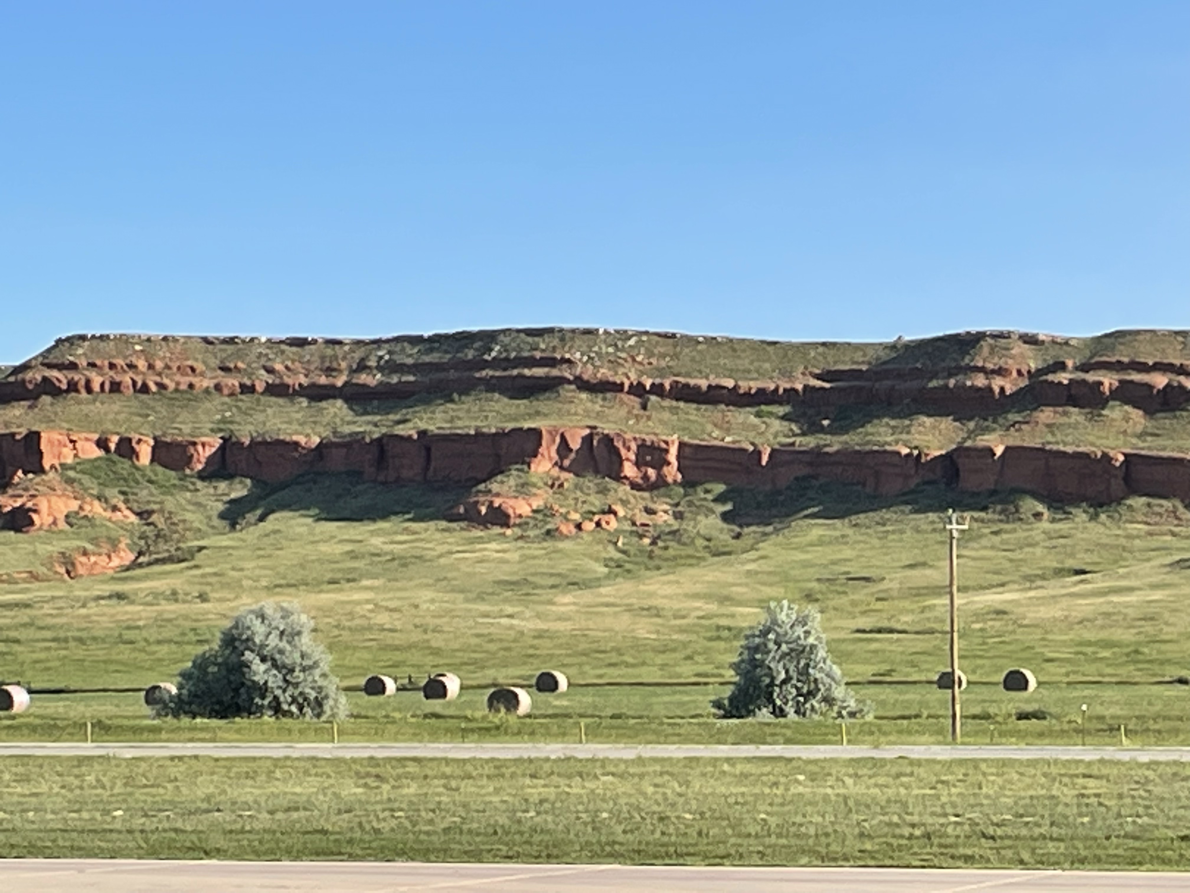
Figure 1. These horizontal mudstones (Spearfish Formation) were deposited in fluvial and lacustrine environments (red color indicates fresh water) about 250 my ago, when Pangea was beginning to split. For comparison, we found coarse sediments in Northern Virginia, forming the western margin of a local basin produced by the breakup of this supercontinent. Despite being a thousand miles west of the ancestral Appalachians, sediments were collecting in modern Wyoming. They somehow escaped the upheaval that was to come, when oceanic crust was subducted by the westward motion of the North American tectonic plate.
We discussed the tumultuous history of Precambrian rocks in Montana in my last post. The story of crustal shortening in western North America continues to this day. The huge, shield volcanoes comprising the Cascades Mountains show that this westward motion has not ceased at the current time.
The story of oceanic subduction and collision with multiple microcontinents is recorded in the rocks I had to drive past, so I have to resort to a geological map again.
Figure 2. Geologic map centered on the Black Hills of South Dakota. Gillette is circled to the left. The purple rocks to the west are Precambrian metasediments. The black hills consist of a Precambrian core of granitic intrusive rocks (light brown ellipse in center of image), surrounded by Paleozoic sediments worn away from the hard, igneous core of the Black Hills. I have written about the Black Hills previously. My point here is that Precambrian rocks, and their Paleozoic cover, were uplifted through Mesozoic strata (Fig. 1) to form one of the geological wonders of the world. Although the precise mechanism for uplift of the Black Hills is unknown and controversial, it is undoubtedly related to the eastward thrusting of Precambrian rocks over younger rocks throughout the Rocky Mountains. The map has the location of the “Badlands” circled; this is an area where younger rocks (reddish brown, less than 60 my) are topographically lower than older rocks (light green, 100 my). The gently undulating topography reflects hidden faults created by the uplift of the Black Hills.
Summary. This was a short post because I was occupied and didn’t have time to explore this fascinating region. Nevertheless, I can confidently say that when Pangea broke up, the North American tectonic plate began to “swallow” the proto-Pacific plate and any microcontinents it harbored.
This 200 my long process created the Rocky Mountains, the overthrust belts of Montana, the Black Hills of South Dakota, the Colorado Plateau, the volcanic Cascade Mountains, the complex system of faults that define California, and so many other geological features of the western North American craton.
It wasn’t as if another gigantic mountain range could form in the aftermath of Pangea’s break-up. The earth can only produce one of them every couple hundred million years, a tectonic pattern called a Wilson Cycle.


Recent Comments