
The Big Picture: Moher Cliffs
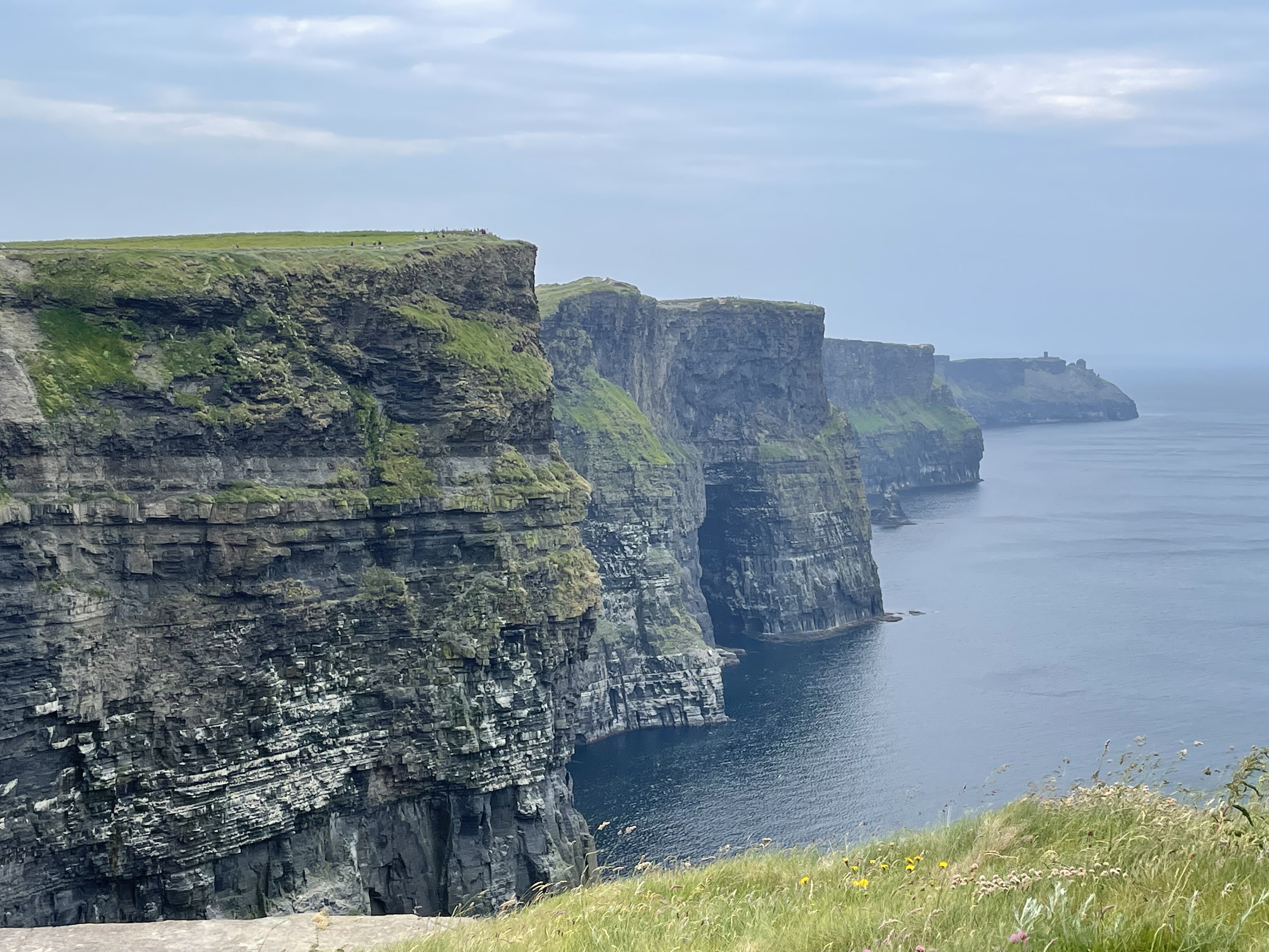
This is a famous photo (taken by me) of the Moher Cliffs that reveals the Late Carboniferous (320-300 Ma) mud/silt/sand stone we saw at Foynes and again at Kilkee. The silt/sand layers are thinner at the bottom of the cliff (white accentuates them) and thicker towards the upper parts. This pattern suggests a transition to shallower water, from turbidites and other delta-front sand deposits, to massive nearshore submarine bars. The land was rising relative to the sea.
These layers of sedimentary rock are flat while gently dipping to the south, unlike the steeply tilted strata at Foynes, or the undulating rocks at Kilkee. The delta system represented by these rocks was extensive and not subjected to major deformation during the collision of tectonic plates that created Pangea.
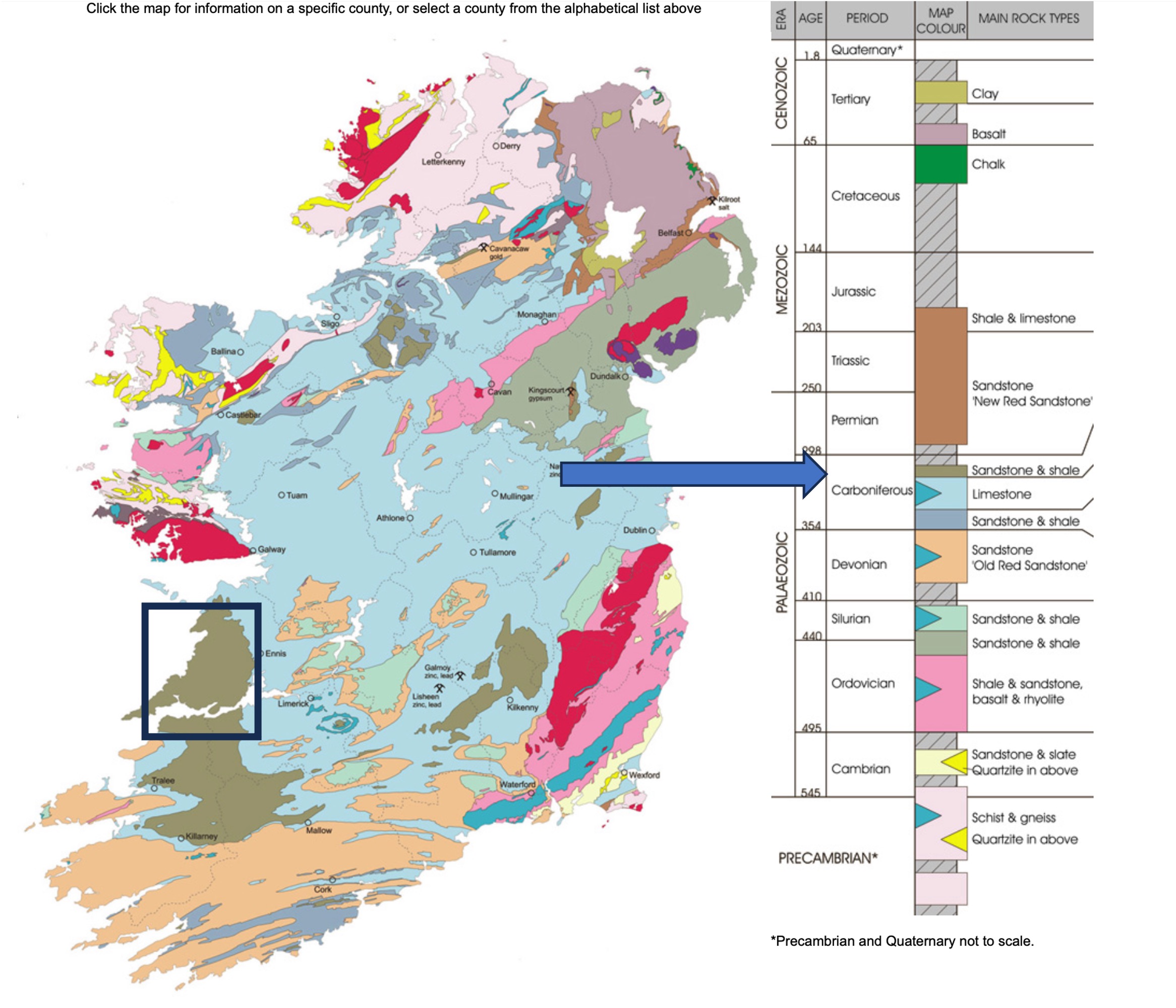
This figure shows the geology of Ireland with the delta sequence colored in brown. Note its extent south from the rectangle that includes the locations discussed in this and previous posts. This area was a delta several hundred miles in extent, about 310 million years ago. The green rocks that cover most of Ireland are the same ones we saw before, and will see again. These limestones were deposited in the extensive, shallow sea that waited for the imminent collision.
My next post will look at the red area on the map, due north of the rectangle, as well as the glacial topography that defines Ireland today.

Recent Comments